 Map Group BUTTERS 1803


The map size is wxh = 88x122mm. The reverse of the page is plain.


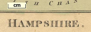
HAMPSHIRE.in a decorative typeface.
north point
up is N

Printed upper left is a north point; north marked by a fleur de lys, a cross line E-W. The north point is upside down, pointing south.
scale

Scale / MilesThere are divisions at 2 mile intervals. 10 miles = 18.3 mm giving a scale 1 to 879423 assuming a modern statute mile. The maps scale is about:-
1 to 880000
14 miles to 1 inch
ENGLISH CHANNEL
Spithead
coast shaded

The coast is shaded for emphasis. Although the map shows, crudely, the configuration of Southampton Water and Portsmouth Harbour, these are not labelled.
castles

Hurst Castle
Calshot Castle
bridges

Most of the major rivers are drawn by wiggly lines. Some are labelled:-
Avon R.
Auborn R.
Loddon R.The Auborn is the Enborn; Loddon wrongly marks the Blackwater. The Rother and Ems, in particular, are missed.
Bridges are not drawn, but are perhaps implied by roads interupting the river where they cross.

A very few parks, just 5, are drawn by a ring of paling fence with the interior coloured green. None are labelled.
forests

The county boundary is a dotted line, coloured bright blue. The map misses off the furthest west and east bits, around what is now Bournemouth, Dorset, and in Rushmoor. The detached part of the county at Ambersham is not included.
Adjacent counties are labelled, eg:-
WILTSHIREbut are not separated by boundaries.
The use of text style to distinguish settlement types seems to be intended, but is wrongly implemented.

Winchesteralso used for Salisbury and Chichester. But also for:-
Alresford
Petersfield

Andover
Portsmouth
Altonbut see:-
SOUTHAMPTONin italic bold block caps.

Chalton
Hertford Br.
New Inn
FawleyThe last not being on any road. Not all road junctions have a place label.

Roads, believed to be post roads, are drawn by a double line, coloured yellow.


The atlas has a map of England and Wales, upsidedown as many other maps are, there is a description of the posts roads, and a gazetteer; its size is 4 x 7 1/2 ins.
It was published again in 'The Picture of England Illustrated with correct colour'd Maps of the several Counties'. Illustrated by William Green. In 2 volumes. Printed for J. Hatchard Bookseller to his Majesty, Piccadilly. 1804.
Hampshire is in vol.1 which has title page, introduction and text for each county.


