 Map Group JANSSON 1646


This map of Hampshire and Berkshire is said to be derived from the separate county maps by Speed, in their post 1623 states. It includes coats of arms and the royal arms; there is text on the reverse; the map is printed 'up is East'.
The map studied is in the Map Collection of Hampshire CC Museums Service, item HMCMS:ACM1934.14. This copy of the map is tinted.
These notes concern Hampshire only.


title
map maker

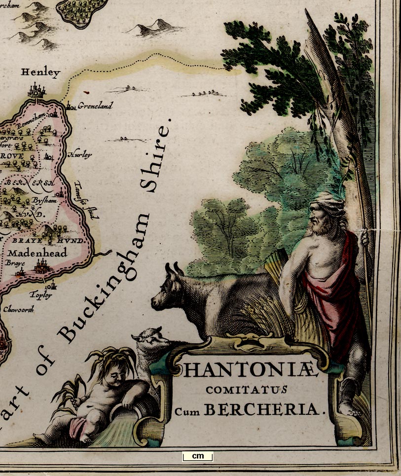
Printed lower right is a scroll cartouche with cherub, sheep, cow, farmer and sheaf of corn, and woodland:-
HANTONIAE / COMITATUS / Cum BERCHERIAHampshire County with Berkshire
Printed lower left is:-

Amstelodami / Apud Johannem Ja~ssonium.Amsterdam, the workshop of Johannes Jansson
compass rose
labelled borders
up is W
rhumb lines

Printed lower left is a compass rose; star points for the cardinal, half cardinal, and false points, and lines for the by points. All directions are extended by rhumb lines across the sea area as far as the coast. North is marked by a fleur de lys, and east by a cross. The map is orientated with west at the top of the sheet, presumably a convenience have labels reading easily on a map on a double page spread in its atlas.

The four borders are labelled:-
Occidens
Septentrio
Oriens
Meridies
scale
old english mile

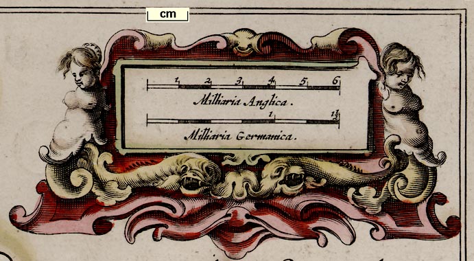
Milliari Anglica.
Milliari Germanica.english miles and german miles, the latter being 4 english miles each.
The english scale line is chequered and labelled at 1 mile intervals. 6 miles = 47.5mm (561 pixels at 300dpi) giving a map scale 1 to 203294 on the bad assumption of an english statute mile. The map scale is about:-
1 to 200000 ?
3 miles to 1 inchA more reliable estimate of the scale is got by comparing the positions of a selection of places with their known positions, using DISTAB.exe. From this procedure the map scale is 1 to 249721, about:-
1 to 250000 ?
4 miles to 1 inchThe map's english mile is:-
old english mile = 1.23 statute miles

bottom left SY835876
top left SP024265
top right TL125115
bottom right SZ936726
heraldic border

It is hardly a 'border', but there is a double line of coats of arms across the upper centre of the map, supported by cherubs and ribbons. These are labelled:-
Cliton a Saxon Ear: / le of Winchester
Saer Quincy Earle / of Winchester
Hugh Spencer Earle / of Winchester
Lodowick Bruget E. / of Winchester
William Paulet Earle / of Winchester
Bogo or Beavous E. of Southampton / a famous warrior against ye Normans
William Fitz William creat / ed earl of Southampton / by Kin. Henry
Tho. Wriotheosley created Ear / of Southampton by Kin. Ed / ward 6 Anno [1].and a blank shield.
sea plain
sandbanks
THE BRITISH SEAand

Titchfield Bayis labelled.
A few sandbanks, off Hayling Island, in Langstone Harbour, and the Hurst and Calshot spits are dotted.
coast shaded
headlands
harbours
The foreshore flats off Hayling Island, the Hayling Shoal, are labelled:-

The MackettTwo headlands are labelled:-
Rameshead
Hengestbury headealso note:-
Black cliffeThe only harbour labelled is:-
Hamble haven
castles

Hurst castle
Calshot castle
S. Andrews Castle
Worth ca.
South castleHaselworth only has a circle; Southsea lacks a flag. No fortifications are shown at Portsmouth.
bridges

Avon flu
Enborne
Loddon fludMost of the main streams, and tributaries seem to be shown.
The map has no roads, but it does show some bridges, clearly drawn by a double line crossing a river. There are examples east and west of Fareham, at Redbridge, etc. A bridge might be named, eg:-
Knight bridge(it could be 'Kinght bridge') over the Enborne.
A pond or lake is drawn at Highclere Park on the tributary to the Enborne, Fleet Pond is drawn, etc.
hillocks

Relief is indicated by groups of hillocks shaded to the right. The hillocks are sometimes quite knobbly, for example in the range running eastwards from Winchester, Magdalen Down.
Dunbury hillis labelled against a range of hills north of Nether Wallop.
Selborne Beacon [1 large post]

Patow Beacons [3 small posts]
BeaconThe last naming a hamlet symbol by the river Itchen east of Toothill.
forests

Limwood
Beare Forest [East Bere Forest]
West For. [West Bere Forest]
NEW FORWoodland areas are lightly tinted green.

Baropey
Titchfeild house
Grove placeTitchfield Park is a double park, with the northern part wooded.

The county boundaries are dashed lines; remember the map is of two counties, Hampshire and Berkshire. The two counties are labelled, eg:-
HANT / SHI: / RE.The detached part of Hampshire in West Sussex is included, labelled:-
PART of HAMSHIRE.Adjacent counties are labelled, eg:-
PART OF SURREYwith or without flourishes on the lettering depending on how much space there is. Dotted lines delimit the adjacent counties.
The county boundaries are each tinted on their county side: Hampshire yellow, Berkshire pink. Adjacent counties also have a tint: Dorset pink, Wiltshire green, Gloucestershire yellow, Oxfordshire greenBucks yellow, Surrey green, Sussex pink, Isle of Wight green. The detached part of Hampshire and the detached parts of Wiltshire are coloured to match their county. But Hayling Island and Whale Island are coloured pink? and Thorney Island green?
Map colourists are said to have no interest in the 'four colour' theorem - which wasn't formulated, and then by a mathematician not a map maker, until the mid 19th century. However, just for fun, I note that it is possible to colour this uncomplicated map with three colours rather than the four used.
Software MAPCOLOR.exe was used to colour the Jansson map of Hampshire and Berkshire; a colour for each county so that touching counties are coloured differently. Note that this map has detached parts which puts it outside the criteria for the four colour map theorem. It turns out that only three colors are necessary for the ten areas:-
Hant Shire = yellow
Bark Shire = pink
Dorset Shire = pink
Wilt Shire = green
Glocester Shire = yellow
Oxford Shire = green
Buckingham Shire = yellow
Surrey = green
Sussex = pink
Isle of Wight = pink

Hundred boundaries are dotted lines, the areas labelled, eg:-
FAWLEY HUND
PART OF EVINGER HUND
RINWOOD HUNDREDThe larger hundred called 'Andover Hundred' is Andover Without Hundred or Andover Extra Hundred. The label:-
Withoutis on the map attached to a hamlet symbol - an error copied from an earlier map.
The hundred boundaries within a county are tinted the same as the county's boundary colour.

WINCHESTERThe buildings are drawn all round the position circle, in front as well as behind, so that the circle is in the middle of the town viewed in perspective.

Andover
Ringwood

Nether Wallop
Micheldevor

Okehanger
East StrattonThe non existent hamlet of Without is noted above.
water mills
windmills

A water mill is drawn by a circle and rays, ie the water wheel, on the Bourne Rivulet north west of Hurstbourne.

A windmill, a post mill, is drawn on a hillock near 'Katerington'.

Bascomb copperas house


Published in 'Joannis Janssonii Novus Atlas, sive Theatrum Orbis Terrarum: In quo Magna Britannia, seu Angliae & Scotiae nec non Hiberniae, Regna exhibenetur. Tomus Quartus. Amstelodami. Apud Joannem Janssonium. Anno MDCXLVI.' ie 1646.
Published in 'Atlas Major, ex Novissimis, Selectissimisque, A Quovis Auctore Editis, Cum Generabilus Omnium Totius Orbis Terrarum Regnorum, Rerumpublicarum Et Insularum, Tum Particularibus in hisce sitarum Regionum Tabulis Geographicis, Juxta perfectissimam Itinerariam Seriem in hoc opere positis, consistens. Ad numerum 521 Tabularum; in Tres Tomos Divisus. Tomus I. Ex collectione Caroli Allard, Amstelo-Batavi. Amstelodami, Prostat apud Carolum Allard, Cum Privilegio Ordinum Hollandiae & Westfrisiae.' about 1705.
Published in 'Atlas Anglois, Ou Description Generale De L'Angleterre, Contenant Les Cartes Geographiques De chaque Province, avec les Genealogies des plus Illustres Familles, & les Archeveches & Eveches. A Londres, Chez David Mortier, Libraire. M.DCC.XV.' ie 1715.
Published in 'Atlas Anglois, Ou Description Generale De L'Angleterre, ... A Londres, Chez Joseph Smith, Marchand Libraire a l'Enseigne d'Inigo Jones, proche Exeter-Exchange dans le Strand. MDCCXXIV.' ie 1724.


In the Map Collection of Hampshire CC Museum Service, is an incomplete text in Latin from Britannia by William Camden, in Latin, from Atlas Novus vol.4, published by Johannes Jansson, Amsterdam, Holland, 1646-59. The pages have been torn from their volume, items HMCMS:FA2004.2.1 to FA2004.2.4.
The sheets in the collection include:-
- parts of the preface;
- most of the the general description of the British Isles, with a preface about William Camden
- the atlas text organised by the territories of the British tribes.
- the Hampshire text on pages 105-111
- a contents page
- an ?advertisement for the atlas.


