 Map Group KEER 1605


The map feature notes have been made from a copy of Keer's map published about 1637, in the Map Collection of Hampshire CC Museums Service, item HMCMS:KD1996.3.
Another copy of the map, probably from the edition published in 1620, item HMCMS:FA1999.88 has the text for Hampshire on the back. This text has been transcribed.
And there are pages in the Collection from Keer's Atlas of 1627, item HMCMS:KD1996.17, including title, preface and eight pages of text.


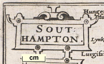
strapwork cartouche
SOUT / HAMPTON.

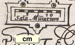
The lower part carries the scale.
scale
old english mile
Sala Miliarum

10 miles = 18.8mm, wrongly assuming a modern statute mile - the scale is thus 1 to 856034. The map scale is about:-
1 to 860000
14 miles to 1 inchA better estimate of the scale is made from town positions, comparing to known town-town distances using DISTAB.exe. The map scale is about:-
1 to 1100000
16.5 miles to 1 inchThe map maker's mile is an:-
Old English Mile = 1.25 statute miles
labelled borders

The left and right map borders are labelled:-
Occidens
Oriensfor west and east.
sea moire effect
coast shaded

The coast is shaded with horizontal lines extended into harbours and river mouths.
castles

The coastal defence castles are drawn and labelled at:-
Hurst cast
Calshot cast
Netley cast
S. Andros
bridges

Rivers are shown by wiggly lines tapering in from the river mouth, the lines stay quite wide and bold. Most are not named, but see:-
Test flu

Some bridges are indicated, at Romsey, Stockbridge, and out of the county.

which is probably 'Old Winchester Hill' near Clanfield.
woods

Forests are clearly shown by groups of trees, not named, not even the New Forest. It is possible to recognize most of the forests.
swash lettering

The county boundary is a dotted line

Swash lettering is used to fill space and label the adjoyning counties and the sea area south of Chichester
town


dot, double circle, tower; labelled lowercase upright text, eg:-
Winchester
Andoner

dot, circle and tower; labelled lowercase italic text, eg:-
RipleyThere is one settlement, Bisthorne north of Christchurch which has dot, circle, but no tower - I am inclined to think this is a mistake not meaningful.


HANT-SHIRE.
CHAPTER. VI.
HANT-SHIRE, lying upon the West of England, is borderered upon the North by Barkshire, upon the East with Surrey and Sussex, upon the South with the British Seas, and Ile of Wight, and upon the West with Dorset and Wilt-shire.
2 The length thereof from Blackwater in the North upon Surrey, unto Bascomb in the South upon the Sea, extended in a right line, is fiftie foure English miles: and the breadth drawne from Peters-field iin the East, unto Tidworth in the West, and confines of Wilt-shire, is little lesse than thirtie miles, the whole Circumference about one hundred fiftie and five miles.
3 The Aire is temperate, though somewhat thick by reason of the Seas, and the many Rivers that through the Shire do fall, whose plentie of fish and fruitfull increase, doe manifoldly redeeme the harmes which they make.
4 The Soile is rich for Corne and Cattel, pleasant for pasturage, and plenteous for woods; in a word, in all commodities either for Sea or Land, blessed and happy.
5 Havens it hath, and those commodious both to let in, and to loose out Ships of great burden in trade of Merchandise, or any other imployments: whereof Portsmouth, Tichfield, Hamble, and South-hampton are the chiefe: besides many other creeks that open their bosomes into those Seas, and the Coast strengthened with many strong Castles, such as Hurst, calshot, South-hampton, S. Andrewes, Worth, Porchester, and South Castle, besides other Bulwarks, or Blockhouses that secure the Countrey: and further in the Land, as malwood, Winchester, and Odiam, so strong, that in the time of King John, thirteene English-men onely defended the Fort for fifteene dayes against Lewis of France, that with a great Host assaulted it most hotly.
6 An-[ ]


TITLE PAGE
England Wales Scotland / and Ireland Described / and Abridged With ye Historic / Relation Of things worthy memory / from a farr Larger Voulume / Done by / John Speed
Anno / Cum privilegio / 1627
And are to / bee sould by / Georg Humble / at ye Whit horse / in popeshead / Alley
TABULATION
A Catalogue of all the Shires, Citties, Bishoprickes, Market Townes, Castles, Parishes, Rivers, Bridges, Chases, Forrests, and Parkes, conteyned in every particular shire of the Kingdom of England.
Shires / Cities / Bishopricks. / Mark Tounes. / Castles / Parish Church / Rivers / Bridgs / Chases / Forrests. / Parkes.
Hant-shire / 01 / 01 / 18 / 05 / 248 / 04 / 31 / 00 / 04 / 22
CHAPTER 1


Published by William Jansson Blaeu in 'Guilielmi Camdeni, Viri Clarissimi Britannia, sive florentissimorum Regnorum Angliae, Scotiae, Hiberniae, & Insularum adjacentium ex intima antiquitate descriptio. In epitomen contracta a Regnero Vitellio Zirizaeo, & Tabulis chorographicis illustrata. Amstelredami, Ex officina Guilielmi Ianssonij, M.DC.XVII.' ie 1617.
Published in 'England Wales Scotland and Ireland Described and Abridged with ye Historic Relation of things Worthy memory from a farr larger Voulume Done by John Speed. Anno Cum privilegio 1620. And are to bee sould by Georg Humble at ye Whit horse in popeshead Alley.' 1620.
Published in 'England Wales Scotland and Ireland Described ... And are to bee sould by Roger Rea the Elder & younger, at ye Golden Crosse in Cornhill against ye Exchange Anno cum privilegie 1662.'
Published in an edition 1665; there is but one copy of this edition known.
Published in editions 1666 and 1668 in which the Hampshire map has the text for Surrey on the reverse.
Published in an edition 1676 in which Hampshire has its own text again


