|
Research Notes
 Map Group LANGLEY 1818
|
 |
|
Langley 1818
|

|
|
|
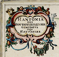
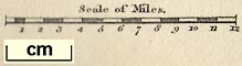
Map, Hampshire, scale about 8.5 miles to 1 inch, by Edward Langley, 173 High
Street, Borough, London, 1817; published in 'Langley's New County Atlas of England and Wales....', 1818.
|
|
The Hampshire map has a vignette of Portchester Castle, Fareham, Hampshire |
| |
 |
PUBLISHING HISTORY |
|
|
ITEMS in the Collection |
|
|
| PUBLISHING |
HISTORY |
|
Published in 'Langley's New County Atlas of England and Wales,
embellished with a beautiful vignette to each Map, exhibiting the mail Coach,
Turnpike, and Principal Cross Roads. With the Cities, Towns, Villages, Parks,
Rivers, & Navigable Canals, Peculiar to each County. Also an Index map of
England and Wales, shewing the connection of one County with another. London.
Published by Langley & Belch, 173, High Street, Borough,' 1818. |
|
The atlas has title page, map of the country and 52 county maps; its size is 7
1/4 x 10 1/4 ins. |
|
Published in another edition '... London Published by Joseph Phelps,
27, Paternoster Row,' 1820. |

| top of page |
|
|
|
ITEMS |
in HMCMS Map Collection and Private Collections (scanned item in bold)
|
|
|
private collection (48) -- map
|
|
| top of page |
|
 |
All Old Hampshire Mapped Resources |