 Map Group LODGE 1788


Warner, Richard: 1795: Collections for the History of Hampshire and the Bishopric of Winchester: (London)


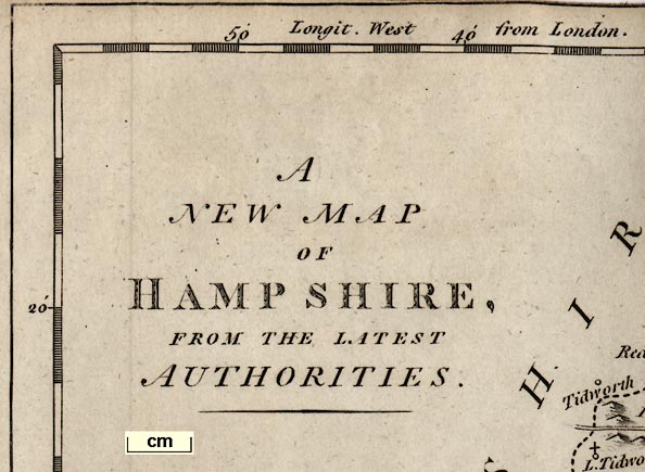
A NEW MAP OF HAMPSHIRE, FROM THE LATEST AUTHORITIES.
compass rose
up is N

Printed on the right is a compass rose; circle, star points for cardinal directions, lines for half cardinal directions, North marked by a fleur de lys. The map is printed with North at the top of the sheet.
lat and long grid

Printed in the borders are scale of latitude and longitude for a rectangular projection; chequered at 2 minute intervals, labelled at 10 minute intervals. The top border is labelled:-
Longit. West from LondonThere is a lat and long grid; just the parallel at 51 degrees west and the meridian at 1 degree north.
scale

The map has a scale line of 10 miles, chequered at two mile intervals, except the first two miles at one mile intervals. Labelled:-
British Statute Miles 69 to a degree10 miles = 49.5mm gives a scale, assuming a statute mile, 1 to 325120, about:-
1 to 330000
5 miles to 1 inch
sea plain
sandbanks

Stokes Bay
ENGLISH CHANNEL
Spithead
Southampton Key or Trisanton BaySandbanks and shallows are suggested by a dotted line offshore in the sea which is otherwise plain.
coast shaded

The coast line is shaded horizontally, taken up into harbours and river estuaries.
bridges
ponds
ferries

Auborn R
Itchen RA river starts at Eastrop by Basingstoke and flows east and north to Hartley Wespall; a river starts at Mapledurwell and flows north east; these meet head on, going no where!
Some ponds, or lakes, are marked, Alresford Pond for example, some are labelled, eg:-
Fleet PondBridges are implied by the roads interupting the rivers. These are mostly unlabelled, but see, for example:-

London Bridge [at Blackwater]
Red Br
Gr. Bridge [N of Romsey]
Knights Br [Berks border]Ferries are neither marked or labelled. However, the road layout by Bursledon is very suggestive of a river crossing by ferry.
coastal defence

Hurst Cast.
Calshot Castle
Southsea CastleThere are no fortifications around Portsmouth or Gosport.
hillocks

The map indicates relief by little hillocks, shaded to the east. These are grouped, a little, but do not clearly portray the shape of the county. There are groupings near the county boundary Liphook-Petersfield and Hale-Bramshaw, for example.
A few hills are labelled, eg:-
Popham Beaconbut no symbol for a beacon, and:-
Basingstoke Downand:-
Black Hill
Knowl Hillon the Wiltshire border.
forests
vegetation

Little tree symbols are used to depict areas of woodland and forests, which may be labelled, eg:-
NEW FORREST
East Bere ForestThere are unlabelled, groups, for example near Froyle. Trees are also drawn in parks.
Some labelling indicates commons etc:-
Aldershot Common
Havant Chace

Hackwood Park
Fremantle ParkMany are not. Some have a settelement symbol within the park, a circle with a small flag, for the great house? eg:-
RotherfieldOr it might be a circle plus a cross, eg:-
Dogmersfieldor just a circle, eg:-
Moyles Court

The county boundary is a dotted line. Hundreds are not shown. Adjacent counties are labelled, eg:-
DORSET SH.The part of Hampshire in the Ambersham area, now Sussex,, is not included.
A very little is drawn in the adjacent counties, Farnham, Downton, Labcomb Corner, for example, just to make sense of the county's mapping.
Remarks
Winchester is a City
Boro-Towns with the No. of Membrs.
they send to Parliamt. by stars [circle and buildings plus the stars]
Market Towns [circle and buildings]
Rectories and Vicarages [circle and cross]
Places where Fairs are kept have
a Line under the Name thus [img]

WINCHESTER

Fareham
Portsmouthbut also:-
SOUTHAMPTON

Owslebury
Alton

Silver Str.
W Wellow
Clanville

Rotherfieldis used for ?great house in a park.
Dinny Lodge
Henaistbury Head
Sparshelt
Gatfield Saye
Barton Traceyand misplacement, eg: Emsworth north of Havant and the river Ems missing; Liphook in Sussex.
There is a nice 'silly' from this sort of error:-
Bishopslabels a village symbol, and to its south is:-
Suttonlabelling a separate hamlet.
Andover 2
Christchurch 2
Lymington 2
Petersfield 2
Southampton 2
Stockbridge 2
Whitchurch 2
Winchester 2
Alton
Appleshaw
Barton Tracey
Bishops Waltham
Botley
Broughton
East Meon
Emsworth
Eversley
Hambledon
Havant
Heckfield
Liphook
Lyss
Mattinger
Southwick
Tangley
Wickham

A network of roads is drawn; the roads drawn by a double line, not differentiated by size etc.
Some routes leaving the county are labelled, eg:-
from Pool
to LondonAnd one junction is labelled:-
Labcomb Corner
roman roads
roman towns

Some roman roads are lebelled:-
Port Way
Ikenield way
Roman Way [Sarum-Winchester]At the end of one road is a circle surrounded by a ring of dots, for the roman town:-

Silchester

Gallowsnorth of East Woodhay.


