 Map Group LUFFMAN1803


Plate 14 in John Luffman's county atlas is an uncoloured engraving, Hampshire, about 37 miles to 1 inch. the map is drawn inside a circle with a double border line. The map size is: wxh, sheet = 9.5x16cm; diam, map = 61mm. The example studied is in a private collection.
Two preface pages from the Atlas are in the Map collection of Hampshire Cc Museums Service, item HMCMS:FA1998.19.4.


map maker
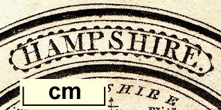
HAMPSHIRE.Printed at the bottom:-
Sold by J. Luffman, 28, Little Bell Alley, Coleman Street, London.
north point
up is N
scale
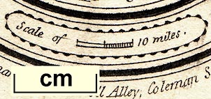
scale of 10 miles.chequered at 5 mile intervals. The scale line is curved! The best estimate of its length is 10 miles = 6.9 mm, giving a scale 1 to 2332383 assuming a statute mile. The map scale is about:-
1 to 2300000
37 miles to 1 inch
Cities are described in this work as [double circle] BATH [upright block caps]
Boroughs ... ... ... [double circle] Bedford [upright lowercase text]
Towns & Villages ... [circle] Pulhely [italic lowercase text]
sea plain
ENGLISH CHANNEL
coast form lines
Dorsetshire
WILTSHIREDorset is in lowercase because space is tight.
WINCHESTER
Southampton
Petersfieldcircle for market towns; labelled in italic lowercase text, eg:-
Alton
FarehamHampshire towns are listed below.
HAMPSHIRE is somewhat more than 60 miles in length from north to south, and about 34 in breadth from east to west. It is divided into 39 hundreds, which contain 1 city, 19 market towns, 253 parishes, and 39,257 houses. Its population amounts to 219,256.
It is one of the most fertile counties in England, and produces corn, hops, cattle, sheep, hogs, and timber: for the latter it is particularly famous, on account of its large forests, the principal of which are the New Forest, and that of East Bere. the manufactures are woollen cloths and kerseys. The chief rivers are the Avon, the Test, the Itchin, and the Stour.
Winchester Co. Town 65 miles from London.
Sends 26 Members to Parlmt.


Alton
Andover
Basingstoke
-
Christ Church
Fareham
-
Gosport
Havant
Kingsclere
Lymington
Alresford
Odiham
Petersfield
Portsmouth
Ringwood
Rumsey
Southampton
Stockbridge
Whitchurch
Winchester


Atlas Pages
Title Page
'A NEW POCKET ATLAS AND GEOGRAPHY OF ENGLAND AND WALES, Illustrated with Fifty-five Copper plates. Shewing all the Great Post Roads with the Towns & Villages situated thereon: Also, A description of the Air, Soil, Productions and Manufactures as well as the number of Hundreds, Cities, Boroughs, Market-towns, Parishes, Houses & Inhabitants. By JOHN LUFFMAN, Geogr. London.
Engraved, Printed & Published by J. LUFFMAN, No.28, Little Bell Alley, Coleman Street, 1803.'
London. Printed for Lackington, Allen and Co. Temple of the Muses Finsbury Square. 1806
PREFACE.
GEOGRAPHY, although a Science both useful and entertaining, and absolutely necessary as a Preparatory to the reading of ancient and modern History, is but too often neglected in the education of our Youth.
A knowledge of Geography of our own Country, in particular, must be obvious to everyone.
With a view to this Part of juvenile Education, I have been induced to offer to the Public the following Sheets, elucidated by Maps, that will at once make the Pupil acquainted, not only with the Form and Situation, but with every Particular relative to each County. The number of Houses, and the Population, is abstracted from the Census taken by order of Government in the Years 1801 and 1802, and printed for the use of the Members of the Parliament of the United Kingdom of Great Britain and Ireland. The Index Map is added in order to shew the relative position of one County with another, and their Situation by Compass from London.
Every Effort has been made to unite Elegance with Utility, and to render this Work equally acceptable to the Traveller and the Student.
JOHN LUFFMAN.
March, 1803.


map maker
ENGLAND.Printed at the bottom:-
Publish'd Oct. 1. 1803, by J. Luffman, No.28 Little Bell Alley, Coleman Street, London.
compass rose
up is N
rhumb lines
North / N by E. / N.N.E. / N.E by N. / N.E. / N.E. by E. / E.N.E. E by N. / East / ...The map is printed with North at the top of the sheet.
Meridian of Londonand the bottom scale of longitude labelled:-
Longitude West / Longitude Easteither side of zero. The prime meridian is through central London, possibly based on St Paul's Cathedral.
The E-W rhumb line through London is also labelled:-
Parallel of London
Explanation.
Cities are thus described [bold dot, and circle] LONDON [upright block caps]
Cities being also County Towns [bold dot, and circle, plus upward line] LINCOLN [upright block caps]
County Towns ... [bold dot] Maidstone [upright lowercase text]
towns ... [circle] Ipswich [italic lowercase text]
The figures annexed to places as BATH 9 shew their rank in the Population and those without figures have a population under Seven Thousand each. The Compass shews the bearings of places from London.
sea plain
ENGLISH CHANNEL
coast form lines
Hampshire
Dorsetshire
WINCHESTERA rank for Winchester is not given.
Southampton / 55


