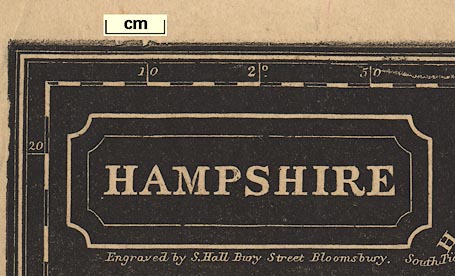
 Map Group PINNOCK 1833


Published in Pinnock's 'Guide to Knowledge' about 1835.


map maker
engraver
publisher

HAMPSHIREand beneath this:-
Engraved by S. Hall Bury Street Bloomsbury.Printed lower right:-
Published by W. Edwards, Ave Maria Lane.

Printed on the left is the coat of arms of the City of Winchester.
north point
up is N

Printed lower right is a north point, N-S line, E-W cross line, North marked by a spear point. The map is printed with North at the top of the sheet.
scale

Printed upper left, beneath the title is a scale of:-
English Mileschequered in miles to 2 miles, then at 2 mile intervals, labelled 1, 2, 4, 6, ... The 16 miles = 41.3 mm gives a scale 1 to 623475 assuming a statue miles. The map scale is about:-
1 to 620000
10 miles to 1 inch

Printed in the map borders are scales of latitude and longitude for a rectangular projection. The bottom scale is labelled:-
Longitude West from GreenwichReading as well as possible from the map the:-
longitude, Winchester = 1d 18.9m Wwhich is close to the accepted value, 1d 18.5m W. The ratio of latitude to longitude scales is 1.60, close to the value, 1.58 at 51dN, to make a 'square' map.
The map includes from 0d 29m to 2d 14m W, from 50d 37m to 51d 22m N; the whole of Hampshire and the Isle of Wight, and some adjacent parts east and west.
sea plain
ENGLISH CHANNEL
Southampton Water
SPITHEADHarbours are not particularly noticed, only:-
Portsmh. Harb.is labelled.
headlands
harbours

The coast line is not emphasised. Some headlands are noticed, eg:-
Hengistbury Hd.
Needs Oar Pt.Harbours are not particularly noticed, only:-
Portsmh. Harb.is labelled.
castles
Hurst Cas.
Calshot Castle
Southsea Cas.Also notice:-
Haslar Hosp.

Avon R
Test R
Blackwater R.Printed white on black, it is not easy to follow river courses, or even to find rivers. Not all the main river systems of the county are shown; no Rother, no Enborne, for examples.

The county boundary is a dash dot line. The detached part of the county in Sussex is shown, but not labelled. Adjacent counties are labelled, eg:-
DORSET SH.
SUSSEXA few settlements and roads are drawn outwith Hampshire for the sake of continuity.

Hundreds are bounded by dotted lines; the areas numbered. The key list for the numbers is not printed on the map sheet.
distances from London

WINCHESTER / 62

Alton / 47
Southampton / 74
54 / PetersfieldThe distance from London accompanies the place name.

Hartley Maudit
Upper Wallop

There is a network of roads drawn by a double line, light bold. On this small map these are probably all turnpike roads? Roads are extended outwith the county to nearby towns.
Basingstoke Can.It is possible to recognise the Basingstoke Canal, Andover Canal, Salisbury and Southampton Canal.


