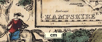
 Map Group RAMBLE 1845


These notes are made from the map in the Map Collection of Hampshire CC Museums Service, item HMCMS:FA2000.45.
The atlas size is 6 x 7 1/8 ins. The map size is: wxh, sheet = 16.5x12cm; wxh, map = 70x108mm.
Published again in Reuben Ramble's, by Darton and Co, London, 1850.


HAMPSHIRE
north point
up is N

Printed upper left is a north point; N-S line; North marked by a fleur de lys; E-W cross line. The map is printed with north at the top of the sheet.
scale

Scale of Mileschequered at 2 miles intervals; on this 10 miles = 11.9mm, giving a scale 1 to 1352390, ie the map scale, perhaps E-W only, is about:-
1 to 1400000
21 miles to 1 inchBut, the map is distorted, stretched out in N-S direction. The latitude scale gives a quite different estimate of scale, 40 minutes latitude = 77.1mm, giving 1 to 962545, the map scale N-S is about:-
1 to 960000
15 miles to 1 inch

Printed in the map borders are scales of latitude and longitude. These appear to be drawn for a trapezoid projection, which is barely worthwhile on such a small map.
sea plain
ENGLISH CHANNEL
THE SOLENT
coast shaded

The coast is emphasisied by shading which extends into harbours and river estuaries.
ponds

Rivers are drawn by wiggly lines, fairly thin above their estuaries. None are labelled. There are some very confused river lines in the Blackmoor area.
Fleet Pondis labelld and drawn; some other ponds are labelled, eg:-
Blackmoor Ponds
Frensham Pond
forests
Holt Forest
Forest of East BereThe New Forest is not labelled.

Some parks are drawn by a ring of fence palings with a pecked interior fill. Hardly any are labelled? but see:-
Bisley Parkon the north east border.

The county boundary is a dotted line. Adjacent counties are labelled, eg:-
WILTSH
town

Winchester

Alton
Odiham

Shalldon
Burriton

A network of roads is shown; roads drawn by a double line.


HAMPSHIRE
HAMPSHIRE contains 354,000 inhabitants: its capital is the city of Winchester. The county includes the Isle of Wight.
The scenery of Hampshire is very pretty and interesting: The North part abounds with long chalk ridges and beech woods; while a great part of the Southern half of the county is occupied by the New Forest, which is one of the noblest forests in England. It was either originally planted or very much enlarged by William the Conqueror, who (it is said) tyrannically turned out a great many people from their homes and destroyed many churches, in order that he might have his way, and get a good place to hunt in. His son, William Rufus, was killed while hunting in this forest. An arrow, shot by a gentleman named Walter Tyrell, glanced against a tree, and shot the king in his breast.
The New Forest is famous for fine pigs, and a very useful hardy sort of ponies, which are bred there: it also abounds with deer. The scenery in it is some of the finest of its kind in the country.
Winchester is a very fine old city, and few places contain a greater number of interesting buildings. The Cathedral is large, and built in a grand style, and is of very great antiquity. The College is also a fine old building. There is a very beautiful Cross, and several fine Churches; and at the distance of about a mile and a-half, stands the Hospital of St. Cross, which is a delightful place, built for the accommodation of a certain number of old men, who have a weekly allowance of money. The custom is kept up here of giving, to all who ask for it, a slice of bread and half-a-pint of good beer. What I have mentioned are not half the curiosities of Winchester, which was a very famous place in the time of the Saxons, and existed long before they came to England.
Southampton is a very handsome town, with a fine port and very ancient walls. In the principal street there is a fine gate of great antiquity called Bargate, and over it are the pictures of two giants. Near Southampton are the beautiful ruins of Netley Abbey.
Portsmouth, Portsea and Gosport are three towns close together, with a fine harbour, and extensive dock-yards for the building of ships of war. Portsmouth is very strongly fortified.


