 Map Group REYNOLDS 1860


Reynold's Geological Map of Hampshire, 1860 is coloured from the 1848 map and is plate 15 from the atlas. The example studied is in the Map Collection of Hampshire CC Museums Service, item HMCMS:FA2000.57.


map maker

HAMPSHIREPrinted at the bottom is:-
London: Published by James Reynolds & Sons, 174, Strand

Index to Sheets of Geological Ordce. Map.These are the sheet numbers of the first edition, the Old Series, 1 inch to 1 mile OS maps. What has been since 1845 a separate organisation, the Geological Survey, started as a department of the Ordnance Survey, 1839 (?), after earlier false starts. The early geological maps were based on the OS 1 inch sheets.
north point
up is N

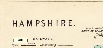
Printed upper left below the title is a north point; N-S line, North marked by an arrow, and E-W cross line.
scale

ENGLISH MILESThe line is chequered at 1 mile intervals. 14 miles = 43.9mm, giving a scale of 1 to 513230. The map scale is about
1 to 510000
8 miles to 1 inch.
RAILWAYSshowing:-
Open Station [continuous line, rectangular block]
Constructing [unfilled double line]It is strange at first that a geological map has this explanation but no explanation of the numbering and colouring of the geological areas. The geology is an addition to an existing map of roads and railways, published 1848 at an exciting stage in the 'railway age'.
sea plain
THE SOLENT
Southampton Water
Stokes Bay
harbours
headlands

The coast line is not emphasised. A few headlands are noticed, eg:-
Hengistbury HeadSome harbours are labelled, eg:-
Portsmouth Harbour
Chichester Harbourthough the latter label is on Langstone Harbour by mistake.
bridges

Rivers are drawn with a double line shaded horizontally until it narrows to a wiggly line. The broad reaches far inland, not just the estaury; for instance, the Test is broad up to Leckford.
Rivers are mostly unlabelled, but see:-
R. AvonBridges are not drawn, but implied by roads crossing and interrupting rivers.
forests
NEW FORESTis labelled.

A few parks are drawn in outline (no fence palings). For example near Northington and near Herriard.

The map shows solid geology; geological ares are coloured and numbered. Notes below.
Some fossil find sites are labelled:-
EOCENE FOSSILS ABUNDANTwest of Barton on the coast.
There is at least one comment about prehistoric finds revant to drift geology:-
FLINT IMPLEMENTS IN DRIFT AT ST. MARY BOURNE

The county boundary is a dashed line. Adjacent counties are labelled, eg:-
WILTSH.but their boundaries are not drawn.
The detached part of Hampshire in West Sussex is shown.
Some main roads, railways, and settlements are shown outside the county for the sake of continuity. Geological data stops at the boundary.
distances from
London

WINCHESTER / 62

ANDOVER / 63
SOUTHAMPTON / 74- or -
groups of blocks on streets; labelled in upright lowercase text, eg:-
Romsey / 73
Alton / 47It is possible that the different treatment signifies a different electoral status?
The figures are the distance from London.

Lr Wallop
Clanfield

The boundary of the two electoral divisions of Hampshire is a thin dotted line. (I think.)

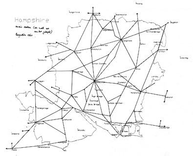
A network of roads is drawn by double line over the whole county. There are at least two grades of road: broad double line, bold light; narrow double line, light light. They are not perfectly easy to distinguish.


Railways are drawn by bold lines. Stations are marked by a bold rectangular spot. These are more prominent than is necessary for a gelogical map; but it must be remembered that the geology is added to an existing map that specifically advertised its coverage of roads and railways.
Lines under construction are meant to be shown by a double line; the bold line without its fill. This is according to the table of symbols. In practice the lines in progress seem to be alternately filled/unfilled lines, for example around Whitchurch.


on the Isle of Wight, Lower Oligocene


Published in a new edition 'Reynolds's Geological Atlas of Great Britain; comprising a series of maps geologically colored, preceded by a description of the Geological structure of Great Britain, and the Geological features of the several counties of England & Wales, mineral products &c; with sections and views. New edition. London. Published by James Reynolds, 174, Strand. 1864.
Published in a 3rd edition, 1889.
Published in a Geological Atlas of Great Britain, by H B Woodward, published by Stanford, London, 1904.


