Research Notes


Map Group UNKNOWN 1850s

Unknown 1850s
Map, Hampshire, and the Isle of Wight, scale about 7.5 miles to 1 inch, with vignette illustrations of towns, published 1850s?

This unidentified map can be dated to about the 1850s from the railways shown. The map studied is in the Map Collection of Hampshire CC Museums Service, item HMCMS:FA1998.31.
The map is sectioned for folding, mounted on ?linen, and folded in a card cover. Printed on the cover:-
MAP OF HAMPSHIRE 1/-
The map size is: wxh, folded = 9.5x13cm; wxh, sheet = 19.5x24.5cm; wxh, map = 187x241mm. The measurements make no allowance for the gaps in the mounting.
 
MAP FEATURES
RAILWAYS
VIGNETTES
ITEMS in the Collection

MAP FEATURES
title    
Printed upper left in ornamental block caps is:-
image snip from map
HAMPSHIRE
The map and its cover give no indication of map maker, engraver, or publisher.

orientation    
up is N    

The map is printed with North at the top of the page. There is no compass rose or north point.

scale line    
scale    

Printed upper left is a:-
image snip from map
Scale of Miles
chequered and labelled at 2 mile intervals. The 12 miles = 41.8 mm giving a scale 1 to 462013. The map scale is about:-
1 to 460000
7 miles to 1 inch

lat and long scales    
The map borders have scales of latitude and longitude for a rectangular projection; chequered at 2 minute intervals, labelled at 10 minute intervals. The map includes from 0d 45m to 1d 52m W, 50d 38m to 51d 28m N; Hampshire and the Isle of Wight. The longitude of Winchester is 1d 18.5m W which agrees with the label on the bottom longitude scale:-
image snip from map
West from Greenwich
The ratio lat/long scales is 1.60 which is 'correct' for Hampshire's latitude.

sea area    
sea shaded    
sea tinted    

image snip from map
The sea area is tinted blue and shaded - or, rather, the coast shading extends far offshore. Some sea areas are labelled, eg:-
ENGLISH CHANNEL
The Solent
Christchurch B.

coast line    
coast shaded    
harbours    

image snip from map
The coast line is emphasised by shading, a second lot of shading lines in between the sea shading. This extends to fill harbours and estuaries.
Harbours can be recognised, only a couple are labelled, eg:-
Portsmouth Har.
Key Haven

coastal defence    
castles    

Only one coastal defence castle is labelled:-
image snip from map
Calshot Cas.
without any building marked.

rivers    
image snip from map
Rivers are drawn with a wiggly line tapering inland from their estuary. Few are labelled, eg:-
Beaulieu R.
Anton R.
The latter labelling the Test.
Most of the main river systems are represented, but without any detail of tributaries etc.
Bridges are implied where roads interrupt a river, but are not specifically indicated or labelled.

relief    
hill hachuring    

Relief is indicated by hill hachuring, perhaps making a serious attempt to show the structure of the county. An example:-
image snip from map
on the Blackwater to Hartfordbridge road in the northeast of the county.

woods    
forests    

Two of the old forests are shown as areas with very small tree and bush symbols, with dotted undergrowth. The two are labelled:-
image snip from map
Forest of Bere
New Forest
It is East Bere Forest that is shown.

parks    
Parks are drawn as an outline with a pecked interior, mostly tinted green. Most are not named, but see:_
image snip from map
Stratfield Saye
labelling the vignette scene beside the park outline.

county    
The county boundary is a dashed line, except where a river is the border, as at Blackwater. The boundary is emphasised with tints, for example:-
image snip from map
Yellow for Hampshire; pink for Wiltshire; blue for Berkshire.
Adjoining counties are labelled, eg:-
BERKSHIRE
A few places are drawn outwith the county to give continuity to the road pattern; Farnham, Salisbury etc.

settlements    
Settlements are shown by a few blocks or by a cross. Places are differentiated for importance by the style of labelling.
city     (overlain by a vignette); labelled in upright block caps, eg:_
WINCHESTER
town     small group of blocks; labelled in upright lowercase text, eg:-
image snip from map
Whitchurch
Southampton
village     a cross (+); labelled in italic lowercase text, eg:-
image snip from map
Leckford
E. Worldham
Botley
One of the maps owners has 'corrected' the spelling of a place name:-
Owlesbury
to
Owslebury
with a heavy handed pen and ink. He has also boxed Shalden; perhaps where he lived.
Are things owned by people, who can rightly mess them about as they like? Or do long lived things own people, who should leave them alone?

roads    
image snip from map
A network of roads is drawn by double solid lines. Roads are differentiated by width into major and minor routes; the major routes have bold and light lines.

railways    
Railways are shown by a bold line overlaying all other features on the map. Stations are marked as:-
image snip from map
Sta.
which is Micheldever Station on the London and Southampton Railway. Some stations are not marked, for instance those at Winchester and Gosport.
A planned route, or one being built, is shown by a bold dashed line, as from Basingstoke to Salisbury.
One of the map's owners has extended the line from Farnham on to Alton, New Alresford and Winchester. Then crossed the last section out and drawn it to join the London and Southampton Railway near Kings Worthy.

canals    
One canal is labelled:-
image snip from map
Basingstoke Canal
Canals are drawn by a curvy bold line. The map shows the Basingstoke Canal with its loop around Dogmersfield Park, and the Andover to Redbridge Canal.

miscellaneous    


race courses    
On Worthy Down north of Winchester is labelled:-
image snip from map
Race Course

  top of page

RAILWAYS
The railways shown are:-
open 1840    
London and Southampton Railway
now called the London and South Western Railway

open 1842    
Bishopstoke to Gosport branch

open 1847    
Eastleigh to Salisbury branch

open 1847    
Chichester to Portsmouth branch

open 1848    
Fareham to Cosham branch

open 1848    
Berkshire and Hampshire Railway

open 1849    
Reading, Guildford and Reigate Railway

authorised 1846    
opened 1857    

Basingstoke and Salisbury Railway

authorised 1853    
opened 1859    

Portsmouth Railway.

Judging by which railways are shown built and being built the date of the map is between 1853 and 1857
 
  top of page

VIGNETTES
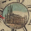
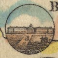
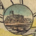
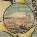
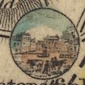
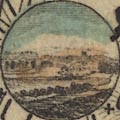
What gives this little map some interest is a series of small circular vignette scenes illustrating places. It is not always clear what is illustrated, though each is labelled:-
Andover    
image snip from map
The parish church.

Basingstoke    
image snip from map
The parish church.

Blackwater    
image snip from map
A large building?

Christchurch    
image snip from map
Presumably Christchurch Priory.

Gosport    
image snip from map
Rather unclear; the town from the harbour, a ship in the foreground.
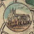
Odiham    
image snip from map
The parish church.

Petersfield    
image snip from map
The market square; if you look closely you can see cattle.
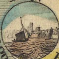
Portsmouth    
image snip from map
The town from the harbour, a ship in the foreground.
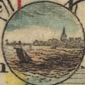
Southampton    
image snip from map
A view from Southampton water, with a sailing boat in the foreground.
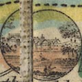
Stratfield Saye    
image snip from map
Stratfield Saye House.

Winchester    
image snip from map
A prospect of the city from the south; a familiar view.

  top of page

ITEMS  in HMCMS Map Collection   (scanned item in bold)
  HMCMS:FA1998.31 -- map
  top of page

   All Old Hampshire Mapped Resources