|
Research Notes
 Map Group UNKNOWN 1860s
|
 |
|
Unknown 1860s
|


|
|
|
Map, Hampshire, with Isle of Wight, scale about 12 miles to 1 inch, published
1860s (about 1862?)
This uncoloured engraved map is plate 17 from an atlas. It has been suggested that is by Haywood, published in Harrison's
School Atlas, 1878-91. The railways suggest otherwise. The map studied
is in the Map Collection of Hampshire CC Museum Service, item
HMCMS:FA2001.94.
|
|
The map size is: wxh, sheet = 17x23cm; wxh, map = 151x194mm.
The map has a piano key border in the style used on Ordnance
Survey one inch maps of the early 19th century, the Old Series.
|
| |
 |
MAP FEATURES |
 |
REFERENCES |
 |
ITEMS in the Collection |
 |
|
| MAP FEATURES |
|
title
|
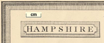
Printed upper left in a shaded cartouche:-
HAMPSHIRE
|
orientation
compass rose
up is N
|
Printed upper right is a compass rose; no circle, star points
for cardinal and half cardinal directions, North marked by a
fleur de lys. The map is printed with North at the top of the
sheet.
|
scale line
scale
|
Printed lower left is a:-
Scale of Miles
chequered in miles to 5 then at 5 miles intervals. The 10
miles = 21.4 mm gives a scale 1 to 750030 assuming a statute
mile. The map scale is about:-
1 to 750000
12 miles to 1 inch
|
sea area
sea plain
|
The sea area is plain, some areas are labelled, eg:-
ENGLISH CHANNEL
Christchurch Bay
Spithead
|
coast line
coast form lines
headlands
harbours
|
The coast line is emphasised by form lines, which continue
into river estuaries and harbours. The most important harbour is
labelled:-
Portsmouth Harb
One of Hampshire headlands is labelled:-
Hengistbury Head
|
coastal defence
castles
|
Most of the coastal defence castles of the county are ignored,
but see:-
Hurst Castle
|
rivers
|
Rivers are drawn by a wiggly line tapering upstream. Some
rivers are labelled, eg:-
R. Avon
R. Itching
Not all the county's main rivers are shown. It is possible to
find the Stour, Avon, Lymington, Beaulieu, Test, Itchen, Hamble,
Meon, Blackwater, Enborne, and a few tributaries.
|
relief
|
No relief is shown.
|
forests
|
No woodland is indicated, not even the New Forest is
labelled.
|
parks
|
parks are drawn in outline with fence palings, the interior
dotted, and a dot for the great house. Many parks are labelled,
by name or name of their house, eg:-
Hackwood Park
Stratton Park
Ashurst Lodge
Tilney Hall
|
county
|
The county boundary is a dotted line. The detached part of
Hampshire in West Sussex is shown, labelled:-
Part of Hants
Adjacent counties are labelled, eg:-
DORSETSHIRE
|
settlements
distances from London
|
Settlements are marked by a few blocks. Places are
differentiated by style of lettering.
|
|
city
|
a few blocks; labelled in upright block caps:-
WINCHESTER / 62
|
|
|
|
town
|
a few blocks; labelled in upright lowercase text, eg:-
Odiham / 41
Stockbridge / 66
Portsmouth / 75
The figure gives the distance from London.
|
|
|
|
village
|
a block; labelled in italic lowercase text, eg:-
Upper Wallop
Highclere
|
|
|
roads
turnpike roads
|
Roads are drawn by a double line, one line bold. At this
period the light bold convention usually indicates turnpike
roads.
Road destinations outwith hampshire are labelled at the
borders, eg:-
To Staines and London
To Newbury
From Salisbury
The flow of travel is towards the capital.
|
canals
|
canals are drawn by a bold curvy line, labelled, eg:-
Basingstoke Canal
Andover Can.
|
railways
|
Railways are drawn by a bold line with cross lines, the same
convention used by the OS Old Series maps.. The line might be
labelled, eg:-
London & Southampton
Raily.
The destination of lines outwith the county might be labelled,
eg:-
To Reigate
from Salisbury
To Reading
|

| top of page |
 |
|
| REFERENCES |
|
|
|
Haywood, James: 1878=1891 (?): Harrison's School Atlas (perhaps) |
 |
|
|
ITEMS |
in HMCMS Map Collection (scanned item in bold)
|

|
HMCMS:FA2001.94 -- map
|

| top of page |
|
 |
All Old Hampshire Mapped Resources |

 Map Group UNKNOWN 1860s


