 Map Group WHITWORTH 1770


map maker
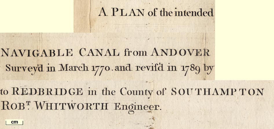
A PLAN of the intended NAVIGABLE CANAL from ANDOVER to REDBRIDGE in the County of SOUTHAMPTON / Survey'd in March 1770, and revis'd in 1789 by ROBT. WHITWORTH Engineer.
compass rose
up is E
From my own experience I note that a tall and thin canal map, which for this canal would put North at the top, has the advantage of giving more space for place name and other labels.
scale
British Statue Miles.chequered in quarter miles for the first mile, then in half miles, labelled at mile intervals. 10 miles = 100.0 mm gives a scale 1 to 64374. The map scale is about:-
1 to 64000
1 inch to 1 mile.
coast form lines
bridges
River Anton or Testis followed by the canal to Fullerton, from where it follows the River Anton, which is drawn but not labelled.
A small unlabelled tributary of the Test is shown at Nursling, which drains the Ashfield area, crossing the canal to the river. The:-
Titburn Brookis shown as a tributary to the Test coming through Romsey from the east, crossing the canal in the town. The larger River Dun is drawn as an insignificant tributary from the west between Kimbridge and Mottisfont - but it is probably not relevant to the hydrology of the canal. The stream through Kings Somborne is drawn crossing under a bend of the canal to a bend in the river. The Wallop Brook at Bossington is not shown; it comes from the west and does not cross the canal.
The small tributary to the Anton:-
Pillhill Brookis shown and labelled at Upper Clatford, crossing under the canal with ponds looking as if they are made by the canal embankment, to the west.
Braiding of the Test and other streams is shown in some detail; but I have not attempted to check the truth of its mapping. The detail of the streams is simplified.
Some of the river bridges are shown, on the River Test, and some of them are labelled:-
Skidmore Bridge [S of Romsey]
Great Bridge [N of Romsey]
Timsbury Bridge [N of Romsey]
Horsebridge [by Houghton]
Kitcomb Bridgeand on the Pillhill Brook:-
Little Ann BridgeThere are many other unlabelled bridges over the rivers and streams.
hill hachuring
Midla Hillby Lakeford.
Grove Place
Broadlands
Marsh Courtare labelled. These might have lands effected by the canal?
table of parishes
PARISHES.
A Andover
B Upper Clatford
C Lower Clatford
...
O Millbrook
street map
ANDOVER
RUMSEYThe large town of Southampton, a mile or two from the end of the canal, has upright block caps.
Ling's Somborn
Longstoke
Bolsington
Park farm
Fullerton
Kimbridge Mill
water mills
Mill [Romsey]
Kimbridge Mill
Houghton Milland on the River Anton:-
Nours's Mill [Lower Clatford]
Clatford Mill
Rooksbury Mill
Mr Barlow's Mill [S of Andover]


The course of the canal follows up the east side of the valley of the River Test from an entrance off Southampton Water at Redbridge. It leaves this valley, crossing over the river, and follows the tributary valley of the River Anton, crossing it first, up the west side, to Andover. Although the canal follows rivers it remains independent of them, makes no attempt to be a river navigation. The rivers and steams crossed are noted above.
Along the plan there are numbers by the canal; from 1 near Andover to 89 at Southampton Water. Another short series numbers what looks like an artificial pond on the Pillhill Brook, from 90 at Little Ann Bridge to 96 at Upper Clatford. These numbers are not equispaced, ie they are not distances. They do not relate to altitude. It would be helpful to have the descriptive text belonging to the map, to understand this feature, and perhaps other detail. (Nothing useful, like a schedule, has been found in the HantsRO collection to explain these numbers: MN: 2.2002.)
3d Lockat Lower Clatford, and:-
21st Lockthe last, just before Southampton Water.
The fall of the canal from Andover to redbridge is given in a table printed lower right, in feet and inches:-
From Andover to Stockbridge 65:8
Stockbridge to Rumsey 61:4
Rumsey to Redbridge 49:9
Total 176:9The average fall of a lock is about 8 feet 5 inches.
From Andover to Stockbridge 7:7:6.12
Stockbridge to Rumsey 9:3:8.60
Rumsey to Redbridge 5:1:4.63
Total 22:4:9.25There is a small mystery in these figures; the last unit, fractions of a chain, are not named. If you add the figures there have to be 110 of the unknown unit to 1 chain. (OR: the sum is wrong.)


