|
Research Notes
 Map Group JOHNSTON 1900s
|
 |
|
Johnston 1900s
|


|
|
|
Railway map, England and Wales, south sheet, published by W and A K Johnston, Edinburgh, Lothian and London, 1900s.
|
|
These notes are taken from the Hampshire part of JOHNSTON'S RAILWAY MAP 1900s, a colour printed railway map of England and Wales, southern sheet. The map studied is in the Map Collection of Hampshire CC Museums Service, item HMCMS:FA2000.2.
|
|
The map size is: wxh, sheet = 48x37cm; wxh, map = 426x323mm,
plus bits outside the border.
|
 |
COVERAGE |
 |
MAP FEATURES |
 |
ITEMS in the Collection |
 |
|
| COVERAGE |
|
|
The whole map includes, in England - most of Suffolk,
Cambridgeshire, Huntingdonshire, Bedfordshire, Warwickshire,
Worcestershire, Herefordshire, Gloucestershire, Somerset, Devon,
Cornwall, Oxfordshire, Buckinghamshire, Bedfordshire,
Hertfordshire, Essex, Middlesex, London, Berkshire, Wiltshire,
Dorset, Hampshire, Isle of Wight, Surrey, West Sussex, East
Sussex, and Kent. And in Wales - most of Cardiganshire,
Carmarthenshire, Pembrokeshire, Radnorshire, Brecknockshire,
Glamorganshire, Monmouthshire.
|
|
These notes are about the Hampshire area only.
|

| top of page |
 |
|
| MAP FEATURES |
|
title
map maker
|
Printed lower right:-
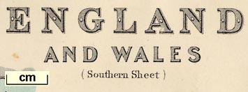
ENGLAND AND WALES (Southern Sheet)
...
and at the bottom:-
Engraved, printed & Published by W. &
A.K. Johnston, Edinburgh & London.
|
orientation
up is N
|
The map is printed with North at the top of the sheet.
|
scale lines
scale
|
Printed lower right there are three scale lines:-
Geographical Miles. 60 = 1
degree.
English Statute Miles. 69.16 = 1
degree.
French Kilometres 111.3 = 1
degree.
The scale of statute miles is chequered and labelled at 10
miles intervals, with a left extension chequered in miles,
labelled at 5 and 10. The 40+10 miles = 65.9 mm giving a scale 1
to 1221050. The map scale is about:-
scale: 1 to 1200000
19 miles to 1 inch
|
lat and long scales
lat and long grid
index grid
|
Printed in the map borders are scales of latitude and
longitude for a conical projection; chequered at 10 minute
intervals, labelled at 30 minute intervals. The map includes from
1d 40m E to 5d 40m W, from 49d 5m to 52d 30m N; plus an inset map
for the Scilly Isles.
A graticule, latitude and longitude grid, is printed at 30
minute intervals. This grid is also an index grid. Its 'squares'
are labelled A..O (no J) across, h..o (no j) down. The north
sheet presumably has a..h.
|
coast line
coast tinted
lighthouses
|
The sea area is plain, labelled:-
ENGLISH CHANNEL
STRAIT OF DOVER
with smaller areas labelled, eg:-
Spithead
The Solent
Southampton Wr.
|
coast line
coast tinted
lighthouses
|
The coast line is tinted blue.
The larger harbours of Hampshire can be recognised but
only:-
Langston Harb.
is labelled.
Some lighthouses are noticed, eg:-
L.H. [on Hurst Spit]
|
rivers
|
Rivers are drawn by wiggly lines, some labelled, eg:-
Alre [the Meon]
Itchen
Anton or Test
In Hampshire, all the main river systems are shown with their
important tributaries.
|
relief
hill hachuring
|
Some relief is indicated by hill hachuring. While the shape of
the county is not well described by these symbols, at least
the:-
South Downs
North Downs
and the edge of Salisbury Plain, are clearly located.
Portsdown in missing.
|
woods
forests
|
Woodland is mostly ignored. In Hampshire there are small tree
or bush symbols and dotting for rough ground, labelled:-
New Forest
|
county
|
County boundaries are a bold lone, emphasised by a tint for
each county. Hampshire is red, the surrounding counties are -
Dorset orange, Wiltshire green, Berkshire orange, Surrey green,
Sussex yellow, Isle of Wight red. County areas are labelled,
eg:-
HANTS
|
settlements
|
Settlements are marked by a circle or dot and circle,
differentiated by style of labelling.
|
|
city
|
dot and circle; labelled in upright lowercase text, eg:-
Winchester
|
|
|
|
town
|
circle; labelled in upright or italic lowercase text, eg:-
Southampton [upright]
Portsmouth [upright]
Alton [italic]
Andover [italic]
|
|
|
village
hamlet
|
circle; labelled in light italic lowercase text, eg:-
Over Wallop
Highclere
The choice of places to be included seems to be influenced by
what space is available between other features.
|
|
|
canals
|
Canals are drawn by a curvy line, bolder than rivers,
sometimes crossing rivers. In Hampshire it is possible to
find:-
|
|
Andover Canal
|
sort of recognisable from Andover to Redbridge, labelled:-
Canal
|
|
|
|
Basingstoke Canal
|
drawn from west of Basingstoke to the county boundary, and
onwards. Not labelled.
|
|
|
railways
|
Railways are clearly drawn by a bold line with cross lines. In
Hampshire the lines built up to 1905 can be recognised, but not
the line built in 1925.
|

| top of page |
 |
|
|
ITEMS |
in HMCMS Map Collection (scanned item in bold)
|

|
HMCMS:FA2000.2 -- railway map
|

| top of page |
|
 |
All Old Hampshire Mapped Resources |

 Map Group JOHNSTON 1900s


