 Map Group NAISH 1716


This is in the Map Collection of Hampshire CC Museums Service, item HMCMS:FA2004.1. Hampshire interest is solely the inset map of the River Avon through Wiltshire, Hampshire, and parts of Dorset that were Hampshire, by Thomas Naish and James Mooring, surveyed 1675, which is printed at the left of the city plan of Salisbury.
Minimal notes are made about the street map of the city of Sarum.


plain cartouche
map maker

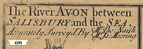
The RIVER AVON between SALISBURY and the SEA. Accurately Survey'd By Mr. Tho: Naish / Mr. Ja: Mooring.Thomas Naish was the Clerk of Works of Salisbury Cathedral. The river map was surveyed in 1675.
up is N
scale
A Scale of Furlongs and Miles for the River Avonchequered in furlongs, labelled 1..10, 20,30 furlongs and 1..4 miles. The 4 miles = 83.1 mm gives a scale 1 to 77465. The inset map scale is about:-
1 to 77000
1 inch to 1 mile

THE SEA
harbours
headlands
Christ Church HarbourThe headland here is labelled:-

Hensbury Headfor Hengistbury Head.
PART OF THE NEW FORREST
ponds
bridges

Rivers are drawn as a wiggly double line with form lines, or a dotted double line. The river of the map is named by the map's title. Two tributaries are shown, at Salisbury:-
the Wyewhich is the River Wylye. And at Christchurch the:-
River StourAlong the Avon's course braiding is shown, in two ways. The solid double line might have two courses; a dotted double line might show another course. The intention behind the use of solid and dotted double lines is not properly understood. Comparing the map with modern maps of the river shows that many of the courses match what is. Note that none of the dotted courses has the appearance of an ox bow cut off.
Near Sopley there is drawn a:-

Decoy Pondin a formal shape, roughly circular with four curved tapering arms.
Some 'bridges' are indicated by a double line, for a road, crossing and interrupting the stream. Some are labelled, eg:-

Bistern Bridge
Fording BridgeAt least one of these, Bistern Bridge, is, today, a ford. The symbol may just indicate a river crossing.

Ibsley
Ringwood
Voles FarmePerhaps labelled with the owner, eg:-

Esqr. Perkins


church & houseNorth Charford, Hale
North Charford Manor House, Breamore (perhaps)
churchHale
church & houseBreamore
Breamore House, Breamore
houseFolds Farm, Fordingbridge (perhaps)
church & bridgeFordingbridge
Great Bridge, Fordingbridge
house & bridge (over 1 braid of stream to island)Bickton, Fordingbridge
footbridge, Bickton
churchHarbridge, Ellingham, Harbridge and Ibsley
churchIbsley, Ellingham, Harbridge and Ibsley
houseSomerley Park, Ellingham, Harbridge and Ibsley
churchEllingham, Ellingham, Harbridge and Ibsley
houseAshley, Ringwood (probably)
churchRingwood
building (2, small)Moortown, Ringwood
churchBisterne, Ringwood
bridgeWattons Ford, Ringwood (probably)
[no symbol]Avon Mill, Sopley
pond (interesting shape)pond, Hurn (probably)
houseunidentified
churchSopley
[no symbol]Winkton Mill, Burton
houseWinkton House, Burton (perhaps)
church (grand) & bridge (over 3 braids of stream)Christchurch
Christchurch Priory
Town Bridge, Christchurch
[harbour]Christchurch Harbour
[headland]Hengistbury Head, Bournemouth


drape cartouche
coat of arms
map maker
publisher
The City of SALISBURY wth. the Adjacent CLOSE, CHURCH and RIVER Accurately Surveyed By William Naish. / ...
Sarum. Printed & Sold by Benjn. Collins, Printer, on the New Canal.Above is a coat of arms of the city.
William Naish is believed to be brother of Thomas who surveyed the river map (see below). He had been a surgeon's mate in the Royal Navy and later opened a apothecary's shop in Salisbury. He was also Assistant Surveyor of the Fabric of Salisbury Cathedral.
Benjamin Collins was a nationally known 18th century publisher who published first editions of William Goldsmith and other well known writers. He was the brother of William Collins, who re-started the Salisbury Journal in 1729. Both brothers were associated with it from that date and when William died in 1740 Benjamin took it over, invigorated it, and it became one of the great regional newspapers. Benjamin severed his connection with the Journal in 1775 and died in 1785.
coat of arms
To the Right Reverend Father in God JOHN Lord BISHOP of SARUM This Plate is humbly dedicated by his Lordship's most obedient humble Servant Benjn. Collins.Bishop John was John Gilbert, who was Bishop of Salisbury from 1748 to 1757 when he was translated to York.


