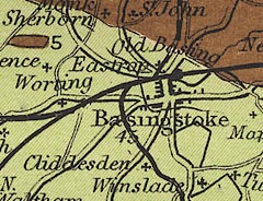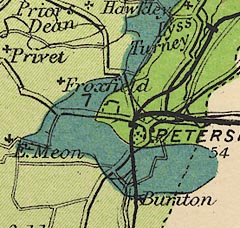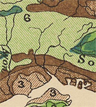
 Map Group STANFORD 1904


map maker
publisher
HAMPSHIREPrinted at the bottom:-
[London: Edward Stanford, Ltd., 12, 13, & 14, Long Acre, W.C.]partly trimmed off.
scale
ENGLISH MILESchequered at 1 mile intervals, labelled at 2 mile intervals. The 14 miles = 43.8 mm gives a scale 1 to 514402. The map scale is about:-
1 to 510000
8 miles to 1 inch
sea plain
THE SOLENT
Southampton Wr.
headlands
harbours

The coast line is unemphasised. A few headlands are noticed, eg:-
Hengistbury Headand some harbours are labelled, eg:-
Portsmouth Harb.

Most rivers are drawn by wiggly line tapering inland, a wide river, the Avon and Test for examples, is drawn by a double line with shading. Some braiding might be indicated, as on the Avon. A few rivers are labelled, eg:-
R. Avon
Blackwater R.The map does not give comprehensive coverage of the major river systems of the county.
forests
NEW FOREST
Woolmer Forestare labelled.
DORSETA few settlements, roads, and railways are shown outwith Hampshire, for the sake of continuity. Rarely, see near Bramshaw and Farnham, a geological area is continued across the county boundary.
distances from London
WINCHESTER / 62
LYMINGTON / 93
PETERSFIELD / 54
Stockbridge / 66
Alton / 47The figure is the distance from London.
Ur. Wallop
Meon Stoke

Railways are drawn by bold lines, perhaps,with a square block for a station. The railways are not named on the map, but an accompanying text in the atlas names the railway, and describes what geology can be seen from the line.
index map

Geology is what this map is about. Areas of solid geology are coloured and labelled with a number that refers to a table of strata near the front of the atlas (transcribed in the note about the atlas):-

Hampshire's geology includes:-
3 [pale brown] OLIGOCENE
4 [mid brown] UPPER EOCENE
5 [brown] LOWER EOCENE
6 [pale green] CHALK
7 [cyan] UPPER GREENSAND AND GAULT CLAY (SELBORNIAN)
8 [green] LOWER GREENSANDThe county is described in the atlas text (see below).
There are some comments about fossils to be found. For example: near Barton in Christchurch Bay, is labelled:-
EOCENE FOSSILS ABUNDANTThe note might be about antiquities, eg:-
FLINT IMPLEMENTS IN DRIFT AT ST. MARY BOURNEPrinted bottom right is an index map showing which
New Series 1 [inch] Ordnancegeological maps are relevant to the county. Sheets:-
267, 268, 269; 282, 283, 284, 285; 314, 315, 316, 317; 329, 330, 331, 332; and 343.


Hampshire. Map 15. Area 1,052,810 acres.
This county is formed entirely of Cretaceous, Tertiary, and newer strata. In the northern part there is a tract of Reading beds, London clay, and Bagshot beds, which occupy a portion of the London Basin. These strata extend from Farnborough to the old Roman town of Silchester and westwards to Kingsclere. Here the Chalk is highly tilted and bent into an anticline, the eroded summit of which leaves bare the Upper Greensand of Burghclere. Southwards there is an undulating expanse of Chalk, from Basingstoke to Andover and Winchester. Eastwards from near Alton to Petersfield on the borders of Surrey, Upper Greensand, Gault, and Lower Greensand appear, in a picturesque region which includes Selborne, the home of Gilbert White, Woolmer Forest on the Gault, and the Lower Greensand hills of Bramshot.
South of Winchester we again enter a Tertiary area, the Hampshire Basin, which includes the Reading beds and London clay along the Chalk borders. These are bent into a gentle anticline near Havant and Fareham, which has been much planed down and concealed by Pleistocene gravel and brickearth. Remnants of an old sea-beach occur below Portsdown Hill. The New Forest is situated on a tract of Bagshot and Bracklesham beds, and partly on Oligocene clays and sands. On the coast at Barton the Barton clays are richly fossiliferous, and many fossils have also been obtained at Hordle (or Hordwell). Westwards the Bagshot beds of Bournemouth have yielded many plant-remains, including fig, cinnamon, palm, and aralia.
... ...
Sea-side resorts: ... Barton-on-Sea, Boscombe (sands and cliffs), Bournemouth (sands and cliffs), Hayling Island (sands), Southsea (shingly).
Railways through Hampshire
VIII. LONDON AND SOUTH WESTERN RAILWAY
London to Winchester, Southampton, Weymouth, and Portland
MAP 28 / Leaving Waterloo Station, we pass over the Lower Eocene strata near Walton-on-Thames, noting sections of Thames Valley gravel at Clapham Junction, and of the London clay near Wimbledon and Surbiton. Crossing a portion of the Thames valley, we enter upon the sandy, fir-clad, and heathy country formed by the Bagshot beds, that extend from near Walton and Hersham, by Weybridge, Woking, and Brookwood, past the Chobham Ridges, to beyond Farnborough. Near Weybridge there is a fine section of Bagshot sands resting on London clay, and covered by an irregular accumulation of gravel. Picturesque pools of water, held up by clayey beds i the Bagshot series, diversify the scenery here and there near Fleet. A few miles south of Fleet is the military station of Aldershot.

MAP 15 / At Basingstoke we come on the Chalk, end thence cross an open undulating tract with scanty hedgerows, wooded hollows, and plantations here and there, and thinly populated. We traverse occasional tunnels and cuttings in this formation, through Micheldever to Winchester. Near Shawford, old terraces of cultivation (lynchets) may be observed.
About four miles south of Winchester we enter the Tertiary tract of the Hampshire Basin, passing along the valley of the Itchen river, across outcrops of Reading beds and London clay, to Eastleigh and Bishopstoke, on to the Bagshot series, which covers a considerable area around Southampton. The ground here is lower and more wooded. At St. Denys we pass the tidal waters of the Itchen, and beyond, at Southampton West, we have views of the old town wall and of Southampton Water, with its mud flats at low tide. The new docks were excavated through estuarine mud with Scrobicularia and freshwater deposits into Bracklesham beds.
MAP 11 / Through Totton and Elling, we cross a low lying pastoral country, bordering the New Forest, with its heaths and woodlands and here and there cultivated tracts, and traverse cuttings in loams and brown and white sands, past Lyndhurst Road, Brockenhurst, and Ringwood, to Wimborne Junction, where we come into more cultivated regions. We cross the Stour, and thence proceed through cuttings in sands and white clays by Broadstone Junction, with peeps of Poole Harbour and of the Chalk range of Purbeck to the south, on to Hamworthy Junction.
MAPS 15, 11 / If we journey from Brockenhurst, via Bournemouth, to Hamworthy Junction, we cross the Avon, which flows out to sea east of Hengistbury Head, through Christchurch and Bournemouth, and along the borders of Poole Harbour, whence various pottery clays are shipped. At Hamworthy Junction,, and again near Moreton, the clays are worked for bricks and tiles. The cuttings for the most part show sands capped by gravel.
...
Winchester to Guildford
MAP 15 / Winchester is situated amid bold hills on a denuded anticline in the Chalk, whereby the Middle Chalk is exposed in the southern parts of the city, and the Lower Chalk in the valley to the south-east.
Leaving the station at Winchester (on Upper Chalk) we pass over an undulating, cultivated Chalk country, and branch off from the main line where it crosses the Great Western Railway from Didcot. Turning eastwards we follow the northern side of the Itchen river with valley gravel and alluvium, through a well-timbered tract to Itchen Abbas. Thence we pass through cuttings in Chalk with flints, cross the river-valley and traverse Chalk to the south of Alresford. In the cuttings beyond, the Chalk has fewer flints, and we pass Ropley, through occasional cuttings, and over a fairly wooded agricultural country with brown flinty soils. Towards Medstead the Chalk is more flinty, clay-with-flints caps much of the escarpment of the Upper Chalk, and the strata are seen in deep cuttings. Beyond we enter a more diversified country, wooded and undulating with some hop-grounds, and descend to the Middle and Lower Chalk at Alton, in the valley of the Wey. An extensive view is obtained to the south over a gently undulating well-timbered tract, largely under cultivation. Selborne, famed as the home of Gilbert White, the naturalist, is situated about four miles SSE. of Alton, on the borders of the Lower Chalk and Upper Greensand.
MAP 28 / From Alton the railway continues along the Wey valley, over tracts of river gravel on Lower Chalk, seen in shallow cuttings, to the Upper Greensand south of Froyle. Thence we traverse the Gault in the lower part of Alice Holt Forest, and beyond cross the false-bedded brown sands of the Lower Greensand, with overlying gravel, as we approach Farnham. ...
Basingstoke to Salisbury, Exeter, Barnstaple, and Ilfracombe
MAPS 15, 11 / From Basingstoke we traverse the Chalk through Whitchurch and Andover to Salisbury. ...
...
Woking to Portsmouth
...

MAP 15 / ... we continue through a sandy country to Petersfield. Thence we cross a belt of Gault and Upper Greensand, traverse the Chalk of the South Downs to Rowland's Castle, and proceed across Reading beds and London clay to Havant (see pp.145, 146). From Havant we cross a drift-covered tract of Chalk and Eocene strata to Portsmouth.
... ...
IX. LONDON, BRIGHTON AND SOUTH COAST RAILWAY
London to Portsmouth
...
MAP 28 / Travelling from London Bridge ...
MAP 15 / ... Here [Arundel] the Lower Eocene beds of the Hampshire Basin occupy a syncline, and the Chalk again occurs to the south concealed by drift. In this region, indeed, from near Arundel to Havant and Portsmouth, both Chalk and Eocene beds are almost wholly concealed by chalky gravel (Combe rock) and brickearth. It is a flat but fertile agricultural tract with many market gardens. Beyond Havant we cross an alluvial,tract to the island region on which Portsmouth is situated.
...
Portsmouth to Worthing, Brighton and Lewes
MAP 15 / Portsmouth is situated on a promontory, practically an island, with Portsmouth Harbour on the west, and Langstone Harbour on the east. A fringe of shingle occurs on Southsea Common on the coast bordering Spithead. The foundation strata consist from south to north of Bracklesham beds, Lower Bagshot beds, London clay, and Reading beds. The last-named is locally noted for the Stamshaw clay used for puddling and other purposes. It is exposed at North End over s small area traversed by the railway. With this exception the Eocene strata and Chalk are concealed by coverings of gravel and brickearth, beneath which they occur successively in passing northwards over the alluvial belt which connects the island with the mainland. The foundation strata of Chalk and Eocene are bent into the Portsdown anticline, so that in proceeding further north we pass from the Chalk, here covered by brickearth on to Reading beds, and to gravel and brickearth over London clay at Havant. / MAP 28 / Thence on to Chichester ...


map maker
publisher
GEOLOGICAL MAP OF GREAT BRITAINPrinted at the bottom:-
Stanford's Geographical. Estabt. London / London: Edward Stanford, Ltd., 12, 13, & 14, Long Acre, W.C.
up is N
scale
1 to 6000000
95 miles to 1 inch
sea plain
Bristol Channel
The Wash
headlands
A very few headlands are labelled, eg:-
Selsey Bill
Avonat Christchurch.
South Downs
LONDON
Lyme Regiseach with a circle, and the name.
table of strata

The solid geology of the country is marked in colour printed areas, each labelled with a number. At this small scale the geology is simplified. The number refers to a table of strata printed upper right on the map:-
Index of Colours
...
3 [pale brown] Oligocene
4 [mid brown] Upper Eocene
5 [brown] Lower Eocene
6 [pale green] Chalk
7 [cyan] Upper Greensand
7a [cyan] Gault
8 [green] Lower Greensand
...


STANFORD'S GEOLOGICAL ATLAS OF GREAT BRITAIN AND IRELAND WITH PLATES OF CHARACTERISTIC FOSSILS PRECEDED BY DESCRIPTIONS OF THE GEOLOGICAL STRUCTURE OF GREAT BRITAIN AND IRELAND AND THEIR COUNTIES; OF THE CHANNEL ISLANDS; AND OF THE FEATURES OBSERVABLE ALONG THE PRINCIPAL LINES OF RAILWAY BY HORACE B. WOODWARD, F.R.S., F.G.S.
THIRD EDITION LONDON: EDWARD STANFORD, LTD. 12, 13, & 14, LONG ACRE, W.C. 1914
PREFACE
THE first edition of Stanford's Geological Atlas ... was published in 1904. It was based in general plan, and especially in regard to the maps, on Reynold's Geological Atlas ... 1860 and 1889. The text, however, was entirely re-written, ... descriptions of the geological features observable along the main lines of railway were added.
A few of the original text-illustrations were retained; others were borrowed from Sir Andrew C. Ramsay's Physical Geology and Geography of Great Britain. The figures of fossils were reproduced chiefly from Lowry's Tabular View of Characteristic British Fossils; others were taken from the Chart of Fossil Crustacea, arranged by J. W. Salter and Dr. Henry Woodward, and a few from Ramsay's Physical Geology.
The maps in the original Atlas were based to a large extent on those of the Geological Survey, and they have been revised, as far as the scale has permitted, from the later published maps of that institution.
...
The present edition has been amplified ... [little of significance to Hampshire].
...
HORACE B. WOODWARD. / CROYDON. / September 1913.


INDEX TO GEOLOGICAL MAPS. / PRINCIPAL ORGANIC REMAINS OR FOSSILS.
...
3 [pale brown] OLIGOCENE: Fluvio-marine Series (shelly clays, sands and limestones) .. .. .. Insects, Mollusca (Corbula, Cyrena, Cytherea, Bulimus, Cerithium, Limnaea, Planorbis); Crocodiles, Chelonians (Trionyx, Emys); Mammals (Anoplotherium, Palaeotherium).
4 [mid brown] UPPER EOCENE: Barton, Bracklesham and Bagshot Beds (sands and clays) .. .. .. Plants (Aralia, Ficus, Sequoia); Nummulites, Insects, Mollusca (Cardita, Crassatella, Cerithium, Conus, Fusus, Rostellaria, Voluta); Reptiles (Chelone, Paelaeophis); Mammals (Lophiodon).
5 [brown] LOWER EOCENE: London Clay / Lower London Tertiaries (pebble beds, sands and clays) Plants (Nipadites); Crustacea; Mollusca (Cyprina, Cyrena, Corbula, Pectunculus, Pleurotoma, Voluta, Nautilus); Fishes, Crocodiles, Turtles, Birds, Mammals (Hyracotherium).
6 [pale green] CHALK .. .. .. Foraminifera; Sponges (Ventriculites); Echinoderms (Echinocorys, Galerites, Marsupites, Micraster); Brachiopods; Mollusca (Inoceramus, Ostrea, Pecten, Ammonites, Belemnitella, Scaphites); Fishes, Saurians, Birds (Enaliornis).
7 [cyan] UPPER GREENSAND AND GAULT CLAY (SELBORNIAN) .. .. .. Sponges (Siphonia); Crustacea; Mollusca (Exogyra, Pecten, Inoceramus, Ammonites, Belemnites); Fishes.
8 [green] LOWER GREENSAND .. .. .. Sponges; Crustacea (Meyeria); Brachiopods; Mollusca (Exogyra, Perna, Trigonia, Ammonites).
...
FORMATIONS OF GREAT BRITAIN
SEDIMENTARY AND METAMORPHIC ROCKS
IGNEOUS ROCKS


