
orientation
Jansson's Hampshire 1646borders
and
Compass rose
Printed lower left on Jansson's map of Hampshire and Berkshire, 1646, is a compass rose; star points for the cardinal, half cardinal, and false points, and lines for the by points. All directions are extended by rhumb lines across the sea area as far as the coast. North is marked by a fleur de lys, and east by a cross. The map is orientated with west at the top of the sheet, presumably a convenience have labels reading easily on a map on a double page spread in its atlas.
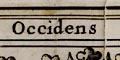
The four borders are labelled:-
OccidensWest, North, East, South.
Septentrio
Oriens
Meridies


