coast line
Jansson's Hampshire 1646
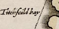
THE BRITISH SEAand Titchfield Bay is labelled.
A few sandbanks, off Hayling Island, in Langstone Harbour, and the Hurst and Calshot spits are dotted.
The coast line is shaded horizontally. The foreshore flats off Hayling Island, the Hayling Shoal, are labelled:-

The MackettTwo headlands are labelled:-
Ramesheadalso notice:-
Hengestbury heade
Black cliffe
The only harbour labelled is:-
Hamble haven
The sea boundary of Hapshire does not change much with changes of local or national politics! but it is subject to change by nature. Rivers, the sea, and winds change the shape of the land; sometimes slowly, sometimes suddenly and dramatically.
If the coast shown by Jansson's map is studied closely and compared with earlier and later mapping you can see differences; some are easy to spot. But, bear in mind the questions how accurate was the cartographer of each map, just what line was being plotted as the coast, how good was the surveying? Don't jump to conclusions too rapidly.


