
Old Hampshire Mapped
Introduction
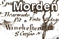
Morden's Hampshire 1695by Robt Morden
This study concentrates upon what can be seen from the map; studies of the background of county mapping in England, and map makers have been published elsewhere. An earlier version of these notes have been published as a booklet:-
Norgate, Martin; Norgate, Jean: 1997:
Notes from Morden's Map of Hampshire:
Hampshire County Council:: ISBN 1 85975 134 2
THE Maps mentioned in the former Proposals (though they were Design'd according to the newest Surveys very Correct, and contained all the Towns that were mentioned in Cambden's yet) were not thought Large and Comprehensive enough, by some Judicious and Ingenious Gentlemen that assist in the Work, Who think it proper and Necessary to have the Maps of every County full as Large as this Sheet will admit, and to Comprehend every Town, Village, &c. throughout.It is believed that Morden's smaller maps made for the 'former proposals' were only about 16.5x20.5cm. The Hampshire sheet of this smaller series was engraved by Sutton Nicholls, and has a three 10 mile scale lines. This was published by Morden in The New Description and State of England, 1701. Hampshire CC Museums Service has a copy of this map in its collections, item: FA1998.23.1 - the copy is the version as amended by Herman Moll, 1708.
The Undertakers therefore to Comply with these and many other Gentlemens Desires, have Resolved to have the Maps so done; with all the Roads, and the Degrees of Longitude and Latitude, and other considerable Additions and Corrections never done before. Though the Expence will be at least 500l. Extraordinary.
Besides which, many Additions will be made to the Book more than were mentioned; particularly a curious Collection of all the Publick Coins of England, supplying what are wanting in Mr. Cambden's of the Britains and Romans, and adding those of the Saxons, Danes, &c. which will be done by an Eminent Hand. And all the Coins fairly Engraved on Copper.
And for these Reasons we are obliged to raise the Price to Thirty Two Shillings, which cannot be esteemed Dear, considering the great Charge extraordinary, in Graving the Map so Large, and the excessive Price of Paper at this time, the Maps alone being worth the Money.
The larger maps used for the 1695 edition were, like the others, based on earlier mapping, with corrections invited from local knowledge. The Hampshire sheet, Hampshire by Robt. Morden., is based on John Norden's map of a century earlier. It does not mention engraver or booksellers at its foot; there is little decoration, just the shell style title cartouche with title and map maker's name.


