 |
Old Hampshire Mapped
Analysis of old county maps of Hampshire and transcribed texts:
Jean and Martin Norgate: 1996-2006
 |
Other Historic Hampshire Resources |
|
Warning: some other pages on this website might not bookmark correctly.
You are recommended to bookmark this page, or any mapmaker's first page, and find your way in again from there.
|
|
Maps
Itineraries |
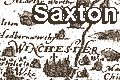 |
Christopher Saxton's map of Hampshire,
1575, engraved by Leonard Terwoort. |
|
 |
John Norden's map of Hampshire,
1595 - Henry Overton edition, published 1670. |
|
 |
Peter Keer's map of Hampshire, 1605, English edition,
published 1620. |
|
 |
John Norden's map of Hampshire,
1590s-1600s, William Hole engraving, published in
Camden's Britannia, 1607. |
|
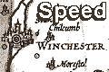 |
John Speed's map of Hampshire, engraved
by Hondius, 1611. |
|
 |
Michael Drayton's map of Hampshire, 1613,
to accompany the second song of Poly-Olbion. |
|
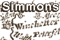 |
Mathew Simmons table of distances, and
thumbnail map, Hampshire, 1643. |
|
 |
John Blaeu's map of Hampshire, 1645. |
|
 |
Johannes Jansson's map of Hampshire, 1646. |
|
 |
Richard Blome's Mapp of Hantshire, 1673,
and extracts from Britannia, or a Geographical Description
of the Kingdoms of England, Scotland and
Ireland. |
|
 |
John Ogilby's road strip maps, 1675,
Hampshire plates. and text from his itineraries. |
|
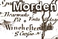 |
Robert Morden's map of Hampshire,
1695, published in later editions of Camden's
Britannia, and his other maps. |
|
 |
John Senex's road strip maps, 1719-57, Hampshire plates. |
|
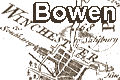 |
Emanuel Bowen's road strip maps, 1720s-50s, Hampshire plates. |
|
|
|
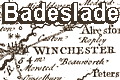
Thomas Badeslade's map of Hampshire, 1742.
|
|
 |
George Bickham's perspective view of Hampshire, 1750. |
|
 |
Thomas Kitchin's large map of Hampshire,
1751, later published in the Large English Atlas by Thomas
Kitchin and Emanuel Bowen, 1760. |
|
 |
Thomas Kitchin's small map of Hampshire, 1751. |
|
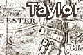 |
Isaac Taylor's one inch map of Hampshire,
1759. Large scale map. |
|
 |
Thomas Kitchin's Post Chaise Companion,
Hampshire plates, 1767. |
|
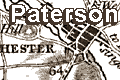 |
Daniel Paterson's British Itinerary,
Hampshire plates, 1785-93. |
|
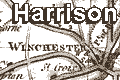 |
John Harrison's map of Hampshire,
1788. |
|
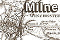 |
Thomas Milne's one inch map of Hampshire,
1791. Large scale map. |
|
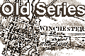 |
Ordnance Survey one inch maps, 1st edition, Old Series,
sheets for Hampshire, 1810-1855. Large scale map. |
|
 |
Aristide Perrot's miniature map of Hampshire, 1823. |
|
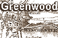 |
C and J Greenwood's one inch map of Hampshire,
1826. Large scale map. |
|
 |
Post Office Circulation in England and Wales 1890,
Hampshire area . |
|
|
|
Other sources |
 |
John Leland's observations about Hampshire made on his
itinerary 1535-43. |
|
 |
William Camden's descriptive text for Hampshire from
Britannia, 1607, ?translation by Holland 1610. |
|
 |
Extracts about Hampshire from Daniel Defoe's guidebook a Tour
through the Whole of Great Britain, published 1724-26. |
|
 |
Thomas Cox's descriptive text about Hampshire from Magna
Britannia, Antiqua et Nova, about 1738. |
|
 |
Entries for Hampshire from Richard Brookes's
General Gazetteer, 16th edition 1815. |
|
 |
Hampshire parts of route descriptions from John Cary's New
Itinerary, 6th edition 1815. |
|
 |
Extracts about Hampshire from William Cobbett's Rural
Rides, 1830. |
|
|
| Miscellany |
 |
Miscellaneous notes about topics from the maps; cartography
and content ...
And notes about the HantsMap project.
|
|
|
 |
General index |
|
|
General booklist |
|
 |
Other Historic Hampshire Resources |
|
Thoughts
 |
|
|
Hobbes |
Thomas Hobbes, 17th century:-
... when at Oxford ... 'tooke great delight to goe to the
bookebinders shops and lye gaping on maps.'
|
|
Conrad
|
Joseph Conrad, in Heart of Darkness:-
Now when I was a little chap I had a passion for maps. I
would look for hours at South America, or Africa,
or Australia, and loose myself in all the glories
of exploration. At that time there were many blank spaces
on the earth, and when I saw one that looked
particularly inviting on a map (but they all looked that)
I would put my finger on it and say, 'When I grow up I
will go there.'
|
|
Dr Dee |
Dr John Dee, 1570:-
Some, to beautify their Halls, Parlors, Chambers, Galeries,
Studies, or Libraries ... liketh, loveth, getteth, and useth,
Maps, Charts, and Geographical Globes
|
|
Swift |
Swift commented:-
So geographers, in Afric maps,
With savage pictures fill their gaps,
And, o'er inhabitable downs,
Place elephants for want of towns.
|
| Thanks |
We are grateful to various friends for
encouragement. In particular: Alastair Penfold, Hampshire
CC Museums Service; and Dominic Fontana, Geography
Department, University of Portsmouth. |