Ogilby's Hampshire 1675
Notes byMartin and Jean Norgate: 1998
These notes are made from the tables of roads by John Ogilby, published in an early edition of Britannia, London, 1675. The pages have been studied from photocopies of items in a private collection.
Table of Roads
The TABLE Explain'd
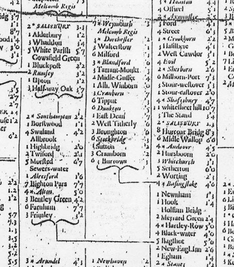
THe midle Colume is the great Road, those on each side are Branches, or Cross-Roads; the Computed Distance, by Miles before, the Measure, by Miles and Furlongs after the Towns; Cities are in CAPITALS, Market-towns in Italique, and Post-towns mark'd thus [star] For Example, from Hodsdon to [star] Ware, a Market and Post-town, it is Computed 3 Miles, by Measure 3 Mile 2 furlongs; there is no Figure at [A l], because it is not a Mile from thence to Ware. ...
Further Directions.
THe Black Lines with a Brace, guide to the Branches: As, from London you are directed to Mile-end, for the Yarmouth Road: At Puckeridg, you have Issuing out the Roads to King's-Lyn and Norwich: The Numbers at the Town that begin each Branch, is the Distance from the Place that Road Issues: As, From York to Tadcaster is Computed 8 Mile, by Measure 9 Mile 6 Furl. Where Branches begin or end at small Towns, they are either a nearer or different Way: As, from Ferribridg to Boroughbridg by Fareborn, is nearer by 7 Miles than by York: You may come from Stilton to London by Aukinbury: And so of the Rest.
JOHN OGILBY.
An example (from the poor photocopy):-