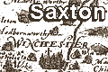
Christopher Saxton

 |
Christopher Saxton was born in Dunningley, near
Wakefield, Yorkshire, about 1542-44. He wrote, in 1596, that
he was:-
[... of Dunningley, in the parish of Westardeslye in the
countye of Yorke, Gent., of age fiftye twoo yeares
or thereabouts.]
Little is known of his early life but that he became a
servant to John Rudd, vicar of Dewsbury, prebendary of
Durham Cathedral, and a map maker. There was a new interest
in land surveying at the time; land owners having estate
plans drawn, enclosure disputes needing maps to clarify
land holding, and a general interest in knowing the land
better in this period of increasing learning.
Saxton was issued a pass, to give him royal authority in
his surveying, by the Privy Council, 11 March 1576:-
A placart to [ ] Saxton servant to Mr. Sackeford Mr. of
the Requests to be assisted in all placs where he shall come
for the view of mete placs to decribe certen counties in
carts being thereunto appointed by her mait.s bill under
her Signet
Already , 11 March 1574, Elizabeth I had granted Grigston
Manor, Suffolk, to Christopher Saxton:-
[... for certain good causes, grand charges and expenses
lately had, and sustained, in the survey of divers parts
of England.]
A licence to publish his maps for ten years was granted
22 July 1577:-
[Whereas Christofer Saxton servaunte to oure trustie
and welbeloved Thomas Sekeford Esquier Master of Requests
unto us hath already (at the greate coste and charges of his
said master) travelyed throughe the greateste parte of this
oure realme of Englande and hathe to the greatepleasure
and commoditie of us ... uppon the perfecte viewe of a
great nomber of the severall Counties and Shyres ... drawen
oute and sette fourthe diverse trewe and pleasaunte mappes
.... And so from tyme to tyme to cause the same platts
and decriptions to be well and fayre ingraven of copper and
to be after impressed and stamped out ...]
Later, Elizabeth I granted Saxton the right to a coat of
arms, recognising his:-
Geographicall descripcion of all the several Shires and
counties within this Realme ... now finished ... to his
lasting praise ...
The blazon of his arms includes: three chaplets or
garlands in a bend gules.
[... for his crest upon the healme on a torse or wreath
argent and sable, the demys arme of a man, with the sleave
gold, the hand proper, coulor holdinge a payre of compasses
gold ...]
Saxton's death is unrecorded. Thomas, his elder brother,
includes Christopher as a legatee in his will written 1610;
and Christopher had died before 1626 when the will of his
son Robert was proved.
|
|
References |
: 1936: Atlas of England and Wales, Saxton 1574-79
(facsimile): BM (London):: eg copy at NLS Map.fac.b
C17 (1579)
Batho, G R: 1959: Two Newly Discovered Maps by
Christopher Saxton: Geographical J: vol.125: pp.70-74
Box, E G: 1932=1935: Hampshire in Early Maps and early
Roadbooks: Hampshire Field Club: XII: pp221-235
Briscoe, A Daly: 1979: Tudor Worthy, Thomas Seckford
of Woodbridge, A: (Ipswich, Suffolk)
Eden, P (ed):: Dictionary of Land Surveyors and
Local Cartographers of Great Britain and Ireland, 1550-1850
Evans, Ifor M; Lawrence, Heather: 1979: Christopher Saxton,
Elizabethan Map-Maker: Wakefield Historical Pblications;
Holland Press:: ISBN 0 901869 06 6
Fordham, Herbert G, Sir: 1928: Christopher Saxton of Dunningley,
his life and work: Miscellanea of the Thoresby Society (Leeds)
: 28: pp356-84, 491
Harley, J B: 1979: Christopher Saxton and the First Atlas
of England and Wales 1579-1979: Map Collector: 8: pp 2-11
Hodgkiss, A G: 1981 (4th edn): Discovering Antique maps:
Shire Publications (Princes Risborough, Buckinghamshire)::
ISBN 0 85263 581 8; an inexpensive and approachable
introduction to old maps
Lawrence, Heather: 1982: Permission to Survey: Map Collector:
no.19: pp.16-20
Lyam, E: 1950: English maps and Map Makers of the Sixteenth
Century: Geographical J: 106: pp10-14
Manley, G: 1934: Saxton's Survey of Northern
England: Geographical J: vol.83: pp.308-16
Marcombe, David: 1978: Saxton's Apprenticeship, John Rudd a
Yorkshire Cartographer: Yorkshire Archaeological J:
vol.50: pp.171-75
Penfold, Alastair J: 1994: Introduction to the Printed Maps
of Hampshire: Hampshire CC Museums Service
Ravenhill, William L O: 1983: Christopher Saxton's Surveying, an
Enigma: (pubd in Tyacke 1983 p112-119)
Ravenhill, William L O (ed): 1992: Christopher Saxton's 16th
Century Maps: Chatsworth Library:: ISBN 1 85310 354 3; facsimile;
copy see NLS Map Library Map.Fac.a.C17 (1579)
Skelton, R A: 1970: County Atlases of the British Isles 1579-1850: Carta Press (London)
Skelton, R A: 1974: Saxton's Survey of England and
Wales: (Amsterdam, Netherlands)
Tyacke, Sarah; Huddy, John: 1980: Christopher Saxton and Tudor
Map-Making: British Library (London):: ISBN 0 904654 44 3
|