Surveying
Saxton's Hampshire 1575- what documentary evidence is there, directly pertinent to Saxton's project?
- what technical knowledge was available to him; surveying techniques, textbooks, instruments?
- what existing data was available?
- how much time did he have?
- what can be deduced from his maps?
DOCUMENTARY EVIDENCE
Christopher Saxton left us no notes about his surveying methods; and wrote no handy textbook on surveying (as did John Norden who began a county survey in the 1590s). And there are few surviving relevant documents:-Local Knowledge
To aid him in his task in Wales Christopher Saxton had an open letter from the Privy Council, addressed to Justices of the Peace etc, 10 July 1576:-
An open Lettre to all Justices of peace mayours & others etc within the several Shieres of Wales. That where the bearer hereof Christofer Saxton is appointed by her Maiestie under her sign and signet to set forth and describe [Cartes] in particulerlie all the shieres of Wales. That the said Justices shall be aiding and assisting unto him to see him conducted unto any towre Castle highe place or hill to view that countrey, and that he may be accompanied with ij or iij honest men such as do best know the countrey for the better accomplishment of that service, and that at his departure from any towne or place that he hath taken the view of the said towne do set forth a horseman that can speke both welshe and englishe to safe conduct him to the next market Towne, etc.A similar letter of instruction was issued by the privy Council for England, 11 March 1576:-
A placart to ... Saxton servant to Mr. Sackeforde, Mr. of Requests to be assisted in all places where he will come for the view of mete places to describe certen counties in Cartes being thereunto appointed by her Majestes bill under her signet
Beacons and Churches
Beacon hills are some of the obvious high places. The beacon system in England dates back to medieval times, perhaps earlier. The organisation of the beacons devolved to Justices of the Peace and other officers at the local level. They would know them, they had honest men who knew the view and could identify places from them for a surveyor. It is very likely such places might be used by Saxton. But, judging from one county, Hampshire, a doubt creeps in. He did not plot all the beacons in the county; so did he use all of them, or even any of them?
Bear in mind that it may not be the hill's top that is the best viewpoint. If you look at known beacon locations they, too, are not always on the tops of hills or even the very highest local hill. What you can see from the position matters more than just height. Church towers are other obvious view points though nowhere as good as high hills; churches were the common starting point for estate surveys at the time.
If all this sounds fairly straightforward I suggest you go out to a local viewpoint and see how easy it is, or isn't, to spot useful places, church towers of the villages you might wish to plot for example. Discover how many of them are not visible from the place you have chosen. Also just see how well you can recognise places from afar.
& tools
SURVEYING TECHNIQUES and INSTRUMENTS
There were two main ways of surveying; triangulation and traverse; crude traverse and accurate triangulation are two ends of a spectrum of surveying techniques. Traverse was the practical surveyor's method of earlier times. Triangulation required some understanding of geometry. There was a difference between what mathematicians knew and could do, and what the practical surveyor did. The period was one where there was increasing interest in navigation, using astronomical observation more systematically; military science was using geometry for gunnery; and agricultural changes required more accurate definition of boundaries.Traverse
Traverse is the way of direct measurement; compass, measuring ropes, poles, or chains, or a waywiser. You measure bearings and distances from point to point to point and plot your route, like dead reckoning navigation. If the traverse is closed, you end up where you started, and then you have a way of checking your accuracy; see if the plot also arrives back where you started. Then if there is an error you can make adjustments all along the plot to improve things. If the traverse is open you need some other way of knowing whether the two end points are correctly positioned with respect to each other. You might measure offsets to features beside the path of the traverse, take a bearing to the feature and estimate or measure its distance. This might be aided by a surveyor's cross staff, the Roman's groma, to set a right line to an offset target.
The obvious routes for traverses were roads. Christopher Saxton did not plot roads on his maps. The social, economic and military importance of roads was recognised at the time. If Saxton had done everything by road traverses it is hard to believe that he would not have plotted these roads. He did plot rivers; perhaps he made traverses up river valleys.
Compass Sketches
Edward Lynam's view, writing in 1936, is that, like most estate surveyors, Christopher Saxton would have started his survey from church towers establishing angles to other towers and hills by compass and cross staff. He would have got distances from local knowledge or perhaps by riding from place to place; he would not have used the slow laborious method of 'chaining' distances. It is possible he used a waywiser. His maps are 'compass sketches', a traverse, yes, but in a very rough and ready way. It is the method of 'view and inquisition' the traditional manner of surveying estates from the Middle Ages to the 19th century.
A Professor Manley's opinion was that Christopher Saxton:-
... climbed very few hills; as a rule only when it appeared to him that he could thereby save a further traverse into sparsely inhabited country ... He was conscientious with regard to county boundaries and other detail in the cultivated lowlands, but wherever possible he avoided the trouble of going beyond the limits of habitation through country which he knew or thought to be uninhabited, especially if he was thereby led into another county.This opinion came from a study of the finished maps of some northern counties. It is a reasonable supposition, but that is all.
Triangulation
Triangulation was first described fully by Gemma Frisius or Phrysius. He was a leading cartographer in Europe, alongside Gerhard Mercator. Frisius published an edition of the Cosmographia by Petrus Apianus, Peter Apian, 1529. In an edition in 1533 he bound in work of his own, known as the Libellus [1, see appendix]. Triangulation uses the fact that knowing the distance between two points and the bearings of a third point from the ends of this base line, you know where the third point is. Angles must be measured more accurately.
In the Libellus Gemma Frisius describes what he claims to be a new method, his invention, of surveying without direct measurement, using an instrument derived from the pivoted sights and angular scale on the back of the astrolabe, an astronomical instrument in common use at the time. Holding an astrolabe sideways, so that its back scale is horizontal you can measure bearings. Frisius makes this an instrument in its own right.
- [2] - The instrument is a graduated circle on a flat board, fitted with a central pivoted pointer with sights, as would be found on the back of an astrolabe.
- [3] - Set the instrument level with a nautical compass on top to line it up on magnetic north. That magnetic north was used is made plain in Apian's part of the book, where there is a woodcut print, in editions from 1524 onwards, showing the compass needle 8 degrees East of North, the magnetic variation in the early 16th century. Once set up the compass is not required for the surveying instrument. The bearing to any point can now be found, keeping the instrument fixed.
- [4] - A critic is imagined saying what's the use of bearing without distance? Indeed there must be bearings from two places before the position of a target place is fixed. So the surveyor must repeat the operation from a new vantage point.
(translated by E G R Taylor?) When you have found them [the second set of bearings] make a dot for this [second] town at any distance you please from the first, provided it is on the right ray [correct bearing], and with this point as centre draw a faint circle, and through it a meridian parallel the first [through the first town]. Next draw from this point lines representing the bearings just found, and wherever a pair of rays drawn to the same place intersect, a little dot must be placed, which represents its position.Gemma Frisius deals with some detail problems, for example what to do when rays meet at too oblique or acute an angle. He points out that distances found by a traverse, measuring on the ground, are inaccurate; not helped by irregular spacing of milestones. But you do need to know at least one distance between stations to set a scale for the map.
Frisius calls the new instrument a planimetrum, and later uses a greek word epipedometron. It is usually known now as the 'simple theodolite'.
As well as authors noted below there was a textbook on surveying by Valentine Leigh, Treatise of Measuring All Kinds of Lands, 1562 (only extant today in editions from 1577 onwards).
Simple Theodolite
William Cunningham, in his Cosmographical Glasse, 1559, explained triangulation, acknowledging Gemma Frisius, and described the instrument needed as a 'geographical plaine sphere' - a planisphere is an element of an astrolabe. A circular plate 'made much like the backe parte of an Astrolabe' with a pivoted alidade, the sights. His scales were marked with the 32 points of the compass, and also from 0..90 degrees in each of four quadrants. The instrument had an inset magnetic compass for alignment.
In 1571 William Bourne prepared for publication a manuscript of popular science in which the second part deals with surveying; by the 'back side of the astrolabe', by cross staff, and by triangulation much as described by Gemma Frisius. This manuscript was presented to Lord Burghley who was sufficiently interested to talk to the author. William Bourne describes a practical surveying compass, closely based on the description by William Cunningham, neither of them making claim to originality. Bourne's description is of an instrument with a circular brass plate, graduated round the edges in degrees and marked with the 32 points of the compass. A magnetic compass is inset off centre so that does not get in the way of the pivoted 'athelidey' ie alidade, which is like that on the back of an astrolabe.
This 'simple theodolite' is commonly just called a theodolite in elizabethan and later texts, which confuses it, for us, with the modern theodolite. The modern surveyor's instrument is not just an azimuth but an altazimuth instrument measuring up and down as well as from side to side, sighting through a telescope. In its turn, this instrument is being replaced by laser devices making digital records.
Thomas Digges in his Geometrical Practise named Pantometria, 1571, uses the term theodolitus ie theodolite for the simple theodolite. It was a popular instrument, a successful invention; do remember that not all inventions were or are effective. The theodolite is mentioned by John Norden in his Surveyor's Dialogue, 1607. John Norden was another elizabethan surveyor, who mapped several counties in the 1590s but failed in his overall project of a new county mapping.
Plain Table
It seems that practical but complacent surveyors, long used to their ways of working, were resistant to newfangled mathematical ideas arising from a resurgence of the art of geometry. The view is widely held today that the average surveyor of elizabethan times could not cope with the simple mathematics required by the geometrical instruments. Out of the surveyor's practical needs comes the invention of the plain table and sight rule, triangulation without arithmetic.
The first step was an instrument called a holometer, devised by Abel Foullon in his book Holometre, Paris, 1551. This book was widely circulated, and was translated into Latin and Italian from its original French. The holometer is a complete field triangulation and plotting instrument; a table for the paper with an inset compass, a brass graduated base line scale on which two arms slide so they can be set a required distance apart for two observation stations, each arm pivots and has sights, etc. It was a cumbersome tool, a reminder of later victorian universal tools which were more bother than help. But the instrument introduced the idea of plotting in the field. And then an unencumbered, plain, table with a sight rule, an alidade and ruler to set on top, was a much more practical step.
The idea is simple. You have a flat table mounted on a tripod stand, in the field, and on this a sheet of paper. There are two fixed stations; which are marked a distance apart on the paper, setting the scale of the map. At station 1 you set up the plain table with the line joining the stations pointing at station 2. With a sight rule, you draw lines out from the plotted position of station 1, each labelled for their target. At station 2 you line up the table again looking back to station 1, then take sights and draw lines to each of the targets. Where corresponding lines cross you plot the target place.
Ralph Agar, writing A Preparative to the Platting of Lands, London, 1596, says that early in his career as a surveyor, about 1566, he used the 'plain' table:-
sometimes directed by needles [ie set up by magnetic compass], sometimes by the former station [ie by a back sight onto station 1 from station 2] as is now usedBy 1571 he abandoned the plain table for the 'theodelite'.
Thomas Digges adds the plain table to his textbook on surveying in the 1591 edition, describing it as:-
a Platting Instrument for such as are ignorant of Arithmetical Calculations ... an Instrument onely for the ignorant and unlearned, that have no knowledge of Noumbers'The plane table is offered as an immediate and practical alternative to recording bearings in a notebook and doing the plotting back at base, where you 'lay down' or 'protract' measurements. Plotting at base has no need for arithmetic, so resistance to working this way is hard to understand. It is done in easier circumstances than standing on a windy wet hilltop trying to keep paper clean and dry ... As Thomas Digges said, plain tabling is:-
... you must in this kind of Platting proceed wonderfull warelye, for if you erre never so little in the severall Stations, when yee come to close uppe the Platte, you shall finde a great and apparent Error ... [to be adjusted] ... by cross Angles of Position.
... not to bee practized but in fayre weather ...We have read at least one 'fact' in a supposedly respectable book about cartography that Saxton made pages of notes of bearings as he travelled about the counties, presumably read from a simple theodolite. In the book this is unsupported by any reference to sources, and we know of no such source.
Arithmetic?
There are contemporary comments about the habits of surveyors:-
- that they multiplied length by width to get area without any regard to the angle between the two dimensions;
- estimated angles by eye, not using an instrument;
- estimated area by averaging the four sides of a plot, and squaring the result;
- estimated the area of a circle by dividing circumference by four and squaring the result.
KNOWN DATA
Christopher Saxton could have had access to some general maps of England and Wales. Laurence Nowell had published a small map, 1563:-A general description of England & Irela~d with ye costes adioyningand Gerhard Mercator, 1564:-
Angliae Scotiae et Hiberniae nova descriptioThese are too small a scale to be of great use, though matching the content of these with the county maps might reveal some relationship. A set of maps that is now gone could have been consulted; maps by Laurence Nowell used by William Lambarde, a kentish antiquary writing a topography of England about 1568-77. These sources are discussed more fully by Huddy and Tyacke 1980, who also discuss the making of the general map of England and Wales more fully.
TIME
Christopher Saxton surveyed all the counties in five seasons of surveying. Not as much as a month per county. Nowhere is there any mention of assistants to help. His project was an official survey, promoted by Elizabeth I on the advice of her ministers as an act of policy. It had to be completed quickly to be useful.The time scale precludes any sort of rigorous, close surveying. Topographical detail must have been culled from where he could. There were sources of information, general maps like: the map of the British Isle by Gerhard Mercator, 1564; the map of England and Wales by Humphrey Lloyd, published by Ortelius, 1573. And descriptive material like: John Leland's Itinerary of his journeys in England; perhaps data from William Lambarde, who was then writing a Topographicall Dictionarie of England.
THE MAPPING
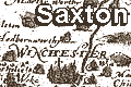
We have investigated one county map, of Hampshire, in more detail. Measuring the position of a number of places on the map and comparing these to their 'known' positions. From these measurements it is possible to work out the true scale of Christopher Saxton's map and express this in statute miles to an inch, and thus work out the size of Saxton's mile as drawn in his scale line. His 'old english mile' is about 1.23 statute miles. The orientation of the map can be checked, it is plotted about 7 degrees east of national grid north, roughly matching the magnetic variation of elizabethan times. A correlation of his place positions to today's positions gives a crude measure of how good his map was. An attempt to determine his surveying methods would require detailed study of the positioning of settlements, rivers, hills, coast line. We believe this would be inconclusive.Another possible line of enquiry is to compare Christopher Saxton's separate county maps with his general map of England and Wales.
ANSWERS?
How did Christopher Saxton survey? we cannot know.It is quite likely that Christopher Saxton could have had access to good instruments, he was working for a government project and Lord Burghley had an interest and knowledge of techniques of the time. It is possible that Saxton had a waywiser and compass, etc; simple traverse instruments. It is possible that Saxton could have had a simple theodolite and worked by triangulation, plotting data in the field or back at base. Such an instrument could have come from the leading instrument maker of the time, Humphrey Cole, who was known to Lord Burghley who was behind the mapping project.
But the time scale suggests that Christopher Saxton worked from crude traverses supported by local knowledge; he could not have got the job done so quickly otherwise.
(These notes were written in response to an enquiry from a BBC researcher, planning a program about elizabethan technology
REFERENCES
Bennett, J A: 1987: Divided Circle: Phaidon & Christies:: ISBN 0 7148 8038 8
Harley, J B: 1977: Christopher Saxton and the First Atlas of England and Wales: Map Collector: vol.8: pp.2-11
Lynam, Edward: 1936: (Introduction to a facsimile reproduction of Christopher Saxton's Atlas of England and Wales): British Museum (London):: NLS Map.Fac.b C17 (1579)
Manley, G: 1934: Saxton's Survey of Northern England: Geographical Journal: vol.83: pp.308-316
Norgate, Martin & Norgate, Jean M: 1996=2002: Old Hampshire Mapped::: website www.geog.port.ac.uk/webmap/hantsmap/
Ravenhill, William (introduction): 1992: Christopher Saxton's 16th Century Maps: Chatsworth Library:: ISBN 1 85310354 3
Taylor, E G R: 1968: Tudor Geography 1485-1583: Octagon Books (New York, United States)
Tyacke, Sarah & Huddy, John: 1980: Christopher Saxton and Tudor Map Making: British Library:: ISBN 0 904654 44 3
APPENDIX - Latin Text etc
Apian, Peter & Frisius, Gemma (ed): 1533: Cosmographia::: folios 58-59:-- [1] Item ejusdem Gemmae Phrysii Libellus de Locorum describendorum ratione, et de eorem distantiis inveniendo, nunquam ante hac visus.
- [2] Primum in assere plano confice instrumentum tale, fiat circulus, qui in quatuor quadranto dissecetur, quadrante quolibet rursus diviso (ut solet) in 90 gradus, postea affigatur per centrum index cum perspicillis aut pinnulis quemadmodum in dorso astrolabii
- [3] Hoc instrumento facto opus erit etiam instrumento nautico (quod Compassum appelamus) nam ab illo fere tota res pendet, quibus habitis ita procedito. Pone instrumentum planimetrum primum in plano, et super ipsum Compassum, ita ut latus Compassi quadrangularis adjacet linae meridinae instrumenti inferioris. Deinde verte instrumentum cum compasso eo usque quo index compassi correspondeat sibi subscripto indici, et post haec instrumento ita manente, compassum tanquam perfunctum suo officio remove.
- [4] Si nunc angulum positionis alterius loci a tuo scire velis, manente instrumento immoto, volve indicem donec per persicilla ejas videas locum alium, videbis mox angulum positionis a meridie vel Septentrione secundum ipsius indicis remotionem ab eis. Sed quorsum haec? roget aliquis, etiam si habeam ab uno loco positiones vel situs omnium locorum, si non adsit distantia nota, nihil profuerit. Verum dicis ab uno loco, nam nisi a duobus locis habeas angulos positionum, non poteris describere tertium.


