
General Map
Senex's Hampshire 1719-57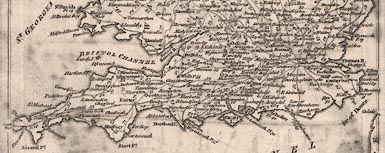
Click on map
for larger image
Southern
England
John Senex's road book includes a map of England and Wales:-
General View of Ogilby's Direct and Principal Cross Roads
There is no scale line. The scale can be estimated, measuring from Lands End to North Foreland gives about:-
1 to 3200000The sheet size about 23x18cm.
50 miles to 1 inch
Click on the map for a large image.
At the foot of the map:-
The Direct Roads are described by a Double Line [image] the cross Roads by a Single Line [image] The figures on these Roads refer to the Pages where they are shown.The map is an index map.


