Map features
Speed's Hampshire 1611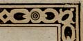
The border of the map is given the appearance of a carved wood picture frame.
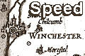
the map has an inset town plan of Winchester.
swash lettering, decoration, antiquities, windmills, watermills, vignette, ...
|
|
Map featuresSpeed's Hampshire 1611 |
| Map feature |
Some images can be clicked for more information. |
|
border; picture frame border. The border of the map is given the appearance of a carved wood picture frame. |
|
|
title cartouche; strapwork cartouche, makers name, engraver's name. |
|
|
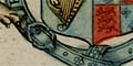
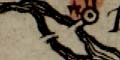
coat of arms; royal arms and a heraldic border. |
|
|
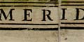
orientation; labelled borders. |
|
|
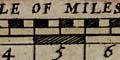
scale line; chequered scale line in a cartouche. |
|
|
coast shaded; sea moire effect, coast shaded with horizontal lines. |
|
|
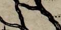
rivers; wiggly lines tapering from their mouth at the coast; none are named. |
|
|
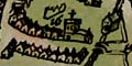
bridges; some bridges are drawn. |
|
|
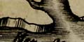
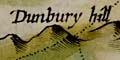
relief; groups of hillocks. |
|
|
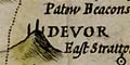
beacons; a post on a hill. |
|
|
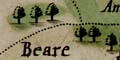
woods, forests; drawings of trees. |
|
|
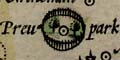
parks; ring of paling fence. |
|
|
county boundary; fine dotted line, adjacent counties labelled. |
|
|
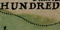
hundred boundaries; fine dotted line, areas labelled. |
|
|
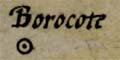
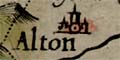
settlements; dot and circle, plus buildings to grade size, which is also indicated by labelling style. |
|
|
market towns; dot and circle, buildings and tower, upright lowercase lettering. |
|
|
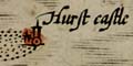
coastal defence, castles; dot and circle, tower and buildings. |
|
|
town plan: the map has an inset town plan of Winchester. |
|
|
miscellany: swash lettering, decoration, antiquities, windmills, watermills, vignette, ... |
  |
Speed's Hampshire 1611, contents |
 |
General index |
 |
Old Hampshire Mapped |