
 |
Old Hampshire Mapped |
|
 |
The Old English Mile |
| statute mile |
The earliest statutory definition of a mile in England is almost
by accident.
An Acte againste newe Buyldinges
Act 35 Elizabeth I cap 6 1592/93
prohibiting building work within three miles of the gates of the
City of London, laid down in passing that:-
|
| 1 mile |
= 8 furlongs |
| 1 furlong |
= 40 rods |
| 1 rod |
= 16 1/2 feet |
|
|
This local ordinance had wider influence, and the by-the-by
definition of a statute mile spread slowly throught England and
wider. It only became universal in the country with the all
encompassing act for weights and measures
Act 5 George IV cap 74 1824
A reminder:-
|
| 1 mile |
= 8 furlongs |
|
= 80 chains |
|
= 1760 yards |
|
= 5280 feet |
| 1 furlong |
= 10 chains |
|
= 220 yards |
|
= 660 feet |
| 1 chain |
= 22 yards |
|
= 66 feet |
| 1 yard |
= 3 feet |
|
|
|
old english mile |
The Old English Mile?
Up to tudor times, and beyond, there was uncertainty as to what
a mile was; except in the mind of the person telling you how
far it was from place to place. There were at least
two contradictory concepts of 'a mile'. The miles was either
8 furlongs of 40 rods; or 5000 feet, the feet being natural
feet, english or roman. Reading old records and measuring of
old map scales can be confusing and difficult.
Arnold's Chronicle, 1502
XVI fote and a half makith a perch as is a boue said, that
is V yardis and half, VIC foote by fife score to the C
making a furlong, that is XXXVIII perchis sauf II fote, VIII
furlong make an English myle, that is VM foote and so IIC
and III perchis also an English myle
so:-
Arnold has, a perch being much the same as a rod:-
|
| 1 perch |
= 5 1/2 yards |
|
= 16 1/2 feet |
|
then a furlong is defined:-
|
| 1 furlong |
= 600 feet |
|
but also:-
|
| 1 furlong |
= 38 perches - 2 feet |
|
= 625 feet |
|
and then the mile:-
|
|
1 mile |
= 8 furlong (4800 or 5000 feet) |
|
= 303 perches (4999 1/2 feet) |
|
= 5000 feet |
|
and the feet are not the length we expect today. The natural
foot seems to have been about 9.9 inches.
This is a typical confusion around the subject of
the mile. The topic is discussed at length in
the reference sources; go read them.
|
|
|
|
a mile |
A Mile
The name 'mile' is from Latin milliarus/miliare - a thousand, or
Latin milliarum/miliarium - a milestone, implying mille passuum,
1000 paces each of 5 roman feet (about 11.65 modern inches). The
roman mile was divided into 8 stadia of 125 paces, 625 feet. But
the roman mile is not the old English mile.
There are many plausible suggestions for the source of our modern
statute mile, none is proven. Connor suggests the most plausible
is a norman mile, imported from France after the
Conquest, 1066.
|
|
|
| map miles |
Map Maker's Miles
Early map makers and compilers of itineraries have used a mile
commonly referred to, nowadays, as the 'old English mile'.
Various maps and itineraries have been studied in the past to
get an estimate of what this unit might have been. The examples
below have been found in various publications; these are not
our estimates.
|
|
source |
old mile = | statute miles |
|
Gough map of England |
1 = |
1.3 |
|
William of Worcester's Itineraries, 1477--1480 |
1 = |
1.5 |
|
Chronycle of Yeres, 1544, tabulations of town to town distances |
1 = |
1.3 |
|
Mercator, map of England ..., 1564 |
1 = |
1.18 |
|
Saxton, map of Hampshire, 1565 |
1 = |
1.22 |
|
Wiliam Smith, Particular Descriptionof England, 1588, tabulations |
1 = |
1.25 |
|
William Harrison, Description of Britain, 1577, tabulations |
1 = |
1.25 |
|
Blaeus' map of England |
1 = |
1.12 |
|
All the figures are averages and approximate. In many cases
the presumed accuracy of 1 in 100 in not supported by
the evidence.
Some of Gibson's maps (Morden's?) of 1695 had three scale lines
corresponding to about 1.29, 1.17, and 1.07 statute miles. The
ratio of these is about 10:9:8 and Flinders Petries suggests they
are customary miles of 10, 9 and 8 furlongs.
However, there does seem to be an 'old English mile' and we can
only estimate its size. It was about 1.2 to 1.3 modern
statute miles.
|
|
|
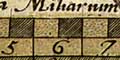
Hampshire
|
OLD HAMPSHIRE MAPPED
The study of maps in the Old Hampshire Mapped project includes
measuring the positions of some towns and villages. This was
initially done to enable the fitting of the National Grid to old
maps as an indexing tool. But the data can also provide
estimates of the maps' scales. Firstly the distances between
places can be compared with known distances calculated from grid
refrences - ignoring the curvature of the earth and the map
projection used as being insignificant in the bounds of the
county. This gives an estimate of a map's scale in statute
miles. Secondly, if there is one, the map's scale line, or
lines, can be used to estimate what the map maker's mile was.
A comparison with the scale in statute miles gives an estimate
of the size of the miles being used by the map maker.
The measurements are mostly based 21 towns. About 200
distances to be calculated per map; a computer
program DISTTAB.exe has been written to help! Although
the distances are not independent the estimates are treated as
such, and simply averaged. The map positions were measured
either to the nearest mm, but mostly using scanned images
at 300dpi (dot per inch) ie to about 1/300th of an inch.
For a large map this provides very accurate distances; for a
thumbnail the errors are greater. The problem of locating a town
is discussed in the notes for OLDMAPS.exe - the computer
program which works out the positioning of the national grid
on old maps.
Map Miles v Statute Miles; Hampshire
|
|
map maker |
date |
map miles |
|
|
|
in statute miles |
|
Saxton |
1575 |
1.25 |
|
Norden |
1595 |
1.24 |
|
Keer |
1605 |
1.25 |
|
Norden |
1607 |
1.24 |
|
Speed |
1611 |
1.22 |
|
Bill |
1626 |
1.31 |
|
Jenner |
1643 |
1.10 |
|
Blaeu |
1645 |
1.26 |
|
Jansson |
1646 |
1.23 |
|
Ogilby |
1675 |
1.01 |
|
Morden |
1676 |
1.15 |
|
Seller |
1694 |
1.26 |
|
Morden |
1695 |
1.23 |
|
Bowen |
1720 |
1.26 |
|
Moll |
1724 |
1.10 |
|
Hutchinson |
1748 |
1.13 |
|
Kitchin |
1751 |
0.97 |
|
Taylor |
1759 |
1.02 |
|
Hogg |
1784 |
1.03 |
|
Milne |
1791 |
0.98 |
|
Harrison |
1788 |
1.00 |
|
Tunnicliff |
1791 |
1.01 |
|
Faden |
1796 |
0.98 |
|
Cole and Roper |
1810 |
1.09 |
|
Greenwood |
1826 |
0.98 |
|
Pigot |
1828 |
1.06 |
|
Greenwood |
1829 |
0.99 |
|
Moule |
1836 |
0.99 |
|
Brannon |
1859 |
0.98 |
|
MacKenzie |
1893 |
1.00 |
|
Similarity between early makers must be expected; they
copied each other. The later makers were using the statute
mile. The range of values is mostly within the limits of
my confidence, and the range of variation of paper dimensions
as humidity changes over day by day.
Notice the mile used by John Ogilby, a statute mile, just as he
claims. He also used customary miles, for the distances to
places off the road, and was quite honest about this, though he
did not say what length these miles were.
|
