 Kennet and Avon Canal Kennet and Avon Canal |
 |
|
|
|
MILE 39
|
Wootton Rivers and Milton Lilbourne, Wiltshire : KAC39.00=KAC40.00 |
|

|
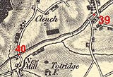
KandAC mile 39
|
|
|
|
KandAC mile 39 - OS 1inch map, early 19th century
|
|
|
... fields, more fields; the canal misses the villages which aren't on
the contour ...
|
|
|
The Kennet and Avon Canal from mile 39 to 40 is part of the Fifteen
Mile Pound which roughly follows a contour line on the side of Pewsey
Vale. The Great Western Railway line to the south west is on the south
of the canal. The small stream flowing toward the Avon still follows
alongside the canal on the south side. The towpath is on the south
side.
|
|
|
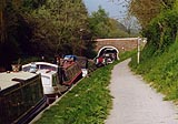
There moorings between Wootton Rivers Bridge and Wootton Rivers Farm
Bridge.
|
|
|
|
Boats, lots of boats.
|
|
|
|
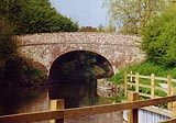
Wootton Rivers Farm Bridge, Wootton Rivers
|
|
|
|
KandAC winding point 39.12
|
|
|
|
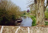
The canal westward of Wootton Rivers Farm Bridge, looking eastward
toward the bridge. Wootton Rivers Bridge is in the distance.
|
|
|
Cuckoo's Knob, a very small settlement, lies to the south of the
canal.
|
|
|
|
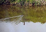
A water vole? Arvicola amphibius? as with many animals it's the track
you spot, not the creature, at first.
|
|
|
|
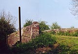
Another pillbox (SU194627) in the fields on the off side, north side.
|
|
|
|
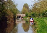
A boat approaching Carrel Crown Bridge. (Pity there wasn't a train as
well!)
|
|
|
|
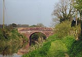
Carrel Crown Bridge, Wootton Rivers
|
|
|
|
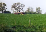
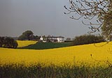
More rape and a fine country house on the off side, north side.
|
|
|
|
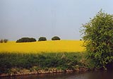
Pow!! rape, off side.
|
|
|
|
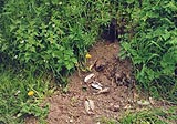
Swan mussel, Anodonta cygnea, shells excavated from the canal bank
earth by a rabbit.
|
|
|
Parish boundary Wootton Rivers - Milton Lilbourne: SU18726227
|
|
|
|
New Mill Bridge, Milton Lilbourne
|
|

|
Kennet and Avon Scrapbook 2000
|
|