 Kennet and Avon Canal Kennet and Avon Canal |
 |
|
|
|
MILE 43
|
Wilcot, Wiltshire : KAC43.00=KAC44.00 |
|

|
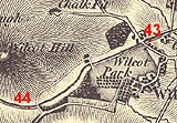
KandAC mile 43
|
|
|
|
KandAC mile 43 - OS 1inch map, early 19th century.
|
|
|
... when a canal does go through a village there's a pub ...
|
|
|
The Kennet and Avon Canal from mile 43 to 44 is part of the Fifteen
Mile Pound which roughly follows a contour line on the side of Pewsey
Vale. The towpath is on the north side.
|
|
|
|
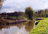
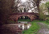
View east from Wilcot Bridge, looking back into mile 43.
|
|
|
|
Wilcot Bridge, Wilcot
|
|
|
Wilcot is clustered round Wilcot Green south of the canal, numerous
thatched cottages. There's a pub, the Golden Swan, at the far end of
the green. Many of the cottages look alike; they are probably the
houses built for inhabitants of East Stowell, thrown out when it was
enclosed as part of Stowell Park, early 19th century.
|
|
|
A canal projected in the 1790s, the Bristol and Salisbury Canal, would
have joined the Kennet and Avon Canal here - if it had been built.
Lots of support in 1792; forgotten five years later.
|
|
|
|
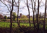
The further part of Wilcot village, and the Church of the Holy Cross,
south of the canal.
|
|
|
|
Wilcot Swing Bridge, Wilcot
|
|
|
|
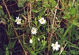
Greater stitchwort, Stellaria holostea, in the hedgerow by the canal.
|
|
|
|
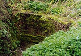
KandAC culvert 43.30
|
|
|
|
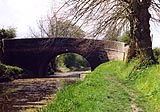
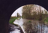
View east from Bowden's Bridge.
|
|
|
|
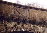
Bowden's Bridge, Wilcot
|
|
|
|
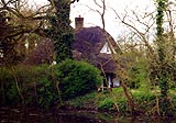
A thatched cottage in the copse by Bowden's Bridge, a real hideaway
with a canalside garden on the offside, the south side.
|
|
|
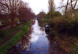
Wilcot Wide Water provides a winding point, a turning place for boats
longer than 30ft, but beware the shallow water in reedy lake.
|
|
|
|
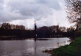
Wilcot Wide Water in the dusk. There are warning lines to fend off
boats from the shoal water.
|
|
|
|
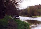
Boat Luce moored opposite Wilcot Wide Water; looking eastwards towards
Wilcot.
|
|
|
|
Wilcot Wide Water, Wilcot
|
|
|
|
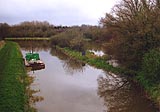
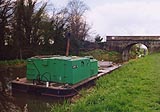
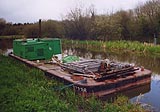
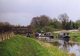
British Waterways Board, BWB, work boat moored near Lady's Bridge.
|
|
|
|
British Waterways Board, BWB, work boat moored near Lady's Bridge.
|
|
|
|
Lady's Bridge, Wilcot
|
|
|
|
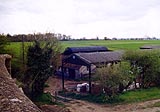
Cocklebury Farm, west of Lady's Bridge on the south side.
|
|
|
|
KandAC mooring 43.75
|
|

|
Kennet and Avon Scrapbook 2000
|
|