 Kennet and Avon Canal Kennet and Avon Canal |
 |
|
|
|
MILE 52
|
Roundway, Wiltshire : KAC52.00=KAC53.00 |
|

|
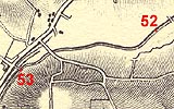
KandAC mile 52
|
|
|
|
KandAC mile 52 - OS 1inch map, early 19th century.
|
|
|
... town margins spread with housing estates; little boxes cheap,
little boxes pretentious, little boxes executive, etc ...
|
|
|
The Kennet and Avon Canal from mile 52 to 53 is part of the Fifteen
Mile Pound which roughly follows a contour line on the side of Pewsey
Vale; this section reaches the outskirts of Devizes. The towpath is on
the south side.
|
|
|
|
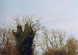
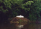
Rooks, Corvus frugilegus, in Lay Wood.
|
|
|
Lay Wood, on the north side of the canal just west of the 52 mile
point, has a fine colony of rooks.
|
|
|

|
Among the footprints of boots, shoes, dogs, etc on the towpath, you
might find deer tracks.
|
|
|
At about 52 miles 40 chains there is a plug in the bed of the canal.
The plug can be lifted with a windlass
|
|
|
|
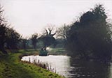
Just a boat on the canal.
|
|
|
|
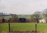
Devizes White Horse, Roundway
|
|
|
The white horse is on part of Roundway Down. On this down the
Royalists defeated the Roundheads, July 1643, during the Civil War.
|
|
|
|
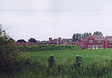
You might catch a view of the Le Marchant Barracks, a brick built
castle. This is still the home of part of the Wiltshire Yeomanry.
|
|
|
|
KandAC winding point 52.41
|
|
|
|
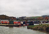
Devizes Marina, Roundway
|
|
|
|
Storm water outflow? just west of Devizes Marina.
|
|
|
|
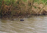
Coot, Fulica atra, on a grey canal on a grey day
|
|
|
|
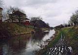
Housing estate east of Coates Bridge.
|
|
|
There is a lot of very new development along the line of the canal on
this side of Devizes. On the north side is a marina; housing and
moorings, one of the economic benefits of restoring the canal.
|
|
|
|
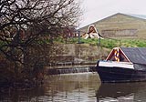
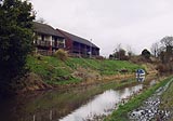
Houses just east of Coates Bridge, overlooking the canal, with
moorings.
|
|
|
|
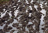
Canal towpath after rainy period and walkers. This is very slippy and
uncomfortable for walking.
|
|
|
The canal under and east of Coates Bridge can be as shallow as 5ft,
even in good times, as there is a lot of silting caused by land drains
running into the canal.
|
|
|
|
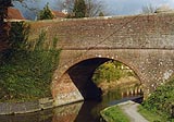
Coates Bridge, Roundway
|
|
|
|
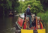
Boats passing.
|
|
|
|
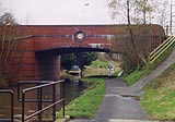
Brickham Bridge, Devizes
|
|
|
Parish boundary Roundway - Devizes: SU01516213
|
|

|
Kennet and Avon Scrapbook 2000
|
|