 Map Group HUTCHINSON 1748


picture frame -
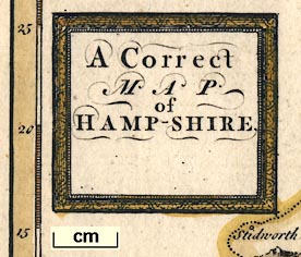
cartouche

A Correct / MAP / of / HAMP-SHIRE
compass rose

There is a compass rose with star points for the cardinal and half cardinal points, north is marked by a fleur de lys.
Map north is about 10 degrees west of, ie counterclockwise of, north. (This does not help fit the county shape to a rectangular page, quite the contrary.)

There are latitude and longitude scales in the map borders, chequered at 5 minutes, labelled at 10 minutes and at degrees, all in arabic numerals. The longitude scales are at the oblique angle of the map; the latitude scales are horizontal.
scale

Miles10 miles = 29.8mm is 1 to 540048, the scale is about:-
1 to 540000
9 miles to 1 inchIt is also possible to estimate scale from town positions. From this the map scale is about:-
1 to 610000
9.5 miles to 1 inch
sea plain
Spit Headlabels either the headland or the sea area offshore. This sea area is labelled:-
St Helen's Roadleading into:-
CHANNEL
coast form lines

The coast is drawn with form lines, broken lines and dotted lines giving an attractive wavy effect lacking the elegance of strictly engraved form lines. The form lines extend into river mouths and into harbours, which are not labelled.
castles
Hurst Cast

Calshot Castare shown, but no others. Portsmouth is not drawn with fortifications.

Rivers are shown by a tapering wiggly line beyond their mouth. At a glance they are a fairly comprehensive set for the size of map, and reasonably accurately drawn. They are mostly unlabelled, but see:-
Tese R.
Itchin R.bridges are not shown.
hillocks

Relief is indicated by bold knobbly hillocks shaded to the east. It is not clear what is being depicted.

A few forests are shown by little trees. East Bere Forest is labelled:-
Bore ForestAnd:-
New Forestis labelled. But Buckholt, Pamber and ?Alice Holt forests are not labelled.

Some parks are depicted by a boundary containing a few trees. No attempt is made to show a paling fence. Parks are not labelled.

The county boundary is a dotted line. Adjoining counties are labelled, eg:-
SURREY
WILTSHIRE

WINCHESTER

StockbridgeThere is some variation in text size:-
South Hamptonis emphasized, for example. This text size is bigger than the city label text.

W Wolham
Gratley
Gosport

Roads are shown by a double line. These are not well engraved; their spacing varies a lot.
Destinations of roads outside the county are indicated, eg:-
to GodlimainIn one case the road is continued, dotted, to its destination (Chichester).


The atlas's publishers also owned, in part, Defoe's 'Tour' and they associated the two works - 'Now Engraving, In a beautiful Manner, and of a proper Size to carry in the Pocket, or to bind with the Tour thro, the whole Island of Great Britain, A Complete Set of Maps of all the Counties of England, Scotland, and Wales ...' in an advert in the London Evening Post, July 1747.
Published in another edition '... Printed for: T, Osborne, D, Browne, J. Hodges, A. Miller, J. Robinson, W Johnston, P. Davey & B. Law. ... 1748.' published about 1756


