 Map Group -- LEWIS 1831


map maker
engraver

SOUTHAMPTONPrinted across the bottom is:-
Drawn by R. Creighton. DRAWN AND ENGRAVED FOR LEWIS' TOPOGRAPHICAL DICTIONARY. Engraved by J. & C. Walker.
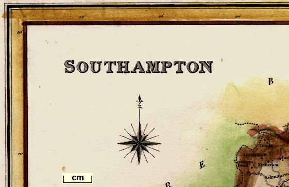
compass rose
up is N

Printed on the left is a compass rose; star points for cardinal, half cardinal and false points, North marked by a fleur de lys. The map is printed with North at the top of the sheet.

Scale of Mileschequered in miles, labelled at 5 mils intervals; The 20 miles = 75.4 mm gives a scale 1 to 426882 assuming a staute mile. The map scale is about:-
1 to 430000
7 miles to 1 inch

Printed in the map borders are scales of latitude and longitude for a slanted rectangular projection; chequered at 5 minutes intervals, labelled at 10 minute intervals. The map includes from 0d 40m to 1d 55m W, from 50d 25m to 51d 30m N; the whole of Hampshire, including parts of Dorset that were in Hampshire, and the Isle of Wight.
Estimating from the scales the:-
longitude, Winchester = 1d 17.5m Wroughy, which suggest a prime meridian close to Greenwich. The bottom scale is labelled:-
West Longitude
sea plain
Christchurch Bay
THE SOLENT
SPITHEAD
ENGLISH CHANNEL
coast form lines
headlands

The coast line is emphasised by form lines.
Some headlands are labelled, eg:-
Hengistbury HeadSome harbours are explicitly labelled, eg:-
Keyhaven
Portsmouth Harbour
castles
fortifications

Hurst Cas.
Calshot Cas.Portsmouth, Portsea, Gosport have a scatter of square blocks within a line - which MIGHT be taken to indicate fortifications:-

lakes
ponds

Rivers are shown by wiggly lines. Beyond the river's estaury the line is quite thin, except the major rivers which have form lines on one side of the single wiggly line. Some braiding is indicated. Some rivers are labelled, eg:-
Anton or Test RiverAn example of a pond, this with form lines, is:-

Fleet Pondwith the railway, added to a later edition of the map, engraved through the middle.
Some bridges are shown by the road interupting the course of the river.
An aqueduct is suggested under the Basingstoke Canal NW of Odiham.
hill hachuring

Hill hachuring is used to suggest relief. There is some labelling, eg:-
Magdalen Hill
Longstock Hill
Portsdown Hill

The county boundary is a bold dotted line. Contiguous counties are labelled in clear block caps, eg:-
DORSETSHIREThe detached part of Hampshire, in West Sussex, is shown.

Drawn across the map is a boundary between the North Division and South Division, a dot dash line. This is not tinted, except where, by chance? it is also a parish union boundary. The two areas are labelled:-
NORTH DIVISION
SOUTH DIVISIONAt the top of the early edition of the map is:-
PLACE of ELECTION for the NORTHERN DIVISION.- Winchester.
POLLING PLACES.- Alton, Andover, Basingstoke, Bishop's Waltham, Kingsclere, Odiham, Petersfield.
PLACE of ELECTION for the SOUTHERN DIVISION.-Southampton.
POLLING PLACES.- Fareham, Lymington, Portsmouth, Ringwood, Romsey.

WINCHESTER

ALTON

Chawton

Beauworth

Roads are shown by double lines. There seem to be three conventions in use to distinguish different types of road.
1. dotted line, instead of continuous, on one or both sides probably indicates unfenced roads.
2. narrow v. broad double line, to indicate importance.
3. lines of equal weight v. one light one bold, to mark particular roads.
All broad width roads have light/bold lines ie the system is partly redundant.

Most are labelled. The following canals are shown:-
Basingstoke Canal
Andover Canal
Itchin Navigation
Arundel Canal

Railways have been added to the later edition of the map, drawn by a bold line with cross ties. The engraving runs over existing features and labels. The railway shown is:-
Southampton
Railway
Southampton Railway


Reference to the Unions
1 Hungerford (Part)
2 Kingsclere
3 Newbury (Part)
4 Bradfield (Part)
5 Andover
6 Whitchurch
7 Basingstoke
8 Hartley-Wintney
9 Stockbridge (Part)
10 New Winchester
11 Alresford
12 Alton
13 Romsey
14 Hursley
15 Fordingridge (Pt.)
16 Ringwood
17 Christchurch
18 New Forest (Part)
19 Lymington
20 South Stoneham
21 Fareham
22 Droxford
23 Petersfield
24 Catherington
25 Portsea Island
26 Havant
27 Midhurst (Part)
28 Parts not yet formed into UnionsThe union boundaries appear to be independent of the county boundary.


Published in 2nd edition 1833
Published in a 3rd edition 'A Topographical Dictionary of England ... Third edition, With a supplementary volume comprising a representative History of England with plans describing the electoral divisions of the several counties ... By Samuel Lewis ... London ... S. Lewis and Co ... 1835.'
Published in a 4th edition 1840.
Published in a 5th edition 'AN ATLAS, COMPRISING MAPS OF THE SEVERAL COUNTIES, DIVIDED INTO UNIONS, AND OF THE ISLANDS OF GUERNSEY, JERSEY, AND MAN; WITH A MAP OF ENGLAND AND WALES, AND A Plan of London and its Environs. / LONDON: PUBLISHED BY S. LEWIS AND CO., 87, HATTON GARDEN. M.DCCC.XLII.' ie 1842.
Published in a 6th edition 1845, 7th edition 1849.


