 Map Group MOULE 1836


plain cartouche
map maker
engraver

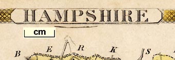
HAMPSHIREPrinted bottom centre:-
Engraved for MOULES ENGLISH COUNTIES by I. Dower.The map border is broad, decorated with overlapped wavy lines, like machine turning.

DUKE OF WELLINGTONmotto:-
VIRTUTIS FORTUNA COMESand several towns:-
SOUTHAMPTON
SOUTHWICK
WINCHESTER
PORTSMOUTH
PETERSFIELD

SOUTHAMPTONfrom across Southampton Water, printed at the bottom right.
north point
up is N

Printed upper left is a north point; N-S line; E-W cross line; North marked by a fleur de lys. The map is printed with North at the top of the sheet.
scale

Scale of English Miles.chequered at 2 mile intervals, 10 miles = 30.5 mm gives a scale 1 to 527654 assuming a statute mile. The map scale is about:-
1 to 530000
miles 8 to 1 inchAn estimate of scale can be made from town positions, comparing known town-town distances, using DISTAB.exe. The map scale is about:-
1 to 520000
8 miles to 1 inch
The grid references of the map borders were calculated as:-
bottom left SY785646
top left ST785758
top right TQ193757
bottom right TV193645This could be useful to present the map in a GIS system.

2 [degrees]which could be taken to be the meridian for the map. This meridian runs through Langstone Harbour and between Basingstoke and Odiham. It is 1, not 2, degrees west of Greenwich. Inside the left border is a mark labelled:-

51 [degrees]of latitude.
coast shaded

The coast line is shaded, the shading taken into harbours and river mouths, and extended out into the sea. Some sea areas are labelled, eg:-
SPITHEAD
Christ Church Bayas are some harbours, eg:-
Southampton Water
Portsmouth HarbourFew headlands are labelled, eg:-
Hengistbury Head
coastal defence
fortifications

Hurst Cas.
Calshot Cas.
Southsea Cast.
Lumps Ft.
Cumberland Ft.Polygonal lines around Portsea and Portsmouth suggest the fortifications of the naval bases:-

ponds
bridges
ferries

Rivers are drawn with a fine wiggly line inland from their estuary. The larger streams, Avon, Test, and Itchen, are drawn with a double line, and braiding shown, for example at Fordingbridge. Some rivers are labelled, eg:-
R. Avon
R. Test
Blackwater R.but river names are crowded out by other place names.
Bridges are implied where a road crosses, and interupts, a river. Some are labelled, eg:-
St. Leonards Bridge
Hartford Br.Ponds are drawn as outline with shading, examples, near Fleet, in Paulton's Park, in Hurstbourne park by Whitchurch.
A ferry might be labelled, eg:-
Ferryover the Beaulieu River from Ginns to Exbury. The ferry over the Itchen at Southampton is not shown.
hill hachuring

A limited amount of the county's relief is shown by hill hachuring; it does not provide a reliable view of the bones of the county. None of the hills seem to be labelled; no beacons are noticed.
forests

The
NEW FORESTis clearly labelled, and decorated with grass and tussock symbols, bushes and trees. Elsewhere little tree symbols are used very sparingly, in enclosures, but notice:-
Freefolk WoodNone of the other great forests are noticed.

Paulton Park
Bramshill Parkor are named by a house, eg:-
Hawley Ho.
Redenham Ho.but may or may not be a formally emparked area.

The county boundary is a circle dash line. The detached part of Hampshire in Sussex is shown.
Contiguous counties are labelled, eg:-
WILTSHIREOutside the county some relevant settlements, roads, etc, are shown and may be labelled, eg Poole, Wimborne, Salisbury, Downton. Chichester is drawn on the London-Chichester road, but is not labelled.
electoral data
Fine dotted lines divide the county into hundreds. The hundred areas are keyed by arabic numbers to a table of hundreds in two series:-
REFERENCES / to the / HUNDREDS & LIBERTIESThe numbers run in two series, 1..24 in the North Division, 1..23 in the South Division (asking for confusion), and:-
This sign [asterisk] denotes that that part of the Hundred belongs to the Hundred having the same sign and figure although in a different Division.For example:-

5 [star]north of Exton labels this area as part of Barton Stacey Hundred in the Northern Division.
street map

WINCHESTER

PETERSFIELD
ANDOVERSmaller towns have groups of rectangualr blocks, along road(s), and perhaps with a cross (+); labelled in upright lowercase text, eg:-

Havant
Alton

Selbourne
Lower Worldham
Twyford

Canals are drawn with a triple line, light bold light, and might be labelled. The following canals are noticed:-
Basingstoke Can.
Andover & Stockbridge C.
Southampton Canal

Salt Works
Rufuss Stone
Telegraph


Published in another edition, 1837.
Published in later editions of 'Complete and Universal Dictionary of the English Language' by Rev James Barclay, 1840 (no maps) to 1852.


