 Map Group -- WALKER 1830


map maker
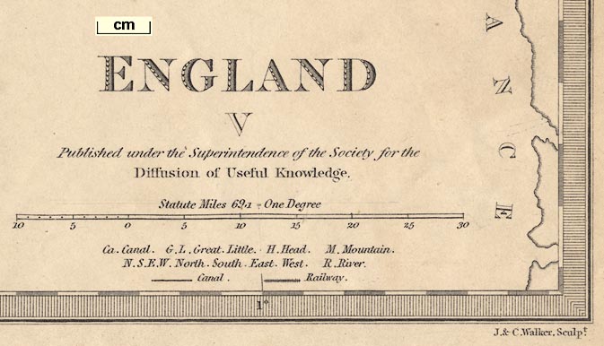
ENGLAND V Published under the Superintendence of the Society for the Diffusion of Useful Knowledge.Printed bottom centre:-
Published by Baldwin & Cradock 47 Paternoster Row June 25th. 1830.Printed bottom right:-
J. & C. Walker, Sculpt.
up is N
scale
Statute Miles 69.1 = One DegreeThe scale has a leftward portion of 10 miles marked at 1 mile intervals, labelled 0,5,10, and the main portion marked and labelled at 5 mile intervals. The 10+30 miles= 83.9 mm gives a scale 1 to 767268. The map scale is about:-
1 to 770000
12 miles to 1 inch
lat and long grid
0 / Meridian of GreenwichA latitude and longitude grid, a graticule, is printed over the map at degree intervals.
The map includes most of Gloucestershire, Oxfordshire, Buckinghamshire, Hertfordshire, Essex, Middlesex, London, Berkshire, Wiltshire, Dorset, Hampshire, Isle of Wight, Surrey, West Sussex, East Sussex, and Kent.
sea plain
sandbanks
ENGLISH CHANNEL
SPITHEAD
Southampton WaterLarge sandbanks, or shallows, might be drawn in dotted outline, as off Selsey Bill, labelled:-
Owers
coast shaded
lighthouses
islands

The coast is shaded or hachured on the landward side, further emphasised by the tinting of the county boundaries. Although headlands, harbours, etc are clearly drawn, none are labelled for Hampshire. Further east a headland and lighthouse:-
Beachy Head
Revolving Lightare labelled.
Heyling I.is labelled.
hill hachuring

Some relief is indicated by hill hachuring. The South Downs and North Hampshire Downs are suggested amongst a few other hills.

Rivers are drawn by a wiggly line tapering inland; braiding might be suggested. Some rivers are labelled, eg:-
Riv. Stour
Wily RiverThe second of these is the River Avon, to which the River Wylye is a tributary joining at Salisbury.
All of Hampshire's main river systems are drawn, with some tributaries. Bridges are not noticed, only implied where a road crosses and interrupts a stream.
forests

A few areas of woodland are shown by a few tree symbols and dotting to suggest rough ground. The only woodland area marked in Hampshire is the:-
NEW FOREST

A very few parks are drawn in outline with fence palings, not labelled.

The county boundaries are dotted lines emphasised by tinting for each county, ie there might be a tint each side of the boundary line, one for each county. The county areas are labelled, eg:-
HAMPSHIREThe detached part of Hampshire is shown within West Sussex, not labelled, but tinted to match Hampshire. Notice also the two detached parts of Wiltshire in Berkshire, on Hampshire's north border.
The county colouring is only really worth studying for the whole sheet, nevertheless the colours around Hampshire, which is red, are: Dorset yellow, Wiltshire green, Berkshire yellow, Surrey lilac, Sussex yellow. Detached parts appear to match their county tint.

WINCHESTER

Alton
Southamptonexcept:-
PORTSMOUTHin upright block caps - it's an important place.

Upper Wallop
E. Worldham

A network of roads is drawn by double lines. Road are graded: major roads, perhaps turnpikes, broader and one line bold; minor roads narrower.

Basingstoke Canal
Southampton Canal


Alton
Andover
Basingstoke
Bishops Waltham
Christ Church
Fareham
Fordingbridge
Gosport
Havant
Kingsclere
Lymington
Alresford
Odiham
Petersfield
Portsmouth
Ringwood
Romsey
Southampton
Stockbridge
Whitchurch
Winchester


