Hundreds
Blome's Hampshire 1673
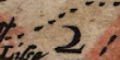
A Table of the HundredsHundred boundaries on the map are confused; it is not always possible to follow the boundary of a particular hundred, and some unnumbered areas are difficult to identify. One unnumbered area, around Alresford, is probably Alresford Liberty, not in the table of hundreds. The map colourist has been confused, and has added more confusion where colouring doesn't follow the boundaries.
1 Crundall
2 Odiam
3 Alton
...
40 Fordingbridge
The relationship between modern and old hundreds is very inexact; modern hundreds have little use today.
Hundreds
Alton
Andover extra
Andoverinfra
Barmanspitt
Bartonstacie
Basingstoke extra
Budlesgate
Buntesboro
Christchurche
Chuteley
Crundall
East Meane
Evinger
Fareham
Fawley
Finchdeane
Fordingbridg
Hambledon
Horwell
Kingesclere
Kinges sombourne
Mansbridg
Maynsboro
Meanstoke
Micheldover
Newforest
Odiam
Overton
Pastrae
Portesdowne
Redbridge
Ringwood
Selbourn
Sutton
Thornegate
Titchefeild
Waltham


