Road map features
Bowen's Hampshire 1720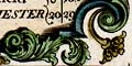
Various other features might be described for the interest of the traveller.
|
| Road map featuresBowen's Hampshire 1720 |
| Road map feature |
Some images can be clicked for more information. |
|
| title cartouche: There is a header to each route |
|
|
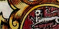
text & coat of arms: The map sheets have descriptive text
giving information about towns; this is not always on the
relevant sheet. The text tells of the foundation, state,
parliamentary represenation, market days, etc and may be
accompanied by a coat of arms. Various other features might be described for the interest of the traveller. |
|
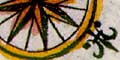
| compass rose: A fleur de lys marks north. Roads are drawn 'up is out from London'. |
|
| scale line: None; roads are marked at 1 mile intervals - the only indicator of scale. |
|
| coast shading: Sea coast is shaded, eg at Southampton pl.130 |
|
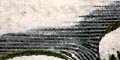
| hill: Hillocks are drawn to indicate ups and downs in the route. |
|
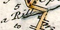
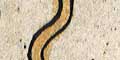
| river: Wiggly shaded lines show rivers. |
|
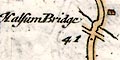
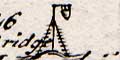
| bridge: Bridges are implied where roads cross rivers. |
|
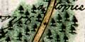
| wood & forest: Drawings of trees indicate woodland. |
|
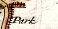
| park: Parks are noted by a paling fence. For example pl.61 mile 60-61 Park running alongside the road and off to the side. |
|
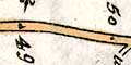
| road: Roads are the main element of these maps. The road distance from London is given each mile. |
|
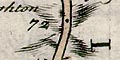
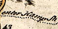
| county: Counties are named along the edge of each scroll. The boundary is shown by a dotted line, and usually a comment, eg enter Hamp Sh. The comment might be very precise, eg pl.216 mile 30 on ye middle of ye Bridge enter Hamp Shire. |
|
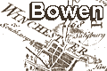
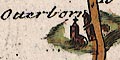
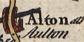
| settlement: Settlements are marked in a variety of ways, and are usually named. |
|
| market towns: and other towns. |
|
| miscellany: fortifications, mills, schools, crosses, posts, graves, antiquities, beacons, etc etc. |
 
| Bowen's Hampshire 1720, contents |

| General index |

| Old Hampshire Mapped |