| Map features
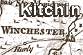
Kitchin's Hampshire 1751 (smaller map)
|
|
| Map feature
|
Some images can be clicked for more information.
|
|
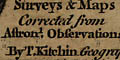
title cartouche: monumental stone, with map maker's name.
|
|
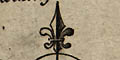
compass rose: minimalist design.
|
|
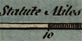
scale line: 'British Statute Miles'.
|
|
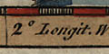
latitude and longitude scales: chequered side and
bottom borders.
|
|
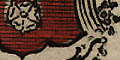
coat of arms: for Southampton.
|
|
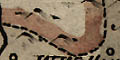
coast: the sea coast is emphasised by form lines which continue
up estauries and into harbours, and into the lower part of rivers.
|
|
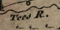
rivers: major rivers are shewn, tapering upstream. Some
are named, eg:-'Tees R.' for the River Test.
Bridges are implied by road crossings, ie not for sure.
|
|
A few lakes are shown, eg on a stream north of Alresford.
None of the Hampshire harbours happens to be labelled, but
Spit Head is labelled.
|
|
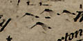
relief: shown by small shaded hillocks, these seem just
to be filling space decoratively. They are scattered about
liberally.
|
|
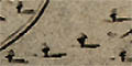
woods, forests: shown by little trees, drawn with a
shadow, these seem just to be filling space decoratively.
New Forrest is labelled as an area rather than as a forest.
|
|
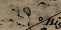
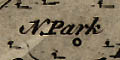
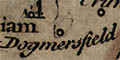
parks: very few parks are shown on this map, a vague circle of
fence palings indicates a park at Dogmersfield and at Farnborough,
the name N Park labels a ?settlement near Beaulieu.
|
|
county: the county boundary is a dashed line.
hundreds are not shown.
|
|
settlements: symbols for houses, hamlets, villages,
cities, etc.
|
|
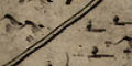
roads: at least three grades of road are shown.
|
|
antiquities: there is no special symbol for antiquities,
but a few roman place names are given.
castle: generally there is no special symbol for castles,
though there might be a flag.
|


