roads
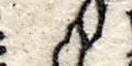
Morden's playing card map, Hampshire, 1676Roads are marked with a double line or a single line, indicating their importance? Their engraving is inconfident, and is judged to have been made at a late stage in map making; roads run through place names. The roads shewn (an = for a double line, a for a single; modern spellings) are:
(from Reading? Berkshire) = Basingstoke = Overton = (passing Whitchurch) Andover = (Wiltshire, towards Salisbury)
(from Reading? Berkshire) Alton
(from Farnham? Surrey) = Alton = Alresford = (crosses a bridge into) Winchester = Southampton
Winchester Bishops Waltham
Southampton Romsey
Southampton (across Southampton Water) Ringwood
Southampton (across Southampton Water) Dibden Lymington
(Surrey) = Petersfield = Portchester
Petersfield (West Sussex, perhaps Chichester)


