hundreds
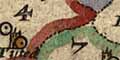
Norden's Hampshire 1607
The relationship between modern and old hundreds is very inexact; modern hundreds have little use today.
Also note that Norden or the engraver has made some serious errors in labelling the areas with key numbers, see below.
The key:-
1 = Crundall
2 = Odiam
3 = Alton
4 = Sutton
5 = Selbourne
6 = East Meane see in Camden's Britannia
7 = Bartonstacie
8 = Finchdeane
9*= Bosmere
10 = Portesdowne
11 = Fareham
12 = Alverstoke and Gosport
13 = Titchfeild
14 = Mansbridge
15 = Waltham
16 = Meanestoke see in Camden's Britannia
17 = Hambledon
18 = Fawley
19 = Budlesgate
20 = Kinges Sombourne
21 = Redbridg
22 = Andover infra
23 = Andover extra
24 = Horwell
25 = Evinger
26 = Pastrae
27 = Thornegate
28 = Kinges Clere
29 = Overton
30 = Micheldevor
31*= Buntesboro
32 = Maynsboro see in Camden's Britannia
33 = Barmanspitt
34 = Basingestoke
35 = Chuteley
36 = Holdshott see in Camden's Britannia
37 = Newforrest
38 = Christchurche
39 = Ringewood
40 = Fordingbridg
* 31 Norden has 13 on the map where it should be 31 in central Hampshire.
Someone has coloured the hundred boundaries on this copy of the map, we think this was done comparatively recently, and has been done wrongly in places - be careful how you follow the lines.


