| Map features
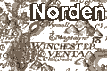
Norden's Hampshire 1607
|
|
| Map feature
|
Some images can be clicked for more information.
|
| title cartouche, map maker
|
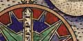
| compass rose, scale line
|
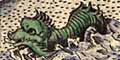
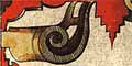
| decoration:
sea monsters, galleons, swash lettering
|
| coast shaded; into a pecked sea.
|
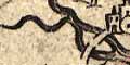
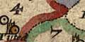
| rivers; wiggly lines narrowing upstream.
Rivers are not named, though some river mouths are named as havens.
|
| bridges; marked by a double line over a
river. Not named.
|
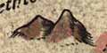
| relief; is suggested by little lumpy hillocks.
|
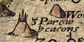
| beacons; a hill with beacon posts on top.
Some are named.
|
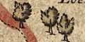
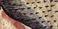
| woods, forests; out of scale trees,
sometimes grouped into woods or forests.
|
| parks; a ring of fence palings. Some
are named.
|
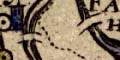
| hundred boundary; a number keying the area
to a table of hundreds.
|
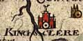
| settlements; table of symbols, houses,
hamlets, villages, cities, etc
|
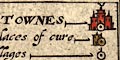
| market towns, and other towns
|
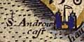
| coastal defence, castles; two towers with
a flag, no dot and circle.
|
| antiquities;
hillforts by a hatched circle like a modern tumulus symbol, with
a flag,
and roman place names.
|
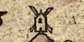
|
miscellany:
windmill, near Clanfield; copperas and alum, near Canford.
|


