|
Research Notes
 Map Group DUGDALE 1835
|
 |
|
Dugdale 1835
|


|
|
|
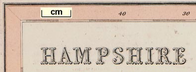
Map, Hampshire, scale about 8 miles to 1 inch, by Thomas Dugdale, drawn and
engraved by J Archer, Pentonville, London, published in Dugdale's Dugdale's England and Wales Delineated by Tallis, London, 1835;
published 1835-60.
|
| |
 |
PUBLISHING HISTORY |
 |
ITEMS in the Collection |
 |
|
| PUBLISHING |
HISTORY |
|
Published in 'Curiosities of Great Britain. England and Wales
Delineated. Historical, Entertaining & Commercial. Alphabetically arranged. By
Thomas Dugdale, Antiquarian assisted by William Burnett, Civil Engineer.' vol.1
published by 'Tallis and Co, Green Arbor Court, Old Bailey, 1835.' vol.2 by
'John Tallis, 15, St. John's Lane, Smithfield.' vol.3 by 'L. Tallis, 3, Jewin
Street, City.' |
|
The book has many topographical views and the maps; its size is 5 1/8 x 7 1/4
ins.
|
|
Published other editions 1843 and 1848. |
|
Published in 'Dugdale's England and Wales Delineated, edited by E. L.
Blanchard. London: L. Tallis, 21, Warwick Square, Paternoster Row.'
1854-60 |
|
The Blanchard edition was issued in fifty parts over the period 1854-60; the map
is the same as the 1835 edition with additions to railways.
|

| top of page |
 |
|
|
ITEMS |
in HMCMS Map Collection (scanned item in bold)
|

|
HMCMS:ACM1934.74.4 -- map
|

|
HMCMS:ACM1934.74.6.1 -- map
|

|
HMCMS:ACM1934.74.6.2 -- map
|

|
HMCMS:FA1998.135 -- map
|

|
HMCMS:FA1998.136 -- map
|

|
HMCMS:FA1998.137 -- map
|

|
HMCMS:FA1998.203 -- map
|

|
HMCMS:FA1998.204 -- map
|

|
HMCMS:FA1998.205 -- map
|

|
HMCMS:FA1998.210 -- map
|

|
HMCMS:FA1999.53 -- book
|

|
HMCMS:FA1999.53.18 -- map
|

|
HMCMS:WOC4716 -- map
|

| top of page |
|
 |
All Old Hampshire Mapped Resources |

 Map Group DUGDALE 1835


