 |
Map features
Norden's Hampshire 1595
|
|
| Map feature |
Some images can be clicked for more information.
|
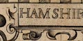 |
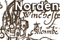
title cartouche; strapwork cartouche 'HAMSHIRE',
a separate cartouche has 'Johes Norden descripsit �
Printed and sold by John Overton at ye white horse
without Newgate'
|
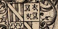 |
coat of arms; Elizabeth I with lion and
dragon supporters; William Sanderson friend and ?patron;
John Pawlett Marquis of Winchester; and Thomas
Wriotheosley Earle of Southampton.
|
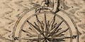 |
orientation; compass rose with cardinal, half
cardinal, false and by points. The cardinal directions
are labelled 'Septen / or / merid / oc'.
|
 |
scale line; 'The scale of miles goeth rounde about
the Mapp'; besides giving the scale, the scales and the
grid printed across the map in fine lines make an index
grid, an innovation of John Norden's.
|
 |
sea; moire effect pattern. The Solent
is labelled 'PARTE OF YE BRITISH SEA'. Off Hurst there is
a large fishes's head and about Spithead can be seen
the ghostly remains of an erased engraving of a
galleon, perhaps making space for the sea area label.
|
 |
coast shaded; and foreshore areas of mudflats
or shingle shown pecked.
|
 |
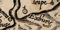
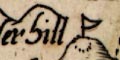
rivers; broad wiggly lines tapering inland, not named.
|
 |
bridges; some drawn, by a double line arched over
the stream.
|
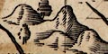 |
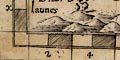
relief; hillocks shaded to the east, few labelled.
|
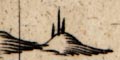 |
beacons; drawn by posts, usually 3, small large
small, on a hillock.
|
 |
woods, forests; wooded areas shown by tree
symbols; some old forests are labelled.
|
 |
parks; ring of fence palings shaded to the
east, perhaps a house symbol inside and a tree or more.
|
 |
county boundary; a dotted line. Adjoining counties
are labelled, eg: 'parte of Wiltshire' with a mixture
of swash and plainer mixed case lettering. The detached
'part of hamshire' from Ambersham to Fernden, is drawn
and labelled.
|
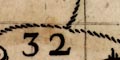 |
hundred boundaries; dotted lines; areas
numbered, referring to a table of hundreds.
|
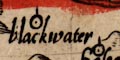 |
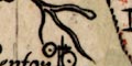
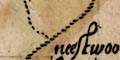
symbols; settlements; positioned by a dot and
circle, differentiated by symbols explained in a table
of symbols, but not by the style of lettering.
|
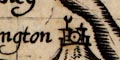 |
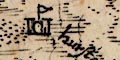
market towns; buildings and
towers, and a ?weathercock on the tower.
|
 |
coastal defence, castles, fortifications; castles
drawn and labelled; artillery style fortifications
at Portsmouth.
|
 |
antiquities; old trenches and forts.
|
 |
miscellany; mills, water mills and windmills,
copperas works; ruins.
|


