map features
Ogilby's Hampshire 1675Examples are mostly from the plates pertinent to the Hampshire map study; 25, 26, 30, 32, 39, 51, 53, 81, 83, and 97.
|
| map featuresOgilby's Hampshire 1675 |
| Map feature |
Some images can be clicked for more information. Examples are mostly from the plates pertinent to the Hampshire map study; 25, 26, 30, 32, 39, 51, 53, 81, 83, and 97. |
|
| title cartouche - different for each of the 10 plates |
|
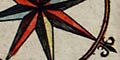
| compass rose - various styles |
|
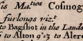
| scale - there is no scale line; road distances are marked. |
|
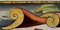
| roads - the key feature of these maps, scrolls and road distances. |
|
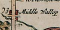
| settlements - symbols and pictures |
|
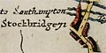
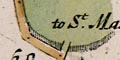
| market towns; and other towns |
|
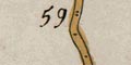
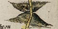
| hills - ascents and descents on the route |
|
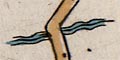
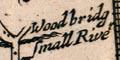
| rivers etc |
|
| bridges - fords, etc |
|
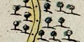
| woods - and forests and lone trees |
|
| parks - fenced |
|
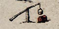
| miscellaneous - water and wind mills, forts, beacons, wells, posts, vegetation, ... |
 
| Ogilby's Hampshire 1675, contents |

| General index |

| Old Hampshire Mapped |