 Kennet and Avon Canal Kennet and Avon Canal |
 |
|
|
|
MILE 60
|
Melksham Without and Semington, Wiltshire : KAC60.00=KAC61.00 |
|

|
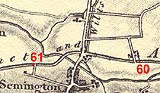
KandAC mile 60
|
|
|
|
KandAC mile 60 - OS 1inch map, early 19th century.
|
|
|
... wandering across England's green and pleasant landscape ...
|
|
|
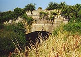
The Kennet and Avon Canal from mile 60 to mile 61 crosses the
Semington Brook by an aqueduct to join the Avon Valley proper. The
towpath is on the north side.
|
|
|
|
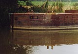
Work boat 84280
|
|
|
|
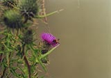
Thistle, Cirsium sp; and bee.
|
|
|
|
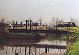
Newtown Swing Bridge, Melksham Without
|
|
|
Newtown Farm lies on the north bank. The Semington Brook is running
alongside the canal about a furlong away on the south side.
|
|
|
|
Barratt's Lock, Melksham Without
|
|
|
|
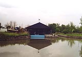
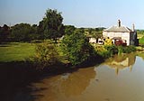
Semington Boatyard, Melksham Without
|
|
|
|
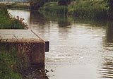
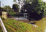
Outflow from the water pumped back up the canal.
|
|
|
What does engineering beauty reside in? Functionality, usually a
minimal design to do the job; plus, perhaps plain fun, exuberant
decoration and grandiose setting? I don't believe this slab of
concrete is minimal effective; and it isn't grand and decorative.
Could do [lots] better.
|
|
|
|
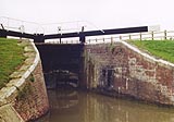
Buckley's Lock, Melksham Without
|
|
|
The Wilts and Berks Canal, a narrow canal, abandoned 1914, met the
Kennet and Avon Canal here. The junction is at the winding pointk. The
canal opened 1810. It went off 51 miles, and 42 locks, northwards via
Melksham, Lacock, Swindon, and Abington to the River Thames. Branches
went to Chippenham and Calne. The entrance is easy to spot; and notice
that some railings here are old fishbelly rail (perhaps from the horse
drawn Avon and Gloucester Railway, owned by the GWR since 1852, closed
1906); the bridge over the branch is bricked up. At times the entrance
to the branch canal was guarded by a stop chain.
|
|
|
John Rennie's first plans for the canal, about 1790, had a route
through Melksham. By 1793 he'd had a change of mind, persuaded by a
probable lack of water, the new route was much as actually built but
included Trowbridge which eventually got passed by to save two miles
and a long aqueduct.
|
|
|
|
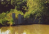
Now blocked off, this was the junction with the Wilts and Berks Canal.
The railings are fishbelly rail from a tramroad.
|
|
|
|
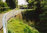
Water intake for pumping water up the canal from below to above the
Semington locks.
|
|
|
|
KandAC winding point 60.39
|
|
|
|
Semington Bridge, Melksham Without
|
|
|
|
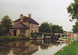
Semington Wharf, Melksham Without
|
|
|
A pipeline crosses the canal at about 60m 46ch; and at about 60m 56ch
there is a plug in the bed of the canal. The farm to the north is
Outmarsh Farm.
|
|
|
|
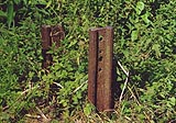
The remains of the wince for the plug.
|
|
|
|
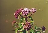
Hemp agrimony, Eupatorium cannabinum, in the canal edge.
|
|
|
|
Steel piling of the canal bank; not very well done! someone was in a
hurry?
|
|
|
Parish boundary Melksham Without - Semington: ST89686094
|
|
|
|
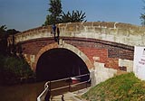
Semington Aqueduct, Semington
|
|
|
Semington lies about a furlong south of the canal. There's a small
store and a garage, and a pub, the Somerset Arms.
|
|
|
|
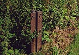
Milepost 60 III; without its board and number.
|
|
|
KandAC culvert 60.78
|
|
|
|
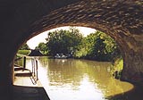
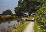
The canal eastward of Semington Swing Bridge; looking westward.
|
|
|
|
Semington Swing Bridge, Semington
|
|
|
|
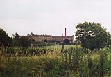
Once the parish union workhouse, then St George's Hospital, now a
residential unit for the disabled to live as independently as they
can; to the south of the canal.
|
|

|
Kennet and Avon Scrapbook 2000
|
|