
 Map Group OGILBY 1675

There are copies of all 10 plates in the Map Collection of Hampshire CC Museums Service. Those illustrated are, in page number order, items FA1997.7, FA1998.174, FA1997.8, FA1998.172, FA1998.166, KD1996.7, FA1998.1, FA1998.2, FA1998.173, FA1997.3. In the Map Collection there are other pages from Britannia, a frontispiece and text pages. A transcription of the introductory texts and those relevant to Hampshire can be seen in:-


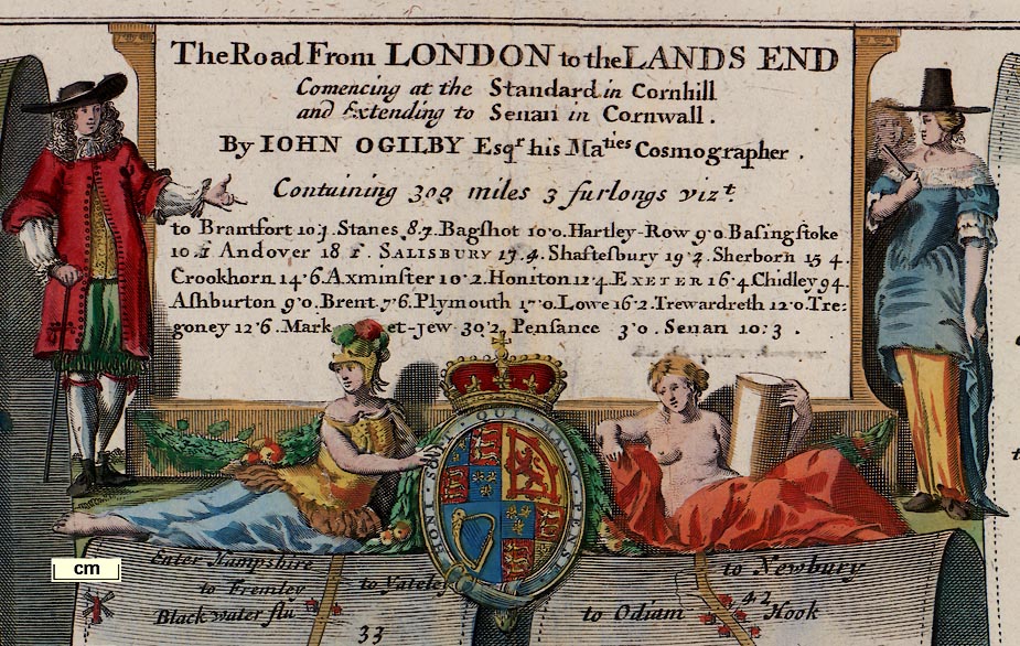
Each of Ogilby's plates has its own title cartouche. These include decorative scenes, or figures, or flowers and fruit, etc, the title of the route and description of the plate's contents, with road distances, map maker's name, etc. There is usually a royal coat of arms, the Lions and Fleur de lyses of England and France quartered with the Lion of Scotland and the Harp of Ireland.

Two cherubs and decorative scrolls; at first this looks plain and uninteresting, but look again. The cherub on the left carries a surveyor's chain and another instrument which might be a cross staff, and a compass hangs in the branch over his head. The cherub on the right is reaching into a branch with a pair of dividers, and a protractor hangs on a twig.
The coat of arms is also poorly drawn, and its motto is back to front. It feels as if an apprentice did this bit of engraving.
compass rose

Compass roses are used on each scroll, or part of a scroll, to indicate the general bearing of the stretch of road. There are more than a dozen variations of design in the whole atlas; different numbers of points, different decoration, different designs of fleur de lys for north, occasional cross for east, etc.
There does not seem to be any system to the use of more or less fancy work in the designs. Of the styles:-
Most decorative - cardinal, half cardinal and false points all shown by broad star pointers in a circle, a fleur de lys for north.
Middlin' decorative - cardinal and half cardinal points shown by broad star pointers in a circle, a fleur de lys for north.
Least decorative - a circle with cross lines for the cardinal points, a fleur de lys for north.

The roads are marked with dots at each furlong, and a double dot at the miles, which are numbered. It is possible to calculate a scale for the maps from these marks. Comparing the routes with the today's maps, judging as best one may what the route is now, the scale seems to be close to this figure.
It is clearly not right to refer to scrolls by letter, as scroll D, for instance, the letter belongs to two scrolls. Where we have needed to distinguish one scroll from another, in indexing, scrolls have been numbered 1, 2, ... from the left of each plate. So pl.25(5) is plate 25 scroll 5.

County boundaries are clearly marked by a dotted line across the route, with text stating what county is being entered as the traveller rides away from London, eg:-
Enter WiltshireThe county of each segment of road is marked along the side of the scroll, eg:-
HAMPSHIRE
Hampshire

Roads are the key feature of these maps. They are shown by a double line, solid or dotted. Junctions are marked clearly, sometimes labelled. Ogilby:-
2. The Road itself is express'd by double Black Lines if included by Hedges, or Prick'd Lines if open; but if the Road be describ'd altogether by Black Lines or Prick'd Lines throughout the whole Plate, then the Distinction aforesaid of Enclos'd and Open is omitted.
Whilst Ogilby uses statute miles on his roads, the distances he provides to places off the road are in customary or Old English miles.
4. The several Deviations or Turnings out of the Road to adjacent Places on either Hand, are exprest by a short double Line, and are generally inscrib'd, to such a Place, and sometimes the reputed Distance of the said Place in Miles is likelwise signify'd by Figures affixt.
Example:-
to Farnborow | to Yately
distances from London
... the beginning of Computation from the Standard in Cornhill
... the said Miles being exprest by double Points, and numbred by the Figures 1, 2, 3, &c. Each subdivided into 8 Furlongs, represented by the single Points included between the said double Ones.The measurements seem to be very accurate; but things occasionally slip - double and single points muddled or misplaced etc.
Distances are tabulated for each road in its title cartouche:-

There are a few instances where alternative routes are drawn:-

hillocks

Inclines up and down on the road are indicated by hillocks; a range of hills beside the road might be drawn. Ogilby:-
8. Ascents are noted as the Hills in ordinary Maps, Descents e contra, with their Bases upwards.Some hills get labelled.
Example, up at pl.97(3) 91'4:-

Example, down at pl.53(2) 70'0:-
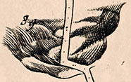
Example, hills pl.25(5) 46'6:-


There is no beacon shown in Hampshire, but on one of the plates in this study there is one in neighbouring Wiltshire, on Beacon Hill pl.32(1) 77'3. The beacon is drawn with a fire basket on a post with a ladder.
sea plain

THE SEA
coast form lines
coast shaded

The coast is drawn with coast form lines or shading
fortifications

A polygonal artillery fort is clearly shown at Cosham, pl.30(6) 69'0
bridges
fords
ponds

Rivers are shown by the usual wiggly lines, graded for size, and might be labelled. Bridges are less certain to interpret from the map. Ogilby:-
7. Rivers are Decypher'd by a treble wav'd Line or more, and the lesser Rills or Brooks by a single or double Line, according to their Eminency.
6. Bridges are usually noted with a Circular Line like an Arch, but are generally, imply'd where the River or Brooks crost are not drawn through the Road.shows a series of small arches across braids of the Test at Stockbridge:-

Many small streams are labelled eg (pl.25(3) m.29'0):-
a RillaND AT PL.51(6) N.2'6:-
a small River

Sheet bridge / Arun Fluvius [pl.30(5) m.53'7]There is probably a bridge if the river is not drawn across the road. Ogilby sometimes notes that bridges are stone and sometimes wood. For example (pl.51(4) m.70'7):-
High bridge of woodA ford might be very clearly indicated, and labelled, eg: (pl.51(3) m.58'2):-
the Road going through the water

Some ponds are shown, eg: (pl.51(3) m.59'2):-
A Pond

forests
trees
vegetation

Groups of trees are used to indicate woods or forests, which might be named, eg: (pl.30( ) m.63-66):-
Bear Forest
into ye Forrest Woolmer [pl.30(4) m.45'4]Some lone trees are shewn, eg (pl.51(6) m.3'7):-
Halfeway Oake

Ogilby provides an irregular running commentary on the vegetation beside his routes. This is probably not very formally done, but is generally helpful and informative.

Heath - shown by pecked engraving beside the road, perhaps labelled, eg: (pl.51(1)):-
Heath [ ] Furze Ground
heath [pl.39(4) m.1-2]
Hilsey green [pl.30(6) m.69-70]Fields - perhaps indicated by text, eg:-
Corn fieles on both sides
Arrable [pl.32(1) m.76-77]
Pasture on both sides [pl.32(1) m.77-78]
Sheepp Downes
Inclosures on both sides

Parks might be shown by a ring of fence palings, perhaps labelled, eg: (pl.25(6) m.60-61):-
ParkThe fence might be missed, but the park named, eg: (pl.51(7) m.22'4):-
Clarendon Park
9. Whatever is posited upon or within the Scroll, is presum'd to bear the same Scale as the Road it self.Settlements are drawn either by pictures or by symbols.
Ogilby:- 5. Capital Towns are describ'd Ichnographically, according to their Form and Extent; but the Lesser Towns and Villages, with the mansion houses, Castles, Churches, Mills, Beacons, Woods, &c. Scenographically, or in Prospect.That is to say you should expect a ground plot (ichnographia) of a town but a pictorial symbol (scene) of lesser places.
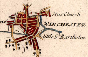
street plan drawn with streets, houses, gardens, town gate, etc; labelled in upright block caps, eg:-
WINCHESTER
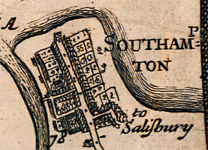
A large town might also get a street plan; and be labelled in upright block caps, eg: (pl.51(5) m.78'0):-
Southamptonwhere you can imagine burgess plots, gardens, behind the houses, as well as town gate, etc.
A town's street plan might be simpler, and might be drawn in two ways; labelled in upright lowercase text, eg: (pl.53(2) m.71'0):-
Stockbridge

is drawn as a prospect, the houses seen in perspective as you approach the town (a descent is assumed). But
Rumsey
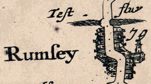
is drawn with the houses laid out flat from the roadside.
Remember that a town, or city, might appear on more than one plate if it is the end of one route and the beginning of another. For example, Andover appears at the end of route 25, and at the start of both routes 26 and 32. And Alton is a junction, appearing on both routes 51 and 81

houses beside the route;labelled in italic lowercase text, eg: (pl.26(1) m.73'0):-
Middle Wallop

has just the drawing of a church, which is all you would likely see from your coach or horse back. eg (pl.51(2) m.51'6):-
ChawtonSome of the churches are labelled '... church' but have been taken to imply the village

A drawing of a house, perhaps labelled, eg:-
Brambridg House
ye Kings house [pl.25(3) m.29'0]
Broadlands [pl.51(6) m.7'8]You might just get the owners name, which makes identification today a little tricky
9. Whatever is posited upon or within the Scroll, is presum'd to bear the same Scale as the Road it self.This can help decide just what feature is being described when working on today's maps
windmills
water mills
paper mills

Windmills, post mill on Portesdown, see pl.30(6) 67'4; and at Catherington, pl.30(6) m.61'1:-
Chalton WindmillWater mills, eg: (pl 32(1) m.69'6):-
a Mill

The mill might be marked by a symbol of a mill wheel, a circle with paddles:-

Paper mills, example pl.51(2) 43'2 on the River Wey near Alton:-


very few inns are marked; they are presumably taken for granted at any village. The turning pl.25(5) 52'2 is labelled:-
to Skippord's Inne
tumuli
henges

The barrows at Popham are drawn as exagerated haystack shapes. And, out of the county, in Wiltshire is (pl.32(2) 83'7):-
Stonehenge


There is a school shown (pl.51(2) 49'4):-
Free Schole

We don't (as yet) know the significance of (pl.51(6) m.10'5):-
Bluck on the heath post

For example (pl.51(6) m.0'0):-
the Ferry

A town gate might be drawn, eg at pl.30(6) 73'0 at Portsmouth

Wells are not generally shown, presumably taken for granted or not needed by a traveller crossing rivers. But two 'sweep wells' have been found on Ogilby's maps, one in Hampshire near Tidpit, now in Dorset, labelled (pl.53(4) m.93'3):-
sweep wellThis device appears to be a shaduf.

A ?famous, ?notorious grave is marked (pl.81(4) m.42'3):-
Caterns grave

On pl.81(4) m.42'2:-
Holy Ghost Chap.


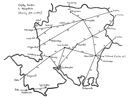
The Road from LONDON to the LANDS ENDfrom London; through Brentford and Staines, Middlesex; Bagshot, Surrey; Blackwater, Hartfordbridge, Hartley Row, Newnham, Basingstoke, Wootton St Lawrence, Whitchurch, to Andover, Hampshire.
HMCMS:FA1991.5
Continuation of the Road from LONDON to the LANDS ENDfrom Andover, through Middle Wallop, to the Wiltshire border, Hampshire; then Lopcombe Corner, Salisbury, Wiltshire; to Shaftesbury, Sherborne, Dorset; and Yeovil to Crookhorn, Somerset.
HMCMS:FA1998.174
The Road from LONDON to PORTSMOUTHfrom London; through Kingston on Thames, Guildford and Godalming, Surrey; then Liphook, Hampshire; across a corner of West Sussex; then Petersfield, Horndean, and Cosham to Portsmouth, Hampshire.
HMCMS:FA1997.8
The Road from LONDON to BARNSTABLEfrom Andover, to the Wiltshire border, Hampshire; then Amesbury, Shrewton, Warminster, Wiltshire; and Bruton to Bridgewater, Somerset.
HMCMS:FA1998.172
The Road from LONDON to CHICHESTERfrom Guildford to Godalming, Surrey; through Midhurst to Chichester, West Sussex;
and from Midhurst, West Sussex; to Petersfield and Winchester, Hampshire.
HMCMS:FA1998.166
The Road from LONDON to SOUTHAMPTONfrom Bagshot, Surrey; across a corner of Hampshire; to Farnham, Surrey; then to Alton, Alresford, Twyford to Southampton, Hampshire;
and from Southampton to Romsey, Hampshire; and on to Salisbury, Wiltshire.
HMCMS:KD1996.7
The Road from LONDON to WEYMOUTHfrom Basingstoke to Sutton Scotney, Stockbridge, and the Wiltshire border by East Dean, Hampshire; through Downton, Wiltshire; to Cranborne, Wimborn, Blandford, and Dorchester to Weymouth, Dorset.
HMCMS:FA1998.1
The Road from OXFORD to CHICHESTERfrom Oxford, Oxfordshire; through Abingdon, East Ilsley and Newbury, Berkshire; then Kingsclere, Basingstoke, Alton and Petersfield, Hampshire; to Chichester, West Sussex.
HMCMS:FA1998.2
The Road from OXFORD to SALISBURYfrom Oxford, Oxfordshire; through Abingdon, Great Shelford, Berkshire; touch Wiltshire; then Hungerford, Berkshire; on to North Tidworth, Wiltshire; across a corner of Hampshire at South Tidworth; through Salisbury, Wiltshire; then Cranborne, Wimborn Minster to Poole, Dorset.
HMCMS:FA1998.173
The Road from LONDON to POOLfrom Alresford to Winchester, Romsey and Ringwood, Hampshire; then to Poole, Dorset;
and from Poole, Dorset; then Christchurch to Lymington, Hampshire;
and from Southampton to Winchester, Hampshire.
HMCMS:FA1997.3


| plate (scroll) mile | Ogilby's name | modern place name | ||
| pl.25 (3) mile 33 | Blackwater flu | Blackwater River | ||
| pl.25 (3) mile 33 | Blackwater | |||
| pl.25 (4) mile 37 | Bramshill House | |||
| pl.25 (4) mile 38 | Hartley Row | Hartley Row | ||
| pl.25 (4) mile 38 | Hartfordbridg | Hartford Bridge | ||
| pl.25 (4) mile 38 | Hart, River | |||
| pl.25 (4) mile 38 | Star Hill | |||
| pl.25 (4) mile 39 | Hartley Wintney | |||
| pl.25 (4) mile 39 | Phoenix Green | |||
| pl.25 (4) mile 40 | Merard Green | Murrell Green | ||
| pl.25 (4) mile 41 | Whitewater, River | |||
| pl.25 (4) mile 41 | Halsum bridg | Woolson Bridge | ||
| pl.25 (4) mile 42 | Hook | Hook | ||
| pl.25 (5) mile 43 | Newnham | Newnham | ||
| pl.25 (5) mile 44 | Lyde River | |||
| pl.25 (5) mile 47 | Loddon, River | |||
| pl.25 (5) mile 48 | Basingstoke | Basingstoke | ||
| pl.25 (5) mile 50 | Wotton | Worting | ||
| pl.25 (5) mile 52 (on l) | Lobb's school | |||
| pl.25 (5) mile 52 (on l) | Skippord's Inn | Skippord's Inn | ||
| pl.25 (5) mile 53 (on l) | Oakley | Oakley | ||
| pl.25 (6) mile 56 | Tetherton | Southington | ||
| pl.25 (6) mile 57 (on r) | Ash | Ashe | ||
| pl.25 (6) mile 57 | Wool Down | |||
| pl.25 (6) mile 57 | Rotten Hill | |||
| pl.25 (6) mile 58 | Laverstoke house | Laverstoke House | ||
| pl.25 (6) mile 58, 59 | Test, River | |||
| pl.25 (6) mile 59 | Whitchurch | Whitchurch | ||
| pl.25 (6) mile 60 (on l) | Charlecot | Tufton | ||
| pl.25 (6) mile 60 | Park | Hurstbourne Park | ||
| pl.25 (6) mile 61 | Bourne Rivulet | |||
| pl.25 (6) mile 61 | Down Hursboorn | Hurstbourne Priors | ||
| pl.25 (6) mile 62 | Faulkner's Cross | |||
| pl.25 (6) mile 63 | Andover Down | |||
| pl.25 (6) mile 64 | Harewood Forest | |||
| pl.25 (6) mile 66 | Andover | Andover |
pl.26 in The Road from London to the Lands End
| plate (scroll) mile | Ogilby's name | modern place name | ||
| pl.26 (1) mile 66 | Andover | Andover | ||
| pl.26 (1) mile 68 (on l) | Platford | Upper Clatford | ||
| pl.26 (1) mile 68 | Pillhill Brook | |||
| pl.26 (1) mile 69 (on r) | Abbots Ann | Abbotts Ann | ||
| pl.26 (1) mile 69 | St John's Cross | |||
| pl.26 (1) mile 70 | Great Wood | |||
| pl.26 (1) mile 70 | Abbotts Ann Down | |||
| pl.26 (1) mile 73 | Middle Wallop | Middle Wallop | ||
| pl.26 (1) mile 73 | Wallop Brook | |||
| pl.26 (1) mile 74 | Suddern Hill | |||
| pl.26 (1) mile 75 | Isle of Wight Hill | |||
| pl.26 (1) mile 75 | Lobb's school |
pl.30 in The Road from London to Portsmouth
| plate (scroll) mile | Ogilby's name | modern place name | ||
| pl.30 (4) mile 46 (on r) | Bramshot | Bramshott | ||
| pl.30 (4) mile 46 (on r) | Forrest Woolmer | Woolmer Forest | ||
| pl.30 (4) mile 46 | Wey, River | |||
| pl.30 (4) mile 47 | Lippock | Liphook | ||
| pl.30 (5) mile 49 (on r) | Forrest Woolmer | Woolmer Forest | ||
| pl.30 (5) mile 53 | Arun Fluvius | Rother, River | ||
| pl.30 (5) mile 53 | Sheet bridg | Sheet Bridge | ||
| pl.30 (5) mile 54 (on r) | Steep | Steep | ||
| pl.30 (5) mile 55 (on l) | Heath house | Heath House | ||
| pl.30 (5) mile 55 | Petersfield | Petersfield | ||
| pl.30 (5) mile 55 | Criddell Stream | |||
| pl.30 (5) mile 56 (on r) | Mapledurham House | |||
| pl.30 (5) mile 57 (on l) | Buriton | Buriton | ||
| pl.30 (5) mile 57 | Butser Hill | |||
| pl.30 (5) mile 59 | Gravel Hill | |||
| pl.30 (5) mile 60 (on l) | Chalton | Chalton | ||
| pl.30 (6) mile 61 (on r) | Katerington | Catherington | ||
| pl.30 (6) mile 61 (on l) | Chalton Windmill | Windmill Hill | ||
| pl.30 (6) mile 62 | Harnden | Horndean | ||
| pl.30 (6) mile 64 | Bear Forest | East Bere Forest (?) | ||
| pl.30 (6) mile 66 (on r) | hall, ye | Southwick House | ||
| pl.30 (6) mile 66 | Purbeck heath | Purbrook Heath | ||
| pl.30 (6) mile 67 (on r) | South Week | Southwick | ||
| pl.30 (6) mile 67 (on r) | Windmill Hill | |||
| pl.30 (6) mile 67 | Portsey down | Portsdown | ||
| pl.30 (6) mile 68 | Cosham | Cosham | ||
| pl.30 (6) mile 69 | Hilsey | Hilsea | ||
| pl.30 (6) mile 69 | Cosham Fort | |||
| pl.30 (6) mile 69 | Hilsey green | Hilsea Green | ||
| pl.30 (6) mile 69 | Portsey bridg | Ports Bridge | ||
| pl.30 (6) mile 69 | Sea | Ports Creek | ||
| pl.30 (6) mile 70 | Isle of Portsea, ye | Portsea Island | ||
| pl.30 (6) mile 71 | Kingston | Kingston | ||
| pl.30 (6) mile 72 (on r) | Emery Mill | |||
| pl.30 (6) mile 72 (on l) | Portsea | |||
| pl.30 (6) mile 73 | Portsmouth | Portsmouth |
pl.32 The Road from London to Barnstable
| plate (scroll) mile | Ogilby's name | modern place name | ||
| pl.32 (1) mile 66 | Andover | Andover | ||
| pl.32 (1) mile 66 | Lobb's school | |||
| pl.32 (1) mile 66 | Anton, River | |||
| pl.32 (1) mile 66 | Bricksbury Hill | |||
| pl.32 (1) mile 69 (on l) | Abbots Ann Church | Abbotts Ann | ||
| pl.32 (1) mile 69 | Monkson | Monxton | ||
| pl.32 (1) mile 69 | Mill Throop | |||
| pl.32 (1) mile 69 | Pillhill Brook | |||
| pl.32 (1) mile 71 (on r) | Apwort Church | Amport | ||
| pl.32 (1) mile 72 (on l) | Greatley Church | Grateley | ||
| pl.32 (1) mile 73 (on r) | Quarley Hill |
pl.39 (The Road from London to Chichester)
A branch from Midhurst to Winchester
| plate (scroll) mile | Ogilby's name | modern place name | ||
| pl.39 (4) mile 7 | Maidenoke | Maiden Oak | ||
| pl.39 (5) mile 8 | Durford | Durford | ||
| pl.39 (5) mile 9 | Rother, River | |||
| pl.39 (5) mile 9 | Sheetbridg | Sheet Bridge | ||
| pl.39 (5) mile 10 | Petersfield | Petersfield | ||
| pl.39 (5) mile 13 | Langridg | Langrish | ||
| pl.39 (5) mile 14 | Bordeane | Bordean | ||
| pl.39 (5) mile 16 | Prevet | Privett | ||
| pl.39 (5) mile 19 (on r) | Woodcote Manor House | |||
| pl.39 (6) mile 20 | Bramdean | Bramdean | ||
| pl.39 (6) mile 21 (on l) | Henton amner | Hinton Ampner | ||
| pl.39 (6) mile 22 | Cheriton | Cheriton | ||
| pl.39 (6) mile 23 | Hill Houses | |||
| pl.39 (6) mile 27 (on l) | Chillcom | Chilcomb | ||
| pl.39 (6) mile 27 | Magdalen | Hospital of St Mary Magdalen | ||
| pl.39 (6) mile 28 (on r) | Hue Church | St Bartholomew's Church | ||
| pl.39 (6) mile 28 (on r) | little St Bartholomew | St Batholomew's Church | ||
| pl.39 (6) mile 28 | Winchester | Winchester | ||
| pl.39 (6) mile 28 | City Bridge | |||
| pl.39 (6) mile 28 | Black Bridge | |||
| pl.39 (6) mile 28 | Itchen, River | |||
| pl.39 (6) mile 29 | Hyde Street Bridge |
pl.51 The Road from London to Southampton
| plate (scroll) mile | Ogilby's name | modern place name | ||
| pl.51 (1) mile 33 | Blackwater River | |||
| pl.51 (1) mile 33 | Bricksbury Hill | |||
| pl.51 (1) mile 34 (on l) | Ld Ansleys house | House in the Wood, The | ||
| pl.51 (1) mile 34 (on l) | Farnborough | |||
| pl.51 (1) mile 34 (on l) | Windmill Hill | |||
| pl.51 (1) mile 34 | Farnborough Comon | Farnborough Park | ||
| pl.51 (1) mile 36 (l and r) | Farnham Common | Farnham Heath | ||
| pl.51 (1) mile 36 | Farnham Com~on or Heath | Laffans Plain | ||
| pl.51 (2) mile 43 (on l) | Turk's Mill | |||
| pl.51 (2) mile 44 (on l) | Wey flvu. | Wey, River | ||
| pl.51 (2) mile 45 (on r) | Bentley | Bentley | ||
| pl.51 (2) mile 46 (on r) | Fraile Church | Upper Froyle | ||
| pl.51 (2) mile 47 (on r) | Sr. Den. Gauden | Lord Mayor Treloar College | ||
| pl.51 (2) mile 48 (on l) | Binsted | Binsted | ||
| pl.51 (2) mile 48 | Holybourne | |||
| pl.51 (2) mile 48 | Cuckoo's Corner | |||
| pl.51 (2) mile 48 | Holybourne Stream | |||
| pl.51 (2) mile 49 (on l) | Windmill Hill | |||
| pl.51 (2) mile 49 | Anstey | |||
| pl.51 (2) mile 49 | Free Schole | Eggar's School | ||
| pl.51 (2) mile 50 | Alton | Alton | ||
| pl.51 (2) mile 50 | Wey fluv | Wey, River | ||
| pl.51 (2) mile 51 (on l) | Chawton | Chawton | ||
| pl.51 (3) mile 52 | Chawton Park Wood | |||
| pl.51 (3) mile 58 | Bighton | Bighton | ||
| pl.51 (3) mile 58 | Alre, River | |||
| pl.51 (3) mile 59 (on l) | Old Alresford Pond | |||
| pl.51 (3) mile 59 | Alre, River | |||
| pl.51 (3) mile 59 | Aleresford | New Alresford | ||
| pl.51 (3) mile 59 | Soke Bridge | |||
| pl.51 (3) mile 60 (on r) | Ould Alresford | Old Alresford | ||
| pl.51 (3) mile 61 (on r) | Ovington | |||
| pl.51 (3) mile 61 | Sewers Water | Itchen, River | ||
| pl.51 (3) mile 61 | Seward's Bridge | |||
| pl.51 (4) mile 64 (on l) | Longwood Downe | Longwood Warren | ||
| pl.51 (4) mile 66 | Morsted | Morestead | ||
| pl.51 (4) mile 67 (on l) | Morsted Com~on | Morestead Down | ||
| pl.51 (4) mile 68 | Twiford | Twyford | ||
| pl.51 (4) mile 69 (on r) | Brambridg House | Brambridge House | ||
| pl.51 (4) mile 70 | Brambridg water | Itchen, River | ||
| pl.51 (4) mile 70 | Itchin fluv. | Itchen, River | ||
| pl.51 (4) mile 70 | High bridge | High Bridge | ||
| pl.51 (5) mile 71 | Albrook house | Allbrook House | ||
| pl.51 (5) mile 73 (on l) | Itchin fluv | Itchen, River | ||
| pl.51 (5) mile 74 (on r) | North Stoneham | North Stoneham | ||
| pl.51 (5) mile 74 | Swaland | Swaythling | ||
| pl.51 (5) mile 75 (on l) | South Stoneham | South Stoneham | ||
| pl.51 (5) mile 75 | Borstwood | Portswood | ||
| pl.51 (5) mile 76 (on l) | St. Dennis | St Denys | ||
| pl.51 (5) mile 77 (on l) | Bittern | Bitterne | ||
| pl.51 (5) mile 78 (on l) | Ferry, the | Itchen Down Farm | ||
| pl.51 (5) mile 78 | Southampton | Southampton | ||
| pl.51 (5) mile 78 | Water Gate | |||
pl.51 A branch from Southampton to Salisbury
| pl.51 (6) mile 0 | Southampton | Southampton | ||
| pl.51 (6) mile 1 (on r) | Itchin fluv | Itchen, River | ||
| pl.51 (6) mile 2 | Shirley Hundred | |||
| pl.51 (6) mile 2 | Tanner's Brook | |||
| pl.51 (6) mile 3 | Halfeway Oake | Halfway Oak | ||
| pl.51 (6) mile 5 | Upton | Upton | ||
| pl.51 (6) mile 6 | Austrey Wood | Nightingale Wood | ||
| pl.51 (6) mile 7 (on l) | Broadlands | Broadlands | ||
| pl.51 (6) mile 8 | Rumsey | Romsey | ||
| pl.51 (6) mile 8 | Test, River | Test, River | ||
| pl.51 (6) mile 9 | Middle Bridge | |||
| pl.51 (6) mile 9 | Pauncefoot Hill | |||
| pl.51 (6) mile 10 | Bluck on ye heath post | Posbrook | ||
| pl.51 (6) mile 11 | Bluck on the Heath | Bloxworth | ||
| pl.51 (7) mile 14 | Sherfield English |
pl.53 The Road from London to Weymouth
| plate (scroll) mile | Ogilby's name | modern place name | ||
| pl.53 (1) mile 50 | Basingstoke | Basingstoke | ||
| pl.53 (1) mile 54 | Kempshot Copse | |||
| pl.53 (1) mile 54 | Peabody Road site | |||
| pl.53 (1) mile 55 (on r) | Altham | North Waltham | ||
| pl.53 (1) mile 56 | Bramley Wood | |||
| pl.53 (1) mile 57 | Mirabyll | |||
| pl.53 (1) mile 57 | Waltham Trinleys | |||
| pl.53 (1) mile 58 (on r) | Popham Beacons | |||
| pl.53 (1) mile 58 | Black Wood | |||
| pl.53 (1) mile 62 | Cranborn | Cranbourne | ||
| pl.53 (2) mile 63 (on l) | Micheldevor | Micheldever | ||
| pl.53 (2) mile 63 | Dever, River | |||
| pl.53 (2) mile 63 | Sutton | Sutton Scotney | ||
| pl.53 (2) mile 71 | Stockbridge | Stockbridge | ||
| pl.53 (2) mile 71 | Test fluv | Test, River | ||
| pl.53 (2) mile 72 | Meon Hill | |||
| pl.53 (2) mile 74 | Broughton | Broughton | ||
| pl.53 (3) mile 77 | West Tytherley | West Tytherley | ||
| pl.53 (3) mile 79 | East Dean | West Dean Station |
pl.81 The Road from Oxford to Chichester
| plate (scroll) mile | Ogilby's name | modern place name | ||
| pl.81 (3) mile 30 | Auborn fluv | Enborne, River | ||
| pl.81 (3) mile 30 | Great Knight. bridg | Knight's Bridge | ||
| pl.81 (3) mile 30 | Litle Knight bridge | Knight's Bridge | ||
| pl.81 (3) mile 31 (on r) | Kingsclere Heath | Kingsclere Free School | ||
| pl.81 (3) mile 31 (on r) | Benham Court | Bench, The | ||
| pl.81 (3) mile 32 (on r) | Stottens | Strattons | ||
| pl.81 (3) mile 33 | Kingscler | Kingsclere | ||
| pl.81 (3) mile 35 (on r) | Willingsby Lodge (?) | Willingsby Lodge | ||
| pl.81 (3) mile 35 | Cottington's Hill | |||
| pl.81 (3) mile 35 | Pettum hill | Plantation Hill | ||
| pl.81 (3) mile 36 | Hollowshot Lane | |||
| pl.81 (4) mile 36 (on l) | Wolverton | Wolverton | ||
| pl.81 (4) mile 37 | Dorrel Wood | |||
| pl.81 (4) mile 38 (on r) | Tangere | Tangier | ||
| pl.81 (4) mile 38 (on r) | Wooton | Wootton St Lawrence | ||
| pl.81 (4) mile 39 | Woodcorner | Lobb's school | ||
| pl.81 (4) mile 39 | Woodcorner | Wood Farm | ||
| pl.81 (4) mile 40 (on r) | Rooks down | Rooks Down | ||
| pl.81 (4) mile 40 (on l) | Parkprivet Warren | Privet and Morgaston Park | ||
| pl.81 (4) mile 41 (on l) | Caterns grave | Castleton | ||
| pl.81 (4) mile 42 | Basingstoke | Basingstoke | ||
| pl.81 (4) mile 42 | Holy Ghost Chap. | Holy Ghost Chapel | ||
| pl.81 (4) mile 44 | Harwood hall | Hackwood House | ||
| pl.81 (5) mile 45 | Wensted | Winslade | ||
| pl.81 (5) mile 47 | Harcote | Herriard | ||
| pl.81 (5) mile 48 (on l) | Weston | Weston Patrick | ||
| pl.81 (5) mile 48 | Nash's Green | |||
| pl.81 (5) mile 50 (on r) | Weston Comon | Weston Common | ||
| pl.81 (5) mile 50 | Golden Pot | |||
| pl.81 (5) mile 52 | Endleys | Enborne, River | ||
| pl.81 (5) mile 53 | Allton | Alton | ||
| pl.81 (5) mile 54 | Chawton | Chawton | ||
| pl.81 (5) mile 55 (on l) | Sr. Richd Knights | Chawton House | ||
| pl.81 (6) mile 56 (on l) | Upper Farringdon | |||
| pl.81 (6) mile 56 | Farringdon street | Lower Farringdon | ||
| pl.81 (6) mile 57 (on r) | Newton Wood | Newton Common | ||
| pl.81 (6) mile 57 | Marylane Copse | |||
| pl.81 (6) mile 57 | Newton Wood | Kitcombe Wood | ||
| pl.81 (6) mile 58 (on l) | Colmere | Colemore | ||
| pl.81 (6) mile 58 (on r) | Rutherfield Park | Rotherfield Park | ||
| pl.81 (6) mile 58 | E. Tysted ch | East Tisted | ||
| pl.81 (6) mile 59 | Stonybrow Wood | |||
| pl.81 (6) mile 61 | Hermitage Copse | |||
| pl.81 (6) mile 63 | Week Green | |||
| pl.81 (6) mile 64 (on l) | Dunhill | Dun Hill | ||
| pl.81 (6) mile 65 (on l) | Steep | Steep | ||
| pl.81 (6) mile 66 (on l) | Barren Heath | Heath Common | ||
| pl.81 (6) mile 66 | Petersfield | Petersfield | ||
| pl.81 (6) mile 67 (on r) | Heath house | Heath House | ||
| pl.81 (6) mile 67 | Stanbridge | Stanbridge | ||
| pl.81 (6) mile 67 | Criddell Stream |
pl.83 The Road from Oxford to Salisbury
| plate (scroll) mile | Ogilby's name | modern place name | ||
| pl.83 (4) mile 44 | South Tudworth | South Tidworth | ||
| pl.83 (4) mile 46 (on l) | Shipton | Shipton Bellinger |
pl.97 The Road from London to Pool
| plate (scroll) mile | Ogilby's name | modern place name | ||
| pl.97 (1) mile 59 | Alre, River | |||
| pl.97 (1) mile 59 | Soke Bridge | |||
| pl.97 (1) mile 60 (on r) | old Alresford | Old Alresford | ||
| pl.97 (1) mile 60 | Alresford | New Alresford | ||
| pl.97 (1) mile 61 | Itchen, River | |||
| pl.97 (1) mile 61 | Sewers bridge | Seward's Bridge | ||
| pl.97 (1) mile 65 | Magdalen house | Hospital of St Mary Magdalen | ||
| pl.97 (1) mile 66 | St Giles Hill | |||
| pl.97 (1) mile 67 | Winchester | Winchester | ||
| pl.97 (1) mile 67 | Black Bridge | |||
| pl.97 (1) mile 67 | Hyde Street Bridge | |||
| pl.97 (1) mile 67 | City Bridge | |||
| pl.97 (1) mile 67 | Itchen, River | |||
| pl.97 (1) mile 69 | Pit | Pitt | ||
| pl.97 (1) mile 71 | Standon | |||
| pl.97 (1) mile 72 | Hursly | Hursley | ||
| pl.97 (2) mile 73 (on r) | Hursly lodge | Hursley Lodge | ||
| pl.97 (2) mile 75 | Enfeild | Ampfield | ||
| pl.97 (2) mile 79 | Rumsey | Romsey | ||
| pl.97 (2) mile 79 | Middle Bridge | |||
| pl.97 (2) mile 79 | Pauncefoot Hill | |||
| pl.97 (2) mile 79 | Test fluv | Test, River | ||
| pl.97 (2) mile 82 | Cadnam River | |||
| pl.97 (2) mile 82 | Blackwater, River | |||
| pl.97 (2) mile 82 | Ouxbridge | Bricksbury Hill | ||
| pl.97 (2) mile 82 | Ower | |||
| pl.97 (2) mile 82 | Wigley | |||
| pl.97 (2) mile 82 | Ower Bridge | |||
| pl.97 (2) mile 85 | Ragged Row | Cadnam | ||
| pl.97 (2) mile 85 | New Forrest | New Forest | ||
| pl.97 (2) mile 86 | Castle Malwood | Malwood Castle | ||
| pl.97 (3) mile 87 (on l) | Minsted | Minstead | ||
| pl.97 (3) mile 89 | Mogshade Hill | |||
| pl.97 (3) mile 93 (on l) | Picket Post | |||
| pl.97 (3) mile 94 | New Forrest | New Forest | ||
| pl.97 (3) mile 95 | Bonner | Poulner | ||
| pl.97 (3) mile 96 | Ringwood | Ringwood | ||
| pl.97 (3) mile 97 | Avon, River | |||
| pl.97 (3) mile 97 | Stoning Bridge | |||
| pl.97 (4) mile 100 | Avon flu | Moors River | ||
| pl.97 (4) mile 100 | Palmers bridge | Palmers Ford | ||
| pl.97 (4) mile 101 | Palmers bridge | St Leonards Bridge | ||
| pl.97 (4) mile 101 | Trickett's Cross | |||
| pl.97 (4) mile 103 (on r) | Preston | Hampreston | ||
| pl.97 (4) mile 104 | Long Ham | Longham | ||
pl.97 A branch from Poole to Lymington
| pl.97 (5) mile 5 | Bourne, The | |||
| pl.97 (6) mile 8 | Ifford | Iford | ||
| pl.97 (6) mile 9 | Iford Bridge | |||
| pl.97 (6) mile 9 | Stour, River | |||
| pl.97 (6) mile 10 | Christ Church | Christchurch | ||
| pl.97 (6) mile 10 | Avon flu | Avon, River | ||
| pl.97 (6) mile 10 | Redford bridge | Town Bridge | ||
| pl.97 (6) mile 11 | Purewell | |||
| pl.97 (6) mile 14 | Somerford bridge | Chewton Bridge | ||
| pl.97 (6) mile 14 | Walkford Brook | |||
| pl.97 (6) mile 15 | Milton | Old Milton | ||
| pl.97 (6) mile 17 | Ashley Bridge | |||
| pl.97 (6) mile 17 | Danes Stream | |||
| pl.97 (6) mile 17 | Hooper's Hill | |||
| pl.97 (6) mile 18 | Lea Green | |||
| pl.97 (6) mile 20 | Evilton | Everton | ||
| pl.97 (6) mile 20 | Efford | Efford | ||
| pl.97 (6) mile 20 | Avon Water | |||
| pl.97 (6) mile 20 | Efford Bridge | |||
| pl.97 (6) mile 21 | Waterloo Bridge | |||
| pl.97 (6) mile 22 | Limington | Lymington | ||
pl.97 A road from Southampton to Winchester
| pl.97 (7) mile 0 | Southampton | Southampton | ||
| pl.97 (7) mile 1 (on r) | Itchin flu | Itchen, River | ||
| pl.97 (7) mile 7 | Fryern Hill | |||
| pl.97 (7) mile 8 (on r) | Church Place | |||
| pl.97 (7) mile 8 | Otterbourne | |||
| pl.97 (7) mile 8 | Otterbourne Stream (?) | |||
| pl.97 (7) mile 9 (on r) | Twyford | |||
| pl.97 (7) mile 9 | Otterborn | Compton | ||
| pl.97 (7) mile 10 (on r) | Itchin fluv. | Itchen, River | ||
| pl.97 (7) mile 11 | St Crosses | St Cross | ||
| pl.97 (7) mile 12 | Winchester | Winchester | ||
| pl.97 (7) mile 12 | Hyde Street Bridge | |||
| pl.97 (7) mile 12 | Black Bridge | |||
| pl.97 (7) mile 12 | City Bridge |
For more detailed analysis of Ogilby's routes see :-


Ogilby, John: 1971 (facsimile) & 1675: Britannia: Osprey Publications (Reading, Berkshire)
scroll cartouche
oval cartouche
map maker
engraver

A New Map of the Kingdom of ENGLAND & Dominon of WALES Whereon are projected all ye Principal Roads Actually Measurd & Delineated By JOHN OGILBY Esqr. his Maties. Cosmographerat the bottom of the cartouche is a crown supported by a crowned lion and a unicorn.
Printed lower left is:-
James Moxon S.

DIEU ET MON DROIT
HO[ ]OIT. Q[ ]AL. Y. [ ]ENSE.Letters in the barter motto obscured by the paws of the lion and unicorn supporters. The blazon is roughly:-
quarterly 1 na d 4 quarterly i and iv azure three fleur de lys or ii and iii gules three lions passant regardant in pale or 2 or a lion rampant or in a tressure florey or 3 azure a harp or stringed argentThe tressure should be florey counter florey. These are the arms of the Stuart kings; the quartered arms of England and France quartered with the arms of Scotland and Ireland. The map is not coloured and does not have reliable colour shadings or any colour letters.
labelled borders
up is N

NORTH
EAST
SOUTH
WESTThe map is printed with North at the top of the sheet.
scale
old english mile
A Scale of MilesEach is chequered in miles, marked at 5 miles and labelled at 10 mile intervals, and has 50 miles in the scale. They are labelled:-
Vulgar Computed Miles 23 in an Inch

Direct Horizontal Miles 26 in an Inch
Dimensurated Road Miles 29 in an I.The direct horizontal miles would seem to be the map's 'proper' scale, its 50 miles = 48.7 mm gives a scale 1 to 1652304 ie 26.1 miles to 1 inch. John Ogilby declares, elsewhere, that his mile is 1760 yards, a statute mile. The map scale is about:-
1 to 1700000
26 miles to 1 inchJohn Ogilby's vulgar miles are larger, 1.12 statute miles according to his scale line. This is perhaps his estimate of an Old English Mile?
The measured road miles provides an estimate of the twistiness of a road? A mile by road achieving only 0.9 miles directly.
The positions of places in Hampshire on the map can be compared to their known places, using DISTTAB.exe software, which gives a different estimate of the map scale, 1 to 1755918, 27 miles to 1 inch. It is unfair to measure such a small part of the map; the confidence in these measurements is small (+-18%)

Printed in the map borders are scales of latitude and longitude for a rectangular projection; marked and labelled at degrees. Notice that the longitude scale increases from west to east; the longitude of Greenwich (not marked on the map) is about 27d E suggesting a prime meridian about 27d W from Greenwich, this is probably the Azores which are centred about 28d W and are the prime meridian on Christopher Saxton's map.
The map includes all of England and Wales, with parts of Scotland, Ireland, France, Belgium and the Netherlands.
sea plain
ships
sea monsters

The sea area is plain, decorated with some sea monsters and a few ships. Some of the main sea areas are labelled, eg:-
OCEANUS BRITANNICUS / THE CHANNEL
coast shaded

The coast line is shaded for emphasis. The Hampshire coast is crudely drawn, inaccurate in detail though the main features can be seen. The Meon estuary is too large; the Hamble's too small; Hayling and Thorney Islands are missing though their spaces are there; etc.

Rivers are drawn by wiggly line tapering inland; drawn not too accurately. In Hampshire it is possible to recognise the tour, Avon, Test, Itchen, Hamble and Meon. Only the:-
Thames flu.at its estuary, is labelled.

County boundaries are dotted lines; the county shapes are crude. County areas are labelled, eg:-
HA MP SH.
LONDON
WINCHESTER

Alton [italic]
Andover [italic]
Southamton [upright]Hampshire towns are listed below.

Roads are drawn by a double line, solid or dotted for direct or cross roads. Printed upper right is:-
A Catalog of the Roadsunder four headings. The roads which cross Hampshire are:-
Exprest in ye Mapp by a Double Black Line
Independents
...
London to ye Lands end
...
London to Portsmouth
...
Dependents
London to Barnstable
...
London to Southampton
...
London to Weymouth
...
Exprest by a Double prickt line
Principal Cross Roads
...
Oxford to Chichester
...
Oxford to Salisbury
...
Accidentals
...
London to Pool
...The roads are not labelled on the map by name, nor do they have a plate number, so the map does not function as an index map.
Alton
Andover
Basingstoke
Christehurch
Kingsclare
Lemington
Alresford
Petersfield
Portesmouth
Ringwood
Rumsey
Southamton
[Stockbridge marked but not labelled]
Whitchurch
Winchester


FEATURES
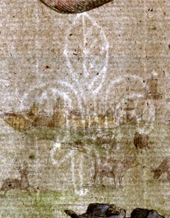
This could be a fleur de lys or the Prince of Wales Feathers? Its height is about 4.5cm.

Printed at the bottom are the names of artist and engraver:-
Fran: Barlow inv: W. Hollar fecit [1675]
scroll cartouche
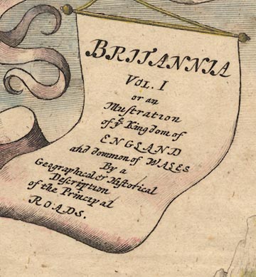
Three winged cherubs above hold banners hanging from a bow, a fourth banner hanging from the bow is a title cartouche:-
BRITANNIA VOL. I or an Illustration of ye Kingdom of ENGLAND and dominion of WALES By a Geographical & Historical Description of the Principal ROADS.The ampersand clearly shows its source in a letter e with a cross stroke on the rising tail for a t, making the Latin 'et' ie 'and'.
road map
street map
roads
distances from London
orientation
compass rose
The 1st scroll is a strip road map titled:-
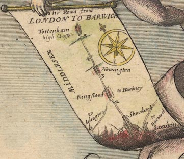
The Road from LONDON TO BARWICKLondon is at the bottom with a road northeast to Harwic[ ]. The road north goes through Shorditch, Kingsland with turnings to Islington and Hackney, Newington, to Tottenham with its high Crosse, just over 5 miles into Middlesex. The miles from London are marked.
A compass rose on the scroll has star points for cardinal and half cardinal directions; North marked by a fleur de lys. Up the scroll is roughly north.
The 2nd scroll has a street map of:-
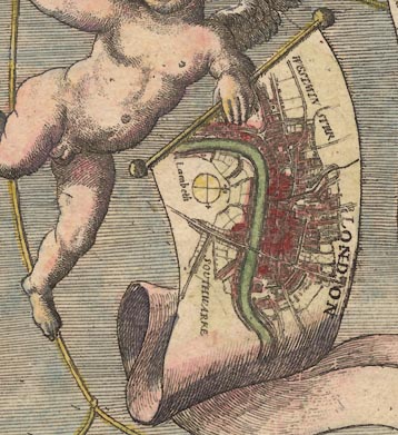
LONDONwith Westminster, Lambeth and Southwark labelled. This is orientated with North roughly at the top, the scroll held sideways. There is a simple compass rose, lines for the cardinal directions; fleur de lys for North, a cross for East.
The 3rd scroll has a road map of the area of:-
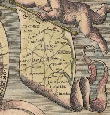
YORKSHIREand surrounding counties, parts of Westmorland, Lanc[ ]shi, Lincolnshire, etc. The map is a road map of the area, but not a strip map. This map is orientated with North at the top.
There is a scale line of:-
English milesThis is [surely] not meant as a serious scale to the map. Its 40 miles = 15.3mm gives a scale about 1 to 4200000, 66 miles to 1 inch. Measuring the positions of York, Lincoln and Durham does not reveal anything interesting, it wasn't likely to!
coat of arms

On the left of the scene is a city, a battlemented and decorated town gate fortified with cannons, lots of them. Above there is a flag with the royal arms. This royal standard is blowing left of the flagpole, for good design reasons no doubt, but the arms are shown the right way round. As the flag is viewed from the back the arms should be backtofront, which would be unacceptable.
The blazon is, forgive inadequacies in my use of the jargon:-
quarterly 1 and 4 quarterly i and iv azure three fleur de lys or for France, ii and iii or three lions passant guardant gules for England, 2 or a lion rampant gules within a double tressure flory counterflory gules for Scotland, 3 azure a harp argent for Ireland.The royal banner of the Stuart kings. The particular colours used are those of a modern colourist. There are no colour letters in the engraving, nor shadings to indicate colours.

Just below the balustrade of the gate tower is a coat of arms in an oval scroll cartouche, carved in the stonework. This repeats the royal arms. There is a rose for England to its left, a thistle for Scotland to its right. Lower, in the arch of the gateway is another oval scroll cartouche with the coat of arms of the City of London; in less formal language:-
White with the red cross of St George and the red sword of St Paul in the canton.
road map

Lower left a group of men appear to be discussing a route. One of them holds a strip road map labelled:-
The Continacion of ye Roa[ ]On which you can just see a bit of road and a compass rose.

One of two men leaving the city on horseback carries a strip road map; nothing legible except a compass rose indicating a road to the south.
instrument
globe
cross staff
compass
chain
simple theodolite
quadrant
protractor
set square
ruler
dividers
waywiser
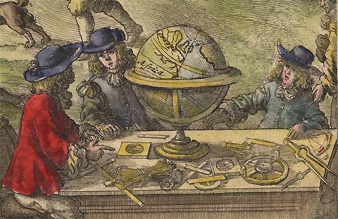
Lower right in the foreground are four surveyors or cartographers round a table littered with instruments: cross staff - a Jacob's staff, magnetic compass, surveyor's chain - perhaps Gunther's chain, simple theodolite - compass to align the scale, alidade with sights to take readings, and a quadrant; and drawing instruments - protractor, set square, ruler, and dividers. The globe is worth a close look. There are Africa and Europe, with the British Isles to the east, Ireland to the east of England. The engraver has made the elementary but understandable mistake of engraving the right way round on his plate; the picture prints backtofront.
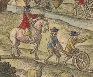
Less obviously, in the mid ground on the right, there is a man trundling a waywiser, measuring a road. An assistant helps, and a supervisor follows on horseback. Is this a good representation of a John Ogilby field party at work?

A man is fishing in a river using a conical net suspended from a pole.
sheep
cattle

In a field in the middle of the scene a huntsman on horse and foot men, one blowing a horn, and dogs, chase a stag. Cattle in the field and sheep and shepherd are all unperturbed.


The scene extends to a coastal town, town walls and town gate, towers, buildings, etc. In the harbour are ships, with other ships offshore. One of these is a three masted ship; sprit with yard for a square sprit sail, foremast with two square sails set, main mast with yards for three sails, only the top sail set, mizzen mast with a yard for a lateen sail. A smaller boat with a single square sail is nearby.

A heavy four wheeled coach pulled by two horses is on the road from the city, climbing a hill into the distance.
windmills

Atop the hill by road from the city is a post mill.

On a prominence overlooking the sea is a beacon. This appears to be a post, supported by braces, with a suspended fire basket or cresset.


Published in 'Britannia, Volume the First: or, an Illustration of the Kingdom of England and Dominion of Wales: By a Geographical and Historical Description of the Principal Roads thereof. Actually Admeasured and Delineated in a Century of Whole-sheet Copper Sculps. Accomodated With the Ichnography of the several Cities and Capital Towns; and Compleated By an Accurate Account of the more Remarkable Passages of Antiquity, Together with a Novel Discourse on the Present State. By John Ogilby Esq; His Majesty's Cosmographer, and Master of His Majesty's Revels in the Kingdom of Ireland. London, Printed by the Author at his House in White-Fryers. MDCLXXV.'
Published in a ?second edition in 1675, with plate numbers.
Published again in 1675 in 'Itinerarium Angliae: or, A Book of Roads, Wherein are Contain'd The Principal Road Ways of His Majesty's Kingdom of England and Dominion of Wales: Actuall Admeasured and Delineated in a Century of Whole-sheet Copper Sculps, and Illustrated with the Ichnography of the several Cities and Capital Towns. By John Ogilby Esq ... London, Printed by the Author at his House in White-Fryers. M.D.C.LXXV.'
Published in a reprint 1698, 'Britannia: or, the Kingdom of England and Dominion of Wales, actually survey'd with a Geographical and Historical Description of the Principal Roads ... By John Ogilby, Esq., Cosmographer to Charles the Second. London: Printed for Abel Swall at the Unicorn in Pater-noster-row, and Robert Morden, at the Atlas in Cornhill, MDCXCVIII.'
Ogilby's maps were issued in a variety of editions, bound with or without itineraries. The map plates are very little changed from first to last, alterations being mostly tidying up and a little error correction. In all cases the first edition plates had no plate numbers; intermediate editions have corrections and no plate numbers; the late editions have plate numbers. The changes spotted for the 'Hampshire' plates are listed below (with thanks to David Webb).
Ric Shortgraye Surveyor.is deleted in the later editions.
Postin later editions the label of each becomes:-
a Post
Ric Shortgraye Surveyor.is deleted in the later editions.
In later editions a post mill is added on scroll 1 about mile 1 to the right of the road in St George's Fields.
The county label on scroll 5 mile 51 on the early edition is:-
HAMPSHIREeven though it is just past a county boundary declaring 'enter Sussex'. On later editions this rare mistake is corrected; the label is erased and:-
SUSSEXis engraved slightly nearer the edge of ths scroll.
to L. Amson later editions this is improved:-
to L. AmsburyOn scroll 2 at mile 86'4 on later editions there is added:-
Shrawton Virgo vulgo Shrutonwhich was not on the early edition.
And on scroll 2 mile 87'4 the words:-
Madenton alsare added to later editions.
Scroll 3 at mile 97'0 on later editions are added, squeezed in messily:-
als Norton Bova[ t]At scroll 5 mile 115'2 the label:-
a Parkis added on later editions on the left of the road.
and at mile 116'0 is added:-
over Brut flvu
Coking hill
to ChilgroveThe same improvement is made on scroll 5 for:-
Durfordand on scroll 6 for:-
to Westmeon
BramdeanAt scroll 4 mile 8'0 the early edition has the label 'enter Hampshire' but no county boundary. The dotted line is added in later editions.
On scroll 5 at mile 4 the early editions have label:-
Langrigwhich is corrected to:-
Langridgby adding a 'd' above in later editions.
At the end of scroll 6 the directions:-
to Southampton~
to Rumseyare added in later editions.
Brook
Rillon later editions these become
a Brook
a RillAt scroll 1 mile 31'6 the label:-
Heath [of] Furze
is added to later editions.At mile 32'7 the 'a' of:-
a Brookis an addition on later editions. And at mile 39'4 the 'a' in two instances of:-
a Rillare added in later editions.
At scroll 5 miles 76-77 in the three instances of:-
a Rillthe 'a' is added in later editions.
On scroll 6 at miles 2'6 there is:-
a Small River
a Millin both cases the 'a' is added in later editions. And at miles 4'6, 5'4 and 12'6 the 'a' is added to:-
a Rillon later editions.
The same addition of the article 'a' is done on later editions on scroll 7 at mile 14'1
a Rivuletand between mile 24 and 25 for:-
a Brooke
a Brooke
a Small River
a Brooke
a Small RiverOn scroll 7 at mile 18'4 the direction:-
a different Wayis added to later editions. And at mile 24'7 the label:-
Bourn fluv.is added to later editions.
to Walterstowhas had the 'to' added for later editions.
(Study the mile numbers on this scroll to see how the confusing similarity of the engraved '1' and '2' figures. It looks as if the engraver has got muddled at mile 119.)
At scroll 7 mile 126'2 the river name:-
Froom fluv.is added on later editions.
At scroll 7 mile 126-127 the town name was:-
chesteron early editions, with the 'ch' hidden in the streets. On later editions the:-
Dorchis added (but the exisiting 'ch' not completely erased).
a Beaconis added in later editions and the beacon symbol tidied up.
At scroll 5 mile 58'3 the label:-
Born fluv.is added on later editions.
At scroll 6 mile 67'6 the dotted county boundary was missed and is added on later editions.
At scroll 6 mile 87'1 the label:-
Seais added on later editions.
little St. Barthol:on the later editions this has:-
omewadded below.
At scroll 2 mile 78'4 on the early edition the turning is labelled:-
to Hamptonon later editions:-
als Southamptonis added below.
At scroll 2 mile 79'1 the river name:-
Test fluvis added on later editions. On scroll 7 at mile 9'6 the village name:-
Otterbornis added on later editions.


Strip Maps Related to Ogilby 1675
| Ogilby 1675 | 25 | 26 | 30 | 32 | 39 | 51 | 53 | 81 | 83 | 97 | |
| Moll 1718 | |||||||||||
| Senex 1719('57) | 25(25) | 26(26) | 30(30) | 32(32) | 39(40) | 51(54) | 53(57) | 81(89) | 83(91) | 97(52) | |
| Gardner 1719 | 25 | 26 | 30 | 32 | 39 | 51 | 53 | 81 | 83 | 97 | |
| Bowen 1720s-50s | 60, 61 | 62 | 73 | 78 | 97 | 129, 130 | 135 | 216, 217 | 223 | 263, 264 | |
| Gents Mag | 1765sup | 1765sup | 7.1765 | 7.1775 | 7.1765 | 7.1765 | 7.1765 | ||||
| Hinton 1765 | 20 | 21 | 20 | ||||||||
| Kitchin 1767 | 25 | 25 | 30 | 33 | 41 | 55 | 58 | 91 | 93 | 50 | |
| Jefferys 1775 | 25 | 26 | 30 | 32 | 40 | 54 | 57 | 89 | 91 | 52 | |
| Bowles 1782 | 45/46 | 45/46 | 57/58 | 61/62 | 77/78 | 103/104 | 109/110 | 167/168 | 171/172 | 93/94 | |
| Paterson 1785 | 43/44 | 47/48 | 31/32 | 69/70 | 37/38 | 59/60 | 39/40 | ||||
| 45/46 | 33/34 | 71/72 | 39/40 | 61/62 | 41/42 | ||||||
| 43/44 | 43/44 | ||||||||||
| Baker 1802 | opp 51 | opp 52 | opp 51 | ||||||||
| Mogg 1814 | 73/74 | 101/102 | 29/30 | 159/160 | 81/82 | 131/132 | 83/84 | ||||
| 75/76 | 31/32 | 83/84 | 133/134 | 85/86 | |||||||
| 99/100 | 87/88 | ||||||||||
| 101/102 | 89/90 | ||||||||||
| 77/78 | |||||||||||
| 79/80 |
For easy access to these maps choose 'comparison strip maps' under each Ogilby plate in:-

For detailed side by side Strip Road Map Comparisons of some of these maps see :-


