Map features
Morden's Hampshire 1695
this map is one of the early useful road maps of the county.
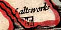
saltworks; a cluster of salt pans by the coast - just the one example near Lymington.
map colouring.
|
| Map featuresMorden's Hampshire 1695 |
| Map feature |
Some images can be clicked for more information. |
|
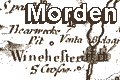
| title cartouche; decorated, with map maker's name |
|
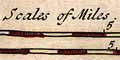
| scale line; two different 'Scales of Miles'. |
|
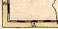
| latitude and longitude scales; chequered side and bottom borders, and time difference from Greenwich at the top. |
|
| coast shaded; into a plain sea, sandbanks or mudflats shown by dotted areas. |
|
| rivers; wiggly lines narrowing upstream; few rivers are labelled. |
|
| bridges; some bridges are shown by a double line or a gap in a river. |
|
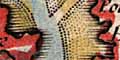
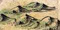
| relief; groups of hillocks shaded on the east side. |
|
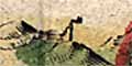
| beacons; a post with a fire basket on top and a ladder up the side - otherwise just a label on the map. |
|
| woods, forests; groups of small trees. |
|
| parks; ring of fence palings, not particularly clear drawing or engraving. |
|
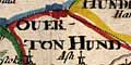
| hundred boundaries; dotted line, hundreds are named in upright block caps. |
|
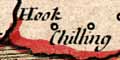
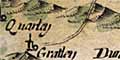
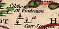
| settlements; houses, hamlets, villages, cities, etc |
|
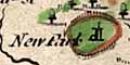
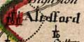
| market towns; and other towns |
|
|
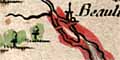
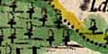
roads; parallel lines, this map is one of the early useful road maps of the county. |
|
|
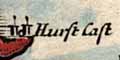
coastal defence, castles; circle with tower each side. |
|
| antiquities; there is no special symbol, but a few roman place names are given. |
|
|
miscellany: saltworks; a cluster of salt pans by the coast - just the one example near Lymington. map colouring. |
| The map has no compass rose. North is clearly indicated by the longitude scale at the bottom taken with the time from Greenwich at the top.. | |
 
| Morden's Hampshire 1695, contents |

| General index |

| Old Hampshire Mapped |