
|
Catalogue of Map Collection
FA1999.5 -- FA1999.59:
Identity number order
 |
FA1998 |
 |
bottom of page |
|
|
A thumbnail image on the right will enlarge, then return here.
The left link will take you to the Map Collection record page, and if (Map Group) is shown, will link to other Hampshire resources.
If you want to return to your place here, use your back browser button.
|
|
Identity number
(Map Group)
|
|
|
 |
|
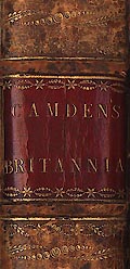
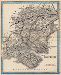
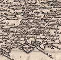
FA1999.5
(Camden 1789)

|
Book, atlas, 3 tooled leather bound volumes, Britannia, or A
Chorographical Description of the Flourishing Kingdoms of
England, Scotland, and Ireland, by William Camden, 1586,
translated from Latin by Richard Gough, published London,
1789.
|
|
|
|
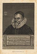
FA1999.5.1
(Camden 1789)
|
Print, engraving portrait of William Camden, after a painting
by Marcus Gherrardis, by Loder, engraved by James Basire,
1789.
|
|
|
|
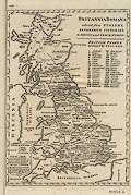
FA1999.5.2
(Camden 1789)
|
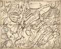
Map, uncoloured engraving, Britannia Roman ie Roman Britain,
probably by John Cary, London, 1789.
|
|
|
|
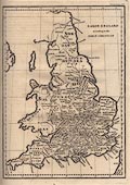
FA1999.5.3
(Camden 1789)
|
Map, uncoloured engraving, Saxon England, probably by John
Cary, London, 1789.
|
|
|
|
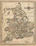
FA1999.5.4
|
Map, uncoloured engraving, Great Britain and Ireland, with the
judges's circuits, scale about 57 miles to 1 inch, and a
triangular table of distances between towns, by John Cary,
London, 1789.
|
|
|
|
FA1999.5.5
(Cary 1789)
|
Map, uncoloured engraving, An Accurate Map of England and
Wales, scale about 22 miles to 1 inch, by John Cary, London,
1789.
|
|
|
|
FA1999.5.6
|
Map, uncoloured engraving, Cornwall, with an inset map of the
Scilly Isles on a scroll, by E Noble and John Cary, London,
1789.
|
|
|
|
FA1999.5.7
|
Map, uncoloured engraving, Devonshire, by E Noble and John
Cary, London, 1789.
|
|
|
|
FA1999.5.8
|
Map, uncoloured engraving, Dorsetshire, by E Noble and John
Cary, London, 1789.
|
|
|
|
FA1999.5.9
|
Map, uncoloured engraving, Somersetshire, by John Cary,
London, 1789.
|
|
|
|
FA1999.5.10
|
Map, uncoloured engraving, Wiltshire, by E Noble and John
Cary, London, 1789.
|
|
|
|
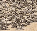
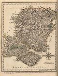
FA1999.5.11
(Cary 1789)
|
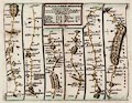
Map, uncoloured engraving, A Map of Hampshire, and the Isle of
Wight, scale about 3 miles to 1 inch, by John Cary, London,
1789.
|
|
|
|
FA1999.5.12
|
Map, uncoloured engraving, Berkshire, by E Noble and John
Cary, London, 1789.
|
|
|
|
FA1999.5.13
|
Map, uncoloured engraving, Surry ie Surrey by E Noble and John
Cary, London, 1789.
|
|
|
|
FA1999.5.14
|
Map, uncoloured engraving, Sussex ie East Sussex and West
Sussex, by John Cary, London, 1789.
|
|
|
|
FA1999.5.15
|
Map, uncoloured engraving, Kent, by E Noble and John Cary,
London, 1789.
|
|
|
|
FA1999.5.16
|
Map, uncoloured engraving, Glocestershire ie Gloucestershire,
by E Noble and John Cary, London, 1789.
|
|
|
|
FA1999.5.17
|
Map, uncoloured engraving, Oxfordshire, by E Noble and John
Cary, London, 1789.
|
|
|
|
FA1999.5.18
|
Map, uncoloured engraving, Buckinghamshire by E Noble and John
Cary, London, 1789.
|
|
|
|
FA1999.5.19
|
Map, uncoloured engraving, Bedfordshire, by E Noble and John
Cary, London, 1789.
|
|
|
|
FA1999.5.20
|
Map, uncoloured engraving, Hartfordshire ie Hertfordshire, by
John Cary, London, 1789.
|
|
|
|
FA1999.5.21
|
Map, uncoloured engraving, Middlesex, by E Noble and John
Cary, London, 1789.
|
|
|
|
FA1999.5.22
|
Map, uncoloured engraving, Essex, by E Noble and John Cary,
London, 1789.
|
|
|
|
FA1999.5.23
|
Map, uncoloured engraving, Suffolk, by John Cary, London,
1789.
|
|
|
|
FA1999.5.24
|
Map, uncoloured engraving, Norfolk, by John Cary, London,
1789.
|
|
|
|
FA1999.5.25
|
Map, uncoloured engraving, Cambridgeshire by John Cary,
London, 1789.
|
|
|
|
FA1999.5.26
|
Map, uncoloured engraving, Huntingdonshire by E Noble and John
Cary, London, 1789.
|
|
|
|
FA1999.5.27
|
Map, uncoloured engraving, Northamptonshire by John Cary,
London, 1789.
|
|
|
|
FA1999.5.28
|
Map, uncoloured engraving, Leicestershire by E Noble and John
Cary, London, 1789.
|
|
|
|
FA1999.5.29
|
Map, uncoloured engraving, Rutlandshire by E Noble and John
Cary, London, 1789.
|
|
|
|
FA1999.5.30
|
Map, uncoloured engraving, Lincolnshire by E Noble and John
Cary, London, 1789.
|
|
|
|
FA1999.5.31
|
Map, uncoloured engraving, Nottinghamshire, by E Noble and
John Cary, London, 1789.
|
|
|
|
FA1999.5.32
|
Map, uncoloured engraving, Derbyshire, by E Noble and John
Cary, London, 1789.
|
|
|
|
FA1999.5.33
|
Map, uncoloured engraving, Warwickshire, by E Noble and John
Cary, London, 1789.
|
|
|
|
FA1999.5.34
|
Map, uncoloured engraving, Worcestershire, by John Cary,
London, 1789.
|
|
|
|
FA1999.5.35
|
Map, uncoloured engraving, Staffordshire, by John Cary,
London, 1789.
|
|
|
|
FA1999.5.36
|
Map, uncoloured engraving, Shropshire, by John Cary, London,
1789.
|
|
|
|
FA1999.5.37
|
Map, uncoloured engraving, Cheshire, by John Cary, London,
1789.
|
|
|
|
FA1999.5.38
|
Map, uncoloured engraving, Herefordshire, by John Cary,
London, 1789.
|
|
|
|
FA1999.5.39
|
Map, uncoloured engraving, South Wales, ie Pembrokeshire,
Cardiganshire, Carmarthenshire, Glamorganshire, Radnorshire,
Brecknockshire, by John Cary, London, 1789.
|
|
|
|
FA1999.5.40
|
Map, uncoloured engraving, Monmouthshire, by John Cary,
London, 1789.
|
|
|
|
FA1999.5.41
|
Map, uncoloured engraving, North Wales, ie Anglesey,
Caernarvonshire, Denbighshire, Merionethshire, Flint,
Montgomeryshire, by John Cary, London, 1789.
|
|
|
|
FA1999.5.42
|
Map, uncoloured engraving, North Part of the West Riding of
Yorkshire, by John Cary, London, 1789.
|
|
|
|
FA1999.5.43
|
Map, uncoloured engraving, South Part of the West Riding of
Yorkshire, by John Cary, London, 1789.
|
|
|
|
FA1999.5.44
|
Map, uncoloured engraving, East Riding of Yorkshire with
Ainsty Liberty, by John Cary, London, 1789.
|
|
|
|
FA1999.5.45
|
Map, uncoloured engraving, North Riding of Yorkshire, by John
Cary, London, 1789.
|
|
|
|
FA1999.5.46
|
Map, uncoloured engraving, Durham, by John Cary, London,
1789.
|
|
|
|
FA1999.5.47
|
Map, uncoloured engraving, Lancashire, by John Cary, London,
1789.
|
|
|
|
FA1999.5.48
|
Map, uncoloured engraving, Westmoreland, by John Cary, London,
1789.
|
|
|
|
FA1999.5.49
|
Map, uncoloured engraving, Cumberland, by John Cary, London,
1789.
|
|
|
|
FA1999.5.50
|
Map, uncoloured engraving, The Roman or Picts Walls, ie
Hadrians Wall, Cumbria and Tyne and Wear, presumably by John
Cary, London, 1789.
|
|
|
|
FA1999.5.51
|
Map, uncoloured engraving, Northumberland, by John Cary,
London, 1789.
|
|
|
|
FA1999.5.52
|
Map, uncoloured engraving, South Part of Scotland, by John
Cary, London, 1789.
|
|
|
|
FA1999.5.53
|
Map, uncoloured engraving, Principal Roman Camps, Forts,
Walls, ... between the River Tyne in England, and Tay in
Scotland, by John Cary, London, 1789.
|
|
|
|
FA1999.5.54
|
Map, uncoloured engraving, Antoninus Pius's Wall in Scotland,
presumably by John Cary, London, 1789.
|
|
|
|
FA1999.5.55
|
Map, uncoloured engraving, North Part of Scotland, by John
Cary, London, 1789.
|
|
|
|
FA1999.5.56
|
Map, uncoloured engraving, Ireland ie Northern Ireland and
Eire, by John Cary, London, 1789.
|
|
|
|
FA1999.5.57
|
Map, uncoloured engraving, Isle of Man, by John Cary, London,
1789.
|
|
|
|
FA1999.5.58
|
Map, uncoloured engraving, Alderney, Channel Islands, by John
Cary, London, 1789.
|
|
|
|
FA1999.5.59
|
Map, uncoloured engraving, Garnsey or Sarina ie Guernsey,
Channel Islands, by John Cary, London, 1789.
|
|
|
|
FA1999.5.60
|
Map, uncoloured engraving, Island of Jersey, Channel Islands,
by John Cary, London, 1789.
|
|
|
|
FA1999.5.61
|
Map, uncoloured engraving, Isles of Zetland ie Shetland, by
John Cary, London, 1789.
|
|
|
|
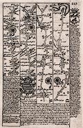
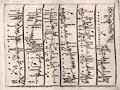
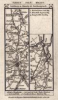
FA1999.6
(Bowen 1720)
|
Strip map, road map, two sided sheet taken from a road book,
Britannia Depicta or Ogilby Improv'd, text by John Owen, Middle
Temple, London, maps by Emanuel Bowen, published Thomas Bowles,
St Paul's Churchyard, London, 1720 onwards.
|
|
|
|
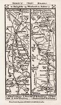
FA1999.7
(Bowen 1720)
|
Strip map, road map, two sided sheet taken from a road book,
Britannia Depicta or Ogilby Improv'd, text by John Owen, Middle
Temple, London, maps by Emanuel Bowen, published Thomas Bowles,
St Paul's Churchyard, London, 1720 onwards.
|
|
|
|
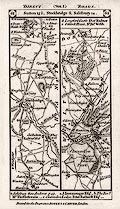
FA1999.8
(Bowen 1720)
|
Strip map, road map, two sided sheet taken from a road book,
Britannia Depicta or Ogilby Improv'd, text by John Owen, Middle
Temple, London, maps by Emanuel Bowen, published Thomas Bowles,
St Paul's Churchyard, London, 1720 onwards.
|
|
|
|
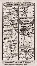
FA1999.9
(Bowen 1720)
|
Strip map, road map, two sided sheet taken from a road book,
Britannia Depicta or Ogilby Improv'd, text by John Owen, Middle
Temple, London, maps by Emanuel Bowen, published Thomas Bowles,
St Paul's Churchyard, London, 1720 onwards.
|
|
|
|
FA1999.10
(Bowen 1720)
|
Strip map, road map, two sided sheet taken from a road book,
Britannia Depicta or Ogilby Improv'd, text by John Owen, Middle
Temple, London, maps by Emanuel Bowen, published Thomas Bowles,
St Paul's Churchyard, London, 1720 onwards.
|
|
|
|
FA1999.11
(Bowen 1720)
|
Strip map, road map, two sided sheet taken from a road book,
Britannia Depicta or Ogilby Improv'd, text by John Owen, Middle
Temple, London, maps by Emanuel Bowen, published Thomas Bowles,
St Paul's Churchyard, London, 1720 onwards.
|
|
|
|
FA1999.12
(Bowen 1720)
|
Strip map, road map, two sided sheet taken from a road book,
Britannia Depicta or Ogilby Improv'd, text by John Owen, Middle
Temple, London, maps by Emanuel Bowen, published Thomas Bowles,
St Paul's Churchyard, London, 1720 onwards.
|
|
|
|
FA1999.13
|
Map, New map of Bournemouth and District, Dorset, scale about
2 miles to 1 inch, by Geographia Ltd, 167 Fleet Street, London,
1950s-60s?
|
|
|
|
FA1999.14
|
Map, Winmax series of British Guide Maps, Fareham and
Titchfield District, Hampshire, scale about 2 miles to 1 inch, by
Gall and Inglis, Edinburgh, Lothian, published by Philip Palmer
Press, Reading, Berkshire, 1920s?
|
|
|
|
FA1999.15
|
Chart, Coloured Charts for Coastal Navigators, sheet 11, The
Solent, coast from Lymington, Lymington and Pennington, past
Southampton Water, Hampshire to Selsey Bill, West Sussex, and the
Isle of Wight, scale about 1 sea mile to 1 inch, by Edward
Stanford Ltd, 12-14 Long Acre, London, 1968.
|
|
|
|
FA1999.16
(Mogg 1814)
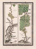
|
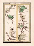
Strip map, road map, part of route London to Poole, Dorset,
and London to Lymington, Lymington and Pennington, Hampshire,
scale about 1 inch to 1 mile, probably published by E Mogg,
London, 1814.
|
|
|
|
FA1999.17
(Mogg 1814)
|
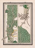
Strip map, road map, part of the route London to Poole,
Dorset, scale about 1 inch to 1 mile, probably published by E
Mogg, London, 1814.
|
|
|
|
FA1999.18
(Mogg 1814)
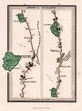
|
Strip map, road map, part of the route London to Southampton,
Hampshire, scale about 1 inch to 1 mile, published by E Mogg,
London, 1814.
|
|
|
|
FA1999.19
(Unknown 1860s-70s)
|
Map, railway map, Hampshire, and Isle of Wight, scale about 6
miles to 1 inch, 1860s-70s?
|
|
|
|
FA1999.20
(Jenner 1643)
|
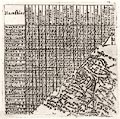
Table of distances, uncoloured engraving, Hamshire, by Mathew
Simmons, 1635, with a thumbnail map, Hampshire and the Isle of
Wight, scale about 25.5 miles to 1 inch, by Thomas Jenner,
London, published in A Direction for the English Traviller,
1643.
|
|
|
|
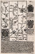
FA1999.21
(Senex 1757)
|
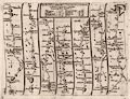
Strip map, road map, uncoloured engraving, scale about 2-2.5
miles to 1 inch, parts of the Road from Oxford to Coventry and
Derby and the Road from Oxford to Salisbury, from a road book by
John Senex, 1719, edition printed for John Bowles and Son, The
Black Horse, Cornhill, London, after 1757.
|
|
|
|
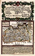
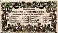
FA1999.22
(Senex 1757)
|
Strip map, road map, uncoloured engraving, scale about 2-2.5
miles to 1 inch, parts of the Road from London to Wells and St
Edmundsbury and the Road from London to Weymouth, from a road
book by John Senex, 1719, edition printed for John Bowles and
Son, The Black Horse, Cornhill, London, after 1757.
|
|
|
|
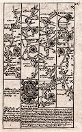
FA1999.23
(Senex 1757)
|
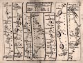
Road map, uncoloured engraving, scale about 50 miles to 1
inch, General View of Ogilby's Direct and Principal Cross Roads,
in England and Wales; and on the other side a strip map, part of
The Road from London to Aberystwyth; from a road book by John
Senex, 1719, edition printed for John Bowles and Son, The Black
Horse, Cornhill, London, after 1757.
|
|
|
|
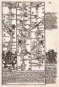
FA1999.24
(Senex 1757)
|
Strip map, road map, uncoloured engraving, scale about 2-2.5
miles to 1 inch, parts of the Road from London to Lands End, by
John Senex, 1719, edition after 1757.
|
|
|
|
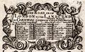
FA1999.25
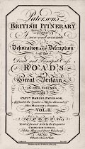
(Paterson 1785)
|
Title page, from a vol.2 of the road book, Paterson' British
Itinerary, by Capt Daniel Paterson, published by Carington
Bowles, 69 St Paul's Churchyard, London, 1785.
|
|
|
|
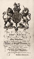
FA1999.26
(Paterson 1785)
|
Dedication page, to George III? from a volume of the road
book, Paterson' British Itinerary, by Capt Daniel Paterson,
published by Carington Bowles, 69 St Paul's Churchyard, London,
1785?
|
|
|
|
FA1999.27
(Paterson 1785)
|
Strip map, road map, uncoloured engraving, Salisbury,
Wiltshire to Southampton, Hampshire and Bristol to Gloucester,
Gloucestershire, from vol.2 of the road book, Paterson' British
Itinerary, by Capt Daniel Paterson, published by Carington
Bowles, 69 St Paul's Churchyard, London, 1785.
|
|
|
|
FA1999.28
(Paterson 1785)
|
Strip map, road map, Hartley Row via Andover, Hampshire into
Wiltshire and Dorset from vol.1 of the road book, Paterson'
British Itinerary, by Capt Daniel Paterson, published by
Carington Bowles, 69 St Paul's Churchyard, London, 1785.
|
|
|
|
FA1999.29
(Paterson 1785)
|
Strip map, road map, uncoloured engraving, Hartley Row via
Andover, Hampshire into Wiltshire and Dorset from vol.1 of the
road book, Paterson' British Itinerary, by Capt Daniel Paterson,
1785, published by Bowles and Carver, London, after 1793.
|
|
|
|
FA1999.30
(Paterson 1785)
|
Strip map, road map, uncoloured engraving, from near Sutton
Scotney, Hampshire via Salisbury, Wiltshire to Dorchester, Dorset
from vol.1 of the road book, Paterson' British Itinerary, by Capt
Daniel Paterson, 1785, published by Bowles and Carver, London,
after 1793.
|
|
|
|
FA1999.31
(Paterson 1785)
|
Strip map, road map, uncoloured engraving, from the
Winterbournes, Dorset to Axminster, Devon and from Salisbury,
Wiltshire to Poole, Dorset from vol.1 of the road book, Paterson'
British Itinerary, by Capt Daniel Paterson, published by Bowles
and Carver, London, after 1793.
|
|
|
|
FA1999.32
|
Map, Shell Map sheet 2, Southern and Eastern England, scale
about 3 miles to 1 inch, by George Philip and Son, for Shell UK
Oil, Shell-Mex House, Strand, London, 1981.
|
|
|
|
FA1999.33
(Kentish 1823)
|
Map, uncoloured lithograph, part of a Great Map of Hampshire,
sheet 36? area south of Winchester, scale about 5 inches to 1
mile, by Nathaniel Lipscomb Kentish, Kingsgate Street,
Winchester, Hampshire, about 1823.
|
|
|
|
FA1999.51
|
Guide book, with maps, Guide to Aldershot and District,
Hampshire, Surrey and Berkshire, by Gale and Polden, Wellington
Works, Aldershot, Rushmoor, Hampshire, 1903.
|
|
|
|
FA1999.51.1
|
Map, Country 20 Miles round Aldershot, published in Guide to
Aldershot and District, Rushmoor, Hampshire, scale about 3 miles
to 1 inch, by the London Geographical Institute, published by
Gale and Polden, Wellington Works, Aldershot, Rushmoor,
Hampshire, 1903.
|
|
|
|
FA1999.52
(OS 1920s Popular Edition)
|
Map, One inch map Popular Edition, 4th edition, sheet 132,
Portsmouth and Southampton, Hampshire, scale 1 mile to 1 inch, by
Ordnance Survey, Southampton, Hampshire, 1919 corrected to 1929,
published by the War Office, London, 1931.
|
|
|
|
FA1999.53
(Dugdale 1835)
|
Book, with engraved prints and maps, one volume of the
Curiosities of Great Britain, or Dugdale's England and Wales, by
Thomas Dugdale, about 1835, published 1850s?
|
|
|
|
FA1999.53.1
|
Print, engraving of the Cross, Winchester, Hampshire, by T H
Shepherd, engraved by H Bond, published in the Curiosities of
Great Britain, or Dugdale's England and Wales, by Thomas Dugdale,
probably a late edition 1850s.
|
|
|
|
FA1999.53.2
|
Print, engraving, Birth Place of Sir Robert Peel, Blackburn,
Lancashire, by T H Shepherd, engraved by C Fenn, published in the
Curiosities of Great Britain, or Dugdale's England and Wales, by
Thomas Dugdale, probably a late edition 1850s.
|
|
|
|
FA1999.53.3
|
Print, engraving, Gravesend, Kent, published in the
Curiosities of Great Britain, or Dugdale's England and Wales, by
Thomas Dugdale, probably a late edition 1850s.
|
|
|
|
FA1999.53.4
|
Print, engraving, Greenwich, London, published in the
Curiosities of Great Britain, or Dugdale's England and Wales, by
Thomas Dugdale, probably a late edition 1850s.
|
|
|
|
FA1999.53.5
|
Print, engraving, Ross, Herefordshire, published in the
Curiosities of Great Britain, or Dugdale's England and Wales, by
Thomas Dugdale, probably a late edition 1850s.
|
|
|
|
FA1999.53.6
|
Print, engraving, Hereford, Hereford and Worcester, published
in the Curiosities of Great Britain, or Dugdale's England and
Wales, by Thomas Dugdale, probably a late edition 1850s.
|
|
|
|
FA1999.53.7
|
Print, engraving, Manebeer Castle, Pembrokeshire, published in
the Curiosities of Great Britain, or Dugdale's England and Wales,
by Thomas Dugdale, probably a late edition 1850s.
|
|
|
|
FA1999.53.8
|
Print, engraving, Goodrich Castle, Hereford and Worcester,
published in the Curiosities of Great Britain, or Dugdale's
England and Wales, by Thomas Dugdale, probably a late edition
1850s.
|
|
|
|
FA1999.53.9
|
Print, engraving, The Infant Orphan Asylum, Snaresbrook,
Essex, by A H Wray, engraved by J Davies, published in the
Curiosities of Great Britain, or Dugdale's England and Wales, by
Thomas Dugdale, probably a late edition 1850s.
|
|
|
|
FA1999.53.10
|
Print, engraving, Whittingtons Alms Houses, by T H Shepherd,
engraved by J Davies, published in the Curiosities of Great
Britain, or Dugdale's England and Wales, by Thomas Dugdale,
probably a late edition 1850s.
|
|
|
|
FA1999.53.11
|
Print, engraving, birth place of William Cobbett, Farnham,
Surrey, published in the Curiosities of Great Britain, or
Dugdale's England and Wales, by Thomas Dugdale, probably a late
edition 1850s.
|
|
|
|
FA1999.53.12
|
Print, engraving, Pope's House, Binfield, Berkshire, published
in the Curiosities of Great Britain, or Dugdale's England and
Wales, by Thomas Dugdale, probably a late edition 1850s.
|
|
|
|
FA1999.53.13
|
Print, engraving, Birthplace of Dryden, Aldwinkle,
Northamptonshire, published in the Curiosities of Great Britain,
or Dugdale's England and Wales, by Thomas Dugdale, probably a
late edition 1850s.
|
|
|
|
FA1999.53.14
|
Print, engraving, Birthplace of Rev James Hervey,
Hardingstone, Northamptonshire, published in the Curiosities of
Great Britain, or Dugdale's England and Wales, by Thomas Dugdale,
probably a late edition 1850s.
|
|
|
|
FA1999.53.15
|
Print, engraving, Thames Tunnel, London, published in the
Curiosities of Great Britain, or Dugdale's England and Wales, by
Thomas Dugdale, probably a late edition 1850s.
|
|
|
|
FA1999.53.16
|
Print, engraving, Her Majesty's Theatre, London, published in
the Curiosities of Great Britain, or Dugdale's England and Wales,
by Thomas Dugdale, probably a late edition 1850s.
|
|
|
|
FA1999.53.17
|
Print, engraving, King's College Chapel, University Library
and Senate House, Cambridge, Cambridgeshire, published in the
Curiosities of Great Britain, or Dugdale's England and Wales, by
Thomas Dugdale, probably a late edition 1850s.
|
|
|
|
FA1999.53.18
(Dugdale 1835)
|
Map, engraving, Hampshire, with the Isle of Wight, scale about
8 miles to 1 inch, by J Archer, Pentonville, London, published,
plate 16, in the Curiosities of Great Britain, or Dugdale's
England and Wales, by Thomas Dugdale, about 1835, published
1850s?
|
|
|
|
FA1999.53.19
|
Map, engraving, Herefordshire, scale about 6 miles to 1 inch,
by J Archer, Pentonville, London, published, plate 17, in the
Curiosities of Great Britain, or Dugdale's England and Wales, by
Thomas Dugdale, probably a late edition 1850s.
|
|
|
|
FA1999.53.20
|
Map, engraving, Hertfordshire, scale about 5 miles to 1 inch,
by J Archer, Pentonville, London, published, plate 18, in the
Curiosities of Great Britain, or Dugdale's England and Wales, by
Thomas Dugdale, probably a late edition 1850s.
|
|
|
|
FA1999.53.21
|
Map, engraving, Huntingdonshire, scale about 4 miles to 1
inch, by J Archer, Pentonville, London, published, plate 19, in
the Curiosities of Great Britain, or Dugdale's England and Wales,
by Thomas Dugdale, probably a late edition 1850s.
|
|
|
|
FA1999.53.22
|
Map, engraving, Isle of Wight, scale about 3 miles to 1 inch,
by J Archer, Pentonville, London, published, plate 20, in the
Curiosities of Great Britain, or Dugdale's England and Wales, by
Thomas Dugdale, probably a late edition 1850s.
|
|
|
|
FA1999.53.23
|
Map, engraving, Kent, scale about 8 miles to 1 inch, by J
Archer, Pentonville, London, published, plate 21, in the
Curiosities of Great Britain, or Dugdale's England and Wales, by
Thomas Dugdale, probably a late edition 1850s.
|
|
|
|
FA1999.53.24
|
Map, engraving, Lancashire, scale about 9 miles to 1 inch, by
J Archer, Pentonville, London, published, plate 22, in the
Curiosities of Great Britain, or Dugdale's England and Wales, by
Thomas Dugdale, probably a late edition 1850s.
|
|
|
|
FA1999.54
(Mogg 1814)
|
Strip map, road map, part of the route London to Poole,
Dorset, scale about 1 inch to 1 mile, probably published by E
Mogg, London, 1814.
|
|
|
|
FA1999.55
(Senex 1719)
|
Strip map, road map, hand coloured engraving, scale about
2-2.5 miles to 1 inch, The Road from London to Barnstable, Devon,
segment from Andover, Hampshire to Bridgewater, Somerset from a
road book by John Senex, London, 1719.
|
|
|
|
FA1999.56
(Cary 1787)
|
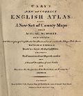
Atlas, leather bound, Cary's New and Correct English Atlas,
county maps of England and maps of Wales, by John Cary, 188
Strand, London, 1787.
|
|
|
|
FA1999.56.1
(Cary 1787)
|
Atlas, hand coloured engraving, South Britain ie England and
Wales, in Cary's New and Correct English Atlas, by John Cary, 188
Strand, London, 1787.
|
|
|
|
FA1999.56.2
|
Atlas, hand coloured engraving, Bedfordshire, scale about 4
miles to 1 inch, in Cary's New and Correct English Atlas, by John
Cary, 188 Strand, London, 1787.
|
|
|
|
FA1999.56.3
|
Atlas, hand coloured engraving, Berkshire, scale about 5 miles
to 1 inch, in Cary's New and Correct English Atlas, by John Cary,
188 Strand, London, 1787.
|
|
|
|
FA1999.56.4
|
Atlas, hand coloured engraving, Buckinghamshire, scale about 5
miles to 1 inch, in Cary's New and Correct English Atlas, by John
Cary, 188 Strand, London, 1787.
|
|
|
|
FA1999.56.5
|
Atlas, hand coloured engraving, Cambridgeshire, scale about 5
miles to 1 inch, in Cary's New and Correct English Atlas, by John
Cary, 188 Strand, London, 1787.
|
|
|
|
FA1999.56.6
|
Atlas, hand coloured engraving, Cheshire, scale about 6 miles
to 1 inch, in Cary's New and Correct English Atlas, by John Cary,
188 Strand, London, 1787.
|
|
|
|
FA1999.56.7
|
Atlas, hand coloured engraving, Cornwall, scale about 10 miles
to 1 inch, in Cary's New and Correct English Atlas, by John Cary,
188 Strand, London, 1787.
|
|
|
|
FA1999.56.8
|
Atlas, hand coloured engraving, Cumberland ie Cumbria area,
scale about 7 miles to 1 inch, in Cary's New and Correct English
Atlas, by John Cary, 188 Strand, London, 1787.
|
|
|
|
FA1999.56.9
|
Atlas, hand coloured engraving, Derbyshire, scale about 7
miles to 1 inch, in Cary's New and Correct English Atlas, by John
Cary, 188 Strand, London, 1787.
|
|
|
|
FA1999.56.10
|
Atlas, hand coloured engraving, Devonshire, scale about 9
miles to 1 inch, in Cary's New and Correct English Atlas, by John
Cary, 188 Strand, London, 1787.
|
|
|
|
FA1999.56.11
|
Atlas, hand coloured engraving, Dorsetshire, scale about 7
miles to 1 inch, in Cary's New and Correct English Atlas, by John
Cary, 188 Strand, London, 1787.
|
|
|
|
FA1999.56.12
|
Atlas, hand coloured engraving, Durham, scale about 5 miles to
1 inch, in Cary's New and Correct English Atlas, by John Cary,
188 Strand, London, 1787.
|
|
|
|
FA1999.56.13
|
Atlas, hand coloured engraving, Essex, scale about 6 miles to
1 inch, in Cary's New and Correct English Atlas, by John Cary,
188 Strand, London, 1787.
|
|
|
|
FA1999.56.14
|
Atlas, hand coloured engraving, Glocestershire ie
Gloucestershire, scale about 6 miles to 1 inch, in Cary's New and
Correct English Atlas, by John Cary, 188 Strand, London,
1787.
|
|
|
|
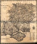
FA1999.56.15
(Cary 1787)
|
Atlas, hand coloured engraving, Hampshire, scale about 6 miles
to 1 inch, in Cary's New and Correct English Atlas, by John Cary,
188 Strand, London, 1787.
|
|
|
|
FA1999.56.16
|
Atlas, hand coloured engraving, Herefordshire, scale about 5
miles to 1 inch, in Cary's New and Correct English Atlas, by John
Cary, 188 Strand, London, 1787.
|
|
|
|
FA1999.56.17
|
Atlas, hand coloured engraving, Hertfordshire, scale about 4
miles to 1 inch, in Cary's New and Correct English Atlas, by John
Cary, 188 Strand, London, 1787.
|
|
|
|
FA1999.56.18
|
Atlas, hand coloured engraving, Huntingdonshire, scale about 3
miles to 1 inch, in Cary's New and Correct English Atlas, by John
Cary, 188 Strand, London, 1787.
|
|
|
|
FA1999.56.19
|
Atlas, hand coloured engraving, Kent, scale about 7 miles to 1
inch, in Cary's New and Correct English Atlas, by John Cary, 188
Strand, London, 1787.
|
|
|
|
FA1999.56.20
|
Atlas, hand coloured engraving, Lancashire, scale about 8
miles to 1 inch, in Cary's New and Correct English Atlas, by John
Cary, 188 Strand, London, 1787.
|
|
|
|
FA1999.56.21
|
Atlas, hand coloured engraving, Leicestershire, scale about 5
miles to 1 inch, in Cary's New and Correct English Atlas, by John
Cary, 188 Strand, London, 1787.
|
|
|
|
FA1999.56.22
|
Atlas, hand coloured engraving, Lincolnshire, scale about 8
miles to 1 inch, in Cary's New and Correct English Atlas, by John
Cary, 188 Strand, London, 1787.
|
|
|
|
FA1999.56.23
|
Atlas, hand coloured engraving, Middlesex, scale about 3 miles
to 1 inch, in Cary's New and Correct English Atlas, by John Cary,
188 Strand, London, 1787.
|
|
|
|
FA1999.56.24
|
Atlas, hand coloured engraving, Monmouthshire, scale about 4.1
miles to 1 inch, in Cary's New and Correct English Atlas, by John
Cary, 188 Strand, London, 1787.
|
|
|
|
FA1999.56.25
|
Atlas, hand coloured engraving, Norfolk, scale about 8 miles
to 1 inch, in Cary's New and Correct English Atlas, by John Cary,
188 Strand, London, 1787.
|
|
|
|
FA1999.56.26
|
Atlas, hand coloured engraving, Northamptonshire, scale about
6 miles to 1 inch, in Cary's New and Correct English Atlas, by
John Cary, 188 Strand, London, 1787.
|
|
|
|
FA1999.56.27
|
Atlas, hand coloured engraving, Northumberland, scale about 1
to 500000, about 8 miles to 1 inch, in Cary's New and Correct
English Atlas, by John Cary, 188 Strand, London, 1787.
|
|
|
|
FA1999.56.28
|
Atlas, hand coloured engraving, Nottinghamshire, scale about 5
miles to 1 inch, in Cary's New and Correct English Atlas, by John
Cary, 188 Strand, London, 1787.
|
|
|
|
FA1999.56.29
|
Atlas, hand coloured engraving, Oxfordshire, scale about 5
miles to 1 inch, in Cary's New and Correct English Atlas, by John
Cary, 188 Strand, London, 1787.
|
|
|
|
FA1999.56.30
|
Atlas, hand coloured engraving, Rutlandshire, scale about 2.5
miles to 1 inch, in Cary's New and Correct English Atlas, by John
Cary, 188 Strand, London, 1787.
|
|
|
|
FA1999.56.31
|
Atlas, hand coloured engraving, Shropshire, scale about 5
miles to 1 inch, in Cary's New and Correct English Atlas, by John
Cary, 188 Strand, London, 1787.
|
|
|
|
FA1999.56.32
|
Atlas, hand coloured engraving, Somersetshire, scale about 8
miles to 1 inch, in Cary's New and Correct English Atlas, by John
Cary, 188 Strand, London, 1787.
|
|
|
|
FA1999.56.33
|
Atlas, hand coloured engraving, Staffordshire, scale about 5
miles to 1 inch, in Cary's New and Correct English Atlas, by John
Cary, 188 Strand, London, 1787.
|
|
|
|
FA1999.56.34
|
Atlas, hand coloured engraving, Suffolk, scale about 7 miles
to 1 inch, in Cary's New and Correct English Atlas, by John Cary,
188 Strand, London, 1787.
|
|
|
|
FA1999.56.35
|
Atlas, hand coloured engraving, Surrey, scale about 4 miles to
1 inch, in Cary's New and Correct English Atlas, by John Cary,
188 Strand, London, 1787.
|
|
|
|
FA1999.56.36
|
Atlas, hand coloured engraving, Sussex ie East Sussex and West
Sussex, scale about 8 miles to 1 inch, in Cary's New and Correct
English Atlas, by John Cary, 188 Strand, London, 1787.
|
|
|
|
FA1999.56.37
|
Atlas, hand coloured engraving, Warwickshire, scale about 5
miles to 1 inch, in Cary's New and Correct English Atlas, by John
Cary, 188 Strand, London, 1787.
|
|
|
|
FA1999.56.38
|
Atlas, hand coloured engraving, Westmoreland now part of
Cumbria, scale about 5 miles to 1 inch, in Cary's New and Correct
English Atlas, by John Cary, 188 Strand, London, 1787.
|
|
|
|
FA1999.56.39
|
Atlas, hand coloured engraving, Wiltshire, scale about 6 miles
to 1 inch, in Cary's New and Correct English Atlas, by John Cary,
188 Strand, London, 1787.
|
|
|
|
FA1999.56.40
|
Atlas, hand coloured engraving, Worcestershire, scale about 5
miles to 1 inch, in Cary's New and Correct English Atlas, by John
Cary, 188 Strand, London, 1787.
|
|
|
|
FA1999.56.41
|
Atlas, hand coloured engraving, Yorkshire ie North, West and
East Ridings of Yorkshire, scale about 11 miles to 1 inch, in
Cary's New and Correct English Atlas, by John Cary, 188 Strand,
London, 1787.
|
|
|
|
FA1999.56.42
|
Atlas, hand coloured engraving, North Riding of Yorkshire ie
North Yorkshire, scale about 9 miles to 1 inch, in Cary's New and
Correct English Atlas, by John Cary, 188 Strand, London,
1787.
|
|
|
|
FA1999.56.43
|
Atlas, hand coloured engraving, The East Riding of Yorkshire
ie East Yorkshire, scale about 7 miles to 1 inch, in Cary's New
and Correct English Atlas, by John Cary, 188 Strand, London,
1787.
|
|
|
|
FA1999.56.44
|
Atlas, hand coloured engraving, Part of the West Riding of
Yorkshire, West Yorkshire, South part, scale about 7 miles to 1
inch, in Cary's New and Correct English Atlas, by John Cary, 188
Strand, London, 1787.
|
|
|
|
FA1999.56.45
|
Atlas, hand coloured engraving, Part of the West Riding of
Yorkshire, West Yorkshire, North part, scale about 7 miles to 1
inch, in Cary's New and Correct English Atlas, by John Cary, 188
Strand, London, 1787.
|
|
|
|
FA1999.56.46
|
Atlas, hand coloured engraving, North Wales, scale about 11
miles to 1 inch, in Cary's New and Correct English Atlas, by John
Cary, 188 Strand, London, 1787.
|
|
|
|
FA1999.56.47
|
Atlas, hand coloured engraving, South Wales, scale about 10
miles to 1 inch, in Cary's New and Correct English Atlas, by John
Cary, 188 Strand, London, 1787.
|
|
|
|
FA1999.57
(Lewis 1831)
|
Atlas, a volume of Lewis's Topographical Dictionary, maps of
the counties of England and maps of Wales, 1831, edition
published by S Lewis and Co, 87 Hatton Garden, London, 1842.
|
|
|
|
FA1999.57.1
|
Map, hand coloured engraving, England and Wales, scale about
43 miles 1 inch, drawn by R Creighton, engraved by Thomas
Starling, in Lewis's Topographical Dictionary, published by S
Lewis and Co, 87 Hatton Garden, London, 1842.
|
|
|
|
FA1999.57.2
|
Map, Plan of London and its Environs, scale about 3 inches to
1 mile, drawn by R Creighton, engraved by J and C Walker, in
Lewis's Topographical Dictionary, published by S Lewis and Co, 87
Hatton Garden, London, 1842.
|
|
|
|
FA1999.57.3
|
Map, hand coloured engraving, Bedfordshire, scale about 5
miles 1 inch, drawn by R Creighton, engraved by J and C Walker,
in Lewis's Topographical Dictionary, published by S Lewis and Co,
87 Hatton Garden, London, 1842.
|
|
|
|
FA1999.57.4
|
Map, hand coloured engraving, Berkshire, scale about 6 miles 1
inch, drawn by R Creighton, engraved by Thomas Starling, in
Lewis's Topographical Dictionary, published by S Lewis and Co, 87
Hatton Garden, London, 1842.
|
|
|
|
FA1999.57.5
|
Map, hand coloured engraving, Buckinghamshire, scale about 7
miles 1 inch, drawn by R Creighton, engraved by J and C Walker,
in Lewis's Topographical Dictionary, published by S Lewis and Co,
87 Hatton Garden, London, 1842.
|
|
|
|
FA1999.57.6
|
Map, hand coloured engraving, Cambridgeshire, scale about 6
miles 1 inch, drawn by R Creighton, engraved by J and C Walker,
in Lewis's Topographical Dictionary, published by S Lewis and Co,
87 Hatton Garden, London, 1842.
|
|
|
|
FA1999.57.7
|
Map, hand coloured engraving, Cheshire, scale about 5 miles 1
inch, drawn by R Creighton, engraved by J and C Walker, in
Lewis's Topographical Dictionary, published by S Lewis and Co, 87
Hatton Garden, London, 1842.
|
|
|
|
FA1999.57.8
|
Map, hand coloured engraving, Cornwall, scale about 11 miles 1
inch, drawn by R Creighton, engraved by Thomas Starling, in
Lewis's Topographical Dictionary, published by S Lewis and Co, 87
Hatton Garden, London, 1842.
|
|
|
|
FA1999.57.9
|
Map, hand coloured engraving, Cumberland ie Cumbria, scale
about 7 miles 1 inch, drawn by R Creighton, engraved by Thomas
Starling, in Lewis's Topographical Dictionary, published by S
Lewis and Co, 87 Hatton Garden, London, 1842.
|
|
|
|
FA1999.57.10
|
Map, hand coloured engraving, Derbyshire, scale about 7 miles
1 inch, drawn by R Creighton, engraved by J and C Walker, in
Lewis's Topographical Dictionary, published by S Lewis and Co, 87
Hatton Garden, London, 1842.
|
|
|
|
FA1999.57.11
|
Map, hand coloured engraving, Devonshire, scale about 8 miles
1 inch, drawn by R Creighton, engraved by J and C Walker, in
Lewis's Topographical Dictionary, published by S Lewis and Co, 87
Hatton Garden, London, 1842.
|
|
|
|
FA1999.57.12
|
Map, hand coloured engraving, Dorsetshire, scale about 7 miles
1 inch, drawn by R Creighton, engraved by J and C Walker, in
Lewis's Topographical Dictionary, published by S Lewis and Co, 87
Hatton Garden, London, 1842.
|
|
|
|
FA1999.57.13
|
Map, hand coloured engraving, Durham, scale about 6 miles 1
inch, drawn by R Creighton, engraved by Thomas Starling, in
Lewis's Topographical Dictionary, published by S Lewis and Co, 87
Hatton Garden, London, 1842.
|
|
|
|
FA1999.57.14
|
Map, hand coloured engraving, Essex, scale about 7 miles 1
inch, drawn by R Creighton, engraved by Thomas Starling, in
Lewis's Topographical Dictionary, published by S Lewis and Co, 87
Hatton Garden, London, 1842.
|
|
|
|
FA1999.57.15
|
Map, hand coloured engraving, Gloucestershire, scale about 6
miles 1 inch, drawn by R Creighton, engraved by J and C Walker,
in Lewis's Topographical Dictionary, published by S Lewis and Co,
87 Hatton Garden, London, 1842.
|
|
|
|
FA1999.57.16
|
Map, hand coloured engraving, Guernsey and its dependent
Isles, Channel Islands, scale about 2 miles 1 inch, drawn by R
Creighton, engraved by J and C Walker, in Lewis's Topographical
Dictionary, published by S Lewis and Co, 87 Hatton Garden,
London, 1842.
|
|
|
|
FA1999.57.17
|
Map, hand coloured engraving, Herefordshire, scale about 6
miles 1 inch, drawn by R Creighton, engraved by Thomas Starling,
in Lewis's Topographical Dictionary, published by S Lewis and Co,
87 Hatton Garden, London, 1842.
|
|
|
|
FA1999.57.18
|
Map, hand coloured engraving, Hertfordshire, scale about 5
miles 1 inch, drawn by R Creighton, engraved by J and C Walker,
in Lewis's Topographical Dictionary, published by S Lewis and Co,
87 Hatton Garden, London, 1842.
|
|
|
|
FA1999.57.19
|
Map, hand coloured engraving, Huntingdonshire, scale about 4
miles 1 inch, drawn by R Creighton, engraved by Thomas Starling,
in Lewis's Topographical Dictionary, published by S Lewis and Co,
87 Hatton Garden, London, 1842.
|
|
|
|
FA1999.57.20
|
Map, hand coloured engraving, Jersey, Channel Islands, scale
about 2 miles 1 inch, drawn by R Creighton, engraved by J and C
Walker, in Lewis's Topographical Dictionary, published by S Lewis
and Co, 87 Hatton Garden, London, 1842.
|
|
|
|
FA1999.57.21
|
Map, hand coloured engraving, Kent, scale about 8 miles 1
inch, drawn by R Creighton, engraved by J and C Walker, in
Lewis's Topographical Dictionary, published by S Lewis and Co, 87
Hatton Garden, London, 1842.
|
|
|
|
FA1999.57.22
|
Map, hand coloured engraving, Lancashire, scale about 7 miles
1 inch, drawn by R Creighton, engraved by J and C Walker, in
Lewis's Topographical Dictionary, published by S Lewis and Co, 87
Hatton Garden, London, 1842.
|
|
|
|
FA1999.57.23
|
Map, hand coloured engraving, Leicestershire, scale about 5
miles 1 inch, drawn by R Creighton, engraved by J and C Walker,
in Lewis's Topographical Dictionary, published by S Lewis and Co,
87 Hatton Garden, London, 1842.
|
|
|
|
FA1999.57.24
|
Map, hand coloured engraving, Lincolnshire, scale about 7
miles 1 inch, drawn by R Creighton, engraved by J and C Walker,
in Lewis's Topographical Dictionary, published by S Lewis and Co,
87 Hatton Garden, London, 1842.
|
|
|
|
FA1999.57.25
|
Map, hand coloured engraving, Isle of Man, scale about 4 miles
1 inch, drawn by R Creighton, engraved by J and C Walker, in
Lewis's Topographical Dictionary, published by S Lewis and Co, 87
Hatton Garden, London, 1842.
|
|
|
|
FA1999.57.26
|
Map, hand coloured engraving, Middlesex, scale about 4 miles 1
inch, drawn by R Creighton, engraved by Thomas Starling, in
Lewis's Topographical Dictionary, published by S Lewis and Co, 87
Hatton Garden, London, 1842.
|
|
|
|
FA1999.57.27
|
Map, hand coloured engraving, Monmouthshire, scale about 5
miles 1 inch, drawn by R Creighton, engraved by J and C Walker,
in Lewis's Topographical Dictionary, published by S Lewis and Co,
87 Hatton Garden, London, 1842.
|
|
|
|
FA1999.57.28
|
Map, hand coloured engraving, Norfolk, scale about 6 miles 1
inch, drawn by R Creighton, engraved by J and C Walker, in
Lewis's Topographical Dictionary, published by S Lewis and Co, 87
Hatton Garden, London, 1842.
|
|
|
|
FA1999.57.29
|
Map, hand coloured engraving, Northamptonshire, scale about 8
miles 1 inch, drawn by R Creighton, engraved by J and C Walker,
in Lewis's Topographical Dictionary, published by S Lewis and Co,
87 Hatton Garden, London, 1842.
|
|
|
|
FA1999.57.30
|
Map, hand coloured engraving, Northumberland, scale about 6
miles 1 inch, drawn by R Creighton, engraved by J and C Walker,
in Lewis's Topographical Dictionary, published by S Lewis and Co,
87 Hatton Garden, London, 1842.
|
|
|
|
FA1999.57.31
|
Map, hand coloured engraving, Nottinghamshire, scale about 6
miles 1 inch, drawn by R Creighton, engraved by J and C Walker,
in Lewis's Topographical Dictionary, published by S Lewis and Co,
87 Hatton Garden, London, 1842.
|
|
|
|
FA1999.57.32
|
Map, hand coloured engraving, Oxfordshire, scale about 6 miles
1 inch, drawn by R Creighton, engraved by J and C Walker, in
Lewis's Topographical Dictionary, published by S Lewis and Co, 87
Hatton Garden, London, 1842.
|
|
|
|
FA1999.57.33
|
Map, hand coloured engraving, Rutlandshire, scale about 4
miles 1 inch, drawn by R Creighton, engraved by J and C Walker,
in Lewis's Topographical Dictionary, published by S Lewis and Co,
87 Hatton Garden, London, 1842.
|
|
|
|
FA1999.57.34
|
Map, hand coloured engraving, Shropshire, scale about 7 miles
1 inch, drawn by R Creighton, engraved by J and C Walker, in
Lewis's Topographical Dictionary, published by S Lewis and Co, 87
Hatton Garden, London, 1842.
|
|
|
|
FA1999.57.35
|
Map, hand coloured engraving, Somersetshire, scale about 6
miles 1 inch, drawn by R Creighton, engraved by J and C Walker,
in Lewis's Topographical Dictionary, published by S Lewis and Co,
87 Hatton Garden, London, 1842.
|
|
|
|
FA1999.57.36
(Lewis 1831)
|
Map, hand coloured engraving, Southampton ie Hampshire, scale
about 7 miles 1 inch, drawn by R Creighton, 1831, engraved by J
and C Walker, in Lewis's Topographical Dictionary, published by S
Lewis and Co, 87 Hatton Garden, London, 1842.
|
|
|
|
FA1999.57.37
|
Map, hand coloured engraving, Staffordshire, scale about 7
miles 1 inch, drawn by R Creighton, engraved by J and C Walker,
in Lewis's Topographical Dictionary, published by S Lewis and Co,
87 Hatton Garden, London, 1842.
|
|
|
|
FA1999.57.38
|
Map, hand coloured engraving, Suffolk, scale about 6 miles 1
inch, drawn by R Creighton, engraved by Thomas Starling, in
Lewis's Topographical Dictionary, published by S Lewis and Co, 87
Hatton Garden, London, 1842.
|
|
|
|
FA1999.57.39
|
Map, hand coloured engraving, Surrey, scale about 5 miles 1
inch, drawn by R Creighton, engraved by Thomas Starling, in
Lewis's Topographical Dictionary, published by S Lewis and Co, 87
Hatton Garden, London, 1842.
|
|
|
|
FA1999.57.40
|
Map, hand coloured engraving, Sussex ie East and West Sussex,
scale about 9 miles 1 inch, drawn by R Creighton, engraved by J
and C Walker, in Lewis's Topographical Dictionary, published by S
Lewis and Co, 87 Hatton Garden, London, 1842.
|
|
|
|
FA1999.57.41
|
Map, hand coloured engraving, Warwickshire, scale about 6
miles 1 inch, drawn by R Creighton, engraved by Thomas Starling,
in Lewis's Topographical Dictionary, published by S Lewis and Co,
87 Hatton Garden, London, 1842.
|
|
|
|
FA1999.57.42
|
Map, hand coloured engraving, Westmorland now part of Cumbria,
scale about 6 miles 1 inch, drawn by R Creighton, engraved by J
and C Walker, in Lewis's Topographical Dictionary, published by S
Lewis and Co, 87 Hatton Garden, London, 1842.
|
|
|
|
FA1999.57.43
|
Map, hand coloured engraving, Wiltshire, scale about 7 miles 1
inch, drawn by R Creighton, engraved by J and C Walker, in
Lewis's Topographical Dictionary, published by S Lewis and Co, 87
Hatton Garden, London, 1842.
|
|
|
|
FA1999.57.44
|
Map, hand coloured engraving, Worcestershire, scale about 7
miles 1 inch, drawn by R Creighton, engraved by Thomas Starling,
in Lewis's Topographical Dictionary, published by S Lewis and Co,
87 Hatton Garden, London, 1842.
|
|
|
|
FA1999.57.45
|
Map, hand coloured engraving, Yorkshire ie North, East and
West Yorkshire, scale about 7 miles 1 inch, drawn by R Creighton,
engraved by Thomas Starling, in Lewis's Topographical Dictionary,
published by S Lewis and Co, 87 Hatton Garden, London, 1842.
|
|
|
|
FA1999.57.46
|
Map, hand coloured engraving, Anglesey, scale about 3 miles 1
inch, drawn by R Creighton, engraved by J and C Walker, in
Lewis's Topographical Dictionary, published by S Lewis and Co, 87
Hatton Garden, London, 1842.
|
|
|
|
FA1999.57.47
|
Map, hand coloured engraving, Brecknockshire, scale about 5
miles 1 inch, drawn by R Creighton, engraved by J and C Walker,
in Lewis's Topographical Dictionary, published by S Lewis and Co,
87 Hatton Garden, London, 1842.
|
|
|
|
FA1999.57.48
|
Map, hand coloured engraving, Cardiganshire, scale about 6
miles 1 inch, drawn by R Creighton, engraved by J and C Walker,
in Lewis's Topographical Dictionary, published by S Lewis and Co,
87 Hatton Garden, London, 1842.
|
|
|
|
FA1999.57.49
|
Map, hand coloured engraving, Carmarthenshire, scale about 6
miles 1 inch, drawn by R Creighton, engraved by J and C Walker,
in Lewis's Topographical Dictionary, published by S Lewis and Co,
87 Hatton Garden, London, 1842.
|
|
|
|
FA1999.57.50
|
Map, hand coloured engraving, Caernarvonshire, scale about 5
miles 1 inch, drawn by R Creighton, engraved by J and C Walker,
in Lewis's Topographical Dictionary, published by S Lewis and Co,
87 Hatton Garden, London, 1842.
|
|
|
|
FA1999.57.51
|
Map, hand coloured engraving, Denbighshire, scale about 6
miles 1 inch, drawn by R Creighton, engraved by J and C Walker,
in Lewis's Topographical Dictionary, published by S Lewis and Co,
87 Hatton Garden, London, 1842.
|
|
|
|
FA1999.57.52
|
Map, hand coloured engraving, Flintshire, scale about 3 miles
1 inch, drawn by R Creighton, engraved by J and C Walker, in
Lewis's Topographical Dictionary, published by S Lewis and Co, 87
Hatton Garden, London, 1842.
|
|
|
|
FA1999.57.53
|
Map, hand coloured engraving, Glamorganshire, scale about 6
miles 1 inch, drawn by R Creighton, engraved by J and C Walker,
in Lewis's Topographical Dictionary, published by S Lewis and Co,
87 Hatton Garden, London, 1842.
|
|
|
|
FA1999.57.54
|
Map, hand coloured engraving, Merionethshire, scale about 5
miles 1 inch, drawn by R Creighton, engraved by J and C Walker,
in Lewis's Topographical Dictionary, published by S Lewis and Co,
87 Hatton Garden, London, 1842.
|
|
|
|
FA1999.57.55
|
Map, hand coloured engraving, Montgomeryshire, scale about 6
miles 1 inch, drawn by R Creighton, engraved by J and C Walker,
in Lewis's Topographical Dictionary, published by S Lewis and Co,
87 Hatton Garden, London, 1842.
|
|
|
|
FA1999.57.56
|
Map, hand coloured engraving, Pembroke, scale about 5 miles 1
inch, drawn by R Creighton, engraved by J and C Walker, in
Lewis's Topographical Dictionary, published by S Lewis and Co, 87
Hatton Garden, London, 1842.
|
|
|
|
FA1999.57.57
|
Map, hand coloured engraving, Radnorshire, scale about 5 miles
1 inch, drawn by R Creighton, engraved by J and C Walker, in
Lewis's Topographical Dictionary, published by S Lewis and Co, 87
Hatton Garden, London, 1842.
|
|
|
|
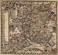
FA1999.58
(Norden 1595)
|
Map, Hamshire ie Hampshire, scale about 4 miles to 1 inch, by
John Norden, about 1595, engraved by Christopher Scwytzer,
modified and published by John Overton, The White Horse, without
Newgate, London, about 1670.
|
|
|
|
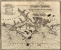
FA1999.59
(Heather 1797)
|
Chart, uncoloured engraving, Spithead, showing the coasts of
Hampshire and the Isle of Wight, by William Heather, engraved by
J Stephenson, published by Heather and Williams, the Navigation
Warehouse, 157 Leadenhall Street, London, 1797.
|
|
|
|
|
 |
top of page |
 |
FA1999.60 -- FA1999.160 |
|