
|
Catalogue of Map Collection
1998: Identity number order
 |
FA1965 -- FA1997 |
 |
bottom of page |
|
|
A thumbnail image on the right will enlarge, then return here.
The left link will take you to the Map Collection record page, and if (Map Group) is shown, will link to other Hampshire resources.
If you want to return to your place here, use your back browser button.
|
|
Identity number
(Map Group)
|
|
|
 |
|
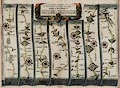
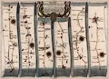
FA1998.1
(Ogilby 1675)

|
Strip map, hand coloured copper plate engraving, road map,
part of The Road From London to Weymouth, scale about 1 inch to 1
mile, from the road book, Britannia, published by John Ogilby,
White Friars, London, 1675.
|
|
|
|
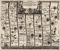
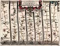
FA1998.2
(Ogilby 1675)
|
Strip map, uncoloured engraving, road map for part of The Road
From Oxford to Chichester, scale about 1 inch to 1 mile, from the
road book, Britannia, published by John Ogilby, White Friars,
London, 1675.
|
|
|
|
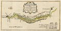
FA1998.3
(Gent Mag 1770s)
|
Map, the proposed Navigable Canal from Andover to Redbridge,
Hampshire, scale about 2 miles to 1 inch, engraved by J Lodge,
surveyed 1770, published in the Gentleman's Magazine, February
1772.
|
|
|
|
FA1998.4
|
Map, street maps, town plans for Winchester, Southampton and
the parish? of Petersfield, Hampshire, drawn by R Creighton,
published by J and C Walker, London, about 1830s.
|
|
|
|
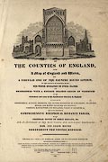
FA1998.5
(Walker 1837)
|
Title page, from a British Atlas of separate maps of counties
of England, by J and C Walker, 1837, published by Longman, Rees
and Co, Paternoster Row and by J and C Walker, Holborn, London,
1865.
|
|
|
|
FA1998.6
(Rowe 1816)
|
Title page, from a New British Atlas of county maps of
England, Ireland, Scotland and Wales, by Robert Rowe, 1816?
published by Henry G Teesdale and Co, 302 Holborn, London,
1830.
|
|
|
|
FA1998.7
(Pigot 1828)
|
Title page, from a British Atlas of county maps of England,
published by J Pigot and Co, Basing Lane, London and Fountain
Street, Manchester, 1828, edition about 1831.
|
|
|
|
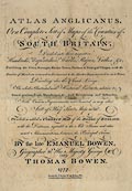
FA1998.8
(Bowen 1767)
|
Title page, from Atlas Anglicanus or the Counties of South
Britain, by the late Emanuel Bowen and by Thomas Bowen, 1767,
published London, 1777.
|
|
|
|
FA1998.9
(Moll 1724)
|
Title page, from an atlas of England and Wales, showing roads
and distances, published by Herman Moll, Devereux Court, Strand,
London, 1724.
|
|
|
|
FA1998.10
(Badeslade 1742)
|
Title page, from Chorographia Britannia, an atlas of Counties
of England and Wales, including harbours, roads etc, drawn by
Thomas Badeslade, engraved by William Henry Toms, Union Court,
Holborn, London, 1742.
|
|
|
|
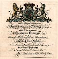
FA1998.11
|
Title page, the Complete and Universal Dictionary, which
included descriptions of the counties, etc of Great Britain, by
Rev James Barclay, published by Brightly and Childs, Bungay,
Suffolk, 1812.
|
|
|
|
FA1998.12
|
Title page, of the Pocket Atlas of the Counties of South
Britain by Carington Bowles, St Paul's Churchyard, London, late
18th century.
|
|
|
|
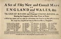
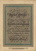
FA1998.13
(Wallis 1810)
|
Title page, of the New Pocket Edition of the English Counties,
or the Travellers Companion, published by James Wallis, Berwick
Street, Soho, London, 1810?
|
|
|
|
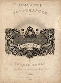
FA1998.14
(Moule 1836)
|
Title page, of the English Topographer, or the English
Counties Delineated, by Thomas Moule, published by George Virtue,
26 Ivy Lane, Paternoster Row, London, 1836.
|
|
|
|
FA1998.15
(Hutchinson 1748)
|
Title page, of Geographia Magnae Britanniae, with county maps
of England, Scotland and Wales, published 1748.
|
|
|
|
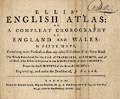
FA1998.16
(Ellis 1765)
|
Title page, of Ellis's English Atlas, in fifty county maps
etc, by J Ellis, London, 1765, published 1773.
|
|
|
|
FA1998.17
(Keer 1605)
|
Title page, from Theatre of the Empire of Great Britain,
England Wales Scotland and Ireland Described, by Peter Keer,
1605, scale about 16.5 miles to 1 inch, published by George
Humble, the White Horse, Popeshead Alley, London, 1627.
|
|
|
|
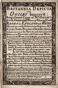
FA1998.18
(Bowen 1720)
|
Title page, to Britannia Depicta or Ogibly Improv'd, by John
Owen, Middle Temple, London, 4th edn with maps by Emanuel Bowen,
1720, published by Thomas Bowles, St Paul's Churchyard, London,
and J Bowles, London, 1726?
|
|
|
|
FA1998.19
(Luffman 1803)
|
Descriptive text, 4 pages, preface, index, etc of a geography
by John Luffman, published 1803.
|
|
|
|
FA1998.20
(Miller 1810)
|
Title page, for a New Miniature Atlas, of county maps with
roads, published by R Miller, 24 Old Fish Street, St Paul's,
London, 1810.
|
|
|
|
FA1998.21
(Ogilby 1675)
|
Descriptive text, pages from a road book, probably by John
Ogilby, about the road from London to Southampton, about
1670s.
|
|
|
|
FA1998.22
(Ogilby 1675)
|
Descriptive text, 25 pages, from a road book, Itinerarium
Angliae, or Book of the Roads, probably by John Ogilby,
describing all the roads mapped in England and Wales, about
1670s.
|
|
|
|
FA1998.23
(Cox 1738)
|
Descriptive text, pages torn from Magna Britannia et Hibernia,
Antiqua et Nova, about Hampshire, the Isle of Wight, and the
Channel Islands, published by Thomas Cox? London, 1720 or
1731.
|
|
|
|
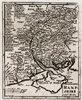
FA1998.23.1
(Morden 1708)
|
Map, uncoloured engraving, Hampshire, scale about 7 miles to 1
inch, by Robert Morden, perhaps before 1693 issued 1701, engraved
by Sutton Nicholls, included in Magna Britannia et Hibernia,
Antiqua et Nova, published by Thomas Cox? about 1720-31.
|
|
|
|
FA1998.24
(Camden 1610)
|
Descriptive text, pages from an atlas of county maps, about
Hantscire ie Hampshire from Britannia, by William Camden, 1586,
probably from the edition published 1610?
|
|
|
|
FA1998.25
(Gough 1780)
|
Descriptive text, about Hampshire, from British Topography,
published by Richard Gough, London, 1780.
|
|
|
|
FA1998.26
|
Map, Youth Hostels in England and Wales, scale about 16 miles
to 1 inch, published for the Youth Hostels Association, Welwyn
Garden City, Hertfordshire, by John Bartholomew and Son,
Edinburgh, Lothian, 1950s-60s.
|
|
|
|
FA1998.27
|
Map, General Map of the World, Mercator projection, published
by Edward Stanford, Long Acre, London, 1930s-40s?
|
|
|
|
FA1998.28
|
Map, National Parks and Conservation Areas proposed by the
National Parks Committee, England and Wales, and the Scottish
National Parks Survey Committee, scale about 20 miles to 1 inch,
published by the Ordnance Survey, 1946.
|
|
|
|
FA1998.29
|
Map, hand drawn, England, Wales and part of Scotland, drawn by
G Willis, 1919.
|
|
|
|
FA1998.30
|
Map, scale about 14 inches to 1 mile, copy, area on Fulham
Road, London, including the house and botanical garden of William
Curtis, surveyed 1822.
|
|
|
|
FA1998.31
(Unknown 1850s)
|
Map, Hampshire, and the Isle of Wight, scale about 1 to
470000, 7 miles to 1 inch, with vignette illustrations of towns,
published 1850s?
|
|
|
|
FA1998.32
(Dispatch 1863)
|
Map, new tourist map of the environs of Southampton, southern
Hampshire, Isle of Wight, part of Wiltshire, scale about 2 miles
to 1 inch, based on the Ordnance Survey, originally about 1863,
published by G W Bacon and Co, 127 Strand, London, late 19th
early 20th century?
|
|
|
|
FA1998.33
(Cruchley 1856)
|
Map, County of Hants, Hampshire, including the Isle of Wight,
from series Cruchley's Railway and Telegraphic Maps of England,
scale about 2.5 miles to 1 inch, published by G F Cruchley, 81
Fleet Street, London, late 19th century?
|
|
|
|
FA1998.34
|
Map, Environs of London, scale about 1 inch to 1 mile,
published by W H Smith and Son, 186 Strand, London, late 19th
century?
|
|
|
|
FA1998.35
|
Map, Fareham, Hampshire, sheet 316, scale 1 mile to 1 inch,
published by the Ordnance Survey, Southampton, Hampshire,
1898.
|
|
|
|
FA1998.36
|
Map, Ringwood area, Hampshire, sheet 314, scale 1 mile to 1
inch, published by the Ordnance Survey, Southampton, Hampshire,
1898.
|
|
|
|
FA1998.37
(Fullarton 1871)
|
Map, Hampshire, and Isle of Wight, scale about 4 miles to 1
inch, by John Bartholomew, published by W H Smith and Son, 186
Strand, London, late 19th century?
|
|
|
|
FA1998.38
|
Map, Basingstoke area, Hampshire, sheet 284, scale 1 mile to 1
inch, published by the Ordnance Survey, Southampton, Hampshire,
1904.
|
|
|
|
FA1998.39
(OS 1903)
|
Map, England and Wales sheets 19, 23, Hampshire, Isle of
Wight, Wiltshire, etc, scale 4 miles to 1 inch, published by the
Ordnance Survey, Southampton, Hampshire, 1903.
|
|
|
|
FA1998.40
|
Map, Isle of Wight, sheets 344, 345 and parts of 330, 331,
scale 1 mile to 1 inch, published by the Ordnance Survey,
Southampton, Hampshire, 1904.
|
|
|
|
FA1998.41
|
Map, Southampton, Hampshire, sheet 38, scale 2 miles to 1
inch, published by the Ordnance Survey, Southampton, Hampshire,
1906.
|
|
|
|
FA1998.42
|
Map, cycling and motoring map, Portsmouth to the East, scale
about 2 miles to 1 inch, by John Bartholomew and Co, Edinburgh,
Lothian, published by G W Bacon and Co, 127 Strand, London, early
20th century.
|
|
|
|
FA1998.43
(Dispatch 1863)
|
Map, county map and guide for tourists and cyclists,
Hampshire, with the Isle of Wight, scale about 3 miles to 1 inch,
1863, published by G W Bacon and Co, 127 Strand, London, about
1890s.
|
|
|
|
FA1998.44
|
Map, Cyclist's Map of the County of Hampshire, with Isle of
Wight, scale about 4 miles to 1 inch, published by George Philip
and Son, London and Liverpool, Merseyside, about 1920s.
|
|
|
|
FA1998.45
(Dispatch 1863)
|
Map, and guide, Hampshire for Cyclists and Tourists, with the
Isle of Wight, scale about 3 miles to 1 inch, 1863, published by
G W Bacon and Co, 127 Strand, London, about 1890s.
|
|
|
|
FA1998.46
(Dispatch 1863)
|
Map, county guide map for cyclists and tourists, Hampshire,
cover but without the map, published by G W Bacon, 127 Strand,
London, about 1900s.
|
|
|
|
FA1998.47
|
Map, large scale map guide for cyclists and tourists, Isle of
Wight, published by G W Bacon, 127 Strand, London, about
1900s.
|
|
|
|
FA1998.48
|
Map, England and Wales, on card sections in a waterproof slip
case, scale about 1 to 260000, about 4 miles to 1 inch, published
by Edward J Burrow and Co, Cheltenham, Gloucestershire, 3rd edn,
1930s?
|
|
|
|
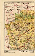
FA1998.50
(Burrow 1930s)
|
Map, and gazetteer, The RAC County Road Map and Gazetteer No
14, Hampshire with the Isle of Wight, scale about 1 to 260000,
about 4 miles to 1 inch, published by Edward J Burrow and Co,
Cheltenham, Gloucestershire, 3rd edn, 1930s?
|
|
|
|
FA1998.51
|
Map, County Road Map of Hampshire, scale about 2.5 miles to 1
inch, by Alexander Gross, published by the Geographer's Map Co,
24 Gray's Inn Road, London, 1920s-30s?
|
|
|
|
FA1998.52
|
Map, Hampshire and West Sussex, scale about 2 miles to 1 inch,
published by Geographia, 167 Fleet Street, London, 1940s-50s?
|
|
|
|
FA1998.53
|
Map, Ministry of Transport Road Map sheet 38, Southampton,
Portsmouth, Etc, scale 2 miles to 1 inch, published by the
Ordnance Survey, Southampton, Hampshire, 1923.
|
|
|
|
FA1998.54
|
Map, Isle of Wight, scale about 2 miles to 1 inch, published
by Geographia, 167 Fleet Street, London, 1940s-50s?
|
|
|
|
FA1998.55
|
Book, with map, The Delineator, of the Isle of Wight, by James
Clarke, published by W W Yelf, Newport, Medina, Isle of Wight,
1826.
|
|
|
|
FA1998.55.1
|
Map, Isle of Wight, scale about 1 miles to 1 inch, included in
The Delineator, by James Clarke, published by W W Yelf, Newport,
Medina, Isle of Wight, 1826.
|
|
|
|
FA1998.56
|
Map, Isle of Wight, scale about 2 miles to 1 inch, published
by Geographia, 167 Fleet Street, London, 1940s-50s?
|
|
|
|
FA1998.57
(OS 1950s Seventh Series)
|
Map, One inch map Seventh Series, sheet 168, Winchester,
Hampshire, scale 1 mile to 1 inch, published by the Ordnance
Survey, Chessington, Surrey, 1959.
|
|
|
|
FA1998.58
|
Map, weatherproof, printed on cotton, in slipcase with
booklet, Isle of Wight, scale 1 mile to 1 inch nominal, with
inset street maps of Ryde, Ventnor and Newport, published by G W
Bacon and Co, 127 Strand, London, late 19th century.
|
|
|
|
FA1998.59
|
Map, Daily Mail General War Map of Europe, published by George
Philip and Son, London Geographical Institute, Fleet Street,
London, World War I, 1914-18.
|
|
|
|
FA1998.60
|
Map, Daily Mail War Map of the Balkan Peninsula, published by
George Philip and Son, London Geographical Institute, Fleet
Street, London, World War I, 1914-18.
|
|
|
|
FA1998.61
|
Map, British Railways, scale about 30 miles to 1 inch,
published by the British Transport Commission, London, 1961.
|
|
|
|
FA1998.62
|
Map, road map, Southampton, Portsmouth and Isle of Wight, ie
parts of Dorset, Wiltshire, Hampshire, West Sussex, scale 2 miles
to 1 inch, published by Ordnance Survey, Southampton, Hampshire,
1914.
|
|
|
|
FA1998.63
(OS 1930s Fifth Edition)
|
Map, One Inch Map Fifth edition, sheet 123, Winchester and
Basingstoke, Hampshire, scale 1 mile to 1 inch, published by the
Ordnance Survey, Southampton, Hampshire, 1932.
|
|
|
|
FA1998.64
|
Map, One Inch Map 3rd edition, Large Sheet Series, sheet 124,
Winchester, Hampshire, scale 1 mile to 1 inch, published by the
Ordnance Survey, Southampton, Hampshire, 1912.
|
|
|
|
FA1998.65
(Smith 1804)
|
Map, New Map of Hampshire, and Isle of Wight, scale about 3
miles to 1 inch, published by Charles Smith, 172 Strand, London,
1804, edition of 1840s?
|
|
|
|
FA1998.66
|
Map, England and Wales, scale about 17 miles to 1 inch,
published by William Darton and Son, Holborn Hill, London, about
1840?
|
|
|
|
FA1998.67
|
Map, Twenty Miles round Petersfield, cycling and touring map,
scale about 2 miles to 1 inch, by Gall and Inglis, Edinburgh,
Lothian, published by J Richardson, High Street, Petersfield,
Hampshire, about 1900s?
|
|
|
|
FA1998.68
|
Map, Hampshire area, scale 2 miles to 1 inch, published by
George Richmond, Ashbury House, 128 Nechells Park Road,
Halesowen, Birmingham, West Midlands, early 20th century.
|
|
|
|
FA1998.69
(Lloyd 1573)
|
Map, copper plate engraving, Angliae Regni, Kingdom of
England, with Wales, scale about 24 miles to 1 inch, authored by
Humphrey Lloyd, Denbigh, Clwyd, drawn and engraved by Abraham
Ortelius, Netherlands, 1573.
|
|
|
|
FA1998.70
|
Bus map, in timetable booklet, buses and trains in the
Winchester area, Hampshire, digital mapping by Pindar, Princes
Risborough, Buckinghamshire, published by Hampshire County
Council, 1997.
|
|
|
|
FA1998.71
|
Map, bus map, routes of Hants and Dorset Motor Services Ltd,
and Wilts and Dorset Motor Services Ltd, Hampshire, Isle of
Wight, Dorset and Wiltshire, scale about 1919.
|
|
|
|
FA1998.72
|
Map, Eastern Counties S, scale 1 to 253440, 4 miles to 1 inch,
published by the Ordnance Survey, Southampton, Hampshire,
1929.
|
|
|
|
FA1998.73
|
Map, England and Wales sheets 20, 24, London, Middlesex,
Surrey, East Sussex, Kent, etc, scale 4 miles to 1 inch,
published by the Ordnance Survey, Southampton, Hampshire,
1905.
|
|
|
|
FA1998.74
|
Map, Environs of Cambridge, Cambridgeshire, scale about 4
miles to 1 inch, by John Bartholomew, published by W H Smith and
Son, 186 Strand, London, late 19th century?
|
|
|
|
FA1998.75
|
Map, Reading, Berkshire, sheet 268, scale 1 mile to 1 inch,
published by the Ordnance Survey, Southampton, Hampshire,
1904.
|
|
|
|
FA1998.76
(Morden 1695)
|
Map, uncoloured engraving, Hamp Shire, ie Hampshire, scale
about 4 miles to 1 inch, by Robert Morden, published in an
edition of Britannia by William Camden, 1695.
|
|
|
|
FA1998.77
|
Map, Country round London, tourist map, scale 1 mile to 1
inch, published by the Ordnance Survey, Southampton, Hampshire,
1921.
|
|
|
|
FA1998.78
|
Map, Suffolk, scale about 4 miles to 1 inch, by John
Bartholomew, Edinburgh, Lothian, published by W H Smith and Son,
186 Strand, London, 1900s-10s?
|
|
|
|
FA1998.79
|
Map, Berks and Wilts, ie Berkshire and Wiltshire, for tourists
and cyclists, scale about 2 miles to 1 inch, published by John
Bartholomew and Co, Edinburgh Geographical Institute, Park Road,
Edinburgh, Lothian, early 20th century.
|
|
|
|
FA1998.80
|
Map, Surrey, for tourists and cyclists, scale about 2 miles to
1 inch, published by John Bartholomew and Co, Edinburgh
Geographical Institute, Park Road, Edinburgh, Lothian, 1948.
|
|
|
|
FA1998.81
|
Map, road map, England and Wales sheet 3, SE England, scale
about miles 3 to 1 inch, published by George Philip and Son, The
London Geographical Institute, 32 Fleet Street, London,
1910s-20s?
|
|
|
|
FA1998.82
|
Railway map, in several sheets at different scales, about 10
miles to 1 inch etc, for the London and North Western Railway,
LNWR, and Caledonian Railway, CR, England, Scotland and Wales,
late 19th century.
|
|
|
|
FA1998.83
|
Railway map, scale about 14 miles to 1 inch, published for the
Great Western Railway, by Emery Walker Ltd, about 1920s.
|
|
|
|
FA1998.84
|
Map, road map, South West England, Shell Map sheet 1, scale
about miles 4 to 1 inch, published for Shell, oil company, by
George Philip and Son, London, 1968.
|
|
|
|
FA1998.85
|
Map, road map, Southern and Eastern England, Shell Map sheet
2, scale about miles 4 to 1 inch, published for Shell, oil
company, by George Philip and Son, London, 1968.
|
|
|
|
FA1998.86
|
Map, road map, South West England and Wales, scale about 5
miles to 1 inch, sheet 3 in series published for Esso Petroleum
Co, by George Philip Printers, London, 1960s?
|
|
|
|
FA1998.87
|
Map, road map, London, scale about 1 mile to 1 inch, sheet 1
in series published for Esso Petroleum Co, by Edward Stanford
Ltd, London, 1950s?
|
|
|
|
FA1998.88
(Dispatch 1863)
|
Map, Hampshire, North Division, Cassell's County Maps series,
scale about 3 miles to 1 inch, by Edward Weller, published by
Cassell, Petter and Galpin, La Belle Sauvage Yard, Ludgate Hill,
London, 1860s.
|
|
|
|
FA1998.89
|
Map, combined index map of parishes in Hampshire, scale 4
miles to 1 inch, for 1 inch, 6inch and 25inch County Series maps
from the Ordnance Survey, published 1916.
|
|
|
|
FA1998.90
|
Map, England and Wales sheet 18, south central England, scale
about 2 miles to 1 inch, by Alexander Gross, published by
Geographia, 55 Fleet Street, London, mid 20th century.
|
|
|
|
FA1998.91
(OS 1810s Old Series)
|
Map, uncoloured engraving, One inch map Old Series, sheet 10,
Isle of Wight and part of Hampshire, scale 1 mile to 1 inch,
published under direction of LtCol Mudge, by the Ordnance Survey,
1810.
|
|
|
|
FA1998.92
(OS 1810s Old Series)
|
Map, One Inch Map 1st edition, Old Series 1 inch map, sheet
12, Basingstoke, part of Hampshire, scale 1 mile to 1 inch,
published under the direction of Col Mudge by the Ordnance
Survey, 1817.
|
|
|
|
FA1998.93
(Bowen 1720)
|
Book binding, half calf speckled leather binding. with marbled
and papers, of road book of strip maps, Ogilby's Roads, ie
Britannia Depicta or Ogilby Improv'd, by John Owen, Middle
Temple, London, published by Thomas Bowles, St Paul's Churchyard,
London, 1720, rebound lat 19th century.
|
|
|
|
FA1998.94
|
Leaflet, advertising small scale maps, England and Wales, for
tourists etc, published by the Ordnance Survey, Southampton,
Hampshire, 1928.
|
|
|
|
FA1998.95
|
Leaflet, advertising small scale maps, Scotland, for tourists
etc, published by the Ordnance Survey, Southampton, Hampshire,
1928.
|
|
|
|
FA1998.96
|
Leaflet, no.1 Maps for Tourists, Notes on the Choice of a
Scale, published by the Ordnance Survey, Southampton, Hampshire,
1927.
|
|
|
|
FA1998.97
|
Leaflet, no.2 Maps for Char-a-banc Tours, published by the
Ordnance Survey, Southampton, Hampshire, 1927.
|
|
|
|
FA1998.98
|
Leaflet, no.3 The New Ordnance Survey Map of Scotland,
published by the Ordnance Survey, Southampton, Hampshire,
1926.
|
|
|
|
FA1998.99
|
Leaflet, no.4 The Ordnance Survey and Archaeology, published
by the Ordnance Survey, Southampton, Hampshire, about 1927.
|
|
|
|
FA1998.100
|
Leaflet, no.4 The New Physical Maps of Great Britain,
published by the Ordnance Survey, Southampton, Hampshire,
1928.
|
|
|
|
FA1998.118
|
Leaflet, about the six inch Ordnance Survey map of Great
Britain, published by the Ordnance Survey, Southampton,
Hampshire, about 1920s?
|
|
|
|
FA1998.119
|
Booklet, Ordnance Survey Maps of the United Kingdom,
description of scales, characteristics, etc, by Col C F Close,
published for the Ordnance Survey, Southampton, Hampshire, by
HMSO, London, 1913.
|
|
|
|
FA1998.120
|
Print, engraving, Characteristic Sheet, for six inch and one
inch maps published for the Ordnance Survey, Southampton,
Hampshire, 1910s-20s?
|
|
|
|
FA1998.121
|
Print, engraving, examples for lettering on six inch maps
published for the Ordnance Survey, Southampton, Hampshire,
1910s-20s?
|
|
|
|
FA1998.122
|
Map, Ancient Britain, South Sheet, scale about 10 miles to 1
inch, published by the Ordnance Survey, Chessington, Surrey,
1951.
|
|
|
|
FA1998.123
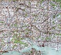
|
Map, photographic satellite image, south coast of Hampshire
and the Isle of Wight, scale about 1 miles to 1 inch, made about
1997.
|
|
|
|
FA1998.124
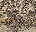
(Milne 1791)
|
Map, hand coloured engraving folded in a slip case, Hampshire,
and Isle of Wight, scale about 1 mile to 1 inch, surveyed by
Thomas Milne, published by William Faden, Charing Cross, London,
1791.
|
|
|
|
FA1998.125
(Moule 1836)
|
Map, uncoloured engraving, Environs of Portsmouth, scale about
2 miles to 1 inch, Portsmouth area, Hampshire, probably engraved
by I Dower and published by Thomas Moule, 1840s.
|
|
|
|
FA1998.126
(Hall 1833)
|
Map, hand coloured engraving, Hampshire or Southampton, and
the Isle of Wight, scale about 1 to 520000, about 8 miles to 1
inch, engraved by Sidney Hall, published by Chapman and Hall, 186
Strand, London, 1831.
|
|
|
|
FA1998.127
(Wallis 1810)
|
Map, hand coloured engraving, Hampshire, and the Isle of
Wight, scale about 14 miles to 1 inch, published by James Wallis,
77 Berwick Street, Soho, London, about 1810.
|
|
|
|
FA1998.128
(Tymms 1832)
|
Map, uncoloured engraving, Hampshire, and the Isle of Wight,
scale about 18.5 miles to 1 inch, from the Family Topographer by
Samuel Tymms, published by J B Nichols and Son, 25 Parliament
Street, London, 1832.
|
|
|
|
FA1998.129
(Wallis 1812)
|
Map, hand coloured engraving, Hampshire, and the Isle of
Wight, scale about 9 miles to 1 inch, engraved by James Wallis,
published by S A Oddy, London, 1812.
|
|
|
|
FA1998.130
(Wilkes 1806)
|
Map, hand coloured engraving, Hampshire, and the Isle of
Wight, scale about 11 miles to 1 inch, published by J Wilkes,
London, 1806.
|
|
|
|
FA1998.131
(Cole and Roper 1810)
|
Map, hand coloured engraving, Hampshire, and the Isle of
Wight, scale about 9 miles to 1 inch, taken from the Beauties of
England and Wales, drawn by G Cole, engraved by J Roper,
published by Vernor and Hood, Poultry, London, 1805.
|
|
|
|
FA1998.132
(Moule 1836)
|
Map, uncoloured engraving, Hampshire, and the Isle of Wight,
scale about 8 miles to 1 inch, engraved by I Dower, published in
Moules English Counties, by Thomas Moule, about 1836.
|
|
|
|
FA1998.133
(Moule 1836)
|
Map, uncoloured engraving, Hampshire, and the Isle of Wight,
scale about 8 miles to 1 inch, engraved by I Dower, published in
Moules English Counties, by Thomas Moule, about 1836.
|
|
|
|
FA1998.134
(Moule 1836)
|
Map, uncoloured engraving, Hampshire, and the Isle of Wight,
scale about 8 miles to 1 inch, about 1836, engraved by I Dower,
published in Moules English Counties, by Thomas Moule, about
1850s-60s.
|
|
|
|
FA1998.135
(Dugdale 1835)
|
Map, hand coloured engraving, Hampshire, with the Isle of
Wight, scale about 8 miles to 1 inch, drawn by J Archer,
Pentonville, London, published in England and Wales Delineated by
T Dugdale, about 1835, published 1840s?
|
|
|
|
FA1998.136
(Dugdale 1835)
|
Map, uncoloured engraving, Hampshire, with the Isle of Wight,
scale about 9 miles to 1 inch, published in England and Wales
Delineated by Thomas Dugdale, about 1835, published 1840s?
|
|
|
|
FA1998.137
(Dugdale 1835)
|
Map, uncoloured engraving, Hampshire, with the Isle of Wight,
scale about 9 miles to 1 inch, published in England and Wales
Delineated by Thomas Dugdale, about 1835, published 1840s?
|
|
|
|
FA1998.138
(Walker 1837)
|
Map, hand coloured engraving, Hampshire and Isle of Wight,
scale about 4 miles to 1 inch, by J and C Walker, 1837, publisher
by Longman, Hurst, Rees, Orme and Co, Paternoster Row, London,
1841.
|
|
|
|
FA1998.139
(Rowe 1816)
|
Map, hand coloured engraving, Hampshire, with the Isle of
Wight, scale about 4 miles to 1 inch, by Robert Rowe, 1816,
published by Henry G Teesdale and Co, 302 Holborn, London, about
1830.
|
|
|
|
FA1998.140
|
Map, hand coloured engraving, Kelly's Map of the Isle of
Wight, scale about 1.5 miles to 1 inch, published by Kelly's
Directories, 182-184 High Holborn, London, late 19th century.
|
|
|
|
FA1998.141
|
Map, coloured engraving, The Isle of Wight, scale about 1.5
miles to 1 inch, by Edward Weller, published by James Briddon,
Ventnor, Isle of Wight, 1880s-90s.
|
|
|
|
FA1998.142
|
Map, engraving, Isle of Wight, scale about 5 miles to 1 inch,
from a book, published early 19th century?
|
|
|
|
FA1998.143
|
Map, Hayling Island Street Map, Havant, Hampshire, scale about
3 inches to 1 mile, published by E and R Gridley, Copnor Press,
Elm Grove, Hayling Island, Havant, Hampshire, 1940s-50s.
|
|
|
|
FA1998.144
|
Map, engraving, Isle of Wight, scale about 9 miles to 1 inch,
published in a New Pocket Edition of the English Counties by
James Wallis, Berwick Street, Soho, London, 1810.
|
|
|
|
FA1998.145
|
Map, engraving, Isle of Wight, about 1 to 180000, about 3
miles to 1 inch, drawn and engraved by J Archer, Pentonville,
London, published in England and Wales Delineated by Thomas
Dugdale, London, 1848.
|
|
|
|
FA1998.146
|
Map, engraving, Isle of Wight, scale about 3 miles to 1 inch,
published mid 19th century?
|
|
|
|
FA1998.147
|
Map, engraving, Isle of Wight, scale about 2 miles to 1 inch,
published mid 19th century?
|
|
|
|
FA1998.148
|
Map, engraving, Map of the Town of Basingstoke, Hampshire,
scale about 40 inches to 1 mile, published by Robert A Davis,
1851.
|
|
|
|
FA1998.149
(Blaeu 1645)
|
Map, hand coloured engraving, Hampshire or the County of
Southampton, or Hantshire, scale about 3.5 miles to 1 inch,
published in Theatrum Orbis Terrarum, by William J Blaeu,
Amsterdam, Netherlands, 1645.
|
|
|
|
FA1998.150
|
Map, drawing, an estate near Tunworth and Mapledurwell and Up
Nately, Hampshire, perhaps late 18th century?
|
|
|
|
FA1998.151
|
Map, pen and ink drawing estate plan, Dummer, Dummer with
Kempshot, Hampshire, late 17th century?
|
|
|
|
FA1998.152
|
Map, ms additions to OS relief map, water and wind mills in
the NE of Hampshire, 1960s-70s.
|
|
|
|
FA1998.153
|
Map, hand coloured engraving, County Series 6 inch map, sheet
Hants 12, Hampshire, engraved under the direction of Col Mudge,
published by the Ordnance Survey, Tower of London, London, 1817,
reprinted from an electrotype, updated, 1870.
|
|
|
|
FA1998.154
|
Map, postcard, Isle of Wight, scale about 4 miles to 1 inch,
published by Southampton, Isle of Wight and South of England
Steam Packet Co, mid 20th century?
|
|
|
|
FA1998.155
|
Map, hand coloured engraving, Isle of Wight, scale about 1
mile to 1 inch, published by J and C Walker, 9 Castle Street,
Holborn, London, late 19th century?
|
|
|
|
FA1998.156
|
Map, engraving, Bird's Eye View of the Isle of Wight, scale
about 1 mile to 1 inch, by Arthur W Fowles, marine artist,
engraved by Lewis Becker, London, printed by James Briddon,
Esplanade, Ventnor, Isle of Wight, 1870s-80s?
|
|
|
|
FA1998.157
(Butters 1803)
|
Map, hand coloured engraving, Hampshire, with the Isle of
Wight, scale about 14 miles to 1 inch, published in an Atlas of
England by R Butters, 22 Fetter Lane, Fleet Street, London,
1803.
|
|
|
|
FA1998.158
|
Map, uncoloured engraving? Map of Hayling Island, Havant,
Hampshire, scale about 3 miles to 1 inch, by Edward Mogg, 14
Great Russell Street, Covent Garden, London, 1850s?
|
|
|
|
FA1998.159
(Pinnock 1833)
|
Map, white on black print, Hampshire, with the Isle of Wight,
scale about 10 miles to 1 inch, by S Hall, Bury Street,
Bloomsbury, published, probably in Pinnock's Guide to Knowledge,
by W Edwards, Ave Maria Lane, London, about 1833.
|
|
|
|
FA1998.160
|
Map, photocopy, basement of Chawton House, Chawton, Hampshire,
nominal scale 1 to 96, 1970s-80s?
|
|
|
|
FA1998.161
(Smith 1804)
|
Map, New Map of Hampshire, and the Isle of Wight, scale about
3 miles to 1 inch, published by Charles Smith, 172 Strand,
London, 1804.
|
|
|
|
FA1998.162
|
Map, and advertisements, Roads to Best Traders, southern
central England, scale about 9 miles to 1 inch, published early
20th century.
|
|
|
|
FA1998.163
(Greenwood 1826)
|
Map, 6 uncoloured steel plate engravings, Map of the County of
Southampton, ie Hampshire, with the Isle of Wight, scale about 1
miles to 1 inch, by C and J Greenwood, published by Greenwood,
Pringle and Co, Regent Street, Pall Mall, London, 1826.
|
|
|
|
FA1998.164
(Greenwood 1826)
|
Map, uncoloured steel plate engraving, Map of the County of
Southampton, ie Hampshire, with the Isle of Wight, scale about 1
miles to 1 inch, by C and J Greenwood and Nathaniel L Kentish,
published by Greenwood, Pringle and Co, Regent Street, Pall Mall,
London, 1826.
|
|
|
|
FA1998.165
(Greenwood 1829)
|
Map, hand coloured engraving, Map of the County of
Southampton, ie Hampshire, with the Isle of Wight, scale about 3
miles to 1 inch, by C and J Greenwood, engraved by J and J Neele,
Strand, London, published by Greenwood and Co, 13 Regent Street,
London, 1829.
|
|
|
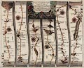
|
FA1998.166
(Ogilby 1675)
|
Strip map, hand coloured copper plate engraving, road map,
part of The Road From London to Chichester, scale about 1 inch to
1 mile, from the road book, Britannia, published by John Ogilby,
White Friars, London, 1675.
|
|
|
|
FA1998.167
(Ogilby 1675)
|
Descriptive text, pages from a road book, about The Road from
London to Chichester, probably by John Ogilby, about 1675.
|
|
|
|
FA1998.168
(Bowen 1720)
|
Strip map, road map, two sided coloured engraving taken from a
road book, Britannia Depicta or Ogilby Improv'd, text by John
Owen, Middle Temple, London, maps by Emmanuel Bowen, published
Thomas Bowles, St Paul's Churchyard, London, 1720 onwards.
|
|
|
|
FA1998.169
|
Map, colour printed, Hampshire Business Map, and directory of
industrial estates etc, scale about 5 miles to 1 inch, by Arka
Cartographics, published by Hampshire County Council, 1997.
|
|
|
|
FA1998.170
|
Map, colour printed leaflet and sketch map about a rapid
transit rail system for Fareham, Gosport and Portsmouth,
Hampshire, published by Hampshire County Council, 1995.
|
|
|
|
FA1998.171
|
Map, colour photocopy of an engraving, Map of Hampshire,
shewing the turnpike roads, scale as copied about 1 to 350000,
about 6 miles to 1 inch, published 1852.
|
|
|
|
FA1998.172
(Ogilby 1675)
|
Strip map, hand coloured copper plate engraving, road map,
part of The Road from London to Barnstable, Devon, scale about 1
inch to 1 mile, from the road book, Britannia, published by John
Ogilby, White Friars, London, 1675.
|
|
|
|
FA1998.173
(Ogilby 1675)
|
Strip map, hand coloured copper plate engraving, road map,
part of The Road from Oxford to Salisbury, Wiltshire, scale about
1 inch to 1 mile, from the road book, Britannia, published by
John Ogilby, White Friars, London, 1675.
|
|
|
|
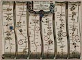
FA1998.174
(Ogilby 1675)
|
Strip map, hand coloured copper plate engraving, road map,
part of The Road from London to the Lands End, scale about 1 inch
to 1 mile, from the road book, Britannia, published by John
Ogilby, White Friars, London, 1675.
|
|
|
|
FA1998.175
(Kitchin 1751 large)
|
Map, hand coloured engraving, New Improved Map of Hampshire,
with the Isle of Wight, scale about 3 miles to 1 inch, by Thomas
Kitchin, about 1751, published about 1790.
|
|
|
|
FA1998.176
|
Map, engraving, Map of the Town of Basingstoke, Hampshire,
scale about 40 inches to 1 mile, published by Robert A Davis,
1851.
|
|
|
|
FA1998.177
(Badeslade 1742)
|
Map, hand coloured engraving, England and Wales, scale about
76 miles to 1 inch, by Thomas Badeslade, engraved and published
by William Henry Toms, 1742.
|
|
|
|
FA1998.178
(Badeslade 1742)
|
Map, hand coloured engraving, chart of the Sea Coast of
England and Wales, scale about 70 miles to 1 inch, by Thomas
Badeslade, engraved and published by William Henry Toms,
1742.
|
|
|
|
FA1998.179
(Badeslade 1742)
|
Map, hand coloured engraving, Great Roads from London to all
parts of South Britain, scale about 70 miles to 1 inch, by Thomas
Badeslade, engraved and published by William Henry Toms,
1742.
|
|
|
|
FA1998.180
(Badeslade 1742)
|
Map, hand coloured engraving, Cross Roads from One Great Town
to another through England and Wales, scale about 71 miles to 1
inch, by Thomas Badeslade, engraved and published by William
Henry Toms, 1742.
|
|
|
|
FA1998.181
|
Timetable, with map and guide, Sunday Rider 1998, selected
Sunday bus services in Hampshire, issued by Hampshire County
Council, Winchester, Hampshire, 1998.
|
|
|
|
FA1998.182
|
Map, hand coloured? engraving, Map of Portsmouth, Hampshire,
scale 6 inches to 1 miles, published by G W Bacon and Co, 127
Strand, London, late 19th century?
|
|
|
|
FA1998.183
(Dawson 1832)
|
Map, copy of hand coloured lithograph, Lymington, Hampshire,
nominal scale 2 inches to 1 mile, indicating proposed changes in
municipal boundaries, by Lt Robert K Dawson RE, 1830s, copied
1937.
|
|
|
|
FA1998.184
|
Map, hand drawn copy, Ichnographia Oppidi Aultonia, Plan of
Alton, Hampshire, scale about 45 inches to 1 mile, originally
drawn by IS, 1666.
|
|
|
|
FA1998.185
|
Map, printed copy, Ichnographia Oppidi Aultonis, Plan of
Alton, Hampshire, scale about 20 inches to 1 mile, originally
drawn by IS, 1666.
|
|
|
|
FA1998.186
|
Map, colour lithograph? Plan of the New Forest, Hampshire,
scale about 1 mile to 1 inch, by A E Taylor, published by Pratts,
1930.
|
|
|
|
FA1998.187
|
Map, uncoloured lithograph, Plan of Southampton Docks, scale
about 16 inches to 1 mile, for the London and South Western
Railway, LSWR, made by Gilbert S Szlumper, Docks and Marine
Manager, Southampton, Hampshire, 1913.
|
|
|
|
FA1998.189
|
Atlas, The Southampton Atlas, Maps and Plans of Old
Southampton, folder of reproduction maps, town plans of
Southampton, Hampshire 1560 to 1905, edited by W H Rogers,
published by Southampton Record Society, Hampshire, 1907.
|
|
|
|
FA1998.190
|
Map, uncoloured lithograph, Map of the New Forest, Hampshire,
scale about 1 miles to 1 inch, published by Gutch and Cox,
booksellers etc, 150 High Street, Southampton, Hampshire,
1890s-1900s?
|
|
|
|
FA1998.191
|
Map, street map with index, Barnett's Fareham and Gosport,
Hampshire, scale about 4 inches to 1 mile, published by G I
Barnett and Son, 1980s-90s.
|
|
|
|
FA1998.192
|
Map, Bacon's Large Scale Plan of Southampton, Hampshire, scale
about 8 inches to 1 mile, published by G W Bacon and Co, 127
Strand, London, early 20th century.
|
|
|
|
FA1998.193
|
Map, Plan of Portsmouth, Hampshire, scale about 6 inches to 1
mile, published by Kelly's Directories, 186 Strand, London,
perhaps 1930s?
|
|
|
|
FA1998.194
|
Leaflet, with street map of town trails, Fareham Town Walks,
Fareham, Hampshire, published by The Fareham Society, 6 High
Street, Fareham Hampshire, 1980s.
|
|
|
|
FA1998.195
|
Map, Map of South Hampshire, scale about 2 inches to 1 mile,
published for Fox and Son, estate agents, southern Hampshire, by
Town and Country Publications, Worthing, West Sussex, mid 20th
century.
|
|
|
|
FA1998.196
|
Map, Gosport including Lee-on-the-Solent and Stokes Bay,
Gosport, Hampshire, scale about 4 inches to 1 mile, published by
G W May, Wigmore Street, London, about 1965-67.
|
|
|
|
FA1998.197
|
Map, ink drawing on linen, Borough of Christchurch, Dorset,
showing water supplies and hydrants for fire fighting, World War
II period, 1939-45.
|
|
|
|
FA1998.198
|
Map, Map of South-East Hampshire, scale about 2 inches to 1
mile, published for Fox and Son, estate agents, southern
Hampshire, by Town and Country Publications, Worthing, West
Sussex, mid 20th century.
|
|
|
|
FA1998.199
|
Map, Borough of Gosport Official Street Plan, Hampshire, scale
about 3 inches to 1 mile, published for Gosport BC by Edward J
Burrow and Co, Streatham Hill, London, about 1981?
|
|
|
|
FA1998.200
|
Map, Burrow's Pointer Guide Map of Gosport, Hampshire, scale
about 3 inches to 1 mile, by Geographia, published by Edward J
Burrow and Co, Cheltenham, Gloucestershire, about 1965?
|
|
|
|
FA1998.203
(Dugdale 1835)
|
Map, uncoloured engraving, Hampshire, with the Isle of Wight,
scale about 8 miles to 1 inch, drawn by J Archer, Pentonville,
London, published in England and Wales Delineated by T Dugdale,
about 1835, published 1840s?
|
|
|
|
FA1998.204
(Dugdale 1835)
|
Map, uncoloured engraving, Hampshire, with the Isle of Wight,
scale about 8 miles to 1 inch, drawn by J Archer, Pentonville,
London, published in England and Wales Delineated by T Dugdale,
about 1835, published 1850s-60s?
|
|
|
|
FA1998.205
(Dugdale 1835)
|
Map, uncoloured engraving, Hampshire, with the Isle of Wight,
scale about 8 miles to 1 inch, drawn by J Archer, Pentonville,
London, published in England and Wales Delineated by T Dugdale,
about 1835, published 1860s-70s?
|
|
|
|
FA1998.206
(Badeslade 1742)
|
Map, Map of Hampshire South West from London, scale about 12
miles to 1 inch, Hampshire and the Isle of Wight, drawn by Thomas
Badeslade, published in Chorographia Britanniae, by William Henry
Toms, Union Court, Holborn, London, 1742.
|
|
|
|
FA1998.207
(Bowen 1720)
|
Strip map, road map, two sided sheet taken from a road book,
Britannia Depicta or Ogilby Improv'd, text by John Owen, Middle
Temple, London, maps by Emmanuel Bowen, published Thomas Bowles,
St Paul's Churchyard, London, 1720 onwards.
|
|
|
|
FA1998.208
(Bowen 1720)
|
Strip map, road map from a road book, Britannia Depicta or
Ogilby Improv'd, text by John Owen, Middle Temple, London, maps
by Emmanuel Bowen, published Thomas Bowles, St Paul's Churchyard,
London, 1720 onwards.
|
|
|
|
FA1998.209
(Rocque 1746)
|
Map, uncoloured engraving, Hamp-Shire ie Hampshire, scale
about 8 miles to 1 inch, by John Rocque, 1746, published in the
Small British Atlas, by John Rocque, Strand, London, 1753.
|
|
|
|
FA1998.210
(Dugdale 1835)
|
Map, hand coloured engraving, Hampshire, with the Isle of
Wight, scale about 9 miles to 1 inch, published in England and
Wales Delineated by Thomas Dugdale, about 1835, published
1840s?
|
|
|
|
FA1998.211
(Raynbird 1860?)
|
Map, hand coloured engraving, Geological Map of Hampshire,
scale about 7 miles to 1 inch, by W and H Raynbird, about
1860.
|
|
|
|
FA1998.213
(Pigot 1828)
|
Map, steel plate engraving, scale about 6.5 miles to 1 inch,
Hampshire, and the Isle of Wight, published by Pigot and Co, 17
Basing Lane, London and 18 Fountain Street, Manchester, 1828,
edition about 1840.
|
|
|
|
FA1998.214
(Cary 1787)
|
Map, Hampshire, hand coloured engraving, Hampshire and Isle of
Wight, scale about 6 miles to 1 inch, drawn by John Cary, Strand,
London, 1787, published in Cary's New and Correct English Atlas,
1793.
|
|
|
|
FA1998.215
(Duncan 1833)
|
Map, uncoloured engraving, New Map of the County of Hampshire,
and the Isle of Wight, scale about 4 miles to 1 inch, published
by J Duncan, Paternoster Row, London, about 1833.
|
|
|
|
FA1998.216
(Lewis 1831)
|
Map, Southampton, ie Hampshire, scale about 7 miles to 1 inch,
drawn by R Creighton, 1831, engraved by J and C Walker, for the
Topographical Dictionary published by Lewis, London? edition of
1840s?
|
|
|
|
FA1998.217
|
Road atlas, Newnes Motorists Touring Maps and Gazetteer, road
maps of the British Isles, scale about 16 miles to 1 inch, by
John Bartholomew and Son, Edinburgh, Lothian, published by George
Newnes, Tower House, Southampton Street, London, 1962.
|
|
|
|
FA1998.218
(Ogilby 1675)
|
Reproduction atlas, road maps, small reproduction edition of
Britannia volume 1, by John Ogilby, 1675, published by Alexander
Duckham and Co, commemorating their 40th birthday, 1939.
|
|
|
|
FA1998.219
(Faden 1796)
|
Map, hand coloured engraving, Hampshire or the County of
Southampton, scale about 2.5 miles to 1 inch, published by
William Faden, Charing Cross, London, 1796.
|
|
|
|
FA1998.220
(Dispatch 1863)
|
Map, colour printed engraving, 2 sheets, Hampshire, with the
Isle of Wight, scale about 3 miles to 1 inch, about 1863,
published 1885.
|
|
|
|
FA1998.221
|
Map, colour printed, Archaeological Features of Hampshire and
the Wiltshire Border, scale 4 miles to 1 inch, published by
Ordnance Survey, Southampton, Hampshire, 1914.
|
|
|
|
FA1998.222
(Cassell, Petter and Galpin 1860s)
|
Map, engraving, Map of Great Britain showing all the Railways,
... 3 of 4 sheets, scale about 9 miles to 1 inch, published by
Cassell, Petter and Galpin, La Belle Sauvage Yard, Ludgate Hill,
London, 1860s?
|
|
|
|
FA1998.223
|
Map, engraving, Great Eastern Railway, 2 sheets, scale about 2
miles to 1 inch, published by Cassell, Petter and Galpin, La
Belle Sauvage Yard, Ludgate Hill, London, 1890s?
|
|
|
|
FA1998.224
|
Map, engraving, Great Northern Railway, 3 sheets, scale about
2 miles to 1 inch, published by Cassell, Petter and Galpin, La
Belle Sauvage Yard, Ludgate Hill, London, 1890s?
|
|
|
|
FA1998.225
|
Map, engraving, Great Western Railway, 3 of ? sheets, scale
about 2 miles to 1 inch, published by Cassell, Petter and Galpin,
La Belle Sauvage Yard, Ludgate Hill, London, 1890s?
|
|
|
|
FA1998.226
(Cassell, Petter and Galpin 1860s)
|
Map, engraving, London and South Western Railway, scale about
2 miles to 1 inch, published by Cassell, Petter and Galpin, La
Belle Sauvage Yard, Ludgate Hill, London, 1860s?
|
|
|
|
FA1998.227
|
Map, engraving, North Western Railway, 2 sheets, scale about 2
miles to 1 inch, published by Cassell, Petter and Galpin, La
Belle Sauvage Yard, Ludgate Hill, London, 1890s?
|
|
|
|
FA1998.228
|
Map, engraving, South Coast Railway, scale about 2 miles to 1
inch, published by Cassell, Petter and Galpin, La Belle Sauvage
Yard, Ludgate Hill, London, 1890s?
|
|
|
|
FA1998.229
|
Map, engraving, South Eastern Railway, scale about 2 miles to
1 inch, published by Cassell, Petter and Galpin, La Belle Sauvage
Yard, Ludgate Hill, London, 1890s?
|
|
|
|
FA1998.230
|
Map, One inch map Popular Edition, 4th edition, sheet 115, SE
London and Sevenoaks, scale 1 mile to 1 inch, published by
Ordnance Survey, 1920-25.
|
|
|
|
FA1998.231.1
|
Estate plan, map, Earl of Normanton's Estates, Hampshire,
auctioned by J Carter Jonas and Sons, 8 Suffolk Street, London,
1919.
|
|
|
|
FA1998.231.2
|
Estate plan, map, Earl of Normanton's Estates, Hampshire,
auctioned by J Carter Jonas and Sons, 8 Suffolk Street, London,
1919.
|
|
|
|
FA1998.232
|
Map, One Inch Map 3rd edition, Large Sheet Series, sheet 144,
Bournemouth and Swanage, Dorset, scale 1 mile to 1 inch,
published by the Ordnance Survey, Southampton, Hampshire,
1908-12.
|
|
|
|
FA1998.233
|
Map, Quarter Inch Map, North Midlands and Lincolnshire, sheet
6 at scale 4 miles to 1 inch, published by Ordnance Survey,
Chessington, Surrey, 1946.
|
|
|
|
FA1998.234
|
Map, Quarter Inch Map, East Anglia, sheet 9 at scale 4 miles
to 1 inch, published by Ordnance Survey, Chessington, Surrey,
1946.
|
|
|
|
FA1998.235
(OS 1950s Seventh Series)
|
Map, One inch map Seventh Series, sheet 181, Chichester, West
Sussex, scale 1 mile to 1 inch, published by Ordnance Survey,
Southampton, Hampshire, 1960.
|
|
|
|
FA1998.236
|
Map, sheet 41/64, Lasham area, Hampshire, scale about 2.5
inches to 1 mile, published by Ordnance Survey, about 1949.
|
|
|
|
FA1998.237
|
Map, sheet 41/72, Petersfield area, Hampshire, scale about 2.5
inches to 1 mile, published by Ordnance Survey, about 1948.
|
|
|
|
FA1998.238
|
Map, sheet 41/63, Ropley area, Hampshire, scale about 2.5
inches to 1 mile, published by Ordnance Survey, about 1949.
|
|
|
|
FA1998.239
|
Map, sheet 41/62, Westmeon area, Hampshire, scale about 2.5
inches to 1 mile, published by Ordnance Survey, about 1949.
|
|
|
|
FA1998.240
|
Map, sheet SU83, Bramshott and Liphook area, Hampshire, scale
about 2.5 inches to 1 mile, published by Ordnance Survey,
Chessington, Surrey, about 1964.
|
|
|
|
FA1998.241
|
Map, sheet SU61, Hambledon area, Hampshire, scale about 2.5
inches to 1 mile, published by Ordnance Survey, Chessington,
Surrey, about 1963.
|
|
|
|
FA1998.242
|
Map, sheet SU71, Compton area, West Sussex, with parts of
Hampshire, scale about 2.5 inches to 1 mile, published by
Ordnance Survey, Chessington, Surrey, about 1958.
|
|
|
|
FA1998.243
(OS 1810s Old Series)
|
Map, One inch map Old Series, sheet 12, Basingstoke, including
part of Hampshire, scale 1 inch to 1 mile, published by the
Ordnance Survey, London, 1817, later print from an
electrotype.
|
|
|
|
FA1998.244
(OS 1810s Old Series)
|
Map, One Inch Map 1st edition, Old Series 1 inch map, sheet
12, Basingstoke, including part of Hampshire, scale 1 inch to 1
mile, published by the Ordnance Survey, London, 1817.
|
|
|
|
FA1998.245
(OS 1810s Old Series)
|
Map, One inch map Old series, sheet 15, Salisbury, including
parts of Dorset, Wiltshire, and Hampshire, scale 1 inch to 1
mile, published by the Ordnance Survey, London, 1811.
|
|
|
|
FA1998.246
|
Map, One Inch Map, The Lake District, scale 1 inch to 1 mile,
published by John Bartholomew and Son, Edinburgh, Lothian,
1939.
|
|
|
|
FA1998.247
|
Map, Tourist's Map of England and Wales, southern section,
scale 10 miles to 1 inch, published by John Bartholomew and Co,
the Edinburgh Geographical Institute, Edinburgh, Lothian,
1900s-10s?
|
|
|
|
FA1998.248
|
Bus map, and railway and ferry map, Public Transport Map of
Hampshire, mapping by M Knowler, FWT Cartography, London,
published by Hampshire County Council, 1994.
|
|
|
|
FA1998.249
|
Map, One Inch Tourist Map, Lorn and Lochaber, scale 1 inch to
1 mile, published by the Ordnance Survey, Chessington, Surrey,
1959-61.
|
|
|
|
FA1998.250
|
Map, One Inch Tourist Map, Loch Lomond and The Trossachs,
scale 1 inch to 1 mile, published by the Ordnance Survey,
Southampton, Hampshire, 1967.
|
|
|
|
FA1998.251
|
Map, Tourist Map of the New Forest, Hampshire, scale 1 inch to
1 mile, published by the Ordnance Survey, Chessington, Surrey,
1966.
|
|
|
|
FA1998.252
|
Map, War Office Series, London District NE Section, scale 2
miles to 1 inch, reduced from the Ordnance Survey, published by
John Bartholomew and Co, Edinburgh Geographical Institute,
Edinburgh, Lothian, 1910s-20s?
|
|
|
|
FA1998.253
|
Map, new reduced survey, Salisbury Plain District, scale 2
inches to 1 mile, published by John Bartholomew and Son, The
Geographical Institute, Duncan Street, Edinburgh, Lothian,
1910s-20s?
|
|
|
|
FA1998.261
|
Map, new map of the Isle of Wight, scale about 1.3 miles to 1
inch, published by Geographia, 55 Fleet Street, London, mid 20th
century.
|
|
|
|
FA1998.262
|
Map, Clear Road Map, no 2, South West England, scale 10 miles
to 1 inch, published by Geographia, 114 Fleet Street, London,
1960s?
|
|
|
|
FA1998.263
|
Map, street, bus, tram, rail and underground map, Plan of
London, scale about 3 inches to 1 mile, by Alexander Gross,
published by Geographia, 55 Fleet Street, London, 1920s-30s?
|
|
|
|
FA1998.264
|
Map, Large Scale Road Map, South Devonshire, scale about 2
miles to 1 inch, published by Geographia, 167 Fleet Street,
London, 1940s-50s?
|
|
|
|
FA1998.265
|
Map, road and rail map, Isle of Wight, scale about 1 to 84000,
about 1 miles to 1 inch, by Alexander Gross, published by
Geographia, 55 Fleet Street, London, 1950s-60s?
|
|
|
|
FA1998.266
|
Map, road and rail map, Environs of Salisbury, scale about 1
to 84000, about 1 miles to 1 inch, by Alexander Gross, published
by Geographia, 55 Fleet Street, London, 1950s-60s?
|
|
|
|
FA1998.267
|
Map, road map, Hampshire and Berkshire, scale about 2 miles to
1 inch, by Alexander Gross, published by Geographia, 33 Strand,
London, 1910s.
|
|
|
|
FA1998.268
|
Map, road map, Southern Counties, scale about 4 miles to 1
inch, by Alexander Gross, published by Geographia, 55 Fleet
Street, London, 1910s-20s.
|
|
|
|
FA1998.269
|
Map, road map, sheet 4, Wales and Midlands, scale about 5
miles to 1 inch, by Edward Stanford, London, published by Esso
Petroleum Co, 1960s-70s.
|
|
|
|
FA1998.270
|
Map, road map, sheet 5, Northern England, scale about 5 miles
to 1 inch, by Edward Stanford, London, published by Esso
Petroleum Co, 1960s-70s.
|
|
|
|
FA1998.271
|
Map, road map, sheet 5, Northern England, scale about 5 miles
to 1 inch, by Edward Stanford, London, published by Esso
Petroleum Co, 1960s-70s.
|
|
|
|
FA1998.272
|
Map, Central Southern England, scale 3 miles to 1 inch,
published by W and A K Johnston and G W Bacon and Co, Edinburgh,
Lothian and London, 1960s?
|
|
|
|
FA1998.273
|
Map, historic map of the Battle of Normandy, France, World War
II, 1944, scale about 3 miles to 1 inch, published by Michelin
Tyre Co, Stoke on Trent, Staffordshire, 1947.
|
|
|
|
FA1998.274
|
Map, Ministry of Transport Road Map, Oxford and Swindon, scale
2 miles to 1 inch, published by Ordnance Survey, Southampton,
Hampshire, 1923.
|
|
|
|
FA1998.275
|
Itinerary, strip map, AA route description, Beckenham to
Findochty, scale roughly 1 mile to 1 inch? published by the
Automobile Association, Fanum House, London Road, Maidstone,
Kent, 1950s-70s?
|
|
|
|
FA1998.276
|
Itinerary, strip map, AA route description, Prescot to
Blackpool, scale roughly 1 mile to 1 inch? published by the
Automobile Association, Fanum House, London Road, Maidstone,
Kent, 1950s-70s?
|
|
|
|
FA1998.277
|
Map, Cyclists' Map, 100 Miles Round London, scale 6 miles to 1
inch, published by George Philip and Son, The London Geographical
Institute, 32 Fleet Street, London, 1900s-10s?
|
|
|
|
FA1998.278
|
Map, Waistcoat Pocket Map, road map of Exeter District, Devon,
scale about 5 miles to 1 inch, published by G W Bacon and Co,
Norwich Street, Fetter Lane, London, 1900s-10s.
|
|
|
|
FA1998.279
|
Map, Readyfold Map, section 1, South East England, scale 3
miles to 1 inch, published by W and A K Johnston, Edina Works,
Edinburgh, Lothian, and London, about 1946?
|
|
|
|
FA1998.280
|
Map, Motoring and Touring Map, section SH, parts of Highland,
Grampian and Tayside, scale about 3 miles to 1 inch, published
1920s?
|
|
|
|
FA1998.281
|
Map, Throughway Map, London, scale about 1 inches to 1 mile,
published for the Automobile Association by John Bartholomew and
Son, Edinburgh, Lothian, 1940s-50s?
|
|
|
|
FA1998.282
|
Map, reduced Ordnance street and railway map, London, scale
about 5 inches to 1 mile, published by Cruchley, 81 Fleet Street,
London, about 1875.
|
|
|
|
FA1998.283
|
Map, engraving, Isle of Wight, scale about 1 inch to 1 mile,
published by James Wyld, 457 Strand, London, 1877.
|
|
|
|
FA1998.284
|
Guide book, leaflet with road and street maps, Winchester Days
to Treasure, designed by Celsius, Winchester, published by
Winchester City Council, Winchester, Hampshire, 1998.
|
|
|
|
FA1998.285
|
Catalogue, of Maps and Books for Tourists, published by Edward
Stanford, 12-14 Long Acre, London, 1909.
|
|
|
|
FA1998.286
|
Map, New York Island, etc, and an account of the Siege of New
York, scale about 1.5 miles to 1 inch, published by William
Faden, Charing Cross, London, 1776.
|
|
|
|
FA1998.287
|
Map, hand coloured engraving, New Map of France, scale about
26 miles to 1 inch, published by John Andrews, Piccadilly,
London, 1793.
|
|
|
|
FA1998.288
|
Map, hand coloured engraving, France, scale about 15 miles to
1 inch, by Sidney Hall, published by Longman, Rees, Orme, Brown
and Green, Paternoster Row, London, about 1830s.
|
|
|
|
FA1998.289
(Knight 1799)
|
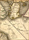
Chart, uncoloured engraving, map of part of the Coast of
Hampshire from Portsmouth to Southampton Water, and the opposing
part of the Isle of Wight, scale about 2 inches to 1 mile, by
Captain John Knight RN, published by William Faden, Charing
Cross, London, 1799.
|
|
|
|
FA1998.290
(Greenwood 1829)
|
Map, hand coloured engraving, Map of the County of
Southampton, ie Hampshire, with the Isle of Wight, scale about 3
miles to 1 inch, by C and J Greenwood, engraved by J and J Neele,
Strand, London, published by Greenwood and Co, 13 Regent Street,
London, 1829.
|
|
|
|
FA1998.291
|
Map, ecclesiastical parishes in Hampshire, with date of
commencement of parish registers, scale about 5 miles to 1 inch,
published by Institute of Heraldic and Genealogical Studies,
Northgate, Canterbury, Kent, 1964.
|
|
|
|
FA1998.292
|
Railway map, hand coloured lithograph, deposited plan for the
Hampshire and Wiltshire Junction Railway, scale 4 inches to 1
mile, engineers, Francis Giles, London and Edwin Tregelles,
Neath, Glamorgan, 1836.
|
|
|
|
FA1998.293
|
Map, England, and Wales showing counties, hand drawn and
coloured by Grace E White at Mrs Dawson's School, Marden Ash,
Ongar, Essex, 1900.
|
|
|
|
FA1998.294
|
Itinerary, strip map description, on fanfold computer printout
paper, from Epsom, Surrey to St Leonard's Park, Horsham, West
Sussex, provided by the Routes Service of the AA, Automobile
Association, 1990.
|
|
|
|
FA1998.295
|
Map, chart of the Harbour of St Malo and Road of Rance,
France, scale about 1.5 miles to 1 inch, published by William
Faden, Charing Cross, London, 1793.
|
|
|
|
FA1998.296
|
Map, Andrew's Military Map of the Seat of War in the
Netherlands, scale about 11 miles to 1 inch, published by John
Andrews, Piccadilly, London, 1793.
|
|
|
|
FA1998.297
|
Chart, the Owers to Christchurch, scale about 1.5 miles to 1
inch, published by The Admiralty, London, 1885.
|
|
|
|
FA1998.298
(OS 1950s Seventh Series)
|
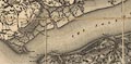
Map, One inch map Seventh Series, sheet 180, The Solent,
Hampshire, and Isle of Wight, scale 1 mile to 1 inch, published
by Ordnance Survey, Southampton, Hampshire, 1960.
|
|
|
|
FA1998.299
|
Chart, Spithead, Fleet Review, by Elizabeth II, to commemorate
the silver jubilee of her accession, The Solent off Gosport and
Portsmouth, Hampshire, scale about 3.2 miles to 1 inch, published
by the Admiralty, Taunton, Somerset, 1977.
|
|
|
|
FA1998.300
(Bowles 1782)
|
Strip map, hand coloured road map from a road book, Bowles's
Post Chaise Companion, by Carington Bowles, St Paul's Churchyard,
London, 1782.
|
|
|
|
|
 |
top of page |
 |
FA1999.5 -- FA1999.59 |
|