
|
Catalogue of Map Collection
FA1999.60 -- FA1999.160:
Identity number order
 |
FA1999.5 -- FA1999.59 |
 |
bottom of page |
|
|
A thumbnail image on the right will enlarge, then return here.
The left link will take you to the Map Collection record page, and if (Map Group) is shown, will link to other Hampshire resources.
If you want to return to your place here, use your back browser button.
|
|
Identity number
(Map Group)
|
|
|
 |
|
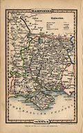
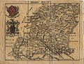
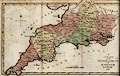
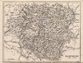
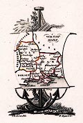
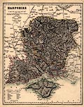
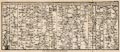
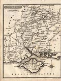
FA1999.60.1
(Pigot 1835)

|
Map, hand coloured engraving, Hampshire, scale about 13 miles
to 1 inch, from A Pocket Topography of England, by Pigot and Co,
London, 1835, edition of 1841.
|
|
|
|
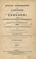
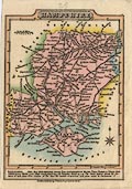
FA1999.60.2
(Pigot 1835)
|
Title page, and descriptive text, for Hampshire from A Pocket
Topography of England, by Pigot and Co, London and Manchester,
1835, edition of 1841.
|
|
|
|
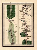
FA1999.61
(Pine 1739)
|
Chart, engraved map plates V and VI, Progress of the Armada,
drawn by H Gravelot, engraved and published by John Pine, London,
1739.
|

|
|
|
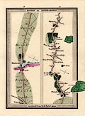
FA1999.62
(Pine 1739)
|
Chart, engraved plates VII and VIII, Progress of the Armada,
drawn by H Gravelot, engraved and published by John Pine, London,
1739.
|
|
|
|
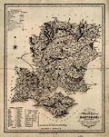
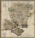
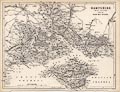
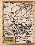
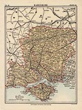
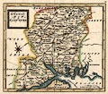
FA1999.63
(Duncan 1833)
|
Map, hand coloured engraving, New Map of the County of
Hampshire, scale about 4 miles to 1 inch, by J Duncan,
Paternoster Row, London, 1833?
|
|
|
|
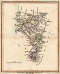
FA1999.64
(Pigot 1828)
|
Map, hand coloured steel plate engraving, Hampshire, and the
Isle of Wight, scale about 6.5 miles to 1 inch, published by
Pigot and Co, 17 Basing Lane, London and 18 Fountain Street,
Manchester, 1828, edition about 1840.
|
|
|
|
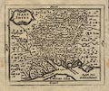
FA1999.65
(Dawson 1832)
|
Map, hand coloured lithograph, Hampshire, scale about 3 miles
to 1 inch, showing the proposed parliamentary divisions, made for
the Reform Bill 1832, by Lieut Robert K Dawson RE, 1831, copied
1937?
|
|
|
|
FA1999.66
(Simpson 1746)
|
Map, Hamp Shire ie Hampshire, scale about 8 miles to 1 inch,
by Samuel Simpson copied from Moll, published in the Agreeable
Historian or Compleat English Traveller, London, 1746.
|
|
|
|
FA1999.67
|
Map, Portsmouth, showing parliamentary boundary 1832, and
proposed boundary 1868, scale 1 inch to 1 mile, by Henry James
RE, zincographed by the Ordnance Survey Office, Southampton,
Hampshire, 1868.
|
|
|
|
FA1999.68
|
Map, two miles to one inch road map sheet no.18, scale 2 miles
to 1 inch, by Geographia, 55 Fleet Street, London, 1940s-50s.
|
|
|
|
FA1999.69
(Bacon 1906)
|
Road book, The Portsmouth Road, by Charles G Harper, published
by Anthony Treherne and Co, 12 York Buildings, Adelphi, London,
1906.
|
|
|
|
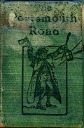
FA1999.69.1
(Bacon 1906)
|
Strip map, road map, uncoloured engraving, The Portsmouth
Road, scale about 4 miles to 1 inch, by G W Bacon and Co, 127
Strand London, 1906.
|
|
|
|
FA1999.70
(Philip 1920s)
|
Map, Cyclist's Map of the County of Hampshire, with Isle of
Wight, scale about 4 miles to 1 inch, published by George Philip
and Son, London and Liverpool, Merseyside, about 1920s.
|
|
|
|
FA1999.71
(Wyld 1839)
|
Guide book, The London and Southampton Railway Guide,
published by James Wyld, Charing Cross East, London, 1839.
|
|
|
|
FA1999.71.1
(Wyld 1839)
|
Railway map, London and Southampton Railway, scale about 4
miles to 1 inch, by James Wyld, Charing Cross East, London,
1839.
|
|
|
|
FA1999.71.2
|
Street map, Southampton, Hampshire, by James Wyld, Charing
Cross East, London, 1839.
|
|
|
|
FA1999.71.3
|
Street map, Portsmouth, Hampshire, by James Wyld, Charing
Cross East, London, 1839.
|
|
|
|
FA1999.71.4
|
Street map, Isle of Wight, by James Wyld, Charing Cross East,
London, 1839.
|
|
|
|
FA1999.71.5
|
Street map, English Channel, by James Wyld, Charing Cross
East, London, 1839.
|
|
|
|
FA1999.72
(Tunnicliff 1791)
|
Book, Topographical Survey of the Counties of Hants, Wilts,
Dorset, Somerset, Devon, and Cornwall, by William Tunnicliff,
Salisbury, Wiltshire, 1791.
|
|
|
|
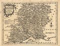
FA1999.72.1
(Tunnicliff 1791)
|
Map, hand coloured engraving, New Map of the Western Circuit
of England, scale about 15 miles to 1 inch, by William
Tunnicliff, Salisbury, Wiltshire, 1791.
|
|
|
|
FA1999.72.2
(Tunnicliff 1791)
|
Map, hand coloured engraving, New Map of Hampshire, scale
about 3 miles to 1 inch, by William Tunnicliff, Salisbury,
Wiltshire, 1791.
|
|
|
|
FA1999.72.3
|
Map, hand coloured engraving, New Map of Wiltshire, scale
about 3 miles to 1 inch, by William Tunnicliff, Salisbury,
Wiltshire, 1791.
|
|
|
|
FA1999.72.4
|
Map, hand coloured engraving, New Map of Dorsetshire, scale
about 3 miles to 1 inch, by William Tunnicliff, Salisbury,
Wiltshire, 1791.
|
|
|
|
FA1999.72.5
|
Map, hand coloured engraving, New Map of Somersetshire, scale
about 3 miles to 1 inch, by William Tunnicliff, Salisbury,
Wiltshire, 1791.
|
|
|
|
FA1999.72.6
|
Map, hand coloured engraving, New Map of Devonshire, scale
about 3 miles to 1 inch, by William Tunnicliff, Salisbury,
Wiltshire, 1791.
|
|
|
|
FA1999.72.7
|
Map, hand coloured engraving, New Map of Cornwall, scale about
3 miles to 1 inch, by William Tunnicliff, Salisbury, Wiltshire,
1791.
|
|
|
|
FA1999.73
(Cox 1738)
|
Book, bound text pages and maps from Magna Britannia et
Hibernia, Antiqua et Nova, about Hampshire, the Isle of Wight,
and the Channel Islands, published by Thomas Cox? London,
1720?
|
|
|
|
FA1999.73.1
(Morden 1708)
|
Map, engraving, Hampshire, scale about 7 miles to 1 inch, by
Robert Morden, perhaps before 1693 issued 1701, engraved by
Sutton Nicholls, included in Magna Britannia et Hibernia, Antiqua
et Nova, published by Thomas Cox? about 1720.
|
|
|
|
FA1999.73.2
|
Map, engraving, Smaller Islands in the British Ocean, by
Robert Morden, included in Magna Britannia et Hibernia, Antiqua
et Nova, published by Thomas Cox? about 1720.
|
|
|
|
FA1999.74
(Walker 1837)
|
Map, Hampshire and Isle of Wight, scale about 4 miles to 1
inch, by J and C Walker, 1837, published by Longman, Hurst, Rees,
Orme and Co, Paternoster Row, London, 1845.
|
|
|
|
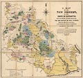
FA1999.75
(Richardson 1789)
|
Map, Map of the New Forest, Hampshire, scale about 1.5 inches
to 1 mile, showing portions enclosed for Navy Timber, by
Richardson, King, Abraham and William Driver, 1789, corrected by
Thomas Couchman, 1849, corrected to 1867.
|
|
|
|
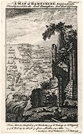
FA1999.77.1
(Bickham 1750)
|
Map, uncoloured engraving, Hampshire, perspective view from
the east, by George Bickham, London, 1750.
|
|
|
|
FA1999.77.2
(Bickham 1750)
|
Descriptive text, 3 engraved text pages, pp.57-59, from the
British Monarchy, accompanying a map of Hampshire by George
Bickham, London, 1750.
|
|
|
|
FA1999.78
(Faden 1796)
|
Map, hand coloured engraving, Hampshire or the County of
Southampton, with Isle of Wight, scale about 2.5 miles to 1 inch,
by William Faden, 5 Charing Cross, London, 1796.
|
|
|
|
FA1999.79
(Smith 1804)
|
Map, New Map of Hampshire, and Isle of Wight, scale about 3
miles to 1 inch, published by Charles Smith, 172 Strand, London,
1804, 2nd edition, 1808.
|
|
|
|
FA1999.80
(Wyld 1846)
|
Map, hand coloured engraving, Hampshire or the County of
Southampton, with Isle of Wight, scale about 2.5 miles to 1 inch,
published by J Wyld, Charing Cross East, London, 1846.
|
|
|
|
FA1999.81
(Cary 1809b)
|
Map, hand coloured copper plate engraving, A New Map of
Hampshire, with Isle of Wight, scale about 2.5 miles to 1 inch,
by John Cary, published by G and J Cary, 86 St James's Street,
London, 1809, edition published 1828.
|
|
|
|
FA1999.82
|
Map, hand coloured engraving, Grand Southern Tour of England,
by M Phillips, engraved and published by Johnathon Hebner, 15
Great Maddox Street, Hanover Square, London, early 19th
century?
|
|
|
|
FA1999.83
(Greenwood 1826)
|
Map, hand coloured steel plate engraving, Map of the County of
Southampton, ie Hampshire, with the Isle of Wight, scale about 1
miles to 1 inch, by C and J Greenwood and Nathaniel L Kentish,
published by Greenwood, Pringle and Co, Regent Street, Pall Mall,
London, 1826.
|
|
|
|
FA1999.84
(Bell 1834)
|
Map, uncoloured engraving, Hampshire or Southampton, and Isle
of Wight, scale about 8 miles to 1 inch, perhaps by James Bell,
1834, engraved by Gray and Son, published in a General Atlas by
Archibald Fullarton and Co, Glasgow, Strathclyde, 1839.
|
|
|
|
FA1999.85
(Moule 1836)
|
Map, hand coloured engraving, Hampshire, and the Isle of
Wight, scale about 8 miles to 1 inch, about 1836, engraved by I
Dower, published in Moules English Counties, by Thomas Moule,
about 1850.
|
|
|
|
FA1999.86
(Lewis 1831)
|
Map, Southampton ie Hampshire, scale about 7 miles to 1 inch,
drawn by R Creighton, 1831, engraved by J and C Walker, for the
Topographical Dictionary published by Lewis, London? about
1830s-40s?
|
|
|
|
FA1999.87
(Cundee 1815)
|
Map, uncoloured engraving, Hampshire, scale about 6 miles to 1
inch, included in the New British Traveller, by Dugdale, 1819,
engraved by Neele, Strand, London, published by J and J Cundee,
Albion Press, London, 1815.
|
|
|
|
FA1999.88
(Keer 1605)
|
Map, uncoloured engraving, Southampton, ie Hampshire, scale
about 16.5 miles to 1 inch, by Pieter van den Keere, 1605,
published 1620.
|
|
|
|
FA1999.89
(Badeslade 1742)
|
Map, Map of Hampshire South West from London, scale about 12
miles to 1 inch, Hampshire and the Isle of Wight, drawn by Thomas
Badeslade, published in Chorographia Britanniae, by William Henry
Toms, Union Court, Holborn, London, 1742.
|
|
|
|
FA1999.90
(Blome 1681)
|
Map, uncoloured engraving, Mapp of Hantshire ie Hampshire,
scale about 7.5 miles to 1 inch, by Richard Blome, 1681, engraved
by Richard Palmer; edition published in England Exactly
Described, by Thomas Taylor, Golden Lion, Fleet Street, 1715.
|
|
|
|
FA1999.91
(Cruchley 1856)
|
Map, coloured engraving, Cruchley's Railway and Telegraphic
Map of Hampshire, with the Isle of Wight, scale about 2.5 miles
to 1 inch, published by G F Cruchley, 81 Fleet Street, London,
1850s-60s.
|
|
|
|
FA1999.92
(Cary 1789)
|
Map, uncoloured engraving, Hampshire, scale about 3 miles to 1
inch, engraved by John Cary, 1789? published by John Stockdale,
Piccadilly, London, 1805.
|
|
|
|
FA1999.93
(Blome 1673)
|
Map, hand coloured etching, A Mapp of Hantshire, ie Hampshire
with the Isle of Wight, scale about 4 miles to 1 inch, by Richard
Blome, about 1673.
|
|
|
|
FA1999.94
|
Map, Pictorial Reference Map of Hayling Island, Havant,
Hampshire, scale about 4 inches to 1 mile, Coasby and Co, 3-5 St
James' Road, Southsea, Portsmouth, Hampshire, 1931.
|
|
|
|
FA1999.95
(Cary 1790)
|
Map, coloured engraving, Hampshire, with the Isle of Wight,
scale about 14 miles to 1 inch, by John Cary, 181 Strand, London,
1790? published 1806.
|
|
|
|
FA1999.96
|
Map, uncoloured engraving, Winchester, Hampshire, scale about
6 inches to 1 mile, drawn by G Cole, engraved by J Roper,
published in the Beauties of England and Wales by Vernor and
Hood, 1805.
|
|
|
|
FA1999.97
(Dower 1838)
|
Map, uncoloured engraving, Hampshire or Southampton, with the
Isle of Wight, scale about 4 miles to 1 inch, by I Dower,
Pentonville, London, for Mudie's History of Hampshire, published
for James Robbins, College Street, Winchester, by D E Gilmour,
High Street, Winchester, Hampshire, 1838?
|
|
|
|
FA1999.98
(Bowen 1720)
|
Strip map, road map from a road book, Britannia Depicta or
Ogilby Improv'd, text by John Owen, Middle Temple, London, maps
by Emmanuel Bowen, published Thomas Bowles, St Paul's Churchyard,
London, 1720 onwards.
|
|
|
|
FA1999.99
|
Descriptive text, 2 pages from a gazetteer, about Portsmouth
and Winchester, Hantshire ie Hampshire, published late 18th
century?
|
|
|
|
FA1999.100
|
Street map, uncoloured engraving, Southampton, Hampshire,
scale about 4 inches to 1 mile, by Tallis? about 1851.
|
|
|
|
FA1999.101
(Hogg 1784)
|
Map, New Map of Hampshire, scale about 10.5 miles to 1 inch,
Hampshire and the Isle of Wight, published by Alexander Hogg, at
the Kings Arms, 16 Paternoster Row, London, about 1784.
|
|
|
|
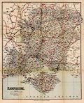
FA1999.102
(Rocque 1746)
|
Map, uncoloured engraving, Hamp-Shire ie Hampshire, scale
about 6 miles to 1 inch, by John Rocque, published by Thomas
Read, 1746.
|
|
|
|
FA1999.103
|
Map, hand coloured engraving, Southampton, of the New Forest
area, Hampshire, scale about 5 miles to 1 inch, about 1810?
|
|
|
|
FA1999.104.1
(Hughes 1860s-70s)
|
Map, uncoloured engraving, Hampshire, North Division, scale
about 5 miles to 1 inch, by William Hughes, London,
1860s-70s.
|
|
|
|
FA1999.104.2
(Hughes 1860s-70s)
|
Map, uncoloured engraving, Hampshire, South Division, and the
Isle of Wight, scale about 5 miles to 1 inch, by William Hughes,
London, 1860s-70s.
|
|
|
|
FA1999.106
(Moule 1836)
|
Book, The English Counties Delineated, or a Topographical
Description of England, vol.1, by Thomas Moule, about 1836,
edition published by George Virtue, 26 Ivy Lane, Paternoster Row,
London, 1839.
|
|
|
|
FA1999.106.1
|
Print, engraving, Canterbury Cathedral, Canterbury, Kent,
drawn by T M Baynes, engraved by S Lacey, in The English Counties
Delineated by Thomas Moule, published by George Virtue, 26 Ivy
Lane, Paternoster Row, London, 1839.
|
|
|
|
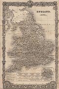
FA1999.106.2
(Moule 1836)
|
Map, uncoloured engraving, England, scale about 35 miles to 1
inch, in The English Counties Delineated by Thomas Moule,
published by George Virtue, 26 Ivy Lane, Paternoster Row, London,
1839.
|
|
|
|
FA1999.106.3
|
Map, uncoloured engraving, Inland Navigation of England and
Wales, scale about 23 miles to 1 inch, in The English Counties
Delineated by Thomas Moule, published by George Virtue, 26 Ivy
Lane, Paternoster Row, London, 1839.
|
|
|
|
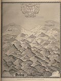
FA1999.106.4
(Moule 1836)
|
Map, engraving, Comparative View of some of the Principal
Hills in Great Britain, drawn by E I Smith, engraved by I Dower,
in The English Counties Delineated by Thomas Moule, published by
George Virtue, 26 Ivy Lane, Paternoster Row, London, 1839.
|
|
|
|
FA1999.106.5
|
Map, uncoloured engraving, Essex, engraved by W Schmollinger,
in The English Counties Delineated by Thomas Moule, published by
George Virtue, 26 Ivy Lane, Paternoster Row, London, 1839.
|
|
|
|
FA1999.106.6
|
Map, uncoloured engraving, Hertfordshire, engraved by W
Schmollinger, in The English Counties Delineated by Thomas Moule,
published by George Virtue, 26 Ivy Lane, Paternoster Row, London,
1839.
|
|
|
|
FA1999.106.7
|
Map, uncoloured engraving, Kent, engraved by W Schmollinger,
in The English Counties Delineated by Thomas Moule, published by
George Virtue, 26 Ivy Lane, Paternoster Row, London, 1839.
|
|
|
|
FA1999.106.8
|
Map, uncoloured engraving, Isle of Thanet, Kent, engraved by I
Dower, in The English Counties Delineated by Thomas Moule,
published by George Virtue, 26 Ivy Lane, Paternoster Row, London,
1839.
|
|
|
|
FA1999.106.9
|
Map, uncoloured engraving, Middlesex, engraved by W
Schmollinger, in The English Counties Delineated by Thomas Moule,
published by George Virtue, 26 Ivy Lane, Paternoster Row, London,
1839.
|
|
|
|
FA1999.106.10
|
Map, uncoloured engraving, Improved Map of London for 1833,
engraved by W Schmollinger, in The English Counties Delineated by
Thomas Moule, published by George Virtue, 26 Ivy Lane,
Paternoster Row, London, 1839.
|
|
|
|
FA1999.106.11
|
Map, uncoloured engraving, Environs of London, engraved by W
Schmollinger, in The English Counties Delineated by Thomas Moule,
published by George Virtue, 26 Ivy Lane, Paternoster Row, London,
1839.
|
|
|
|
FA1999.106.12
|
Map, uncoloured engraving, Metropolitan Boroughs, in The
English Counties Delineated by Thomas Moule, published by George
Virtue, 26 Ivy Lane, Paternoster Row, London, 1839.
|
|
|
|
FA1999.106.13
|
Map, uncoloured engraving, Surrey, engraved by W Schmollinger,
in The English Counties Delineated by Thomas Moule, published by
George Virtue, 26 Ivy Lane, Paternoster Row, London, 1839.
|
|
|
|
FA1999.106.14
|
Map, uncoloured engraving, Sussex ie East Sussex and West
Sussex, engraved by W Schmollinger, in The English Counties
Delineated by Thomas Moule, published by George Virtue, 26 Ivy
Lane, Paternoster Row, London, 1839.
|
|
|
|
FA1999.106.15
|
Map, uncoloured engraving, Bedfordshire, probably engraved by
W Schmollinger, in The English Counties Delineated by Thomas
Moule, published by George Virtue, 26 Ivy Lane, Paternoster Row,
London, 1839.
|
|
|
|
FA1999.106.16
|
Map, uncoloured engraving, Buckinghamshire, probably engraved
by W Schmollinger, in The English Counties Delineated by Thomas
Moule, published by George Virtue, 26 Ivy Lane, Paternoster Row,
London, 1839.
|
|
|
|
FA1999.106.17
|
Map, uncoloured engraving, Cambridgeshire, engraved by W
Schmollinger, in The English Counties Delineated by Thomas Moule,
published by George Virtue, 26 Ivy Lane, Paternoster Row, London,
1839.
|
|
|
|
FA1999.106.18
|
Map, uncoloured engraving, Cambridge, Cambridgeshire, engraved
by I Dower, in The English Counties Delineated by Thomas Moule,
published by George Virtue, 26 Ivy Lane, Paternoster Row, London,
1839.
|
|
|
|
FA1999.106.19
|
Map, uncoloured engraving, Huntingdonshire, probably engraved
by W Schmollinger, in The English Counties Delineated by Thomas
Moule, published by George Virtue, 26 Ivy Lane, Paternoster Row,
London, 1839.
|
|
|
|
FA1999.106.20
|
Map, uncoloured engraving, Norfolk, engraved by W
Schmollinger, in The English Counties Delineated by Thomas Moule,
published by George Virtue, 26 Ivy Lane, Paternoster Row, London,
1839.
|
|
|
|
FA1999.106.21
|
Map, uncoloured engraving, Suffolk, engraved by W
Schmollinger, in The English Counties Delineated by Thomas Moule,
published by George Virtue, 26 Ivy Lane, Paternoster Row, London,
1839.
|
|
|
|
FA1999.106.22
|
Map, uncoloured engraving, Cornwall, probably engraved by W
Schmollinger, in The English Counties Delineated by Thomas Moule,
published by George Virtue, 26 Ivy Lane, Paternoster Row, London,
1839.
|
|
|
|
FA1999.106.23
|
Map, uncoloured engraving, Devonshire, engraved by I Dower, in
The English Counties Delineated by Thomas Moule, published by
George Virtue, 26 Ivy Lane, Paternoster Row, London, 1839.
|
|
|
|
FA1999.106.24
|
Map, uncoloured engraving, Environs of Plymouth and Devonport,
Devon, engraved by I Dower, in The English Counties Delineated by
Thomas Moule, published by George Virtue, 26 Ivy Lane,
Paternoster Row, London, 1839.
|
|
|
|
FA1999.106.25
|
Map, uncoloured engraving, Dorsetshire, in The English
Counties Delineated by Thomas Moule, published by George Virtue,
26 Ivy Lane, Paternoster Row, London, 1839.
|
|
|
|
FA1999.106.26
(Moule 1836)
|
Map, uncoloured engraving, Hampshire, scale about 8 miles to 1
inch, about 1836, engraved by I Dower, in The English Counties
Delineated by Thomas Moule, published by George Virtue, 26 Ivy
Lane, Paternoster Row, London, 1839.
|
|
|
|
FA1999.106.27
(Moule 1836)
|
Map, uncoloured engraving, Environs of Portsmouth, Hampshire,
in The English Counties Delineated by Thomas Moule, 1836, edition
published by George Virtue, 26 Ivy Lane, Paternoster Row, London,
1839.
|
|
|
|
FA1999.106.28
|
Map, uncoloured engraving, Isle of Wight, in The English
Counties Delineated by Thomas Moule, published by George Virtue,
26 Ivy Lane, Paternoster Row, London, 1839.
|
|
|
|
FA1999.106.29
|
Map, uncoloured engraving, Somersetshire, engraved by I Dower,
in The English Counties Delineated by Thomas Moule, published by
George Virtue, 26 Ivy Lane, Paternoster Row, London, 1839.
|
|
|
|
FA1999.106.30
|
Map, uncoloured engraving, City of Bath, Somerset, in The
English Counties Delineated by Thomas Moule, published by George
Virtue, 26 Ivy Lane, Paternoster Row, London, 1839.
|
|
|
|
FA1999.106.31
|
Map, uncoloured engraving, Environs of Bath and Bristol,
Somerset, in The English Counties Delineated by Thomas Moule,
published by George Virtue, 26 Ivy Lane, Paternoster Row, London,
1839.
|
|
|
|
FA1999.106.32
|
Map, uncoloured engraving, Wiltshire, in The English Counties
Delineated by Thomas Moule, published by George Virtue, 26 Ivy
Lane, Paternoster Row, London, 1839.
|
|
|
|
FA1999.107
(Perrot 1823)
|
Map, engraving, Wiltshe Hamp ie Wiltshire and Hampshire with
the Isle of Wight, scale about 45.5 miles to 1 inch, by Aristide
Michel Perrot, drawn by Thierry, engraved by Mme Migneret,
France, 1823.
|
|
|
|
FA1999.108
(Cowley 1743)
|
Map, hand coloured engraving, Hamp-Shire ie Hampshire, scale
about 14 miles to 1 inch, by J Cowley, London, 1743.
|
|
|
|
FA1999.109
(Morden 1695)
|
Map, uncoloured engraving, England, including Wales, scale
about 27 miles to 1 inch, by Robert Morden, London, about
1695.
|
|
|
|
FA1999.110.1
(Seller 1694)
|
Map, uncoloured engraving, Hant Shire ie Hampshire, scale
about 13 miles to 1 inch, by John Seller, London, 1694, published
in Camden's Britannia Abridged, 1701.
|
|
|
|
FA1999.110.2
(Seller 1694)
|
Descriptive text, about Hampshire, and Isle of Wight,
accompanying a map by John Seller, London, 1694, part of Camden's
Britannia Abridged, published by Joseph Wild, London, 1701.
|
|
|
|
FA1999.111
(Cobbett 1832)
|
Map, uncoloured engraving, Hampshire, with the Isle of Wight,
scale about 12 miles to 1 inch, published in A Geographical
Dictionary of England and Wales, by William Cobbett, Fleet
Street, London, 1832.
|
|
|
|
FA1999.112
(Fisher 1845)
|
Map, coloured engraving, Hampshire, with the Isle of Wight,
scale about 5 miles to 1 inch, drawn and engraved by F P Becker
and Co, published by in Fisher's County Atlas of England and
Wales, by Fisher, Son and Co, Caxton Press, Angel Street, London,
1845.
|
|
|
|
FA1999.113
(Wallis 1810)
|
Map, hand coloured engraving, Hampshire, with the Isle of
Wight, scale about 15 miles to 1 inch, earlier published by James
Wallis, 1810, published by P Martin, 198 Oxford Street, London,
1819.
|
|
|
|
FA1999.114
(Hobson 1850)
|
Map, coloured engraving, Hampshire and Isle of Wight, scale
about 4 miles to 1 inch, by J and C Walker, 1837, overprinted
with places of meets of foxhounds by Hobson, published by J and C
Walker, Holborn, London, 1850.
|
|
|
|
FA1999.115
(Mogg 1822)
|
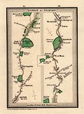
Road map, Route from New Shoreham to Chichester, and Route
from Chichester to Fareham, East Sussex, West Sussex, and
Hampshire, scale about 2.5 miles to 1 inch, from Paterson's
Roads, by the late LtCol Paterson, map by Edward Mogg, Charing
Cross, London, 1822.
|
|
|
|
FA1999.116
(Tymms 1832)
|
Descriptive text, for Hampshire and the Isle of Wight, from
the Family Topographer, by Samuel Tymms, 1832.
|
|
|
|
FA1999.117
|
Map, Cycling and Motoring Road Map, England and Wales sheet 4,
East Anglia etc, scale about 5 miles to 1 inch, published by G W
Bacon and Co, 127 Strand, London, 1910s?
|
|
|
|
FA1999.118
(Mogg 1814)
|
Map, London and South East England road map, scale about 1 to
65000, about 1 inch to 1 mile, probably published by E Mogg,
London, 1814.
|
|
|
|
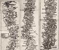
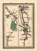
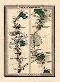
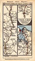
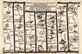
FA1999.119.1
(Mogg 1814)
|
Strip map, road map, part of route London to Portsmouth,
Hampshire, scale about 1 to 65000, about 1 inch to 1 mile,
probably published by E Mogg, London, 1814.
|
|
|
|
FA1999.119.2
(Mogg 1814)
|
Strip map, road map, part of route London to Southampton,
Hampshire, scale about 1 inch to 1 mile, probably published by E
Mogg, London, 1814.
|
|
|
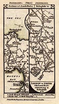
|
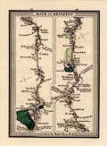
FA1999.119.3
(Mogg 1814)
|
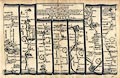
Strip map, road map, part of route London to Gosport,
Hampshire, scale about 1 inch to 1 mile, probably published by E
Mogg, London, 1814.
|
|
|
|
FA1999.119.4
(Mogg 1814)
|
Strip map, road map, part of route London to Gosport,
Hampshire, scale about 1 inch to 1 mile, probably published by E
Mogg, London, 1814.
|
|
|
|
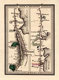
FA1999.119.5
(Mogg 1814)
|
Strip map, road map, part of a route London to Exeter, Devon,
across Hampshire, scale about 1 inch to 1 mile, probably
published by E Mogg, London, 1814.
|
|
|
|
FA1999.119.6
(Mogg 1814)
|
Strip map, road map, part of a route London to Exeter, Devon,
across Hampshire, scale about 1 inch to 1 mile, probably
published by E Mogg, London, 1814.
|
|
|
|
FA1999.119.7
(Mogg 1814)
|
Strip map, road map, part of a route London to Exeter, Devon,
across Hampshire, scale about 1 inch to 1 mile, probably
published by E Mogg, London, 1814.
|
|
|
|
FA1999.119.8
(Mogg 1814)
|
Strip map, road map, part of a route Bath to Brighton, across
Hampshire, scale about 1 inch to 1 mile, probably published by E
Mogg, London, 1814.
|
|
|
|
FA1999.119.9
(Mogg 1814)
|
Strip map, road map, part of a route Bath to Brighton, across
Hampshire, scale about 1 inch to 1 mile, probably published by E
Mogg, London, 1814.
|
|
|
|
FA1999.119.10
(Mogg 1814)
|
Strip map, road map, part of a route Bath to Brighton, across
Hampshire, scale about 1 inch to 1 mile, probably published by E
Mogg, London, 1814.
|
|
|
|
FA1999.120.1
(Paterson 1785)
|
Strip map, road map, uncoloured engaving, part of the road
from London to Lands End, across Cornwall, and part of the road
from London to Exeter, Devon, across Hampshire, from vol.1 of the
road book, Paterson' British Itinerary, by Capt Daniel Paterson,
1785, published by Bowles and Carver, London, after 1793.
|
|
|
|
FA1999.120.2
(Paterson 1785)
|
Strip map, road map, part of the road from London to Gosport,
Hampshire, and part of the road from London to Exeter, Devon,
across Hampshire, from vol.1 of the road book, Paterson' British
Itinerary, by Capt Daniel Paterson, published by Carington
Bowles, London, 1785.
|
|
|
|
FA1999.121
(Bowles 1782)
|
Strip map, uncoloured engraving, road map from a road book,
Bowles's Post Chaise Companion, by Carington Bowles, St Paul's
Churchyard, London, 1782.
|
|
|
|
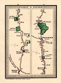
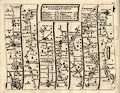
FA1999.123.1
(Gardner 1719)
|
Strip map, road map, uncoloured engraving, part of the Road
from London to Barnstable, Devon, across Hampshire, Wiltshire,
Somserset, scale about 2 miles to 1 inch, reduced from Ogilby's
map, 1675, published in a Pocket Guide to the English Traveller,
by Thomas Gardner, London, 1719.
|
|
|
|
FA1999.123.2
(Gardner 1719)
|
Strip map, road map, uncoloured engraving, part of the Road
from London to Southampton, Hampshire, about 2 miles to 1 inch,
reduced from Ogilby's map, 1675, published in a Pocket Guide to
the English Traveller, by Thomas Gardner, London, 1719.
|
|
|
|
FA1999.123.3
(Gardner 1719)
|
Strip map, road map, uncoloured engraving, part of the Road
from London to Weymouth, Dorset, across Hampshire, Wiltshire, and
Dorset, scale about 2 miles to 1 inch, reduced from Ogilby's map,
1675, published in a Pocket Guide to the English Traveller, by
Thomas Gardner, London, 1719.
|
|
|
|
FA1999.124
(Gent Mag 1765)
|
Strip map, road map, uncoloured engraving, the Road from
London to the Lands End, and the Road from Exeter to Truro, scale
about 2 miles to 1 inch, published in the Gentleman's Magazine,
London, about 1765.
|
|
|
|
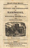
FA1999.125
(Pinnock 1821)
|
Descriptive text, pages of the chapter of text for The History
and Topography of Hampshire, from Pinnock's County Histories
series, published by Pinnock and Maunder, Mentorian Press, 267
Strand, London, about 1825.
|
|
|
|
FA1999.125.1
(Pinnock 1821)
|
Map, uncoloured engraving, with The History and Topography of
Hampshire, scale about 10 miles to 1 inch, from Pinnock's County
Histories series, engraved by Neele and Son, 352 Strand,
published by Pinnock and Maunder, Mentorian Press, 267 Strand,
London, about 1825.
|
|
|
|
FA1999.126
(Bartholomew 1880s)
|
Map, coloured engraving, Hampshire, scale about 8 miles to 1
inch, from Encyclopaedia Britannica, by John Bartholomew,
Edinburgh, Lothian, about 1880.
|
|
|
|
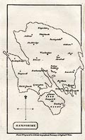
FA1999.127
|
Map, colour engraving, Hampshire, scale about 4 miles to 1
inch, by John Bartholomew, Edinburgh, Lothian, published by
George Philip and Son, London, about 1875-85?
|
|
|
|
FA1999.128
(Kitchin 1763)
|
Descriptive text, about Hampshire, from England Illustrated,
published by R and J Dodsley, Pall Mall, London, 1764.
|
|
|
|
FA1999.128.1
(Kitchin 1763)
|
Map, uncoloured engraving, A New Map of Hamp Shire, ie
Hampshire, scale about 7 miles to 1 inch, by Thomas Kitchin,
published in England Illustrated, by R and J Dodsley, Pall Mall,
London, 1763-64.
|
|
|
|
FA1999.129
|
Page, the return for the County of Hants, ie Hampshire, for
the Redistribution of Seats Act, 1885, made by Sir Charles Dilke
for the House of Commons, London, 1885.
|
|
|
|
FA1999.129.1
|
Map, Hampshire, New Divisions of County, scale about 4 miles
to 1 inch, by LtCol R Owen Jones RE, to accompany the return for
the Redistribution of Seats Act, London, 1885.
|
|
|
|
FA1999.130
|
Descriptive text, for Hampshire from Bosworth's Antiquities,
published 1786.
|
|
|
|
FA1999.131
(Cole and Roper 1810)
|
Descriptive text, for Hampshire, from English Topography, by
Joseph Nightingale, London, 1816.
|
|
|
|
FA1999.132
(Ellis 1819)
|
Descriptive text, for Hampshire from the New and Correct Atlas
of England and Wales, by G Ellis, London, 1819.
|
|
|
|
FA1999.133
(Fisher 1845)
|
Descriptive text, for Hampshire, from Fisher's County Atlas of
England and Wales, published by Fisher, Son and Co, Angel Street,
St Martin's le Grande, London, 1842-45.
|
|
|
|
FA1999.134
(Camden 1695)
|
Page, descriptive text for Hamshire ie Hampshire, from
Britannia, by William Camden, translated and corrected by Edmund
Gibson, Queens College, Oxford, Oxfordshire, published 1695.
|
|
|
|
FA1999.135
(Gardner 1719)
|
Book binding, Pocket Guide to the English Traveller, by Thomas
Gardner, 1719, probably a replacement binding, early 20th
century?
|
|
|
|
FA1999.136
(Morden 1701)
|
Book binding, for Mapps of England and Wales by Robert Morden,
1701, replacement binding, mid 20th century?
|
|
|
|
FA1999.137
(Laurie and Whittle 1806)
|
Road map, scale about 8 miles to 1 inch, London to Gosport,
Southampton, etc, Hampshire and Salisbury, etc, Wiltshire on the
way to Lands End, from a road book by Laurie and Whittle, 53
Fleet Street, London, 1806, edition of 1815.
|
|
|
|
FA1999.138
(Kitchin 1767)
|
Road book, uncoloured engravings of strip map road maps,
Kitchin's Post Chaise Companion, by Thomas Kitchin, published by
Robert Sayer, 53 Fleet Street, John Bowles, Cornhill, and
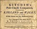
Carington Bowles, St Paul's Church Yard, London, 1767.
|
|
|
|
FA1999.138.0
(Kitchin 1767)
|
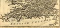
Road map, uncoloured engraving, General Map of the Direct and
Principal cross Roads in England and Wales, in Kitchin's Post
Chaise Companion, by Thomas Kitchin, published by Robert Sayer,
53 Fleet Street, John Bowles, Cornhill, and Carington Bowles, St
Paul's Church Yard, London, 1767.
|
|
|
|
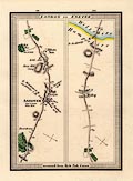
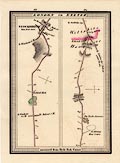
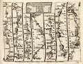
FA1999.138.25
(Kitchin 1767)
|
Strip map, road map, uncoloured engraving, Road from London to
the Lands End, in Kitchin's Post Chaise Companion, by Thomas
Kitchin, published by Robert Sayer, 53 Fleet Street, John Bowles,
Cornhill, and Carington Bowles, St Paul's Church Yard, London,
1767.
|
|
|
|
FA1999.138.30
(Kitchin 1767)
|
Strip map, road map, uncoloured engraving, Road from London to
Portsmouth, Hampshire, in Kitchin's Post Chaise Companion, by
Thomas Kitchin, published by Robert Sayer, 53 Fleet Street, John
Bowles, Cornhill, and Carington Bowles, St Paul's Church Yard,
London, 1767.
|
|
|
|
FA1999.138.33
(Kitchin 1767)
|
Strip map, road map, uncoloured engraving, Road from London to
Barnstable, Devon, in Kitchin's Post Chaise Companion, by Thomas
Kitchin, published by Robert Sayer, 53 Fleet Street, John Bowles,
Cornhill, and Carington Bowles, St Paul's Church Yard, London,
1767.
|
|
|
|
FA1999.138.41
(Kitchin 1767)
|
Strip map, road map, uncoloured engraving, Road from London to
Chichester, West Sussex, in Kitchin's Post Chaise Companion, by
Thomas Kitchin, published by Robert Sayer, 53 Fleet Street, John
Bowles, Cornhill, and Carington Bowles, St Paul's Church Yard,
London, 1767.
|
|
|
|
FA1999.138.50
(Kitchin 1767)
|
Strip map, road map, uncoloured engraving, Road from London to
Pool, Dorset, in Kitchin's Post Chaise Companion, by Thomas
Kitchin, published by Robert Sayer, 53 Fleet Street, John Bowles,
Cornhill, and Carington Bowles, St Paul's Church Yard, London,
1767.
|
|
|
|
FA1999.138.55
(Kitchin 1767)
|
Strip map, road map, uncoloured engraving, Road from London to
Southampton, Hampshire, in Kitchin's Post Chaise Companion, by
Thomas Kitchin, published by Robert Sayer, 53 Fleet Street, John
Bowles, Cornhill, and Carington Bowles, St Paul's Church Yard,
London, 1767.
|
|
|
|
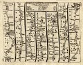
FA1999.138.58
(Kitchin 1767)
|
Strip map, road map, uncoloured engraving, Road from London to
Weymouth, Dorset, in Kitchin's Post Chaise Companion, by Thomas
Kitchin, published by Robert Sayer, 53 Fleet Street, John Bowles,
Cornhill, and Carington Bowles, St Paul's Church Yard, London,
1767.
|
|
|
|
FA1999.138.91
(Kitchin 1767)
|
Strip map, road map, uncoloured engraving, Road from Oxford,
Oxfordshire to Chichester, West Sussex, in Kitchin's Post Chaise
Companion, by Thomas Kitchin, published by Robert Sayer, 53 Fleet
Street, John Bowles, Cornhill, and Carington Bowles, St Paul's
Church Yard, London, 1767.
|
|
|
|
FA1999.138.93
(Kitchin 1767)
|
Strip map, road map, uncoloured engraving, Road from Oxford,
Oxfordshire to Salisbury, Wiltshire, continued to Pool, Dorset,
in Kitchin's Post Chaise Companion, by Thomas Kitchin, published
by Robert Sayer, 53 Fleet Street, John Bowles, Cornhill, and
Carington Bowles, St Paul's Church Yard, London, 1767.
|
|
|
|
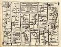
FA1999.139
|
Road atlas, road maps, The Complete Atlas of Britain, scale
about 4 miles to 1 inch, published by the Automobile Association,
AA, Fanum House, Basing View, Basingstoke, Hampshire, 4th edition
1981.
|
|
|
|
FA1999.140
(Hutchinson 1748)
|
Map, hand coloured engraving, A Correct Map of Hampshire,
scale about 9.5 miles to 1 inch, probably by Thomas Hutchinson,
1748, published in Geographia Magnae Britanniae, 2nd edn, by
Osborne et al, London, 1750.
|
|
|
|
FA1999.141
|
Reproduction map, street plan, Map of the Parish of
Alverstoke, Gosport, Hampshire, scale about 4 inches to 1 mile,
by I T Lewis, Winchester, Hampshire, 1832.
|
|
|
|
FA1999.142
|
Street map, Plan of the City of Winchester, scale about 12
inches to 1 mile, published by Warren, The Library, 85 High
Street, Winchester, Hampshire, early 20th century?
|
|
|
|
FA1999.143
(Smith 1804)
|
Map, hand coloured engraving folded in a slip case, New Map of
Hampshire, with the Isle of Wight, scale about 3 miles to 1 inch,
by Charles Smith, 172 Strand, London, engraved by Jones and
Smith, 1804 corrected to 1821.
|
|
|
|
FA1999.144
(Dower 1838)
|
Map, hand coloured engraving, Environs of Andover, Hampshire,
scale about 1.5 miles to 1 inch, by I Dower, Pentonville, London,
published for James Robbins, College Street, Winchester by D E
Gilmour, Public Library, High Street, Winchester, Hampshire,
about 1838?
|
|
|
|
FA1999.145
(Dower 1838)
|
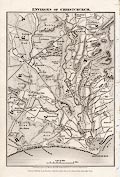
Map, uncoloured engraving, Environs of Christchurch, Dorset,
scale about 1.5 miles to 1 inch, by I Dower, Pentonville, London,
for Mudie's History of Hampshire, published for James Robbins,
College Street, Winchester by D E Gilmour, Public Library, High
Street, Winchester, Hampshire, about 1838?
|
|
|
|
FA1999.146
(Dower 1838)
|
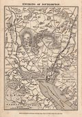
Map, uncoloured engraving, Environs of Southampton, Hampshire,
scale about 1.5 miles to 1 inch, by I Dower, Pentonville, London,
published for James Robbins, College Street, Winchester by D E
Gilmour, Public Library, High Street, Winchester, Hampshire,
about 1847?
|
|
|
|
FA1999.147
|
Atlas, McLeod's Hand Atlas, of the world, many maps engraved
by Edward Weller, by Walter McLeod, 1854.
|
|
|
|
FA1999.148
|
Guide book, itineraries with road and strip maps, Malcolm's
Motor and Cyclists' Guide, for Portsmouth area, Hampshire, ie
southern England, published by F Malcom, 69 Albert Road,
Southsea, Portsmouth, Hampshire, 1900s?
|
|
|
|
FA1999.149
|
Road map, itinerary and strip maps, Gosport to Mullion Cove,
AA Route, prepared for a member by the Automobile association,
AA, Fanum House, New Coventry Street, London, mid 20th
century.
|
|
|
|
FA1999.150
|
Road map, itinerary and strip maps, Mullion Cove to Gosport,
AA Route, prepared for a member by the Automobile association,
AA, Fanum House, New Coventry Street, London, mid 20th
century.
|
|
|
|
FA1999.151
|
Map, road map, sheet 4, Wales and Midlands, scale about 5
miles to 1 inch, by Edward Stanford, London, published by Esso
Petroleum Co, 1960.
|
|
|
|
FA1999.152
|
Map, road map, sheet 3, South and West England, scale about 5
miles to 1 inch, by Edward Stanford, London, published by Esso
Petroleum Co, 1959.
|
|
|
|
FA1999.153
|
Map, road map, sheet 2, South and East England, scale about 5
miles to 1 inch, by Edward Stanford, London, published by Esso
Petroleum Co, 1960s.
|
|
|
|
FA1999.154
|
Map, Motoring and Touring Map, section E, parts of the
Midlands of England, scale about 3 miles to 1 inch, published
1920s?
|
|
|
|
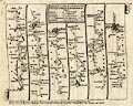
FA1999.156
|
Road book, with road maps etc, the New Book of the Road, maps
by Fairey Surveys, Maidenhead, Berkshire, scale about 4 miles to
1 inch, published by Reader's Digest and the Automobile
Association, AA, 1975.
|
|
|
|
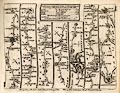
FA1999.157
|
Road book, Road Book of England and Wales, with road maps by
John Bartholomew and Son, Edinburgh, Lothian, scale about 5 miles
to 1 inch, published by the Automobile Association, AA, London,
1950.
|
|
|
|
FA1999.158
(Dower 1838)
|
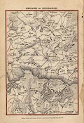
Map, uncoloured engraving, Environs of Petersfield, Hampshire,
scale about 1.5 miles to 1 inch, by I Dower, Pentonville, London,
published for James Robbins, College Street, Winchester by D E
Gilmour, Public Library, High Street, Winchester, Hampshire,
about 1838?
|
|
|
|
FA1999.159
(Dower 1838)
|
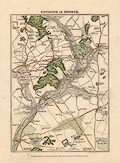
Map, hand coloured engraving, Environs of Winchester,
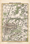
Hampshire, scale about 1.5 miles to 1 inch, by I Dower,
Pentonville, London, published for James Robbins, College Street,
Winchester by D E Gilmour, Public Library, High Street,
Winchester, Hampshire, about 1838?
|
|
|
|
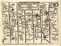
FA1999.160
|
Road book, Illustrated Road Book of England and Wales, with
road maps by John Bartholomew and Son, Edinburgh, Lothian, scale
about 5 miles to 1 inch, published by the Automobile Association,
AA, London, 4th edition 1966.
|
|
|
|
|
 |
top of page |
 |
FA2000 |
|