
|
Catalogue of Map Collection
ACM -- DA:
Identity number order
|
|
 |
bottom of page |
|
|
A thumbnail image on the right will enlarge, then return here.
The left link will take you to the Map Collection record page, and if (Map Group) is shown, will link to other Hampshire resources.
If you want to return to your place here, use your back browser button.
|
|
Identity number
(Map Group)
|
|
|
 |
|
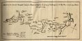
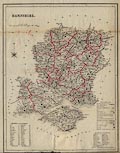
ACM1934.14
(Jansson 1646)

|
Map, hand coloured copper plate engraving, Hantoniae Comitatus
cum Bercheria, ie Hampshire and Berkshire, scale about 4 miles to
1 inch, from the Atlas Novus, by Jan Jansson, Amsterdam,
Netherlands, 1646.
|

|
|
|
ACM1934.74.1
(Cary 1789)
|
Map, uncoloured engraving, Map of Hampshire, with the Isle of
Wight, scale about 3 miles to 1 inch, by John Cary, Strand,
London, about 1789?
|
|
|
|
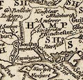
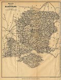
ACM1934.74.2
(Cooper 1808)
|
Map, hand coloured engraving, Hampshire, and the Isle of
Wight, scale about 15 miles to 1 inch, drawn and engraved by H
Cooper, published by R Phillips, Bridge Street, Blackfriars,
London, 1808.
|
|
|
|
ACM1934.74.3
(Lewis 1835)
|
Map, hand coloured engraving, Hampshire and Isle of Wight,
scale about 3 miles to 1 inch, drawn by R Creighton, 1835?
engraved by J and C Walker, 1830s-40s.
|
|
|
|
ACM1934.74.4
(Dugdale 1835)
|
Map, uncoloured engraving, Hampshire, with the Isle of Wight,
scale about 8 miles to 1 inch, drawn by J Archer, Pentonville,
London, published in England and Wales Delineated by T Dugdale,
1835, published about 1848.
|
|
|
|
ACM1934.74.6.1
(Dugdale 1835)
|
Map, uncoloured engraving, Hampshire, with the Isle of Wight,
scale about 8 miles to 1 inch, drawn by J Archer, Pentonville,
London, published in England and Wales Delineated by T Dugdale,
about 1835, published 1850s-60s?
|
|
|
|
ACM1934.74.6.2
(Dugdale 1835)
|
Map, hand coloured engraving, Hampshire, with the Isle of
Wight, scale about 8 miles to 1 inch, drawn by J Archer,
Pentonville, London, published in England and Wales Delineated by
T Dugdale, about 1835, published 1840s-50s?
|
|
|
|
ACM1934.74.7
(Bell 1834)
|
Map, uncoloured engraving, Hampshire or Southampton, and Isle
of Wight, scale about 8 miles to 1 inch, perhaps by James Bell,
1834, engraved by Gray and Son, published in a General Atlas by
Archibald Fullarton and Co, Glasgow, Strathclyde, 1839.
|

|
|
|
ACM1934.74.8
(Hughes 1868)
|
Map, chromolithograph, Hampshire with the Isle of Wight, scale
about 5.5 miles to 1 inch, by William Hughes, printed by James S
Virtue and Co, London, about 1868.
|
|
|
|
ACM1934.74.9
(Cary 1787)
|
Map, Hampshire, hand coloured copper plate engraving,
Hampshire and Isle of Wight, scale about 6 miles to 1 inch,
published in a New and Correct English Atlas, by John Cary,
Strand, London, 1787, published 1793.
|
|
|
|
ACM1934.74.10
(Kitchin 1751 small)
|
Map, Hampshire, copper plate engraving, Hampshire and Isle of
Wight, scale about 11 miles to 1 inch, issued by Thomas Kitchin,
London, about 1751.
|
|
|
|
ACM1934.74.11
(Rocque 1746)
|
Map, uncoloured engraving, Hamp-Shire ie Hampshire, scale
about 8 miles to 1 inch, by John Rocque, 1746, published in the
Small British Atlas, by John Rocque, Strand, London, 1753.
|
|
|
|
ACM1934.74.12
(Moule 1836)
|
Map, uncoloured engraving, Hampshire, and the Isle of Wight,
scale about 8 miles to 1 inch, 1836? engraved by I Dower,
published in Moule's English Counties, by Thomas Moule, about
1850.
|
|
|
|
ACM1934.74.13
(Lewis 1831)
|
Map, Southampton, ie Hampshire, scale about 7 miles to 1 inch,
showing parish unions, drawn by R Creighton, engraved by J and C
Walker, for a Topographical Dictionary of England, published by S
Lewis, 1830s.
|
|
|
|
ACM1934.74.14
(Morden 1708)
|
Map, engraving, Hampshire, scale about 7 miles to 1 inch, by
Robert Morden, perhaps before 1693 issued 1701, engraved by
Sutton Nicholls, included in Magna Britannia et Hibernia, Antiqua
et Nova, published by Thomas Cox? about 1720-31.
|
|
|
|
ACM1934.74.15
(Hall 1860)
|
Map, hand coloured lithograph, Hampshire or Southampton, scale
about 1 to 320000, about 5 miles to 1 inch, Hampshire and Isle of
Wight, engraved by Sidney Hall, published by Chapman and Hall,
193 Piccadilly, London, about 1860.
|
|
|
|
ACM1934.74.16
(Murray 1830)
|
Map, hand coloured engraving, Hampshire, and the Isle of
Wight, scale about 4 miles to 1 inch, for the Atlas of English
Counties, published by T L Murray, 19 Adam Street, London,
1830.
|

|
|
|
ACM1934.74.17
(Smith 1804)
|
Map, A New Map of Hampshire, hand coloured copper plate
engraving, Hampshire and Isle of Wight, scale about 3 miles to 1
inch, engraved by Jones and Smith, issued by Charles Smith, 172
Strand, London, 1801.
|
|
|
|
ACM1934.74.18.1
(Greenwood 1829)
|
Map, engraving, Map of the County of Southampton, Hampshire
with the Isle of Wight, scale about 3 miles to 1 inch, by C and J
Greenwood, engraved by J and J Neele, Strand, London, published
by Greenwood and Co, 13 Regent Street, London, 1829.
|
|
|
|
ACM1934.74.18.2
(Greenwood 1829)
|
Map, uncoloured engraving, Map of the County of Southampton,
ie Hampshire, with the Isle of Wight, scale about 3 miles to 1
inch, by C and J Greenwood, engraved by J and J Neele, Strand,
London, published by Greenwood and Co, 13 Regent Street, London,
1829.
|
|
|
|
ACM1934.74.19
(Morden 1695)
|
Map, uncoloured engraving, Hamp Shire, ie Hampshire, scale
about 5 miles to 1 inch, by Robert Morden, published in an
edition of Britannia by William Camden, 1695.
|
|
|
|
ACM1934.74.20
(Morden 1695)
|
Map, hand coloured engraving, Hamp Shire, ie Hampshire, scale
about 5 miles to 1 inch, by Robert Morden, published in an
edition of Britannia by William Camden, 1695.
|
|
|
|
ACM1934.74.22
(Milne 1791)
|
Map, hand coloured engraving, Hampshire, and Isle of Wight,
scale about 1 mile to 1 inch, in 6 parts, surveyed by Thomas
Milne, published by William Faden, Charing Cross, London,
1791.
|
|
|
|
ACM1934.75
(Blaeu 1645)
|
Map, Hantonia sive Southamtonensis Comitatus, ie Hampshire,
scale about 3.5 miles to 1 inch, by William J Blaeu, Amsterdam,
Netherlands, 1645.
|
|
|
|
ACM1944.85
|
Celestial globe, on stand, published by Newton and Son, London
1857-58.
|
|
|
|
ACM1944.86
|
Terrestrial globe, on stand, published by Newton and Son,
London 1857-58.
|
|
|
|
ACM1965.92.2
|
Map, Hertford, ie Hertfordshire, with ms additions by an
excise officer, scale about 3 miles to 1 inch, published by John
Darton and Co, 58 Holborn Hill, London, early 19th century?
|
|
|
|
B1963.2
(Walton 1870s)
|
Book, Geography of Hampshire, by J Walton, Horfield, Bristol,
Collins' County Geographies series published by William Collins,
Sons and Co, Bridewell Place, New Bridge Street, London,
1870s?
|
|
|
|
B1963.2.1
(Weller 1870s)
|
Map, hand coloured engraving, Hampshire, in the Geography of
Hampshire, by J Walton, Horfield, Bristol, published by William
Collins, Sons and Co, Bridewell Place, New Bridge Street, London,
1870s?
|
|
|
|
B1964.17.1
(Kelly 1875)
|
Map, The Post Office Map of Hampshire, scale about 6 miles to
1 inch, published by Kelly and Co, Post Office Directory Offices,
51 Great Queen Street, Lincoln's Inn Fields, London, 1875.
|
|
|
|
B1964.17.2
|
Map, The Post Office Map of Wiltshire, scale about 5 miles to
1 inch, published by Kelly and Co, Post Office Directory Offices,
51 Great Queen Street, Lincoln's Inn Fields, London, 1875.
|
|
|
|
B1964.17.3
|
Map, The Post Office Map of Dorsetshire, scale about 5 miles
to 1 inch, published by Kelly and Co, Post Office Directory
Offices, 51 Great Queen Street, Lincoln's Inn Fields, London,
1875.
|
|
|
|
B1964.23
|
Atlas, Philips' Shilling Atlas of Modern Geography, maps of
the World, engraving, published by George Philip and Son,
Liverpool, Merseyside, mid 19th century?
|
|
|
|
B1970.330
|
Map, road map and Eazi Way Distance Finder, South East
England, scale about 10 miles to 1 inch, published by Hutchinson
Publicity, 1-2 Pleydell Court, London, 1920s-30s?
|
|
|
|
B1972.67.1
(Cruchley 1856)
|
Map, Cruchley's Road and Railway Map of the County of
Hampshire, or Hampshire for Cyclists, Tourists, Etc, scale about
2.5 miles to 1 inch, by Cruchley, 1856, published by Gall and
Inglis, Bernard Terrace, Edinburgh, Lothian, 1890s-1900s?
|
|
|
|
B1972.67.3
|
Map, Newcastle upon Tyne, sheet 3 at scale 2 miles to 1 inch,
published by the Ordnance Survey, Southampton, Hampshire,
1913.
|
|
|
|
B1972.67.12
|
Map, Gloucester, Newport and Monmouth, sheet 27 at scale 2
miles to 1 inch, published by the Ordnance Survey, Southampton,
Hampshire, 1914.
|
|
|
|
B1972.67.13
|
Map, Oxford area, Oxfordshire and Swindon area, Wiltshire,
sheet 28 at scale 2 miles to 1 inch, published by the Ordnance
Survey, Southampton, Hampshire, 1914.
|
|
|
|
B1972.67.16
|
Map, Weymouth area, Dorset, Yeovil and Taunton area, Somerset,
sheet 37 at scale 2 miles to 1 inch, published by the Ordnance
Survey, Southampton, Hampshire, 1914.
|
|
|
|
B1972.67.17
|
Map, central England, sheet 6 at scale 4 miles to 1 inch,
published by the Ordnance Survey, Southampton, Hampshire,
1913.
|
|
|
|
B1972.67.18
|
Map, Bristol, sheet 32 at scale 2 miles to 1 inch, published
by the Ordnance Survey, Southampton, Hampshire, 1908-10.
|
|
|
|
B1972.67.19
|
Map, road map, London, sheet 34 at scale 2 miles to 1 inch,
published by Ordnance Survey, 1914.
|
|
|
|
B1972.67.20
|
Map, road map, Salisbury, Reading and Winchester, ie parts of
Wiltshire, Berkshire, Hampshire, scale 1 to 126720, 2 miles to 1
inch, published by the Ordnance Survey, Southampton, Hampshire,
1919.
|
|
|
|
B1972.67.25
|
Map, New Reduced Survey, sheet 5 North Lancashire, scale 2
miles to 1 inch, published by John Bartholomew and Co, Edinburgh
Geographical Institute, Edinburgh, Lothian, 1900s-10s?
|
|
|
|
B1972.67.30
|
Map, Quarter Inch to Mile Map, Scotland sheet 5, Forth and
Tay, scale 4 miles to 1 inch, published by John Bartholomew and
Co, The Geographical Institute, Edinburgh, Lothian,
1900s-10s?
|
|
|
|
B1972.67.31
|
Map, Quarter Inch to Mile Map, Scotland sheet 7, Border
Country, scale 4 miles to 1 inch, published by John Bartholomew
and Co, The Geographical Institute, Edinburgh, Lothian,
1900s-10s?
|
|
|
|
B1972.67.34
|
Map, Half Inch Contoured Map, sheet 8 Salisbury Plain, scale 2
miles to 1 inch, published by John Bartholomew and Son, The
Edinburgh Geographical Institute, Duncan Street, Edinburgh,
Lothian, 1948.
|
|
|
|
B1972.67.36
(OS 1920s Popular Edition)
|
Map, Windsor, Berkshire, One inch map Popular Edition, sheet
114 at scale 1 mile to 1 inch, published by Ordnance Survey,
1920.
|
|
|
|
B1972.67.38
|
Map, One Inch Map 3rd edition, Large Sheet Series, sheet 122,
Frome area, Somerset, scale 1 mile to 1 inch, published by the
Ordnance Survey, Southampton, Hampshire, 1910.
|
|
|
|
B1972.67.39
|
Map, One Inch Map 3rd edition, Large Sheet Series, sheet 150,
Kingsbridge, Devon, scale 1 mile to 1 inch, published by the
Ordnance Survey, Southampton, Hampshire, 1911.
|
|
|
|
B1972.67.40
(OS 1940s New Popular Edition)
|
Map, One inch map New Popular Edition, sheet 167, Salisbury,
scale 1 mile to 1 inch, published by Ordnance Survey,
Southampton, Hampshire, 1940.
|
|
|
|
B1977.681
|
Map, New Forest, Hampshire, scale 1 mile to 1 inch, published
by the Ordnance Survey, Southampton, Hampshire, 1938.
|
|
|
|
B1979.162
(Swiss 1860-99)
|
Map, chromolithograph, No 9 Hunting Map, Hampshire, east
Wiltshire, west Surrey, West Sussex, showing the meets of local
hunts, scale about 2 miles to 1 inch, published by A H Swiss and
Co, 111-112 Fore Street, Devonport, Devon, late 19th century.
|
|
|
|
B1979.333
|
Road book, The Road Book of England and Wales, with road maps
by John Bartholomew and Son, Edinburgh, Lothian, scale about 12
miles to 1 inch, published by the Automobile Association, AA,
London, 1925?
|
|
|
|
B1979.409
|
Map, Southern England, tourist or leisure map, scale about
miles 3 to 1 inch, published for Southern Tourist Board, by
Estate Publications, Marden, Kent, 1970s?
|
|
|
|
B1979.630.3
(OS 1930s Fifth Edition)
|
Map, One inch map Fifth edition, sheet 140, Bournemouth and
Weymouth, Dorset, scale 1 mile to 1 inch, published by Ordnance
Survey, Southampton, Hampshire, 1936.
|
|
|
|
B1979.630.6
|
Map, Snowdon and District, scale 1 mile to 1 inch, published
by Ordnance Survey, Southampton, Hampshire, 1925-28.
|
|
|
|
B1979.818
|
Map, One Inch New Series, sheets 344, 345 and parts of sheets
330, 331, Isle of Wight, at scale 1 mile to 1 inch, published by
the Ordnance Survey, Southampton, Hampshire, 1904-05.
|
|
|
|
B1979.946
|
Map, Warren's Sixpenny Map of Winchester, published by Warren
and Son, High Street, 85, Winchester, Hampshire,.
|
|
|
|
B1980.380
|
Map, City Map, Southampton, Hampshire, scale about 6 inches to
1 mile, published by the Ordnance Survey, Southampton, Hampshire,
1979.
|
|
|
|
B1980.613.34
(OS 1930s Fifth Edition)
|
Map, SW London and Windsor, One inch map Fifth Edition, sheet
114, scale 1 mile to 1 inch, published by Ordnance Survey,
1934.
|
|
|
|
B1980.613.45
(OS 1930s Fifth Edition)
|
Map, One inch map Fifth edition, sheet 141, Southampton,
Portsmouth, Hampshire, and The Isle of Wight, scale 1 mile to 1
inch, published by Ordnance Survey, Southampton, Hampshire,
1936-38.
|
|
|
|
B1980.613.49
|
Map, Half Inch Contoured Map, sheet 3 Exmoor, scale 2 miles to
1 inch, published by John Bartholomew and Son, Edinburgh
Geographical Institute, Edinburgh, Lothian, 1920s-30s?
|
|
|
|
B1980.613.50
|
Map, Half Inch Contoured Map, sheet 4 Dorset, scale 2 miles to
1 inch, published by John Bartholomew and Son, Edinburgh
Geographical Institute, Edinburgh, Lothian, 1920s-30s?
|
|
|
|
B1980.613.51
|
Map, Half Inch Contoured Map, sheet 5 New Forest, scale 2
miles to 1 inch, published by John Bartholomew and Son, The
Edinburgh Geographical Institute, Duncan Street, Edinburgh,
Lothian, 1948.
|
|
|
|
B1980.613.53
|
Map, Half Inch Contoured Map, sheet 7 North Somerset, scale 2
miles to 1 inch, published by John Bartholomew and Son, Edinburgh
Geographical Institute, Edinburgh, Lothian, 1920s-30s?
|
|
|
|
B1980.613.55
|
Map, Half Inch Contoured Map, sheet 9 Surrey, scale 2 miles to
1 inch, published by John Bartholomew and Co, the Geographical
Institute, Duncan Street, Edinburgh, Lothian, 1920s-30s?
|
|
|
|
B1980.613.56
|
Map, Half Inch Contoured Map, sheet 24 Oxfordshire, scale 2
miles to 1 inch, published by John Bartholomew and Son, Edinburgh
Geographical Institute, Edinburgh, Lothian, 1920s-30s?
|
|
|
|
B1980.613.58
|
Map, Half Inch Contoured Map, sheet 31 Kent, scale 2 miles to
1 inch, published by John Bartholomew and Son, the Edinburgh
Geographical Institute, Edinburgh, Lothian, 1920s-30s?
|
|
|
|
B1980.613.61
|
Map, Sixth Inch Motoring Map, sheet 1, Home Counties, scale 6
miles to 1 inch, published by John Bartholomew and Son,
Edinburgh, Lothian, 1960s?
|
|
|
|
B1980.613.62
|
Map, tourist's large scale road map, Isle of Wight, scale
about 1.5 miles to 1 inch, published by G Dean, Broadway,
Sandown, Isle of Wight, about 1947.
|
|
|
|
B1980.613.63
|
Map, Large Scale Road Map, Dartmoor and Exmoor, or Devon,
scale about 2.5 miles to 1 inch, published by Geographia, 167
Fleet Street, London, 1950s-60s?
|
|
|
|
B1980.613.65
|
Map, Motor Map, road map, sheet 2, South East England, scale
about 7 miles to 1 inch, drawn and published for Motor magazine
by George Philip and Son, London, 1968.
|
|
|
|
B1980.613.66
|
Map, Motor Map, road map, sheet 1, South West England, scale
about 7 miles to 1 inch, drawn and published for Motor Magazine
by George Philip and Son, London, 1968.
|
|
|
|
B1980.1087
|
map, Bird's Eye View of the River Thames from Oxford to
London, section 3, Chertsey to London, by G W Bacon and Co, 127
Strand, London, late 19th century?
|
|
|
|
B1982.436
|
Map, Isle of Wight, scale about 1.5 miles to 1 inch, published
by G Dean and Co, The Broadway, Sandown, Isle of Wight,
1950s-60s?
|
|
|
|
B1982.647.16
|
Map, hand coloured engraving, New Map of Wiltshire, scale
about 3 miles to 1 inch, by John Cary, 86 St James's Street,
London, 1820s?
|
|
|
|
B1982.720.1
|
Map, pen and ink drawing, Leckford Estate Plan of Water
Courses, Leckford, Hampshire, by H C H and F E H Shenton, civil
engineers, 28 Victoria Street, Westminster, London, about
1920.
|
|
|
|
B1982.894
(Hogg 1784)
|
Map, New Map of Hampshire, scale about 10.5 miles to 1 inch,
Hampshire and the Isle of Wight, published by Alexander Hogg, at
the Kings Arms, 16 Paternoster Row, London, about 1784.
|
|
|
|
B1986.415
|
Map, Burrow's Reference Map of Aldershot, Rushmoor, Hampshire,
scale about 3 inches to 1 mile, published by Edward J Burrow and
Co, Cheltenham, Gloucestershire, about 1970?
|
|
|
|
B1987.102
|
Map, Test Valley Street Plan, just Andover and Romsey,
Hampshire, published by British Publishing Co, Gloucester,
Gloucestershire, about 1986.
|
|
|
|
B1987.194.1
|
Map, road map, Hampshire, scale about 1 to 253440, about 4
miles to 1 inch, published by the Ordnance Survey, Southampton,
Hampshire, 1919.
|
|
|
|
B1987.195.3
|
Map, Salisbury, Winchester, Reading area, Wiltshire,
Hampshire, Berkshire, scale 1 to 126720, 2 miles to 1 inch,
published by the Ordnance Survey, Southampton, Hampshire,
1912.
|
|
|
|
B1987.195.8
|
Map, England, South East and London, scale 1 to 253440, 4
miles to 1 inch, published by the Ordnance Survey, Southampton,
Hampshire, 1920.
|
|
|
|
B1987.195.12
|
Map, Greater London, scale 2 miles to 1 inch, published by the
Ordnance Survey, Southampton, Hampshire, 1935.
|
|
|
|
B1987.489.1
(OS 1920s Popular Edition)
|
Map, One inch map Popular Edition, sheet 132, Portsmouth and
Southampton, Hampshire, scale 1 mile to 1 inch, published by the
Ordnance Survey, Southampton, Hampshire, 1932.
|
|
|
|
B1987.489.3
(OS 1940s New Popular Edition)
|
Map, One inch map New Popular Edition, sheet 179, Bournemouth,
Dorset, scale 1 mile to 1 inch, published by the Ordnance Survey,
Southampton, Hampshire, 1947.
|
|
|
|
B1990.161.4
(Geographia 1925)
|
Road book, with road strip maps and gradient diagrams, Premier
Road Book of Great Britain, by Alexander Gross and F
Waite-Browne, published by Geographia, 55 Fleet Street, London,
about 1925?
|
|
|
|
B1990.161.6
|
Map, Half Inch Contoured Map, sheet 4 Dorset, scale 2 miles to
1 inch, published by John Bartholomew and Son, The Geographical
Institute, Duncan Street, Edinburgh, Lothian, 1948.
|
|
|
|
B1990.161.8
|
Map, New Forest, Hampshire, scale 1 mile to 1 inch, published
by the Ordnance Survey, Southampton, Hampshire, 1938.
|
|
|
|
B1990.163.46
|
Map, and gazetteer, The RAC County Road Map and Gazetteer No
14, Hampshire with the Isle of Wight, scale about 4 miles to 1
inch, published by Edward J Burrow and Co, Cheltenham,
Gloucestershire, 4th edn, 1940s?
|
|
|
|
B1990.163.47
|
Map, Street Plan and Guide to the City of Southampton,
Hampshire, scale about 3 inches to 1 mile, published by Service
Publications, Caxton House, Shoreham-by-Sea, East Sussex,
1950s-60s?
|
|
|
|
B1990.1004.1
(Hughes 1840)
|
Map, colour printed engraving, Journey Map of Hampshire, scale
4.5 miles to 1 inch, engraved by W Hughes, published by Charles
Knight and Co, Ludgate Street, London, 1840.
|
|
|
|
B1990.1007.1
(Pinnock 1821)
|
Map, uncoloured engraving, Hampshire, with the Isle of Wight,
scale about 10 miles to 1 inch, engraved by Neele and Son,
Strand, London, published by G and W B Whittaker, Ave Maria Lane,
London, 1821.
|
|
|
|
B1990.1123.1
(VCH 1899)
|
Geological map, Geological Map - Northern Section, Hampshire,
scale about 4 miles to 1 inch, by John G Bartholomew, Edinburgh
Geographical Institute, Edinburgh, Lothian, for The Victoria
County History, 1899.
|
|
|
|
B1990.1123.2
(VCH 1899)
|
Geological map, Geological Map - Southern Section, Hampshire,
scale about 4 miles to 1 inch, by John G Bartholomew, Edinburgh
Geographical Institute, Edinburgh, Lothian, for The Victoria
County History, 1899.
|
|
|
|
B1990.1132.1
(Dower 1838)
|
Map, hand coloured engraving, Hampshire or Southampton, with
the Isle of Wight, scale about 4 miles to 1 inch, by I Dower,
Pentonville, London, for Mudie's History of Hampshire, published
for James Robbins, College Street, Winchester, by D E Gilmour,
High Street, Winchester, Hampshire, 1838?
|
|
|
|
B1990.1135.1
(Lodge 1788)
|
Map, uncoloured engraving, New Map of Hampshire, scale about 5
miles to 1 inch, probably by John Lodge, 1788, published in
Collections for the History of Hampshire, 1795.
|
|
|
|
B1990.1143.1
|
Street map, Ancient Ichnography of the City of Winchester,
scale about 17 inches to 1 mile, drawn by Rev John Milner,
engraved by James Cave, Winchester, Hampshire, 1800s-10s?
|
|
|
|
B1990.1148
(Moll 1724)
|
Descriptive text, pages about Hantshire, ie Hampshire, and the
Isle of Wight, a section from a New Description of England,
published 1724.
|
|
|
|
B1990.1148.1
(Moll 1724)
|
Map, uncoloured engraving, Hamp Shire ie Hampshire, scale
about 6.5 miles to 1 inch, by Herman Moll, included in a New
Description of England, published 1724.
|
|
|
|
B1990.1148.2
|
Map, engraving, Isle of Wight, scale about 2.5 miles to 1
inch, by Herman Moll, included in a New Description of England,
published 1724.
|
|
|
|
B1990.1148.3
|
Map, engraving, Holy Island, Fairn Islands and Staiples, etc,
scale about 3 miles to 1 inch, by Herman Moll, included in a New
Description of England, published 1724.
|
|
|
|
B1990.1148.4
|
Map, engraving, Scilly Islands, Cornwall, scale about 4 miles
to 1 inch, by Herman Moll, included in a New Description of
England, published 1724.
|
|
|
|
B1990.1794
(Cary 1815)
|
Book, Cary's New Itinerary, by John Cary, 181 Strand, London,
6th edn, 1815.
|
|
|
|
B1990.1794.1
(Cary 1815)
|
Road map, uncoloured engraving, New Map of England and Wales,
scale about 21 miles to 1 inch, inserted in Cary's New Itinerary,
by John Cary, 181 Strand, London, 6th edn, 1815.
|
|
|
|
B1990.1794.2
|
Road map, Environs of London, scale about 3 miles to 1 inch,
inserted in Cary's New Itinerary, by John Cary, 181 Strand,
London, 6th edn, 1815.
|
|
|
|
B1990.1794.3
|
Road map, Environs of Cheltenham, Gloucestershire, scale about
1.5 miles to 1 inch, inserted in Cary's New Itinerary, by John
Cary, 181 Strand, London, 6th edn, 1815.
|
|
|
|
B1990.1794.4
|
Road map, Environs of Margate and Ramsgate, Kent, scale about
1.5 miles to 1 inch, inserted in Cary's New Itinerary, by John
Cary, 181 Strand, London, 6th edn, 1815.
|
|
|
|
B1990.1794.5
|
Road map, Environs of Bath, Somerset, and parts of
Gloucestershire and Wiltshire, scale about 2 miles to 1 inch,
inserted in Cary's New Itinerary, by John Cary, 181 Strand,
London, 6th edn, 1815.
|
|
|
|
B1990.1794.6
|
Road map, Environs of Brighton, East Sussex, scale about 2
miles to 1 inch, inserted in Cary's New Itinerary, by John Cary,
181 Strand, London, 6th edn, 1815.
|
|
|
|
B1990.1794.7
|
Road map, Environs of Littlehampton, Bognor, Worthing,
Arundel, Etc, East Sussex, scale about 2 miles to 1 inch,
inserted in Cary's New Itinerary, by John Cary, 181 Strand,
London, 6th edn, 1815.
|
|
|
|
B1990.1794.8
|
Road map, Isle of Wight, scale about 4 miles to 1 inch,
inserted in Cary's New Itinerary, by John Cary, 181 Strand,
London, 6th edn, 1815.
|
|
|
|
B1990.1795
(Cary 1802)
|
Road book, Cary's New Itinerary, by John Cary, 181 Strand,
London, 2nd edn, 1802.
|
|
|
|
B1990.1795.1
(Cary 1802)
|
Road map, uncoloured engraving, Map of England and Wales,
scale about 39 miles to 1 inch, inserted in Cary's New Itinerary,
by John Cary, 181 Strand, London, 1803.
|

|
|
|
B1990.1795.2
(Cary 1802)
|
Road map, New Map of the Cross Roads, England and Wales, scale
about 32 miles to 1 inch, inserted in Cary's New Itinerary, by
John Cary, 181 Strand, London, 1802.
|
|
|
|
B1990.1796
(Cooke 1802)
|
Book, 2 parts, Topographical and Statistical description of
the County of Berks ie Berkshire, and the same of Hants ie
Hampshire, by George A Cooke, published by C Cooke, 17
Paternoster Row, London, about 1810s.
|
|
|
|
B1990.1796.1
|
Map, Berkshire, scale about 12 miles to 1 inch, inserted in
Topographical and Statistical description of the County of Berks,
by George A Cooke, published by C Cooke, 17 Paternoster Row,
London, about 1810s.
|
|
|
|
B1990.1796.2
(Cooke 1802)
|
Map, uncoloured engraving, Hampshire, scale about 19 miles to
1 inch, inserted in Topographical and Statistical description of
the County of Hants, by George A Cooke, published by C Cooke, 17
Paternoster Row, London, about 1810s.
|
|
|
|
B1992.177
(Wyld 1839)
|
Guide book, The London and Southampton Railway Guide,
published by James Wyld, London, 1839.
|
|
|
|
B1992.177.1
(Wyld 1839)
|
Railway map, uncoloured engraving, The London and Southampton
Railway, scale about 1 to 260000, about 4 miles to 1 inch,
published by James Wyld, London, 1839.
|

|
|
|
B1992.177.2
(Wyld 1839)
|
Street map, Southampton, published by James Wyld, London,
1839.
|
|
|
|
B1992.177.3
(Wyld 1839)
|
Street map, Portsmouth, published by James Wyld, London,
1839.
|
|
|
|
B1992.177.4
(Wyld 1839)
|
Map, Isle of Wight, published by James Wyld, London, 1839.
|
|
|
|
B1992.177.5
(Wyld 1839)
|
Map, English Channel, published by James Wyld, London,
1839.
|
|
|
|
B1992.189
(Mogg 1822)
|
Road book, Paterson's Roads, by the late LtCol Paterson, with
maps by Edward Mogg, Charing Cross, London, 1822.
|
|
|
|
B1992.189.1
(Mogg 1822)
|
Road map, uncoloured engraving, General Map of the Roads of
England and Wales, scale about 24 miles to 1 inch, inserted in
Paterson's Roads, by the late LtCol Paterson, map by Edward Mogg,
Charing Cross, London, 1822.
|
|
|
|
B1992.189.2
|
Road map, Mail Road from London to Holyhead, scale about 22
miles to 1 inch, inserted in Paterson's Roads, by the late LtCol
Paterson, map by Edward Mogg, Charing Cross, London, 1822.
|
|
|
|
B1992.189.3
|
Road map, Isle of Thanet and Adjacent Country, ie Kent, scale
about 2 miles to 1 inch, inserted in Paterson's Roads, by the
late LtCol Paterson, map by Edward Mogg, Charing Cross, London,
1822.
|
|
|
|
B1992.189.4
|
Road map, Route from Deal to Hythe, and Route from Hythe to
Rye, Kent, scale about 2 miles to 1 inch, inserted in Paterson's
Roads, by the late LtCol Paterson, map by Edward Mogg, Charing
Cross, London, 1822.
|
|
|
|
B1992.189.5
|
Road map, Route from Rye to Eastbourne, Route from Eastbourne
to New Shoreham, Kent and East Sussex, scale about 3 miles to 1
inch, inserted in Paterson's Roads, by the late LtCol Paterson,
map by Edward Mogg, Charing Cross, London, 1822.
|
|
|
|
B1992.189.6
(Mogg 1822)
|
Road map, Route from New Shoreham to Chichester, and Route
from Chichester to Fareham, East Sussex, West Sussex, and
Hampshire, scale about 2.5 miles to 1 inch, inserted in
Paterson's Roads, by the late LtCol Paterson, map by Edward Mogg,
Charing Cross, London, 1822.
|
|
|
|
B1992.189.7
(Mogg 1822)
|
Road map, The Country Round Southampton, scale about 2.5 miles
to 1 inch, inserted in Paterson's Roads, by the late LtCol
Paterson, map by Edward Mogg, Charing Cross, London, 1822.
|
|
|
|
B1992.189.8
|
Road map, Isle of Wight, scale about 2 miles to 1 inch,
inserted in Paterson's Roads, by the late LtCol Paterson, map by
Edward Mogg, Charing Cross, London, 1822.
|
|
|
|
B1992.189.9
|
Road map, Map of the Lakes, ie the Lake District, Cumbria and
Lancashire, scale about 3 miles to 1 inch, inserted in Paterson's
Roads, by the late LtCol Paterson, map by Edward Mogg, Charing
Cross, London, 1822.
|
|
|
|
B1993.85
|
Map, Roman Britain, Ordnance Survey, 1931.
|
|
|
|
B1993.86
|
Map, Britain in the Dark Ages, Ordnance Survey, 1939.
|
|
|
|
B1995.312
|
Street map, Borough of Gosport Official Street Plan, Gosport,
Hampshire, by E J Burrow and Co, 1981.
|
|
|
|
B1995.313
|
Street map, Street and Road Map of Fareham and District,
Hampshire, by Home Publishing Co.
|
|
|
|
B1996.226
|
Road book, road and strip maps, street maps, and gazetteer,
The Cyclist's Touring Maps, by John Bartholomew and Son,
Edinburgh, Lothian, 1950s-60s?
|
|
|
|
B1999.14
|
Book, Historian's Guide to Early British Maps, edited by Helen
Wallis, published by Offices of the Royal Historical Society,
London, 1994.
|
|
|
|
B1999.15
|
Book, County Atlases of the British Isles published after
1703, vol.1 1704-42, by Donald Hodson, published by the Tewin
Press, Hertfordshire, 1984.
|
|
|
|
B1999.16
|
Book, County Atlases of the British Isles published after
1703, vol.2 1743-63, by Donald Hodson, published by the Tewin
Press, Hertfordshire, 1989.
|
|
|
|
B1999.17
|
Book, County Atlases of the British Isles published after
1703, vol.3 1764-89, by Donald Hodson, published by the British
Library, London, 1997.
|
|
|
|
B1999.117.1
(Cooke 1802)
|
Map, Hampshire, scale about 19 miles to 1 inch, inserted in
Topographical and Statistical description of the County of Hants,
by George A Cooke, published by C Cooke, 17 Paternoster Row,
London, about 1810s.
|
|
|
|
B1999.280.1
(Brannon 1859)
|
Map, New Map of Hampshire, with the Isle of Wight, scale about
3 miles to 1 inch, by P Brannon, engraved by Brannon and Co,
1859, published by William White, 18-20 Bank Street, Sheffield,
West Yorkshire, 1878.
|
|
|
|
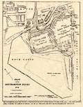
B1999.280.2
(Giles 1878)
|
Map, uncoloured engraving, Plan of the Southampton Docks,
Southampton, Hampshire, scale about 10 inches to 1 mile, by
Alfred Giles, engineer, 1878.
|
|
|
|
B1999.371.1
(Vancouver 1810)
|
Map, hand coloured engraving, Soil and Substrata of ... the
County of Hants, scale about 6 miles to 1 inch, engraved by
Neele, Strand, published by R Philips, New Bridge Street, London,
1810.
|
|
|
|
B1999.518.1757.13.1
(Gent Mag 1700s)
|
Map, uncoloured engraving, New Map of England and Wales, scale
about 25 miles to 1 inch, by Thomas Jefferys, published in the
Gentleman's Magazine, London, 1757.
|
|
|
|
B1999.518.1765.7.1
(Gent Mag 1765)
|
Strip map, road map, uncoloured engraving, Road from London to
Portsmouth, Hampshire, to Chichester, West Sussex, to
Southampton, Hampshire, to Poole, Dorset and from Southampton to
Winchester, Hampshire, about 1765.
|
|
|
|
B1999.518.1765.13.1
(Gent Mag 1765)
|
Strip map, road map, uncoloured engraving, Road from London to
Lands End, Cornwall and from Exeter, Devon to Truro, Cornwall,
about 1765.
|
|
|
|
B1999.518.1772.3.2
(Gent Mag 1770s)
|
Map, uncoloured engraving, Plan of the proposed Navigable
Canal from Andover to Redbridge, Hampshire, scale about 2 miles
to 1 inch, engraved by J Lodge, surveyed 1770.
|
|
|
|
B1999.518.1775.7.1
(Gent Mag 1765)
|
Strip map, uncoloured engraving, road map, part of the Road
from London to Barnstable, Devon, and to Truro, Cornwall, across
Hampshire, Wiltshire, Somserset etc, about 1775.
|

|
|
|
B1999.518.1778.4.1
(Gent Mag 1770s)
|
Map, uncoloured engraving, Plan of the intended Navigable
Canal from Basingstoke to the River Wey, scale about 4 miles to 1
inch, about 1777.
|
|
|
|
B2000.285
(Brookes 1773)
|
Gazetteer, The General Gazetteer or Compendious Geographical
Dictionary, by R Brookes, published London, 3rd edition,
1773.
|
|
|
|
B2000.285.1
|
Map, An Accurate Map of the World, engraved by G Relles,
inserted in Brookes's Gazetteer, published London, 3rd edition,
1773.
|
|
|
|
B2000.285.2
|
Map, An Accurate Map of Africa, from Sieur Robert, France,
engraved by G Relles, inserted in Brookes's Gazetteer, published
London, 3rd edition, 1773.
|
|
|
|
B2000.285.3
|
Map, An Accurate Map of North America, by Thomas Bowen,
inserted in Brookes's Gazetteer, published London, 3rd edition,
1773.
|
|
|
|
B2000.285.4
|
Map, An Accurate Map of South America, by Thomas Bowen,
inserted in Brookes's Gazetteer, published London, 3rd edition,
1773.
|
|
|
|
B2000.285.5
|
Map, An Accurate Map of Asia, from Sieur Robert, France,
engraved by G Relles, inserted in Brookes's Gazetteer, published
London, 3rd edition, 1773.
|
|
|
|
B2000.285.6
(Brookes 1773)
|
Map, uncoloured engraving, A New Map of England and Wales,
scale about 60 miles to 1 inch, engraved by G Relles, inserted in
Brookes's Gazetteer, published London, 3rd edition, 1773.
|
|
|
|
B2000.285.7
|
Map, An Accurate Map of Europe, by Thomas Bowen, inserted in
Brookes's Gazetteer, published London, 3rd edition, 1773.
|
|
|
|
B2000.285.8
|
Map, A New and Correct Map of France, by J Gibson, inserted in
Brookes's Gazetteer, published London, 3rd edition, 1773.
|
|
|
|
B2000.285.9
|
Map, A New Map of the Empire of Germany, engraved by G Relles,
inserted in Brookes's Gazetteer, published London, 3rd edition,
1773.
|
|
|
|
B2000.334
|
Book, London and South Western Railway Gradient Manual,
published by the London and South Western Railway, LSWR,
1887.
|
|
|
|
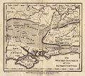
B2001.83.1
(Marshall 1798)
|
Map, uncoloured engraving, The Western Districts of the
Southern Counties, scale about 1 to 620000, about 10 miles to 1
inch, included in The Rural Economy of the Southern Counties,
vol.11, by Mr Marshall, published by G Nicol, Pall Mall, and G G
and J Robinson, Paternoster Row, and J Debrett, Piccadilly,
London, 1798.
|
|
|
|
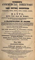
B2002.76
(Robson 1839)
|
Directory, Robson's Commercial Directory of the Seven Counties
of Middlesex, Essex, Herts, Kent, Surrey, Sussex, and Hants with
the Isle of Wight, published by William Robson and Co, London
Directory and Court Guide Office, 4 Cloak Lane, Cheapside,
London, 20th edition, 1839.
|
|
|
|
B2002.76.1
|
Map, Essex, scale about 4 miles to 1 inch, in the 20th edition
of Robson's Commercial Directory of the Seven Counties ...,
published by William Robson and Co, London Directory and Court
Guide Office, 4 Cloak Lane, Cheapside, London, 1839.
|
|
|
|
B2002.76.2
|
Map, Hertfordshire, scale about 3 miles to 1 inch, in the 20th
edition of Robson's Commercial Directory of the Seven Counties
..., published by William Robson and Co, London Directory and
Court Guide Office, 4 Cloak Lane, Cheapside, London, 1839.
|
|
|
|
B2002.76.3
|
Map, Kent, scale about 4 miles to 1 inch, in the 20th edition
of Robson's Commercial Directory of the Seven Counties ...,
published by William Robson and Co, London Directory and Court
Guide Office, 4 Cloak Lane, Cheapside, London, 1839.
|
|
|
|
B2002.76.4
|
Map, Middlesex including part of London, scale about 2 miles
to 1 inch, in the 20th edition of Robson's Commercial Directory
of the Seven Counties ..., published by William Robson and Co,
London Directory and Court Guide Office, 4 Cloak Lane, Cheapside,
London, 1839.
|
|
|
|
B2002.76.5
|
Map, Surrey including part of London, scale about 3 miles to 1
inch, in the 20th edition of Robson's Commercial Directory of the
Seven Counties ..., published by William Robson and Co, London
Directory and Court Guide Office, 4 Cloak Lane, Cheapside,
London, 1839.
|
|
|
|
B2002.76.6
|
Map, Sussex ie East Sussex and West Sussex, scale about 5
miles to 1 inch, in the 20th edition of Robson's Commercial
Directory of the Seven Counties ..., published by William Robson
and Co, London Directory and Court Guide Office, 4 Cloak Lane,
Cheapside, London, 1839.
|
|
|
|
B2002.76.7
(Robson 1839)
|
Map, uncoloured engraving, Hampshire with the Isle of Wight,
scale about 4.5 miles to 1 inch, in the 20th edition of Robson's
Commercial Directory of the Seven Counties ..., published by
William Robson and Co, London Directory and Court Guide Office, 4
Cloak Lane, Cheapside, London, 1839.
|
|
|
|
B2002.84
(Spencer 1772)
|
Book, the Complete English Traveller, or New Survey and
Description of England and Wales, by Nathaniel Spencer, published
by John Cooke, Shakespear's Head, Pater Noster Row, London,
1772.
|

|
|
|
B2002.84.1
(Unknown 1772)
|
Map, uncoloured engraving, An Accurate Map of Great Britain,
scale about 40 miles to 1 inch, in the Complete English
Traveller, written by Nathaniel Spencer, published by John Cooke,
Shakespear's Head, Pater Noster Row, London, 1772.
|
|
|
|
B2002.84.2
(Bowen 1772)
|
Map, uncoloured engraving, A New and Accurate Map of England,
with Wales, scale about 47 miles to 1 inch, by Thomas Bowen, for
the Complete English Traveller, written by Nathaniel Spencer,
published by John Cooke, Shakespear's Head, Pater Noster Row,
London, 1772.
|
|
|
|
B2002.86
(Kelly 1889)
|
Directory, Kelly's Directory of Hampshire, Wiltshire and
Dorsetshire, published by Kelly and Co, 51 Great Queen Street,
Lincoln's Inn Fields, London, 8th edition 1889.
|
|
|
|
B2002.86.1
(Kelly 1889)
|
Map, uncoloured engraving, Kelly's Map of Hampshire, scale
about 4 miles to 1 inch, by Kelly and Co, 51 Great Queen Street,
Lincoln's Inn Fields, London, 1889.
|
|
|
|
B2002.86.2
|
Map, uncoloured engraving, Kelly's Map of Wiltshire, scale
about 3.5 miles to 1 inch, by Kelly and Co, 51 Great Queen
Street, Lincoln's Inn Fields, London, 1889.
|
|
|
|
B2002.86.3
|
Map, uncoloured engraving, Kelly's Map of Dorsetshire, scale
about 3.5 miles to 1 inch, by Kelly and Co, 51 Great Queen
Street, Lincoln's Inn Fields, London, 1889.
|
|
|
|
BWM272
|
Atlas, The Southampton Atlas, Maps and Plans of Old
Southampton, folder of reproduction maps, town plans of
Southampton, Hampshire 1560 to 1905, edited by W H Rogers,
published by Southampton Record Society, Hampshire, 1907.
|
|
|
|
BWM376
(Unknown 1762)
|
Street map, Town and Manor of Basingstoke, part of the estate
of the Duke of Bolton, Basingstoke, Hampshire, scale about 1 to
1600, 40 inches to 1 mile, surveyed 1762, copied by Henry Downs,
1836.
|
|
|
|
BWM453
|
Map, hand coloured engraving, New Map of England and Wales,
scale about 20 miles to 1 inch, published by Charles Smith, 172
Strand, London, 1804, 3rd edition corrected to 1818.
|
|
|
|
BWM454
|
Atlas, a new set of Maps both of Antient and Present Geography
, of the World, by Edward Wells, Christchurch, Oxford,
Oxfordshire, published by Bonwicke, Walthoe, Wilkin and Ward,
London, late 17th century.
|
|
|
|
BWM455
|
Sale catalogue, with maps, Hackwood Building Estate,
Basingstoke, Hampshire 1900.
|
|
|
|
BWM462
|
Sale catalogue, with map of Dummer Estate, Dummer, Dummer with
Kempshot, Hampshire, scale about 13 inches to 1 mile, for sale by
Daniel Smith, Son and Oakley, London, 1864.
|
|
|
|
BWM463
|
Sale catalogue, with maps, for sale by Frederick Ellen,
auctioneer, Andover, Hampshire, in London, of BEAUREPEAIRE and
BROCAS LANDS estates, Bramley, Pamber and Sherborne St John,
Hampshire and Mortimer, Berkshire, 21 Aug 1872.
|
|
|
|
BWM469.4
(Bradshaw 1841)
|
Railway guide, Bradshaw's Railway Companion, railway maps and
timetables, published by Bradshaw and Blacklock, 27 Brown Street,
Manchester, 1841.
|
|
|
|
BWM469.4.10
(Bradshaw 1841)
|
Railway map, hand coloured engraving, railways in Surrey, West
and East Sussex, and Hampshire, scale about 1 to 620000, about 10
miles to 1 inch, p.10 in Bradshaw's Railway Companion, published
by Bradshaw and Blacklock, 27 Brown Street, Manchester, 1841.
|
|
|
|
BWM469.5
|
Guide book, Plans of Towns, to accompany Bradshaw's
Continental Railway Guide, published late 19th century.
|
|
|
|
BWM469.40
|
Guide book, Practical Guides Condensed, continental routes, by
An Englishman Abroad, published by Simpkin, Marshall and Co,
London, etc, late 19th century.
|
|
|
|
BWM469.41
|
Guide book, with map and strip maps, The Rhine and its
Beauties, published by F E Longley, 96 Warwick Lane, London, etc,
late 19th century.
|
|
|
|
BWM500
(Dawson 1832)
|
Map, copy of hand coloured lithograph, Basingstoke, Hampshire,
nominal scale 1 mile to 1 inch, indicating proposed changes in
municipal boundaries, by Lt Robert K Dawson RE, 1835, copied
1937.
|
|
|
|
BWM550
(Saxton 1575)
|
Reproduction map, Southamtoniae, ie Hampshire, scale about 3
miles to 1 inch, engraved by Leonard Terwoort, Antwerp,
Netherlands, published by Christopher Saxton, map maker, London?
about 1575, reproduced by the British Museum, London.
|
|
|
|
BWM575
|
Map, pen and ink drawing, Lees Farm, Nately Scures, Newnham,
Hampshire, scale about say 26 inches to 1 mile, for a farm survey
for James Webb, by W Francis, 1792.
|
|
|
|
BWM600.1
|
Notice, with sketch map, for Quarter Sessions, Winchester,
Hampshire, applying for the substitution of a footpath on the
land of Rev Hugh A Tapsfield, Manydown area? Wootton St Lawrence,
Hampshire, 1917.
|
|
|
|
BWM635
(Knight 1797)
|
Chart, uncoloured engraving, Coast of Sussex and Hampshire
from Selsey to Christ Church, scale about 1.5 miles to 1 inch, by
Captain John Knight RN, published by William Faden, Charing
Cross, London, 1797.
|

|
|
|
BWM643
|
Plan, Basing House, Hampshire, ground plan as excavated, scale
about 1 to 340, published in Archaeologia, by the Society of
Antiquaries, London, 1909.
|
|
|
|
BWM1956.8
|
Distance table, Reciprocal Distances of the Principal Towns of
England ..., published by Edward Baines and Son, printer, Mercury
Office, Leeds, West Yorkshire, 3rd edition 1835.
|
|
|
|
BWM1958.44
|
Celestial globe, with compass, on stand, reduced to 1850 by J
Addison, published by Malby and Co, Strand, London, 1848.
|
|
|
|
BWM1964.288
|
Map, photocopy of an engraving, estate plans of lands in
Newtown, and at Ashford Hill House, Ashford Hill with Headley,
Hampshire, owned by Corpus Christi College, Oxford, 1606.
|
|
|
|
BWM1964.668
(Cruchley 1856)
|
Map, Hampshire, including the Isle of Wight, from series
Cruchley's County Maps of England, scale about 2.5 miles to 1
inch, 1856, published by Gall and Inglis, 25 Paternoster Square,
London and Bernard Terrace, Edinburgh, Lothian, about 1890.
|
|
|
|
BWM1965.562
(Cruchley 1856)
|
Map, Hampshire, including the Isle of Wight, from series
Cruchley's County Maps of England, scale about 2.5 miles to 1
inch, 1856, published by Gall and Inglis, 25 Paternoster Square,
London and Bernard Terrace, Edinburgh, Lothian, about 1890.
|
|
|
|
BWM1965.563
(Dispatch 1863)
|
Map, Hampshire, scale about 3 miles to 1 inch, 1863, published
by G W Bacon and Co, 127 Strand, London, about 1890s?
|
|
|
|
BWM1968.151
|
Map, cycle and touring map of England and Wales sheet 19,
parts of Berkshire, Hampshire and Surrey, scale about 2 miles to
1 inch, published by Gall and Inglis, 25 Paternoster Square,
London and Edinburgh, Lothian, early 20th century.
|
|
|
|
BWM1996.200
|
Map, Plan of London printed on cloth, printed by John
Bartholomew and Ltd, Duncan Street, Edinburgh, 1960s.
|
|
|
|
BWM1996.235
|
Photograph, colour slide, map, London, 1900.
|
|
|
|
CRH1952.74.2
|
Map, pen and ink drawing, Ibsley Common, Ellingham, Harbridge
and Ibsley, Hampshire, scale about 6 inches to 1 mile, for
publication in Local Papers, by Heywood Sumner, 1931.
|
|
|
|
CRH1956.60
|
Atlas, The Survey Atlas of England and Wales, editor John
Bartholomew, published under the patronage of the Royal
Geographical Society, by The Edinburgh Geographical Institute,
Edinburgh, Lothian, 1903.
|
|
|
|
CRH1957.115.1
|
Chart, scale about 2.5 miles to 1 inch, Fleet Review of the
Royal Navy at Spithead, in the Solent off Gosport and Portsmouth,
Hampshire, published by the Admiralty, London, 1911.
|
|
|
|
CRH1957.115.2
|
Chart, scale about 3 miles to 1 inch, Spithead, Fleet Review
of the Royal Navy at Spithead, in the Solent off Gosport and
Portsmouth, Hampshire, published by the Admiralty, London,
1911.
|
|
|
|
CRH1957.115.3
|
Chart, Fleet Review of the Royal Navy, Spithead, in the Solent
off Gosport and Portsmouth, Hampshire, scale about 4 miles to 1
inch, published by the Admiralty, London, 1935.
|
|
|
|
CRH1958.90
(Kitchin 1751 large)
|
Map, hand coloured engraving, A New Improved Map of Hampshire,
and the Isle of Wight, scale about 3 miles to 1 inch, about 1751,
published for inclusion in the Large English Atlas series by
Thomas Kitchin, London, about 1790.
|
|
|
|
CRH1960.8
(Norden 1607)
|
Map, Hamshire olim Pars Belgarum, Hampshire, scale about 6
miles to 1 inch, by John Norden about 1595, version engraved by
William Hole and published in Camden's Britannia, 6th Latin
edition, about 1607.
|
|
|
|
CRH1960.13
|
Atlas, Royal Atlas of Modern Geography, maps of the World, by
Alexander Keith Johnston, published by William Blackwood and
Sons, Edinburgh, Lothian, 1875.
|
|
|
|
CRH1960.94.9
(OS 1922 relief)
|
Map, physical map of England and Wales, scale about 16 miles
to 1 inch, vertical interval 200ft, published by the Ordnance
Survey, Southampton, Hampshire, 1922.
|
|
|
|
CRH1961.13
(Hall 1830s)
|
Map, England and Wales, scale about 27 miles to 1 inch, by
Sidney Hall, published by Longman, Rees, Orme, Brown and Green,
Paternoster Row, London, about 1830s?
|
|
|
|
CRH1963.26
(OS 1922)
|
Atlas, Ordnance Survey Atlas of England and Wales, scale 4
miles to 1 inch, published by the Ordnance Survey, Southampton,
Hampshire, 1922.
|
|
|
|
CRH1964.110
|
Map, photograph copy from an unidentified original, the New
Forest of Hampshire, scale about 1.5 miles to 1 inch in the copy,
perhaps about 1810s-20s.
|
|
|
|
CRH1970.57.7
|
Toy egg, varnished fruitwood egg decorated with an oval
transfer print of the Bridge of Dochart, Killin, the egg opens up
to reveal a colour printed wooden globe which balances inside the
top so that it can revolve, 1870-1890s.
|
|
|
|
DA1984.27
|
Map, daily Express War Map of Europe, scale about 57 miles to
1 inch, by George Philip and Son, London Geographical Institute,
London, published by Daily Express Publications, World War II,
1939-45.
|
|
|
|
|
 |
top of page |
 |
FA1965 -- FA1997 |
|