
|
Catalogue of Map Collection
FA2000: Identity number order
 |
FA1999.60 -- FA1999.160 |
 |
bottom of page |
|
|
A thumbnail image on the right will enlarge, then return here.
The left link will take you to the Map Collection record page, and if (Map Group) is shown, will link to other Hampshire resources.
If you want to return to your place here, use your back browser button.
|
|
Identity number
(Map Group)
|
|
|
 |
|
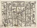
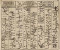
FA2000.1
(Walker 1830)

|
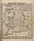
Map, England, plate 5, south east, scale about 12 miles to 1
inch, by J and C Walker, published for the Society for the
Diffusion of Useful Knowledge, by Baldwin and Cradock, 47
Paternoster Row, London, 1830.
|
|
|
|
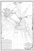
FA2000.2
(Johnston 1900s)
|
Railway map, coloured, England and Wales, southern sheet,
scale about 19 miles to 1 inch, by W and A K Johnston, Edinburgh,
Lothian and London, about 1900s.
|
|
|
|
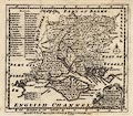
FA2000.3
|
Map, Andover, sheet 33 at scale 2 miles to 1 inch, published
by the Ordnance Survey, Southampton, Hampshire, 1908.
|
|
|
|
FA2000.4
|
Map, Winchester area, Hampshire, sheet 300, scale 1 mile to 1
inch, published by the Ordnance Survey, Southampton, Hampshire,
1876.
|
|
|
|
FA2000.5
(OS 1950s Seventh Series)
|
Map, One inch map Seventh Series, sheet 168, Winchester,
Hampshire, scale 1 mile to 1 inch, published by the Ordnance
Survey, Chessington, Surrey, 1959 reprinted 1963.
|
|
|
|
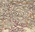
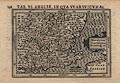
FA2000.6
(Mercator 1595)
|
Map, uncoloured engraving, Warwicum Northamptonia Huntingdonia
... etc, part of Angleterre, England, showing Hampshire, scale
about 20 to 30 miles to 1 inch, by Gerhard Mercator 1595,
published by Jodocus Hondius, 1630?
|
|
|
|
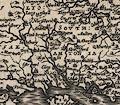
FA2000.7
(Bertius 1616)
|
Map, uncoloured engraving, Angliae, in qua Warwicum Etc or
Warwicum Northampton Hunting etc, scale about 45 miles to 1 inch,
engraved by Jodocus Hondius the younger, reduced from the
Mercator map of 1595, published by Petrus Bertius, 1616.
|
|
|
|
FA2000.8.1
(Rocque 1746)
|
Map, uncoloured engraving, Hamp-Shire ie Hampshire, scale
about 6 miles to 1 inch, by John Rocque, 1746, published in the
Small British Atlas, by John Rocque, Strand, London, 1753?
|
|
|
|
FA2000.8.2
(Rocque 1746)
|
Descriptive text, Hampshire or the County of Southampton,
about 1746, from the Small British Atlas, published by John
Rocque, Strand, London, 1753?
|
|
|
|
FA2000.9
(Senex 1757)
|
Strip map, road map, hand coloured engraving, scale about
2-2.5 miles to 1 inch, The Road from Oxford to Chichester, with a
segment in Hampshire, and The Road from Oxford to Cambridge, by
John Senex, 1719, edition printed for John Bowles and Son, The
Black Horse, Cornhill, London, after 1757.
|
|
|
|
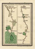
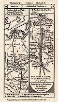
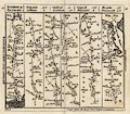
FA2000.10.1
(Mogg 1814)
|
Strip map, road map, part of route London to Southampton,
Hampshire, scale about 1 inch to 1 mile, probably published by E
Mogg, London, 1814.
|
|
|
|
FA2000.10.2
(Mogg 1814)
|
Strip map, road map, part of route London to Southampton,
Hampshire, scale about 1 inch to 1 mile, probably published by E
Mogg, London, 1814.
|
|
|
|
FA2000.10.3
(Mogg 1814)
|
Strip map, road map, part of route London to Poole, Dorset,
scale about 1 inch to 1 mile, probably published by E Mogg,
London, 1814.
|
|
|
|
FA2000.10.4
(Mogg 1814)
|
Strip map, road map, part of route London to Lymington,
Lymington and Pennington, Hampshire, and London to Christchurch,
Dorset, scale about 1 inch to 1 mile, probably published by E
Mogg, London, 1814.
|
|
|
|
FA2000.10.5
(Mogg 1814)
|
Strip map, road map, part of route London to Exeter, Devon,
scale about 1 inch to 1 mile, probably published by E Mogg,
London, 1814.
|
|
|
|
FA2000.10.6
(Mogg 1814)
|
Strip map, road map, part of route Bath, Somerset to Brighton,
Sussex, scale about 1 inch to 1 mile, probably published by E
Mogg, London, 1814.
|
|
|
|
FA2000.10.7
(Mogg 1814)
|
Strip map, road map, part of route Bath, Somerset to Brighton,
Sussex, scale about 1 inch to 1 mile, probably published by E
Mogg, London, 1814.
|
|
|
|
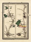
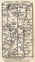
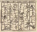
FA2000.19
(Hinton 1765)
|
Strip map, road map, uncoloured engraving, parts of the Road
from London to Southampton, Hampshire, Southampton to Salisbury,
Wiltshire, London to Pool, Dorset and to Lymington, London to
Shrewsbury, Shropshire, scale about 2.2 miles to 1 inch,
published in the Universal Magazine of Knowledge and Pleasure, by
John Hinton, Kings Arms, St Paul's Churchyard, London,
1765-73.
|
|
|
|
FA2000.20
(Bacon 1907)
|
Atlas, Bacon's Library Atlas of the British Isles, edited by G
W Bacon, published by G W Bacon and Co, London, 1907.
|
|
|
|
FA2000.20.1
|
Map, Bedfordshire, scale about 1 to 140000, about 2 miles to 1
inch, in Bacon's Library Atlas of the British Isles, published by
G W Bacon and Co, Bacon's Geographical Establishment, London,
1907.
|
|
|
|
FA2000.20.2
|
Map, Berkshire, scale about 1 to 170000, about 3 miles to 1
inch, in Bacon's Library Atlas of the British Isles, published by
G W Bacon and Co, Bacon's Geographical Establishment, London,
1907.
|
|
|
|
FA2000.20.3
|
Map, Buckinghamshire, scale about 1 to 210000, about 3 miles
to 1 inch, in Bacon's Library Atlas of the British Isles,
published by G W Bacon and Co, Bacon's Geographical
Establishment, London, 1907.
|
|
|
|
FA2000.20.4
|
Map, Cambridgeshire, scale about 1 to 190000, about 3 miles to
1 inch, in Bacon's Library Atlas of the British Isles, published
by G W Bacon and Co, Bacon's Geographical Establishment, London,
1907.
|
|
|
|
FA2000.20.5
|
Map, Cheshire, scale about 1 to 220000, about 3.5 miles to 1
inch, in Bacon's Library Atlas of the British Isles, published by
G W Bacon and Co, Bacon's Geographical Establishment, London,
1907.
|
|
|
|
FA2000.20.6
|
Map, Cornwall, scale about 1 to 340000, about 5 miles to 1
inch, in Bacon's Library Atlas of the British Isles, published by
G W Bacon and Co, Bacon's Geographical Establishment, London,
1907.
|
|
|
|
FA2000.20.7
|
Map, Cumberland and Westmorland N, scale 3 miles to 1 inch, in
Bacon's Library Atlas of the British Isles, published by G W
Bacon and Co, Bacon's Geographical Establishment, London,
1907.
|
|
|
|
FA2000.20.8
|
Map, Cumberland and Westmorland S, scale about 3 miles to 1
inch, in Bacon's Library Atlas of the British Isles, published by
G W Bacon and Co, Bacon's Geographical Establishment, London,
1907.
|
|
|
|
FA2000.20.9
|
Map, Derbyshire, scale about 1 to 210000, about 3 miles to 1
inch, in Bacon's Library Atlas of the British Isles, published by
G W Bacon and Co, Bacon's Geographical Establishment, London,
1907.
|
|
|
|
FA2000.20.10
|
Map, Devonshire North Sheet, scale about 1 to 250000, about 4
miles to 1 inch, in Bacon's Library Atlas of the British Isles,
published by G W Bacon and Co, Bacon's Geographical
Establishment, London, 1907.
|
|
|
|
FA2000.20.11
|
Map, Devonshire South Sheet, scale about 1 to 250000, about 4
miles to 1 inch, in Bacon's Library Atlas of the British Isles,
published by G W Bacon and Co, Bacon's Geographical
Establishment, London, 1907.
|
|
|
|
FA2000.20.12
|
Map, Dorsetshire, scale about 1 to 210000, about 3.5 miles to
1 inch, in Bacon's Library Atlas of the British Isles, published
by G W Bacon and Co, Bacon's Geographical Establishment, London,
1907.
|
|
|
|
FA2000.20.13
|
Map, Durham, scale about 1 to 190000, about 3 miles to 1 inch,
in Bacon's Library Atlas of the British Isles, published by G W
Bacon and Co, Bacon's Geographical Establishment, London,
1907.
|
|
|
|
FA2000.20.14
|
Map, Essex, scale about 1 to 260000, about 4 miles to 1 inch,
in Bacon's Library Atlas of the British Isles, published by G W
Bacon and Co, Bacon's Geographical Establishment, London,
1907.
|
|
|
|
FA2000.20.15
(Bacon 1907)
|
Map, Hampshire North Sheet, scale about 1 to 190000, about 3
miles to 1 inch, in Bacon's Library Atlas of the British Isles,
published by G W Bacon and Co, Bacon's Geographical
Establishment, London, 1907.
|
|
|
|
FA2000.20.16
(Bacon 1907)
|
Map, Hampshire South Sheet, with the Isle of Wight, scale
about 1 to 190000, about 3 miles to 1 inch, in Bacon's Library
Atlas of the British Isles, published by G W Bacon and Co,
Bacon's Geographical Establishment, London, 1907.
|
|
|
|
FA2000.20.17
|
Map, Herefordshire, scale about 1 to 180000, about 3 miles to
1 inch, in Bacon's Library Atlas of the British Isles, published
by G W Bacon and Co, Bacon's Geographical Establishment, London,
1907.
|
|
|
|
FA2000.20.18
|
Map, Hertfordshire, scale about 1 to 180000, about 3 miles to
1 inch, in Bacon's Library Atlas of the British Isles, published
by G W Bacon and Co, Bacon's Geographical Establishment, London,
1907.
|
|
|
|
FA2000.20.19
|
Map, Huntingdonshire, scale about 1 to 130000, about 2 miles
to 1 inch, in Bacon's Library Atlas of the British Isles,
published by G W Bacon and Co, Bacon's Geographical
Establishment, London, 1907.
|
|
|
|
FA2000.20.20
|
Map, Kent, scale about 1 to 260000, about 4 miles to 1 inch,
in Bacon's Library Atlas of the British Isles, published by G W
Bacon and Co, Bacon's Geographical Establishment, London,
1907.
|
|
|
|
FA2000.20.21
|
Map, Lancashire N, scale about 1 to 190000, about 3 miles to 1
inch, in Bacon's Library Atlas of the British Isles, published by
G W Bacon and Co, Bacon's Geographical Establishment, London,
1907.
|
|
|
|
FA2000.20.22
|
Map, Lancashire S, scale about 1 to 190000, about 3 miles to 1
inch, in Bacon's Library Atlas of the British Isles, published by
G W Bacon and Co, Bacon's Geographical Establishment, London,
1907.
|
|
|
|
FA2000.20.23
|
Map, Leicestershire and Rutlandshire, scale about 1 to 200000,
about 3 miles to 1 inch, in Bacon's Library Atlas of the British
Isles, published by G W Bacon and Co, Bacon's Geographical
Establishment, London, 1907.
|
|
|
|
FA2000.20.24
|
Map, Lincolnshire, scale about 1 to 300000, about 5 miles to 1
inch, in Bacon's Library Atlas of the British Isles, published by
G W Bacon and Co, Bacon's Geographical Establishment, London,
1907.
|
|
|
|
FA2000.20.25
|
Map, Middlesex, and London, scale about 1 to 130000, about 2
miles to 1 inch, in Bacon's Library Atlas of the British Isles,
published by G W Bacon and Co, Bacon's Geographical
Establishment, London, 1907.
|
|
|
|
FA2000.20.26
|
Map, Monmouthshire and the River Wye, scale about 1 to 160000,
about 2.5 miles to 1 inch, in Bacon's Library Atlas of the
British Isles, published by G W Bacon and Co, Bacon's
Geographical Establishment, London, 1907.
|
|
|
|
FA2000.20.27
|
Map, Norfolk, scale about 1 to 270000, about 4 miles to 1
inch, in Bacon's Library Atlas of the British Isles, published by
G W Bacon and Co, Bacon's Geographical Establishment, London,
1907.
|
|
|
|
FA2000.20.28
|
Map, Northamptonshire N, scale about 1 to 180000, about 3
miles to 1 inch, in Bacon's Library Atlas of the British Isles,
published by G W Bacon and Co, Bacon's Geographical
Establishment, London, 1907.
|
|
|
|
FA2000.20.29
|
Map, Northamptonshire S, scale about 1 to 180000, about 3
miles to 1 inch, in Bacon's Library Atlas of the British Isles,
published by G W Bacon and Co, Bacon's Geographical
Establishment, London, 1907.
|
|
|
|
FA2000.20.30
|
Map, Northumberland, scale about 1 to 270000, about 4 miles to
1 inch, in Bacon's Library Atlas of the British Isles, published
by G W Bacon and Co, Bacon's Geographical Establishment, London,
1907.
|
|
|
|
FA2000.20.31
|
Map, Nottinghamshire, scale about 1 to 190000, about 3 miles
to 1 inch, in Bacon's Library Atlas of the British Isles,
published by G W Bacon and Co, Bacon's Geographical
Establishment, London, 1907.
|
|
|
|
FA2000.20.32
|
Map, Oxfordshire, scale about 1 to 210000, about 3 miles to 1
inch, in Bacon's Library Atlas of the British Isles, published by
G W Bacon and Co, Bacon's Geographical Establishment, London,
1907.
|
|
|
|
FA2000.20.33
|
Map, Shropshire N, scale about 1 to 160000, about 2.5 miles to
1 inch, in Bacon's Library Atlas of the British Isles, published
by G W Bacon and Co, Bacon's Geographical Establishment, London,
1907.
|
|
|
|
FA2000.20.34
|
Map, Shropshire S, scale about 1 to 160000, about 2.5 miles to
1 inch, in Bacon's Library Atlas of the British Isles, published
by G W Bacon and Co, Bacon's Geographical Establishment, London,
1907.
|
|
|
|
FA2000.20.35
|
Map, Somerset, scale about 1 to 230000, about 3.5 miles to 1
inch, in Bacon's Library Atlas of the British Isles, published by
G W Bacon and Co, Bacon's Geographical Establishment, London,
1907.
|
|
|
|
FA2000.20.36
|
Map, Staffordshire, scale about 1 to 250000, about 4 miles to
1 inch, in Bacon's Library Atlas of the British Isles, published
by G W Bacon and Co, Bacon's Geographical Establishment, London,
1907.
|
|
|
|
FA2000.20.37
|
Map, Suffolk, scale about 1 to 250000, about 4 miles to 1
inch, in Bacon's Library Atlas of the British Isles, published by
G W Bacon and Co, Bacon's Geographical Establishment, London,
1907.
|
|
|
|
FA2000.20.38
|
Map, Surrey, scale about 1 to 170000, about 2.5 miles to 1
inch, in Bacon's Library Atlas of the British Isles, published by
G W Bacon and Co, Bacon's Geographical Establishment, London,
1907.
|
|
|
|
FA2000.20.39
|
Map, Sussex, scale about 1 to 280000, about 4.5 miles to 1
inch, in Bacon's Library Atlas of the British Isles, published by
G W Bacon and Co, Bacon's Geographical Establishment, London,
1907.
|
|
|
|
FA2000.20.40
|
Map, Warwickshire, scale about 1 to 190000, about 3 miles to 1
inch, in Bacon's Library Atlas of the British Isles, published by
G W Bacon and Co, Bacon's Geographical Establishment, London,
1907.
|
|
|
|
FA2000.20.41
|
Map, Wiltshire, scale about 1 to 200000, about 3 miles to 1
inch, in Bacon's Library Atlas of the British Isles, published by
G W Bacon and Co, Bacon's Geographical Establishment, London,
1907.
|
|
|
|
FA2000.20.42
|
Map, Worcestershire and Gloucestershire N, scale about 1 to
190000, about 3 miles to 1 inch, in Bacon's Library Atlas of the
British Isles, published by G W Bacon and Co, Bacon's
Geographical Establishment, London, 1907.
|
|
|
|
FA2000.20.43
|
Map, Worcestershire and Gloucestershire S, scale about 1 to
190000, about 3 miles to 1 inch, in Bacon's Library Atlas of the
British Isles, published by G W Bacon and Co, Bacon's
Geographical Establishment, London, 1907.
|
|
|
|
FA2000.20.44
|
Map, Yorkshire NE, scale about 1 to 270000, about 4 miles to 1
inch, in Bacon's Library Atlas of the British Isles, published by
G W Bacon and Co, Bacon's Geographical Establishment, London,
1907.
|
|
|
|
FA2000.20.45
|
Map, Yorkshire NW, scale about 1 to 270000, about 4 miles to 1
inch, in Bacon's Library Atlas of the British Isles, published by
G W Bacon and Co, Bacon's Geographical Establishment, London,
1907.
|
|
|
|
FA2000.20.46
|
Map, Yorkshire SE, scale about 1 to 270000, about 4 miles to 1
inch, in Bacon's Library Atlas of the British Isles, published by
G W Bacon and Co, Bacon's Geographical Establishment, London,
1907.
|
|
|
|
FA2000.20.47
|
Map, Yorkshire SW, scale about 1 to 270000, about 4 miles to 1
inch, in Bacon's Library Atlas of the British Isles, published by
G W Bacon and Co, Bacon's Geographical Establishment, London,
1907.
|
|
|
|
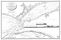
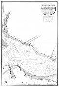
FA2000.21.1
(Mackenzie 1780s)
|
Chart, uncoloured engraving, Chart of the Channel between the
Isle of Wight and the Coast of Hampshire, scale about 1 to
24000?, about 3ins to 1 nautical mile, surveyed by Lt Murdoch
Mackenzie, 1781, drawn by Besancon, engraved by Caplin, published
by the Depot-general de la Marine, France, 1824.
|
|
|
|
FA2000.21.2
(Mackenzie 1780s)
|
Chart, uncoloured engraving, Chart of Part of the Isle of
Wight and the Coast of Hampshire between Calshot and Gillkicker,
scale about 1 to 24000?, about 3ins to 1 nautical mile, surveyed
by Lt Murdoch Mackenzie, 1783, drawn by Besancon, engraved by
Caplin, published by the Depot-general de la Marine, France,
1823.
|
|
|
|
FA2000.21.3
(Mackenzie 1780s)
|
Chart, uncoloured engraving, Chart of Selsea Bill, the Owers,
and Chichester and Emsworth Harbours, scale about 1 to 40000?,
about 1 1/2 ins to 1 mile, surveyed by Lt Murdoch Mackenzie,
1786, drawn by Besancon, engraved by Caplin, published by the
Depot-general de la Marine, France, 1823.
|
|
|
|
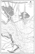
FA2000.22
(Mackenzie 1780s)
|
Chart, uncoloured engraving, St Helen's Road, Spithead,
Portsmouth and Langstone Harbours, scale about 1 to 23000?, about
3 ins to 1 nautical mile, surveyed by Lt Murdoch Mackenzie, 1783,
published by the Hydrographical Office, 1808.
|
|
|
|
FA2000.23.1
|
Railway map, London and the South East, british railway lines
diagram, by Phil Tyler and Doug Rose, FWT Cartography, London,
published by Rail Settlement Plan, 1997.
|
|
|
|
FA2000.23.2
|
Railway map, London Connections, british railway lines
diagram, by FWT Cartography, London, published by Rail Settlement
Plan, 1997.
|
|
|
|
FA2000.24
|
Map, railway, bus and ferry map, Public Transport Map of
Hampshire, scale about 1 to 110000, about 1.5 miles to 1 inch, by
Pindar, Aylesbury, Buckinghamshire, published by Hampshire CC,
Winchester, Hampshire, 2000.
|
|
|
|
FA2000.25
|
Atlas, Economist Atlas, mapping the shape of the World today,
published for Economist Books by Guild Publishing, London etc,
1989.
|
|
|
|
FA2000.26
|
Map, engraving, Marches of the British Armies in the Peninsula
of India, 1790-91, 3rd Mysore War, scale about 1 to 750000, about
12 miles to 1 inch, from originals by Capt A Beatson and Capt A
Allan, compiled and published by J Rennell, 1792.
|
|
|
|
FA2000.27
|
Map, engraving, Plan of the Ladies Walk, Andover, shewing
trees planted to commemorate the marriage of the Edward, Prince
of Wales to Princess Alexandra, 10 March 1863, scale about 30
inches to 1 mile, prepared by Frederick Ellen, mayor, printed by
Standige and Co, Old Jewry, London, 1863.
|
|
|
|
FA2000.28
(Moorsom 1859)
|
Railway map, deposited plan, Plan and Section of Ringwood,
Christchurch, and Bournemouth Railway, scale about 1 to 4800,
about 13 inches to 1 mile, by Capt W S Moorsom, engineer, about
1859.
|
|
|
|
FA2000.29
(Homersham 1857)
|
Railway map, lithograph deposited plan, Plan and Section of
Ringwood, Christchurch and Bournemouth Railway, scale about 1 to
3100, about 20 inches to 1 mile, by William Collett Homersham,
engineer, 1857.
|
|
|
|
FA2000.30
(Lewis 1835)
|
Atlas, supplementary volume Representative History of England,
from the Topographical Dictionary of England, published by Samuel
Lewis and Co, London, 1835.
|
|
|
|
FA2000.30.1
|
Map, coloured engraving, Bedfordshire, showing electoral
divisions etc, scale about 1 to 260000, about 4 miles to 1 inch,
drawn by R Creighton, engraved by J and C Walker, published by
Samuel Lewis and Co, 87 Aldersgate Street, London, 1835.
|
|
|
|
FA2000.30.2
|
Map, coloured engraving, Bedford, Bedfordshire, showing
borough boundary, scale about 1 to 32000, about 2 inches to 1
mile, drawn by R Creighton, engraved by J and C Walker, published
by Samuel Lewis and Co, 87 Aldersgate Street, London, 1835.
|
|
|
|
FA2000.30.3
|
Map, coloured engraving, Berkshire, showing electoral
divisions etc, scale about 1 to 340000, about 5 miles to 1 inch,
drawn by R Creighton, engraved by J and C Walker, published by
Samuel Lewis and Co, 87 Aldersgate Street, London, 1835.
|
|
|
|
FA2000.30.4
|
Map, 4 coloured engravings, Reading, Abingdon, Windsor and
Wallingford, Berkshire, showing borough boundaries, various
scales, drawn by R Creighton, engraved by J and C Walker,
published by Samuel Lewis and Co, 87 Aldersgate Street, London,
1835.
|
|
|
|
FA2000.30.5
|
Map, coloured engraving, Buckinghamshire, showing electoral
divisions etc, scale about 1 to 340000, about 5 miles to 1 inch,
drawn by R Creighton, engraved by J and C Walker, published by
Samuel Lewis and Co, 87 Aldersgate Street, London, 1835.
|
|
|
|
FA2000.30.6
|
Map, 3 coloured engravings, Great Marlow, High Wycombe, and
Buckingham, Buckinghamshire, showing borough boundaries, various
scales, drawn by R Creighton, engraved by J and C Walker,
published by Samuel Lewis and Co, 87 Aldersgate Street, London,
1835.
|
|
|
|
FA2000.30.7
|
Map, coloured engraving, Aylesbury area, Buckinghamshire,
showing borough boundary, scale about 1 to 140000, about 2 miles
to 1 inch, drawn by R Creighton, engraved by J and C Walker,
published by Samuel Lewis and Co, 87 Aldersgate Street, London,
1835.
|
|
|
|
FA2000.30.8
|
Map, coloured engraving, Cambridgeshire, showing electoral
divisions etc, scale about 1 to 350000, about 5 miles to 1 inch,
drawn by R Creighton, engraved by J and C Walker, published by
Samuel Lewis and Co, 87 Aldersgate Street, London, 1835.
|
|
|
|
FA2000.30.9
|
Map, coloured engraving, Cambridge, Cambridgeshire, showing
borough boundary, scale about 1 to 32000, about 2 inches to 1
mile, drawn by R Creighton, engraved by J and C Walker, published
by Samuel Lewis and Co, 87 Aldersgate Street, London, 1835.
|
|
|
|
FA2000.30.10
|
Map, coloured engraving, Cheshire, showing electoral divisions
etc, scale about 1 to 400000, about 6 miles to 1 inch, drawn by R
Creighton, engraved by J and C Walker, published by Samuel Lewis
and Co, 87 Aldersgate Street, London, 1835.
|
|
|
|
FA2000.30.11
|
Map, 3 coloured engravings, Chester, Stockport, and
Macclesfield, Cheshire, showing borough boundaries, various
scales, drawn by R Creighton, engraved by J and C Walker,
published by Samuel Lewis and Co, 87 Aldersgate Street, London,
1835.
|
|
|
|
FA2000.30.12
|
Map, coloured engraving, Cornwall, showing electoral divisions
etc, scale about 1 to 560000, about 9 miles to 1 inch, drawn by R
Creighton, engraved by J and C Walker, published by Samuel Lewis
and Co, 87 Aldersgate Street, London, 1835.
|
|
|
|
FA2000.30.13
|
Map, 4 coloured engravings, Bodmin, Launceston, Liskeard, and
Helstone, Cornwall, showing borough boundaries, various scales,
drawn by R Creighton, engraved by J and C Walker, published by
Samuel Lewis and Co, 87 Aldersgate Street, London, 1835.
|
|
|
|
FA2000.30.14
|
Map, 3 coloured engravings, Truro, St Ives, and Penryn and
Falmouth, Cornwall, showing borough boundaries, various scales,
drawn by R Creighton, engraved by J and C Walker, published by
Samuel Lewis and Co, 87 Aldersgate Street, London, 1835.
|
|
|
|
FA2000.30.15
|
Map, coloured engraving, Cumberland, showing electoral
divisions etc, scale about 1 to 440000, about 7 miles to 1 inch,
drawn by R Creighton, engraved by J and C Walker, published by
Samuel Lewis and Co, 87 Aldersgate Street, London, 1835.
|
|
|
|
FA2000.30.16
|
Map, 3 coloured engravings, Carlisle, Whitehaven, and
Cockermouth, Cumberland, showing borough boundaries, various
scales, drawn by R Creighton, engraved by J and C Walker,
published by Samuel Lewis and Co, 87 Aldersgate Street, London,
1835.
|
|
|
|
FA2000.30.17
|
Map, coloured engraving, Derbyshire, showing electoral
divisions etc, scale about 1 to 420000, about 7 miles to 1 inch,
drawn by R Creighton, engraved by J and C Walker, published by
Samuel Lewis and Co, 87 Aldersgate Street, London, 1835.
|
|
|
|
FA2000.30.18
|
Map, coloured engraving, Derby, Derbyshire, showing borough
boundary, scale about 1 to 32000, about 2 inches to 1 mile, drawn
by R Creighton, engraved by J and C Walker, published by Samuel
Lewis and Co, 87 Aldersgate Street, London, 1835.
|
|
|
|
FA2000.30.19
|
Map, coloured engraving, Devonshire, showing electoral
divisions etc, scale about 1 to 690000, about 11 miles to 1 inch,
drawn by R Creighton, engraved by J and C Walker, published by
Samuel Lewis and Co, 87 Aldersgate Street, London, 1835.
|
|
|
|
FA2000.30.20
|
Map, 2 coloured engravings, Exeter, and Tavistock, Devon,
showing borough boundaries, various scales, drawn by R Creighton,
engraved by J and C Walker, published by Samuel Lewis and Co, 87
Aldersgate Street, London, 1835.
|
|
|
|
FA2000.30.21
|
Map, 4 coloured engravings, Barnstaple, Tiverton, Ashburton,
and Dartmouth, Devon, showing borough boundaries, various scales,
drawn by R Creighton, engraved by J and C Walker, published by
Samuel Lewis and Co, 87 Aldersgate Street, London, 1835.
|
|
|
|
FA2000.30.22
|
Map, 4 coloured engravings, Devonport, Plymouth, Honiton, and
Totnes, Devon, showing borough boundaries, various scales, drawn
by R Creighton, engraved by J and C Walker, published by Samuel
Lewis and Co, 87 Aldersgate Street, London, 1835.
|
|
|
|
FA2000.30.23
|
Map, coloured engraving, Dorsetshire, showing electoral
divisions etc, scale about 1 to 370000, about 6 miles to 1 inch,
drawn by R Creighton, engraved by J and C Walker, published by
Samuel Lewis and Co, 87 Aldersgate Street, London, 1835.
|
|
|
|
FA2000.30.24
|
Map, 4 coloured engravings, Dorchester, Bridport, Weymouth and
Melcomb Regis, and Poole, Dorset, showing borough boundaries,
various scales, drawn by R Creighton, engraved by J and C Walker,
published by Samuel Lewis and Co, 87 Aldersgate Street, London,
1835.
|
|
|
|
FA2000.30.25
|
Map, 3 coloured engravings, Wareham, Shaftesbury, and Lyme
Regis, Dorset, showing borough boundaries, various scales, drawn
by R Creighton, engraved by J and C Walker, published by Samuel
Lewis and Co, 87 Aldersgate Street, London, 1835.
|
|
|
|
FA2000.30.26
|
Map, coloured engraving, Durham, showing electoral divisions
etc, scale about 1 to 350000, about 5 miles to 1 inch, drawn by R
Creighton, engraved by J and C Walker, published by Samuel Lewis
and Co, 87 Aldersgate Street, London, 1835.
|
|
|
|
FA2000.30.27
|
Map, 4 coloured engravings, Durham, Sunderland, South Shields,
and Gateshead, in Durham, showing borough boundaries, various
scales, drawn by R Creighton, engraved by J and C Walker,
published by Samuel Lewis and Co, 87 Aldersgate Street, London,
1835.
|
|
|
|
FA2000.30.28
|
Map, coloured engraving, Essex, showing electoral divisions
etc, scale about 1 to 420000, about 7 miles to 1 inch, drawn by R
Creighton, engraved by J and C Walker, published by Samuel Lewis
and Co, 87 Aldersgate Street, London, 1835.
|
|
|
|
FA2000.30.29
|
Map, 3 coloured engravings, Colchester, Maldon, and Harwich,
Essex, showing borough boundaries, various scales, drawn by R
Creighton, engraved by J and C Walker, published by Samuel Lewis
and Co, 87 Aldersgate Street, London, 1835.
|
|
|
|
FA2000.30.30
|
Map, coloured engraving, Gloucestershire, showing electoral
divisions etc, scale about 1 to 410000, about 7 miles to 1 inch,
drawn by R Creighton, engraved by J and C Walker, published by
Samuel Lewis and Co, 87 Aldersgate Street, London, 1835.
|
|
|
|
FA2000.30.31
|
Map, 3 coloured engravings, Gloucester, Tewkesbury, and
Stroud, Gloucestershire, showing borough boundaries, various
scales, drawn by R Creighton, engraved by J and C Walker,
published by Samuel Lewis and Co, 87 Aldersgate Street, London,
1835.
|
|
|
|
FA2000.30.32
|
Map, 2 coloured engravings, Cheltenham, and Cirencester,
Gloucestershire, showing borough boundaries, various scales,
drawn by R Creighton, engraved by J and C Walker, published by
Samuel Lewis and Co, 87 Aldersgate Street, London, 1835.
|
|
|
|
FA2000.30.33
|
Map, coloured engraving, Herefordshire, showing electoral
divisions etc, scale about 1 to 470000, about 7 miles to 1 inch,
drawn by R Creighton, engraved by J and C Walker, published by
Samuel Lewis and Co, 87 Aldersgate Street, London, 1835.
|
|
|
|
FA2000.30.34
|
Map, 2 coloured engravings, Hereford, and Leominster,
Herefordshire, showing borough boundaries, various scales, drawn
by R Creighton, engraved by J and C Walker, published by Samuel
Lewis and Co, 87 Aldersgate Street, London, 1835.
|
|
|
|
FA2000.30.35
|
Map, coloured engraving, Hertfordshire, showing electoral
divisions etc, scale about 1 to 280000, about 4 miles to 1 inch,
drawn by R Creighton, engraved by J and C Walker, published by
Samuel Lewis and Co, 87 Aldersgate Street, London, 1835.
|
|
|
|
FA2000.30.36
|
Map, 2 coloured engravings, Hertford, and St Albans,
Hertfordshire, showing borough boundaries, various scales, drawn
by R Creighton, engraved by J and C Walker, published by Samuel
Lewis and Co, 87 Aldersgate Street, London, 1835.
|
|
|
|
FA2000.30.37
|
Map, coloured engraving, Huntingdonshire, showing electoral
divisions etc, scale about 1 to 220000, about 4 miles to 1 inch,
drawn by R Creighton, engraved by J and C Walker, published by
Samuel Lewis and Co, 87 Aldersgate Street, London, 1835.
|
|
|
|
FA2000.30.38
|
Map, coloured engraving, Huntingdon, Huntingdonshire, showing
borough boundaries, scale about 1.5 inches to 1 mile, drawn by R
Creighton, engraved by J and C Walker, published by Samuel Lewis
and Co, 87 Aldersgate Street, London, 1835.
|
|
|
|
FA2000.30.39
|
Map, coloured engraving, Kent, showing electoral divisions
etc, scale about 1 to 470000, about 7 miles to 1 inch, drawn by R
Creighton, engraved by J and C Walker, published by Samuel Lewis
and Co, 87 Aldersgate Street, London, 1835.
|
|
|
|
FA2000.30.40
|
Map, 4 coloured engravings, Canterbury, Rochester, Chatham,
and Dover ie Dover, Kent, showing borough boundaries, various
scales, drawn by R Creighton, engraved by J and C Walker,
published by Samuel Lewis and Co, 87 Aldersgate Street, London,
1835.
|
|
|
|
FA2000.30.41
|
Map, 2 coloured engravings, Greenwich, and Hythe, Kent,
showing borough boundaries, various scales, drawn by R Creighton,
engraved by J and C Walker, published by Samuel Lewis and Co, 87
Aldersgate Street, London, 1835.
|
|
|
|
FA2000.30.42
|
Map, 2 coloured engravings, Maidstone, and Sandwich, Kent,
showing borough boundaries, various scales, drawn by R Creighton,
engraved by J and C Walker, published by Samuel Lewis and Co, 87
Aldersgate Street, London, 1835.
|
|
|
|
FA2000.30.43
|
Map, coloured engraving, Lancashire, showing electoral
divisions etc, scale about 1 to 520000, about 8 miles to 1 inch,
drawn by R Creighton, engraved by J and C Walker, published by
Samuel Lewis and Co, 87 Aldersgate Street, London, 1835.
|
|
|
|
FA2000.30.44
|
Map, 4 coloured engravings, Lancaster, Blackburn, Great and
Little Bolton, and Wigan, Lancashire, showing borough boundaries,
various scales, drawn by R Creighton, engraved by J and C Walker,
published by Samuel Lewis and Co, 87 Aldersgate Street, London,
1835.
|
|
|
|
FA2000.30.45
|
Map, 2 coloured engravings, Liverpool, and Clitheroe,
Lancashire, showing borough boundaries, various scales, drawn by
R Creighton, engraved by J and C Walker, published by Samuel
Lewis and Co, 87 Aldersgate Street, London, 1835.
|
|
|
|
FA2000.30.46
|
Map, 2 coloured engravings, Manchester, and Salford,
Lancashire, showing borough boundaries, various scales, drawn by
R Creighton, engraved by J and C Walker, published by Samuel
Lewis and Co, 87 Aldersgate Street, London, 1835.
|
|
|
|
FA2000.30.47
|
Map, 2 coloured engravings, Preston, and Oldham, Lancashire,
showing borough boundaries, various scales, drawn by R Creighton,
engraved by J and C Walker, published by Samuel Lewis and Co, 87
Aldersgate Street, London, 1835.
|
|
|
|
FA2000.30.48
|
Map, 4 coloured engravings, Ashton under Lyne, Warrington,
Bury, and Rochdale, Lancashire, showing borough boundaries,
various scales, drawn by R Creighton, engraved by J and C Walker,
published by Samuel Lewis and Co, 87 Aldersgate Street, London,
1835.
|
|
|
|
FA2000.30.49
|
Map, coloured engraving, Leicestershire, showing electoral
divisions etc, scale about 1 to 340000, about 5 miles to 1 inch,
drawn by R Creighton, engraved by J and C Walker, published by
Samuel Lewis and Co, 87 Aldersgate Street, London, 1835.
|
|
|
|
FA2000.30.50
|
Map, coloured engraving, Leicester, Leicestershire, showing
borough boundaries, scale about 2 inches to 1 mile, drawn by R
Creighton, engraved by J and C Walker, published by Samuel Lewis
and Co, 87 Aldersgate Street, London, 1835.
|
|
|
|
FA2000.30.51
|
Map, coloured engraving, Lincolnshire, showing electoral
divisions etc, scale about 1 to 560000, about 9 miles to 1 inch,
drawn by R Creighton, engraved by J and C Walker, published by
Samuel Lewis and Co, 87 Aldersgate Street, London, 1835.
|
|
|
|
FA2000.30.52
|
Map, 4 coloured engravings, Lincoln, Grantham, Great Grimsby,
Stamford, Lincolnshire, showing borough boundaries, various
scales, drawn by R Creighton, engraved by J and C Walker,
published by Samuel Lewis and Co, 87 Aldersgate Street, London,
1835.
|
|
|
|
FA2000.30.53
|
Map, coloured engraving, Boston, Lincolnshire, showing borough
boundaries, scale about 1 1/4 inches to 1 mile, drawn by R
Creighton, engraved by J and C Walker, published by Samuel Lewis
and Co, 87 Aldersgate Street, London, 1835.
|
|
|
|
FA2000.30.54
|
Map, coloured engraving, Middlesex, which includes London
north of the Thames, showing electoral divisions etc, scale about
1 to 200000, about 3 miles to 1 inch, drawn by R Creighton,
engraved by J and C Walker, published by Samuel Lewis and Co, 87
Aldersgate Street, London, 1835.
|
|
|
|
FA2000.30.55
|
Map, 3 coloured engravings, London, Westminster, and Tower
Hamlets, Middlesex, showing borough boundaries, various scales,
drawn by R Creighton, engraved by J and C Walker, published by
Samuel Lewis and Co, 87 Aldersgate Street, London, 1835.
|
|
|
|
FA2000.30.56
|
Map, 2 coloured engravings, St Mary le Bone, and Finsbury,
Middlesex ie London, showing borough boundaries, various scales,
drawn by R Creighton, engraved by J and C Walker, published by
Samuel Lewis and Co, 87 Aldersgate Street, London, 1835.
|
|
|
|
FA2000.30.57
|
Map, coloured engraving, Monmouthshire, showing electoral
divisions etc, scale about 1 to 250000, about 4 miles to 1 inch,
drawn by R Creighton, engraved by J and C Walker, published by
Samuel Lewis and Co, 87 Aldersgate Street, London, 1835.
|
|
|
|
FA2000.30.58
|
Map, 3 coloured engravings, Monmouth, Newport on Usk, and Usk,
Monmouthshire, showing borough boundaries, various scales, drawn
by R Creighton, engraved by J and C Walker, published by Samuel
Lewis and Co, 87 Aldersgate Street, London, 1835.
|
|
|
|
FA2000.30.59
|
Map, coloured engraving, Norfolk, showing electoral divisions
etc, scale about 1 to 450000, about 7 miles to 1 inch, drawn by R
Creighton, engraved by J and C Walker, published by Samuel Lewis
and Co, 87 Aldersgate Street, London, 1835.
|
|
|
|
FA2000.30.60
|
Map, 4 coloured engravings, Norwich, Thetford, Great Yarmouth,
and Kings Lynn, Norfolk, showing borough boundaries, various
scales, drawn by R Creighton, engraved by J and C Walker,
published by Samuel Lewis and Co, 87 Aldersgate Street, London,
1835.
|
|
|
|
FA2000.30.61
|
Map, coloured engraving, Northamptonshire, showing electoral
divisions etc, scale about 1 to 370000, about 6 miles to 1 inch,
drawn by R Creighton, engraved by J and C Walker, published by
Samuel Lewis and Co, 87 Aldersgate Street, London, 1835.
|
|
|
|
FA2000.30.62
|
Map, 2 coloured engravings, Peterborough, and Northampton,
Northamptonshire, showing borough boundaries, various scales,
drawn by R Creighton, engraved by J and C Walker, published by
Samuel Lewis and Co, 87 Aldersgate Street, London, 1835.
|
|
|
|
FA2000.30.63
|
Map, coloured engraving, Northumberland, showing electoral
divisions etc, scale about 1 to 500000, about 8 miles to 1 inch,
drawn by R Creighton, engraved by J and C Walker, published by
Samuel Lewis and Co, 87 Aldersgate Street, London, 1835.
|
|
|
|
FA2000.30.64
|
Map, 4 coloured engravings, Newcastle upon Tyne, North
Shields, Morpeth, and Berwick upon Tweed, Northumberland, showing
borough boundaries, various scales, drawn by R Creighton,
engraved by J and C Walker, published by Samuel Lewis and Co, 87
Aldersgate Street, London, 1835.
|
|
|
|
FA2000.30.65
|
Map, coloured engraving, Nottinghamshire, showing electoral
divisions etc, scale about 1 to 350000, about 6 miles to 1 inch,
drawn by R Creighton, engraved by J and C Walker, published by
Samuel Lewis and Co, 87 Aldersgate Street, London, 1835.
|
|
|
|
FA2000.30.66
|
Map, 2 coloured engravings, Nottingham, and Newark,
Nottinghamshire, showing borough boundaries, various scales,
drawn by R Creighton, engraved by J and C Walker, published by
Samuel Lewis and Co, 87 Aldersgate Street, London, 1835.
|
|
|
|
FA2000.30.67
|
Map, coloured engraving, East Retford area, Nottinghamshire,
showing borough boundary, scale about 3 miles to 1 inch, drawn by
R Creighton, engraved by J and C Walker, published by Samuel
Lewis and Co, 87 Aldersgate Street, London, 1835.
|
|
|
|
FA2000.30.68
|
Map, coloured engraving, Oxfordshire, showing electoral
divisions etc, scale about 1 to 340000, about 5 miles to 1 inch,
drawn by R Creighton, engraved by J and C Walker, published by
Samuel Lewis and Co, 87 Aldersgate Street, London, 1835.
|
|
|
|
FA2000.30.69
|
Map, 3 coloured engravings, Oxford, Banbury, and New
Woodstock, Oxfordshire, showing borough boundaries, various
scales, drawn by R Creighton, engraved by J and C Walker,
published by Samuel Lewis and Co, 87 Aldersgate Street, London,
1835.
|
|
|
|
FA2000.30.70
|
Map, coloured engraving, Rutlandshire, showing electoral
divisions etc, scale about 1 to 170000, about 3 miles to 1 inch,
drawn by R Creighton, engraved by J and C Walker, published by
Samuel Lewis and Co, 87 Aldersgate Street, London, 1835.
|
|
|
|
FA2000.30.71
|
Map, coloured engraving, Shropshire, showing electoral
divisions etc, scale about 1 to 440000, about 7 miles to 1 inch,
drawn by R Creighton, engraved by J and C Walker, published by
Samuel Lewis and Co, 87 Aldersgate Street, London, 1835.
|
|
|
|
FA2000.30.72
|
Map, 2 coloured engravings, Shrewsbury, and Ludlow,
Shropshire, showing borough boundaries, various scales, drawn by
R Creighton, engraved by J and C Walker, published by Samuel
Lewis and Co, 87 Aldersgate Street, London, 1835.
|
|
|
|
FA2000.30.73
|
Map, 2 coloured engravings, Bridgnorth, and Wenlock,
Shropshire, showing borough boundaries, various scales, drawn by
R Creighton, engraved by J and C Walker, published by Samuel
Lewis and Co, 87 Aldersgate Street, London, 1835.
|
|
|
|
FA2000.30.74
|
Map, coloured engraving, Somersetshire, showing electoral
divisions etc, scale about 1 to 450000, about 7 miles to 1 inch,
drawn by R Creighton, engraved by J and C Walker, published by
Samuel Lewis and Co, 87 Aldersgate Street, London, 1835.
|
|
|
|
FA2000.30.75
|
Map, 4 coloured engravings, Frome, Taunton, Wells, and
Bridgewater, Somerset, showing borough boundaries, various
scales, drawn by R Creighton, engraved by J and C Walker,
published by Samuel Lewis and Co, 87 Aldersgate Street, London,
1835.
|
|
|
|
FA2000.30.76
|
Map, 2 coloured engravings, Bristol, and Bath, Somerset,
showing borough boundaries, various scales, drawn by R Creighton,
engraved by J and C Walker, published by Samuel Lewis and Co, 87
Aldersgate Street, London, 1835.
|
|
|
|
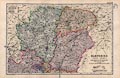
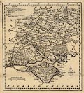
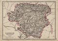
FA2000.30.77
(Lewis 1835)
|
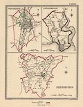
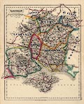
Map, coloured engraving, Hampshire and Isle of Wight,
including the Christchurch area now in Dorset, showing electoral
divisions etc, scale about 3 miles to 1 inch, drawn by R
Creighton, engraved by J and C Walker, published by Samuel Lewis
and Co, 87 Aldersgate Street, London, 1835.
|
|
|
|
FA2000.30.78
(Lewis 1835)
|
Map, 3 coloured engravings, Winchester, Southampton, and
Petersfield, Hampshire, showing borough boundaries, various
scales, drawn by R Creighton, engraved by J and C Walker,
published by Samuel Lewis and Co, 87 Aldersgate Street, London,
1835.
|
|
|
|
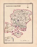
FA2000.30.79
(Lewis 1835)
|
Map, 3 coloured engravings, Portsmouth, and Andover,
Hampshire, and Newport, Medina, Isle of Wight, showing borough
boundaries, various scales, drawn by R Creighton, engraved by J
and C Walker, published by Samuel Lewis and Co, 87 Aldersgate
Street, London, 1835.
|
|
|
|
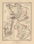
FA2000.30.80
(Lewis 1835)
|
Map, 2 coloured engravings, Christchurch, Hampshire now in
Dorset, and Lymington, Hampshire, showing borough boundaries,
various scales, drawn by R Creighton, engraved by J and C Walker,
published by Samuel Lewis and Co, 87 Aldersgate Street, London,
1835.
|
|
|
|
FA2000.30.81
|
Map, coloured engraving, Staffordshire, showing electoral
divisions etc, scale about 1 to 320000, about 5 miles to 1 inch,
drawn by R Creighton, engraved by J and C Walker, published by
Samuel Lewis and Co, 87 Aldersgate Street, London, 1835.
|
|
|
|
FA2000.30.82
|
Map, 4 coloured engravings, Lichfield, Tamworth, Stafford,
Newcastle under Lyne, Staffordshire, showing borough boundaries,
various scales, drawn by R Creighton, engraved by J and C Walker,
published by Samuel Lewis and Co, 87 Aldersgate Street, London,
1835.
|
|
|
|
FA2000.30.83
|
Map, 2 coloured engravings, Wolverhampton, Walsall,
Staffordshire, showing borough boundaries, various scales, drawn
by R Creighton, engraved by J and C Walker, published by Samuel
Lewis and Co, 87 Aldersgate Street, London, 1835.
|
|
|
|
FA2000.30.84
|
Map, coloured engraving, Stoke upon Trent, Staffordshire,
showing borough boundary, scale about 1 mile to 1 inch, drawn by
R Creighton, engraved by J and C Walker, published by Samuel
Lewis and Co, 87 Aldersgate Street, London, 1835.
|
|
|
|
FA2000.30.85
|
Map, coloured engraving, Suffolk, showing electoral divisions
etc, scale about 1 to 450000, about 7 miles to 1 inch, drawn by R
Creighton, engraved by J and C Walker, published by Samuel Lewis
and Co, 87 Aldersgate Street, London, 1835.
|
|
|
|
FA2000.30.86
|
Map, 4 coloured engravings, Bury St Edmunds, Ipswich, Sudbury,
Eye, Suffolk, showing borough boundaries, various scales, drawn
by R Creighton, engraved by J and C Walker, published by Samuel
Lewis and Co, 87 Aldersgate Street, London, 1835.
|
|
|
|
FA2000.30.87
|
Map, coloured engraving, Surrey, showing electoral divisions
etc, scale about 1 to 240000, about 4 miles to 1 inch, drawn by R
Creighton, engraved by J and C Walker, published by Samuel Lewis
and Co, 87 Aldersgate Street, London, 1835.
|
|
|
|
FA2000.30.88
|
Map, coloured engraving, Lambeth, Surrey, showing borough
boundary, scale about 2 inches to 1 mile, drawn by R Creighton,
engraved by J and C Walker, published by Samuel Lewis and Co, 87
Aldersgate Street, London, 1835.
|
|
|
|
FA2000.30.89
|
Map, 3 coloured engravings, Southwark, London then Surrey,
Guilford ie Guildford, and Reigate, Surrey, showing borough
boundaries, various scales, drawn by R Creighton, engraved by J
and C Walker, published by Samuel Lewis and Co, 87 Aldersgate
Street, London, 1835.
|
|
|
|
FA2000.30.90
|
Map, coloured engraving, Sussex, showing electoral divisions
etc, scale about 1 to 540000, about 8 miles to 1 inch, drawn by R
Creighton, engraved by J and C Walker, published by Samuel Lewis
and Co, 87 Aldersgate Street, London, 1835.
|
|
|
|
FA2000.30.91
|
Map, 3 coloured engravings, Lewes, Chichester, Brighthelmstone
ie Brighton, in East and West Sussex, showing borough boundaries,
various scales, drawn by R Creighton, engraved by J and C Walker,
published by Samuel Lewis and Co, 87 Aldersgate Street, London,
1835.
|
|
|
|
FA2000.30.92
|
Map, 2 coloured engravings, Midhurst, and Horsham, West
Sussex, showing borough boundaries, various scales, drawn by R
Creighton, engraved by J and C Walker, published by Samuel Lewis
and Co, 87 Aldersgate Street, London, 1835.
|
|
|
|
FA2000.30.93
|
Map, 3 coloured engravings, Arundel, Hastings, and Rye, in
East and West Sussex, showing borough boundaries, various scales,
drawn by R Creighton, engraved by J and C Walker, published by
Samuel Lewis and Co, 87 Aldersgate Street, London, 1835.
|
|
|
|
FA2000.30.94
|
Map, coloured engraving, New Shoreham area, East Sussex,
showing borough boundary, scale about 2 miles to 1 inch, drawn by
R Creighton, engraved by J and C Walker, published by Samuel
Lewis and Co, 87 Aldersgate Street, London, 1835.
|
|
|
|
FA2000.30.95
|
Map, coloured engraving, Warwickshire, showing electoral
divisions etc, scale about 1 to 330000, about 5 miles to 1 inch,
drawn by R Creighton, engraved by J and C Walker, published by
Samuel Lewis and Co, 87 Aldersgate Street, London, 1835.
|
|
|
|
FA2000.30.96
|
Map, 2 coloured engravings, Warwick, and Coventry,
Warwickshire, showing borough boundaries, various scales, drawn
by R Creighton, engraved by J and C Walker, published by Samuel
Lewis and Co, 87 Aldersgate Street, London, 1835.
|
|
|
|
FA2000.30.97
|
Map, coloured engraving, Birmingham, Warwickshire now West
Midlands, showing borough boundary, scale about 1 1/2 inches to 1
mile, drawn by R Creighton, engraved by J and C Walker, published
by Samuel Lewis and Co, 87 Aldersgate Street, London, 1835.
|
|
|
|
FA2000.30.98
|
Map, coloured engraving, Westmorland now in Cumbria, showing
electoral divisions etc, scale about 1 to 370000, about 6 miles
to 1 inch, drawn by R Creighton, engraved by J and C Walker,
published by Samuel Lewis and Co, 87 Aldersgate Street, London,
1835.
|
|
|
|
FA2000.30.99
|
Map, coloured engraving, Kirby Kendal ie Kendal, Westmorland
now Cumbria, showing borough boundary, scale about 2 inches to 1
mile, drawn by R Creighton, engraved by J and C Walker, published
by Samuel Lewis and Co, 87 Aldersgate Street, London, 1835.
|
|
|
|
FA2000.30.100
|
Map, coloured engraving, Wiltshire, showing electoral
divisions etc, scale about 1 to 350000, about 6 miles to 1 inch,
drawn by R Creighton, engraved by J and C Walker, published by
Samuel Lewis and Co, 87 Aldersgate Street, London, 1835.
|
|
|
|
FA2000.30.101
|
Map, 4 coloured engravings, Salisbury, Devizes, Marlborough,
and Westbury, Wiltshire, showing borough boundaries, various
scales, drawn by R Creighton, engraved by J and C Walker,
published by Samuel Lewis and Co, 87 Aldersgate Street, London,
1835.
|
|
|
|
FA2000.30.102
|
Map, 2 coloured engravings, Wilton, and Malmesbury, Wiltshire,
showing borough boundaries, various scales, drawn by R Creighton,
engraved by J and C Walker, published by Samuel Lewis and Co, 87
Aldersgate Street, London, 1835.
|
|
|
|
FA2000.30.103
|
Map, 2 coloured engravings, Chippenham, and Calne, Wiltshire,
showing borough boundaries, various scales, drawn by R Creighton,
engraved by J and C Walker, published by Samuel Lewis and Co, 87
Aldersgate Street, London, 1835.
|
|
|
|
FA2000.30.104
|
Map, coloured engraving, Cricklade area, Wiltshire, showing
borough boundary, scale about 3 miles to 1 inch, drawn by R
Creighton, engraved by J and C Walker, published by Samuel Lewis
and Co, 87 Aldersgate Street, London, 1835.
|
|
|
|
FA2000.30.105
|
Map, coloured engraving, Worcestershire, showing electoral
divisions etc, scale about 1 to 380000, about 6 miles to 1 inch,
drawn by R Creighton, engraved by J and C Walker, published by
Samuel Lewis and Co, 87 Aldersgate Street, London, 1835.
|
|
|
|
FA2000.30.106
|
Map, 2 coloured engravings, Worcester, and Droitwich,
Worcestershire, showing borough boundaries, various scales, drawn
by R Creighton, engraved by J and C Walker, published by Samuel
Lewis and Co, 87 Aldersgate Street, London, 1835.
|
|
|
|
FA2000.30.107
|
Map, 4 coloured engravings, Dudley, Kidderminster, Evesham,
and Bewdley, Worcestershire, showing borough boundaries, various
scales, drawn by R Creighton, engraved by J and C Walker,
published by Samuel Lewis and Co, 87 Aldersgate Street, London,
1835.
|
|
|
|
FA2000.30.108
|
Map, coloured engraving, North Riding of Yorkshire now North
Yorkshire, showing electoral divisions etc, scale about 1 to
600000, about 9 miles to 1 inch, drawn by R Creighton, engraved
by J and C Walker, published by Samuel Lewis and Co, 87
Aldersgate Street, London, 1835.
|
|
|
|
FA2000.30.109
|
Map, coloured engraving, East Riding of Yorkshire now
Humberside, showing electoral divisions etc, scale about 1 to
410000, about 7 miles to 1 inch, drawn by R Creighton, engraved
by J and C Walker, published by Samuel Lewis and Co, 87
Aldersgate Street, London, 1835.
|
|
|
|
FA2000.30.110
|
Map, coloured engraving, West Riding of Yorkshire now West
Yorkshire and South Yorkshire, showing electoral divisions etc,
scale about 1 to 630000, about 10 miles to 1 inch, drawn by R
Creighton, engraved by J and C Walker, published by Samuel Lewis
and Co, 87 Aldersgate Street, London, 1835.
|
|
|
|
FA2000.30.111
|
Map, 3 coloured engravings, York, Richmond, and Thirsk, North
Yorkshire, showing borough boundaries, various scales, drawn by R
Creighton, engraved by J and C Walker, published by Samuel Lewis
and Co, 87 Aldersgate Street, London, 1835.
|
|
|
|
FA2000.30.112
|
Map, 2 coloured engravings, Leeds, and Pontefract, West
Yorkshire, showing borough boundaries, various scales, drawn by R
Creighton, engraved by J and C Walker, published by Samuel Lewis
and Co, 87 Aldersgate Street, London, 1835.
|
|
|
|
FA2000.30.113
|
Map, 4 coloured engravings, Scarborough, Whitby, New Malton,
and North Allerton ie Northallerton, North Yorkshire, showing
borough boundaries, various scales, drawn by R Creighton,
engraved by J and C Walker, published by Samuel Lewis and Co, 87
Aldersgate Street, London, 1835.
|
|
|
|
FA2000.30.114
|
Map, 2 coloured engravings, Kingston upon Hull, and Beverley,
Yorkshire now Humberside, showing borough boundaries, various
scales, drawn by R Creighton, engraved by J and C Walker,
published by Samuel Lewis and Co, 87 Aldersgate Street, London,
1835.
|
|
|
|
FA2000.30.115
|
Map, 4 coloured engravings, Huddersfield, Ripon, Halifax, and
Knaresborough, in North Yorkshire and West Yorkshire, showing
borough boundaries, various scales, drawn by R Creighton,
engraved by J and C Walker, published by Samuel Lewis and Co, 87
Aldersgate Street, London, 1835.
|
|
|
|
FA2000.30.116
|
Map, 3 coloured engravings, Bradford, Wakefield, and
Sheffield, in West Yorkshire and South Yorkshire, showing borough
boundaries, various scales, drawn by R Creighton, engraved by J
and C Walker, published by Samuel Lewis and Co, 87 Aldersgate
Street, London, 1835.
|
|
|
|
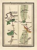
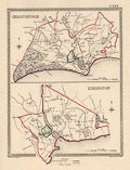
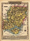
FA2000.32
(Lewis 1835)
|
Map, 3 coloured engravings, Winchester, Southampton, and
Petersfield, Hampshire, showing borough boundaries, various
scales, drawn by R Creighton, engraved by J and C Walker,
published by Samuel Lewis and Co, 87 Aldersgate Street, London,
1835.
|
|
|
|
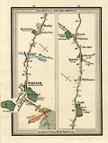
FA2000.33
(Lewis 1835)
|
Map, 3 coloured engravings, Portsmouth, and Andover,
Hampshire, and Newport, Medina, Isle of Wight, showing borough
boundaries, various scales, drawn by R Creighton, engraved by J
and C Walker, published by Samuel Lewis and Co, 87 Aldersgate
Street, London, 1835.
|
|
|
|
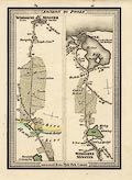
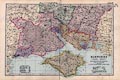
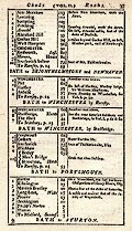
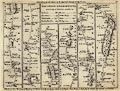
FA2000.34
(Cooper 1808)
|
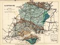
Map, hand coloured engraving, Hampshire, and the Isle of
Wight, scale about 15 miles to 1 inch, drawn and engraved by H
Cooper, 1808, published by G and W B Whitaker, 13 Ave Maria Lane,
London, 1824.
|
|
|
|
FA2000.35
(Paterson 1785)
|
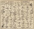
Descriptive text, 44 pages with title page and dedication
page, from vol.I of the road book, Paterson's British Itinerary,
by Daniel Paterson, published by Carington Bowles, 69 St Paul's
Churchyard, London, 1785.
|
|
|
|
FA2000.36
(Paterson 1785)
|
Descriptive text, 60 text pages from vol.II of the road book,
Paterson's British Itinerary, by Daniel Paterson, published by
Carington Bowles, 69 St Paul's Churchyard, London, 1785.
|
|
|
|
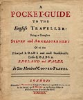
FA2000.37
(Gardner 1719)
|
Title page, and table of contents, from the road book, Pocket
Guide to the English Traveller, published by J Tonson and J
Watts, London, 1719.
|
|
|
|
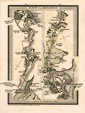
FA2000.38
(Paterson 1785)
|
Strip map, road map, uncoloured engraving, part of the road
from London to Portsmouth from vol.1 of the road book, Paterson'
British Itinerary, by Capt Daniel Paterson, published by
Carington Bowles, 69 St Paul's Churchyard, London, 1785.
|
|
|
|
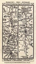
FA2000.39
(Paterson 1785)
|
Strip map, road map, uncoloured engraving, end of the road
from London to Portsmouth, road from London to Chichester, part
of road from London to Winchester and Poole, from vol.1 of the
road book, Paterson' British Itinerary, by Capt Daniel Paterson,
published by Carington Bowles, 69 St Paul's Churchyard, London,
1785.
|
|
|
|
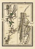
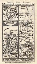
FA2000.40
(Paterson 1785)
|
Strip map, road map, uncoloured engraving, part of the road
from London to Winchester and Poole, from vol.1 of the road book,
Paterson' British Itinerary, by Capt Daniel Paterson, published
by Carington Bowles, 69 St Paul's Churchyard, London, 1785.
|
|
|
|
FA2000.41
(Paterson 1785)
|
Strip map, road map, uncoloured engraving, end of the road
from London to Poole, road from London to Farnham, end of the
road from London to Southampton, part of the road from London to
Lands End, from vol.1 of the road book, Paterson' British
Itinerary, by Capt Daniel Paterson, published by Carington
Bowles, 69 St Paul's Churchyard, London, 1785.
|
|
|
|
FA2000.42
(Kitchin 1769)
|
Map, uncoloured engraving, Hampshire, with the Isle of Wight,
scale about 1 to 450000, about 7 miles to 1 inch, from the
Kitchin's Pocket Atlas, published by Thomas Kitchin, Holborn
Hill, London, 1769.
|
|
|
|
FA2000.43
|
Chart, yachtsman's Allweather Chart, The Solent, from
Stanfords Charts, Stanford House, 9 Nestles Avenues, Hayes,
Middlesex, 1995.
|
|
|
|
FA2000.44
|
Chart, yachtsman's Allweather Chart Pack no.24, The Solent and
approaches, by Stanfords Charts, and GEOprojects, 9-10 South
Street, Reading, Berkshire, 2000.
|
|
|
|
FA2000.45
(Ramble 1845)
|
Map, hand coloured lithograph surrounded by vignette scenes,
Hampshire, with the Isle of Wight, scale about 21 miles to 1
inch, published in Reuben Ramble's Travels through the Counties
of England by Darton and Clark, 58 Holborn Hill, London,
1845.
|
|
|
|
FA2000.46
(Dispatch 1863)
|
Map, 2 sheet engraving plates 32 and 33, Hampshire, with the
Isle of Wight, scale about 1 to 190000, about 3 miles to 1 inch,
by Edward Weller, 1858, published in Cassell's British Atlas, by
Cassell, Petter and Galpin, La Belle Sauvage Yard, Ludgate Hill,
London, 1864-67.
|
|
|
|
FA2000.47
(Bowen 1755)
|
Map, uncoloured engraving, Hampshire Divided into Hundreds,
scale about 1 to 640000, about 10 miles to 1 inch, engraved for W
Owen for the General Magazine of Arts and Sciences by Emanuel
Bowen, London, 1755, edition of 1758?
|
|
|
|
FA2000.49
(Senex 1719)
|
Descriptive text, 2 pages, Table of Cross Roads, from the road
book published by John Senex, London, 1719 or 1757 etc.
|
|
|
|
FA2000.50
|
Map, Hampshire Food and Drink Trails, cartography by Arka
Cartographics, printed by Alresford Press, New Alresford,
Hampshire, published by Southern Tourist Board with Hampshire
Fare and Hampshire CC, 2000.
|
|
|
|
FA2000.51
(Bowles 1782)
|
Strip map, uncoloured engraving, road map from a road book,
Bowles's Post Chaise Companion, by Carington Bowles, St Paul's
Churchyard, London, 1782.
|
|
|
|
FA2000.52
(Bowles 1782)
|
Strip map, uncoloured engraving, road map from a road book,
Bowles's Post Chaise Companion, by Carington Bowles, St Paul's
Churchyard, London, 1782.
|
|
|
|
FA2000.54
(Bowles 1782)
|
Strip map, uncoloured engraving, road map from a road book,
Bowles's Post Chaise Companion, by Carington Bowles, St Paul's
Churchyard, London, 1782.
|
|
|
|
FA2000.55
(Bowles 1782)
|
Title page, from volume 2 road book, Bowles's Post Chaise
Companion, by Carington Bowles, St Paul's Churchyard, London, 2nd
edition 1782.
|
|
|
|
FA2000.56
(Hobson 1850)
|
Map, coloured engraving, Hampshire and Isle of Wight, scale
about 4 miles to 1 inch, by J and C Walker, 1837, overprinted
with places of meets of foxhounds by Hobson, 1850, published by J
and C Walker, Holborn, London, 1893.
|
|
|
|
FA2000.57
(Reynolds 1860)
|
Map, coloured engraving, Hampshire, with the Isle of Wight,
scale about 1 to 510000, about 8 miles to 1 inch, showing the
geology of the county, published by James Reynolds and Sons, 174
Strand, London, 1860.
|
|
|
|
FA2000.58
(Wallis 1810)
|
Map, hand coloured engraving, Hampshire, with the Isle of
Wight, scale about 14 miles to 1 inch, earlier published by James
Wallis, 1810, published by W Lewis, Finch Lane, London,
1819-36.
|
|
|
|
FA2000.59
(Wallis 1810)
|
Descriptive text, Hampshire, from Lewis's New Traveller's
Guide, earlier published by James Wallis, 1810, published by W
Lewis, Finch Lane, London, 1819-36.
|
|
|
|
FA2000.60
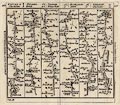
(Jefferys 1775)
|
Strip map, road map, uncoloured engraving, The Road from
London to Bridgewater, scale about 1.5 miles to 1 inch, from road
book, Jefferys's Itinerary, by Thomas Jefferys, published by R
Sayer and T Bennet, London 1775.
|
|
|
|
FA2000.61
(Hinton 1765)
|
Strip map, road map, uncoloured engraving, roads or parts of
roads from Shrewsbury to Welshpool, London to Wells and St
Edmunds Bury, and London to Weymouth, scale about 2 miles to 1
inch, published in the Universal Magazine of Knowledge and
Pleasure, by John Hinton, Kings Arms, St Paul's Churchyard,
London, 1765-73.
|
|
|
|
FA2000.62
(Gray 1824)
|
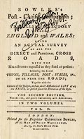
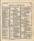
Road book, Gray's New Book of Roads, or Traveller's Guide to
the Roads of England and Wales, by George Carrington Gray, with
an atlas of county maps and general map of England and Wales, by
George A Cooke, 1802, published by Sherwood, Jones and Co,
Paternoster Road, London, 1824.
|
|
|
|
FA2000.62.0
(Cooke 1802)
|
Map, uncoloured engraving, England and Wales, index map to
county maps, perhaps by George Cooke, 1802, bound in Gray's New
Book of Roads, published by Sherwood, Jones and Co, Paternoster
Road, London, 1824.
|
|
|
|
FA2000.62.1
|
Map, South of Scotland, by George Cooke, 1802, bound in Gray's
New Book of Roads, 1824, published by Sherwood, Jones and Co,
Paternoster Road, London, 1824.
|
|
|
|
FA2000.62.2
|
Map, Cumberland, ie part of Cumbria, by George Cooke, 1802,
bound in Gray's New Book of Roads, 1824, published by Sherwood,
Jones and Co, Paternoster Road, London, 1824.
|
|
|
|
FA2000.62.3
|
Map, Northumberland, by George Cooke, 1802, bound in Gray's
New Book of Roads, 1824, published by Sherwood, Jones and Co,
Paternoster Road, London, 1824.
|
|
|
|
FA2000.62.4
|
Map, Westmoreland now part of Cumbria, by George Cooke, 1802,
bound in Gray's New Book of Roads, 1824, published by Sherwood,
Jones and Co, Paternoster Road, London, 1824.
|
|
|
|
FA2000.62.5
|
Map, The Lakes, in Cumbria, by George Cooke, 1802, bound in
Gray's New Book of Roads, 1824, published by Sherwood, Jones and
Co, Paternoster Road, London, 1824.
|
|
|
|
FA2000.62.6
|
Map, Lancashire, by George Cooke, 1802, bound in Gray's New
Book of Roads, 1824, published by Sherwood, Jones and Co,
Paternoster Road, London, 1824.
|
|
|
|
FA2000.62.7
|
Map, Cheshire, by George Cooke, 1802, bound in Gray's New Book
of Roads, 1824, published by Sherwood, Jones and Co, Paternoster
Road, London, 1824.
|
|
|
|
FA2000.62.8
|
Map, Index Map to Yorkshire, by George Cooke, 1802, bound in
Gray's New Book of Roads, 1824, published by Sherwood, Jones and
Co, Paternoster Road, London, 1824.
|
|
|
|
FA2000.62.9
|
Map, Durham, by George Cooke, 1802, bound in Gray's New Book
of Roads, 1824, published by Sherwood, Jones and Co, Paternoster
Road, London, 1824.
|
|
|
|
FA2000.62.10
|
Map, East Riding of Yorkshire, ie Humberside, and South
Yorkshire? by George Cooke, 1802, bound in Gray's New Book of
Roads, 1824, published by Sherwood, Jones and Co, Paternoster
Road, London, 1824.
|
|
|
|
FA2000.62.11
|
Map, North Riding of Yorkshire, ie North Yorkshire, by George
Cooke, 1802, bound in Gray's New Book of Roads, 1824, published
by Sherwood, Jones and Co, Paternoster Road, London, 1824.
|
|
|
|
FA2000.62.12
|
Map, West Riding of Yorkshire, ie West Yorkshire, by George
Cooke, 1802, bound in Gray's New Book of Roads, 1824, published
by Sherwood, Jones and Co, Paternoster Road, London, 1824.
|
|
|
|
FA2000.62.13
|
Map, Lincolnshire, by George Cooke, 1802, bound in Gray's New
Book of Roads, 1824, published by Sherwood, Jones and Co,
Paternoster Road, London, 1824.
|
|
|
|
FA2000.62.14
|
Map, Cambridgeshire, by George Cooke, 1802, bound in Gray's
New Book of Roads, 1824, published by Sherwood, Jones and Co,
Paternoster Road, London, 1824.
|
|
|
|
FA2000.62.15
|
Map, Norfolk, by George Cooke, 1802, bound in Gray's New Book
of Roads, 1824, published by Sherwood, Jones and Co, Paternoster
Road, London, 1824.
|
|
|
|
FA2000.62.16
|
Map, Suffolk, by George Cooke, 1802, bound in Gray's New Book
of Roads, 1824, published by Sherwood, Jones and Co, Paternoster
Road, London, 1824.
|
|
|
|
FA2000.62.17
|
Map, Essex, by George Cooke, 1802, bound in Gray's New Book of
Roads, 1824, published by Sherwood, Jones and Co, Paternoster
Road, London, 1824.
|
|
|
|
FA2000.62.18
|
Map, Middlesex, by George Cooke, 1802, bound in Gray's New
Book of Roads, 1824, published by Sherwood, Jones and Co,
Paternoster Road, London, 1824.
|
|
|
|
FA2000.62.19
|
Map, Hertfordshire, by George Cooke, 1802, bound in Gray's New
Book of Roads, 1824, published by Sherwood, Jones and Co,
Paternoster Road, London, 1824.
|
|
|
|
FA2000.62.20
|
Map, Buckinghamshire, by George Cooke, 1802, bound in Gray's
New Book of Roads, 1824, published by Sherwood, Jones and Co,
Paternoster Road, London, 1824.
|
|
|
|
FA2000.62.21
|
Map, Bedfordshire, by George Cooke, 1802, bound in Gray's New
Book of Roads, 1824, published by Sherwood, Jones and Co,
Paternoster Road, London, 1824.
|
|
|
|
FA2000.62.22
|
Map, Huntingdonshire, by George Cooke, 1802, bound in Gray's
New Book of Roads, 1824, published by Sherwood, Jones and Co,
Paternoster Road, London, 1824.
|
|
|
|
FA2000.62.23
|
Map, Rutlandshire, by George Cooke, 1802, bound in Gray's New
Book of Roads, 1824, published by Sherwood, Jones and Co,
Paternoster Road, London, 1824.
|
|
|
|
FA2000.62.24
|
Map, Northamptonshire, by George Cooke, 1802, bound in Gray's
New Book of Roads, 1824, published by Sherwood, Jones and Co,
Paternoster Road, London, 1824.
|
|
|
|
FA2000.62.25
|
Map, Derbyshire, by John Farey, bound in Gray's New Book of
Roads, 1824, published by Sherwood, Jones and Co, Paternoster
Road, London, 1824.
|
|
|
|
FA2000.62.26
|
Map, Nottinghamshire, by George Cooke, 1802, bound in Gray's
New Book of Roads, 1824, published by Sherwood, Jones and Co,
Paternoster Road, London, 1824.
|
|
|
|
FA2000.62.27
|
Map, Shropshire, by George Cooke, 1802, bound in Gray's New
Book of Roads, 1824, published by Sherwood, Jones and Co,
Paternoster Road, London, 1824.
|
|
|
|
FA2000.62.28
|
Map, Staffordshire, by George Cooke, 1802, bound in Gray's New
Book of Roads, 1824, published by Sherwood, Jones and Co,
Paternoster Road, London, 1824.
|
|
|
|
FA2000.62.29
|
Map, Warwickshire, by George Cooke, 1802, bound in Gray's New
Book of Roads, 1824, published by Sherwood, Jones and Co,
Paternoster Road, London, 1824.
|
|
|
|
FA2000.62.30
|
Map, Leicestershire, by George Cooke, 1802, bound in Gray's
New Book of Roads, 1824, published by Sherwood, Jones and Co,
Paternoster Road, London, 1824.
|
|
|
|
FA2000.62.31
|
Map, Monmouthshire, by George Cooke, 1802, bound in Gray's New
Book of Roads, 1824, published by Sherwood, Jones and Co,
Paternoster Road, London, 1824.
|
|
|
|
FA2000.62.32
|
Map, Herefordshire, by George Cooke, 1802, bound in Gray's New
Book of Roads, 1824, published by Sherwood, Jones and Co,
Paternoster Road, London, 1824.
|
|
|
|
FA2000.62.33
|
Map, Worcestershire, by George Cooke, 1802, bound in Gray's
New Book of Roads, 1824, published by Sherwood, Jones and Co,
Paternoster Road, London, 1824.
|
|
|
|
FA2000.62.34
|
Map, Glocestershire ie Gloucestershire, by George Cooke, 1802,
bound in Gray's New Book of Roads, 1824, published by Sherwood,
Jones and Co, Paternoster Road, London, 1824.
|
|
|
|
FA2000.62.35
|
Map, Oxfordshire, by George Cooke, 1802, bound in Gray's New
Book of Roads, 1824, published by Sherwood, Jones and Co,
Paternoster Road, London, 1824.
|
|
|
|
FA2000.62.36
|
Map, Berkshire, by George Cooke, 1802, bound in Gray's New
Book of Roads, 1824, published by Sherwood, Jones and Co,
Paternoster Road, London, 1824.
|
|
|
|
FA2000.62.37
|
Map, Surry ie Surrey, by George Cooke, 1802, bound in Gray's
New Book of Roads, 1824, published by Sherwood, Jones and Co,
Paternoster Road, London, 1824.
|
|
|
|
FA2000.62.38
|
Map, Kent, by George Cooke, 1802, bound in Gray's New Book of
Roads, 1824, published by Sherwood, Jones and Co, Paternoster
Road, London, 1824.
|
|
|
|
FA2000.62.39
|
Map, Sussex, ie East Sussex and West Sussex, by George Cooke,
1802, bound in Gray's New Book of Roads, 1824, published by
Sherwood, Jones and Co, Paternoster Road, London, 1824.
|
|
|
|
FA2000.62.40
|
Map, Wiltshire, by George Cooke, 1802, bound in Gray's New
Book of Roads, 1824, published by Sherwood, Jones and Co,
Paternoster Road, London, 1824.
|
|
|
|
FA2000.62.41
(Cooke 1802)
|
Map, uncoloured engraving, Hampshire, with the Isle of Wight,
scale about 19 miles to 1 inch, by George Cooke, 1802, bound in
Gray's New Book of Roads, 1824, published by Sherwood, Jones and
Co, Paternoster Road, London, 1824.
|
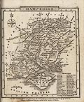
|
|
|
FA2000.62.42
|
Map, Dorsetshire, by George Cooke, 1802, bound in Gray's New
Book of Roads, 1824, published by Sherwood, Jones and Co,
Paternoster Road, London, 1824.
|
|
|
|
FA2000.62.43
|
Map, Somersetshire, by George Cooke, 1802, bound in Gray's New
Book of Roads, 1824, published by Sherwood, Jones and Co,
Paternoster Road, London, 1824.
|
|
|
|
FA2000.62.44
|
Map, Cornwall, by George Cooke, 1802, bound in Gray's New Book
of Roads, 1824, published by Sherwood, Jones and Co, Paternoster
Road, London, 1824.
|
|
|
|
FA2000.62.45
|
Map, Devonshire, by George Cooke, 1802, bound in Gray's New
Book of Roads, 1824, published by Sherwood, Jones and Co,
Paternoster Road, London, 1824.
|
|
|
|
FA2000.62.46
|
Map, South Wales, by George Cooke, 1802, bound in Gray's New
Book of Roads, 1824, published by Sherwood, Jones and Co,
Paternoster Road, London, 1824.
|
|
|
|
FA2000.62.47
|
Map, North Wales, by George Cooke, 1802, bound in Gray's New
Book of Roads, 1824, published by Sherwood, Jones and Co,
Paternoster Road, London, 1824.
|
|
|
|
FA2000.62.48
|
Map, Isle of Thanet, bound in Gray's New Book of Roads, 1824,
published by Sherwood, Jones and Co, Paternoster Road, London,
1824.
|
|
|
|
FA2000.62.49
(Gray 1824)
|
Map, England and Wales, index map to itineraries, scale about
1 to 3800000, about 60 miles to 1 inch, bound in Gray's New Book
of Roads, 1824, published by Sherwood, Jones and Co, Paternoster
Road, London, 1824.
|
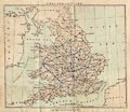
|
|
|
FA2000.65
|
Guide book, paperback, Holiday Guide 1950, area 4 South West
England, for British Railways, published by the Railway
Executive, 1950.
|
|
|
|
FA2000.66
|
Road atlas, The Dunlop Touring Maps of the British Isles, 8th
edition, published for the Dunlop Rubber Co by E J Burrow and Co,
Cheltenham, Gloucestershire, 1940s?
|
|
|
|
FA2000.77
|
Road book, 3 Miles to 1 Inch Road Atlas, maps of England,
Scotland and Wales, scale about 1 to 190000, 3 miles to 1 inch,
plus road strip maps and street maps, by W and A K Johnston,
Edinburgh, Lothian, published by Associated Newspapers, London,
1930s?
|
|
|
|
FA2000.78
|
Road book, AA Road Book of England and Wales, itineraries and
gazetteer, with street maps, and general maps, published by the
Automobile Association, AA, Fanum House, New Coventry Street,
London, late 1930s?
|
|
|
|
FA2000.79
|
Road atlas, Pictorial Britain, roads in Great Britain and
Ireland, by Alfred E Taylor and S P B Mais, published by H K
McCann Co, for Anglo-American Oil Co ie Esso, London, about
1932.
|
|
|
|
FA2000.80
|
Bus map, Basingstoke Area Network Map, bus, rail and coach,
Basingstoke, Hampshire, by Pindar plc, Princes Risborough,
Buckinghamshire, published Hampshire CC with Basingstoke and
Deane BC and Stagecoach Hampshire, Hampshire, 2000.
|
|
|
|
FA2000.81
|
Railway map, Guide to Train Services and Stations in
Hampshire, with route and timetable guide, published by Hampshire
CC, Winchester, Hampshire, 2000.
|
|
|
|
FA2000.83
(Cockeran 1949)
|
Road book, This is Britain by Road, guide book with strip
maps, and road maps by George Philip and Son, by A E Cockeran,
published by Clerke and Cockeran, 72-78 Fleet Street, London,
about 1949?
|
|
|
|
FA2000.84.1
|
Print, perspective map, the Plains of Waterloo, Waterloo,
Belgium, where the Duke of Wellington and Prince Blucher defeated
Napoleon Bonaparte, 18 June 1815.
|
|
|
|
FA2000.84.2
|
Map, coloured engraving, the Battle of Waterloo, 18 June 1815,
and other actions around Waterloo, Belgium, drawn after the
action by Lt Tyler.
|
|
|
|
|
 |
top of page |
 |
FA2001 -- FA2004 |
|