
|
Catalogue of Map Collection
FA2001 -- FA2004: Identity number order
 |
FA2000 |
 |
bottom of page |
|
|
A thumbnail image on the right will enlarge, then return here.
The left link will take you to the Map Collection record page, and if (Map Group) is shown, will link to other Hampshire resources.
If you want to return to your place here, use your back browser button.
|
|
Identity number
(Map Group)
|
|
|
 |
|
FA2001.4

|
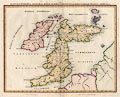
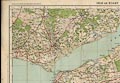
Map, Salisbury Plain Low Flying Chart, sheet 2, east, covering
much of Hampshire, scale 1 to 50000, about 1 inch to 1 mile, air
information overprinted by Military Survey, on map by Ordnance
Survey, 1992.
|
|
|
|
FA2001.5
(Richardson 1912)
|
Map, colour printed, South East and Central England, scale
about 1 to 320000, about 5 miles to 1 inch, by G W Bacon,
published by Frank Richardson Ltd, Deansgate, Manchester, about
1912.
|
|
|
|
FA2001.6
(OS 1810s Old Series)
|
Map, Hampshire, One inch map Old Series, sheet 11, Winchester,
including part of Hampshire, scale 1 inch to 1 mile, published by
the Ordnance Survey, Tower of London, 1840.
|
|
|
|
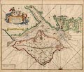
FA2001.7
(Waghenaer 1583)
|
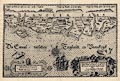
Chart, uncoloured engraving, Beschrijvinghe der Zee Custen van
Engelandt tuschen Wicht ende Doveren - Map of the Sea Coast of
England between Wight and Dover, scale about 1 to 470000, 7 or 8
miles to 1 inch, engraved by Johannes van Doetecum, 1583,
published in Die Spieghel der Zeevaeri - the Mariners Mirror, by
Lucas Janszoon Waghenaer, Enchuisen, Netherlands, 1584.
|
|
|
|
FA2001.8
(Philip 1920s)
|
Road book, road maps, Philips' Road Atlas-Guide to Great
Britain, map scale about 1 to 630000, 10 miles to 1 inch,
published by George Philip and Son, The London Geographical
Institute, 32 Fleet Street, London, 1920s-30s.
|
|
|
|
FA2001.9
(Burrow 1930s)
|
Guide book, itinerary, RAC Circular Tour in the South of
England, published for the Royal Automobile Club, RAC, by E J
Burrow and Co, Cheltenham, Gloucestershire, 1930s?
|
|
|
|
FA2001.10
(Blome 1673)
|
Map, uncoloured etching, A Mapp of Hantshire, ie Hampshire
with the Isle of Wight, scale about 4 miles to 1 inch, by Richard
Blome, about 1673.
|
|
|
|
FA2001.11
(Blome 1673)
|
Descriptive text, about Hantshire ie Hampshire, published with
a county map by Richard Blome, about 1673.
|
|
|
|
FA2001.12
(Speed 1611)
|
Map, uncoloured engraving, Hantshire described and divided,
Hampshire with part of the Isle of Wight, and a town plan of
Winchester, scale about 4 miles to 1 inch, by John Speed,
engraved by Jodocus Hondius, about 1611.
|
|
|
|
FA2001.17
|
Road book, Duckham's Road Maps and Guide to Better Motoring,
road maps by George Philip and Son, published by Alexander
Duckham and Co, Hammersmith, London, about 1953.
|
|
|
|
FA2001.18
|
Map, perspective map, Panorama Map of Central South Coast,
published by W and A K Johnston and by G W Bacon, Edinburgh and
London, 1950s.
|
|
|
|
FA2001.19
|
Railway map, Bradshaw's Railway Map of Great Britain and
Ireland, scale about 1 to 1200000, about 19 miles to 1 inch,
published by Henry Blacklock and Co, Bradshaw House, Surrey
Street, Strand, London and Albert Square, Manchester, about
1908?
|
|
|
|
FA2001.20
(Dunlop 1930s)
|
Road map, The Dunlop Maps, 16 cards in a leather case with
plastic windows, scale about 1 to 750000, about 12 miles to 1
inch, by John Bartholomew, Edinburgh, Lothian, published by E J
Burrow, Cheltenham, Gloucestershire, 1930s?
|
|
|
|
FA2001.43
|
Map, Basingstoke area, Hampshire, sheet 284, scale 1 to 63360,
1 inch to 1 mile, electrotype published by the Ordnance Survey,
Southampton, Hampshire, 1880.
|
|
|
|
FA2001.44
|
Road book, The Roadreader, road maps of England, Wales and
Scotland, scale about 1 to 580000, about 8 miles to 1 inch, with
the Bergquist Easy Reference System, published by Ivor Nicholson
and Watson Ltd, London, 1937.
|
|
|
|
FA2001.45
(Pigot 1828)
|
Map, hand coloured steel plate engraving, Hampshire, and the
Isle of Wight, scale about 6.5 miles to 1 inch, published by
Pigot and Co, 17 Basing Lane, London and 18 Fountain Street,
Manchester, 1828, edition about 1840.
|
|
|
|
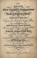
FA2001.46
(Smith 1826)
|
Road book, uncoloured engravings of strip map road maps and
itineraries, Smith's New Pocket Companion, by Charles Smith and
Son, 172 Strand, London, 1827.
|
|
|
|
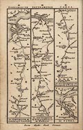
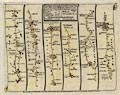
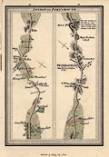
FA2001.46.13
(Smith 1826)
|
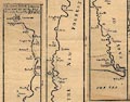
Strip map, uncoloured engraving road maps, London to
Portsmouth, to Southampton, etc, scale about 9 miles to 1 inch,
in Smith's New Pocket Companion, engraved by Pickett, published
by Charles Smith and Son, 172 Strand, London, 1827.
|
|
|
|
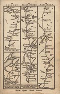
FA2001.46.16
(Smith 1826)
|
Strip map, uncoloured engraving road maps, London to
Lymington, to Gosport, to Salisbury etc, scale about 9 miles to 1
inch, in Smith's New Pocket Companion, engraved by Pickett,
published by Charles Smith and Son, 172 Strand, London, 1827.
|
|
|
|
FA2001.46.22
(Smith 1826)
|
Strip map, uncoloured engraving road maps, end of the Lands
End road, London to Exeter etc, scale about 9 miles to 1 inch, in
Smith's New Pocket Companion, engraved by Pickett, published by
Charles Smith and Son, 172 Strand, London, 1827.
|
|
|
|
FA2001.46.31
(Smith 1826)
|
Strip map, uncoloured engraving road maps, London to the west
country, scale about 9 miles to 1 inch, in Smith's New Pocket
Companion, engraved by Pickett, published by Charles Smith and
Son, 172 Strand, London, 1827.
|
|
|
|
FA2001.47
(AutoMapic 1954)
|
Road map, plastic and paper Auto-Mapic gadget, Road Map of
Great Britain, mostly scale about 1 to 100000, about 16 miles to
1 inch, made in Austria, about 1954.
|
|
|
|
FA2001.57
(Dower 1838)
|
Map, uncoloured engraving, Environs of Southampton, Hampshire,
scale about 1.5 miles to 1 inch, by I Dower, Pentonville, London,
published for James Robbins, College Street, Winchester by D E
Gilmour, Public Library, High Street, Winchester, Hampshire,
about 1847?
|
|
|
|
FA2001.58
|
Map, colour printed, Bacon's Motoring and Cycling Road Map,
London District, by John Bartholomew and Co, Edinburgh, Lothian,
published by G W Bacon and Co, 127 Strand, London, 1920s?
|
|
|
|
FA2001.59
|
Trade card, and map of the Isle of Wight, for S Knight,
bookseller, toy shop, etc, Sussex House, Ventnor, Isle of Wight,
early 19th century.
|
|
|
|
FA2001.60
|
Street map, Portsmouth 1904, presentation for the National
Union of Teachers, NUT Conference, Portsmouth, Hampshire,
published and given by G W Bacon and Co, 127 Strand, London,
1904.
|
|
|
|
FA2001.61
|
Road map, road book with itineraries, The Halford Pocket Atlas
and Route Guide, no.2, West of England and South Wales, with road
maps by Geographia, 55 Fleet Street, London, published by The
Halford Cycle Co, Corporation Street, Birmingham, West Midlands,
about 1930s?
|
|
|
|
FA2001.62
|
Road map, County Road Map and Gazetteer, no.5 Hampshire with
the Isle of Wight, scale about 1 to 250000, about 4 miles to 1
inch, by E J Burrow and Co, Cheltenham, Gloucestershire,
published by the British Motor Corporation, BMC, Cowley,
Oxfordshire, 1950s.
|
|
|
|
FA2001.63
|
Chart, English Channel, Western Section, Lands End to Cape
Barfleur, by Edward Stanford, 12-14 Long Acre, London, about
1950.
|
|
|
|
FA2001.69
|
Map, watercolour drawing, Map of Christchurch and its Environs
1803-04, scale about 1 to 42000, about 1.5 inches to 1 mile,
drawn about 1950s?
|
|
|
|
FA2001.70
|
Map, Overton Township Plan, with Conservation area etc,
Overton, Hampshire, scale 1 to 5000, about 12.5 ins to 1 mile,
drawn by Hampshire CC, Winchester, Hampshire, 1972.
|
|
|
|
FA2001.71
|
Railway map, Map of Electric Railways of London, The
Underground, published at Electric Railway House, Broadway,
Westminster, London, 1910s?
|
|
|
|
FA2001.72
|
map, Aviation Map of Great Britain, sheet 7, SW England, 2nd
RAF war edition, scale 1 to 500000, about 8 miles to 1 inch,
published by the Ordnance Survey, Southampton, Hampshire,
1940.
|
|
|
|
FA2001.87
(Kitchin 1751 large)
|
Map, hand coloured engraving, A New Improved Map of Hampshire,
and the Isle of Wight, scale about 3 miles to 1 inch, about 1751,
published for inclusion in the Large English Atlas series by
Thomas Kitchin, London, about 1790.
|
|
|
|
FA2001.90
|
Map, New Business Map of the New Forest, scale about 1.5 miles
to 1 inch, published by Stephens and Mackintosh, advertising
agents, Leicester, Leicestershire, 1904.
|
|
|
|
FA2001.91
|
Chart, English Channel eastern section, coast from Isle of
Wight, The Solent, Southampton and Portsmouth, Hampshire, West
and East Sussex, and Kent, and the north coast of France, scale
about 6 sea miles to 1 inch, by Edward Stanford Ltd, 12-14 Long
Acre, London, 1950.
|
|
|
|
FA2001.92
(Hall 1833)
|
Map, hand coloured engraving, Hampshire or Southampton, and
the Isle of Wight, scale about 8 miles to 1 inch, engraved by
Sidney Hall, 1830s, published by Chapman and Hall, Piccadilly,
London, about 1870s.
|
|
|
|
FA2001.93
(Hall 1820)
|
Map, hand coloured engraving, Hampshire, with Isle of Wight,
scale about 1 to 1100000, about 19 miles to 1 inch, by Sidney
Hall, published in a Leigh's New Atlas of England and Wales, by
Samuel Leigh, 18 Strand, London, about 1820.
|
|
|
|
FA2001.94
(Unknown 1860s)
|
Map, uncoloured engraving, Hampshire, with Isle of Wight,
scale about 1 to 750000, about 12 miles to 1 inch, published
about 1862?
|
|
|
|
FA2001.95
(Mogg 1814)
|
Strip map, road map, part of route London to Southampton,
Hampshire, scale about 1 inch to 1 mile, probably published by E
Mogg, London, 1814.
|
|
|
|
FA2001.96
(Mogg 1814)
|
Strip map, road map, part of a route London to Exeter, Devon,
across Hampshire, scale about 1 inch to 1 mile, probably
published by E Mogg, London, 1814.
|
|
|
|
FA2001.97
(Collins 1693)
|
Chart, hand coloured engraving, map of The Solent, including
the coast of Hampshire and the Isle of Wight, scale about 1 to
100000, about 1 1/2 miles to 1 inch, by Captain Greenvile
Collins, engraved by J Harris, published in Great Britain's
Coasting Pilot, 1693-1753
|
|
|
|
FA2001.98
|
Chart, colour printed, St Catherine Point to Start Point,
scale about 1 to 320000, about 5 sea miles to 1 inch, drawn by W
R Courtney from British Admiralty Charts, published by Imray,
Laurie, Norie and Wilson, 123 Minories, London, 1936.
|
|
|
|
FA2001.99
|
Chart, uncoloured engraving, The Solent, Western Part, scale
about 1 to 20000, about 4 inches to 1 sea mile, surveyed by
LtCmdr J P Cary and HMS Flinders, 1929-30, published by The
Hydrographic Office, The Admiralty, 1935, with corrections to
1948.
|
|
|
|
FA2001.100
|
Chart, uncoloured engraving, Eastern Approaches to The Solent,
Nab Tower to Spithead, scale about 1 to 20000, about 4 inches to
1 sea mile, published by The Hydrographic Office, The Admiralty,
1935, with corrections to 1948.
|
|
|
|
FA2001.101
|
Chart, uncoloured engraving, Port of Southampton, scale about
1 to 7500, about 10 inches to 1 sea mile, published by The
Hydrographic Office, The Admiralty, 1927, with corrections to
1948.
|
|
|
|
FA2001.102
|
Chart, half missing, uncoloured engraving, Southampton Water,
scale about 1 to 20000, about 4 inches to 1 sea mile, surveyed by
Southampton Harbour Board, published by The Hydrographic Office,
The Admiralty, 1935, with corrections to 1948.
|
|
|
|
FA2001.103
|
Chart, coloured printed, Langston Harbour and Approaches,
scale about 1 to 19000, about 4 inches to 1 sea mile, published
by The Hydrographic Office, The Admiralty, 1943, with corrections
to 1948.
|
|
|
|
FA2001.104
|
road book, Johnston's Handy Road Atlas of Great Britain and
Ireland, road maps at 10 miles to 1 inch, published by W and A K
Johnston and G W Bacon, Edinburgh, Lothian, 1950s-60s?
|
|
|
|
FA2001.105
|
map, Pictorial Map of Leisure and Pleasure in Hampshire and
Isle of Wight, scale about 1 to 160000, about 2 1/2 miles to 1
inch, published by Michael F Grant Associates, 1 The Steyne,
Worthing, East Sussex, 1990s?
|
|
|
|
FA2001.106
|
road book, 100 Miles Round Bournemouth, published by
Geographia, 55 Fleet Street, London, 1940s-50s?
|
|
|
|
FA2001.107
|
Road atlas, RAC Road Atlas Southern Britain, scale about 1 to
95000, about 1 1/2 miles to 1 inch, by maps by George Philip Ltd,
London, published by the Royal Automobile Club, RAC, 1989.
|
|
|
|
FA2001.108
|
Railway map, The Overgorund, intercity trains in England,
Wales and Scotland, published by the British Railways Board,
1990s.
|
|
|
|
FA2001.109
(Sporting Review 1842)
|
Map, uncoloured engraving, Map of the Meets of the Hampshire
Hounds, scale about 5 miles to 1 inch, published in the Sporting
Review, by I Mitchell, 33 Old Bond Street, London, 1 March
1842.
|
|
|
|
FA2001.117
|
road map, AA Quarter Inch Motoring Maps of Great Britain,
sheet 21, Portsmouth - Salisbury, scale 4 miles to 1 inch,
published for the Automobile Association, AA, by John Bartholomew
and Son, Edinburgh Geographical Institute, Duncan Street,
Edinburgh, Lothian, 1933.
|
|
|
|
FA2001.118
|
Road map, two in one, Motoring Map of the Arterial Roads and
By-passes around London, scale about 1 mile to 1 mile, and Motor
Road Map England and Wales South, scale about 8 miles to 1 inch,
published by G W Bacon and Co, 7-9 Norwich Street, Fetter Lane,
London, 1930s?
|
|
|
|
FA2001.119
|
Itinerary, strip map description, on fanfold computer printout
paper, from Epsom, Surrey to Oxford, Oxfordshie, provided by the
Routes Service of the AA, Automobile Association, 1992.
|
|
|
|
FA2001.120
|
Itinerary, strip map description, on fanfold computer printout
paper, from Epsom, Surrey to Bourne, Lincolnshire, provided by
the Routes Service of the AA, Automobile Association, 1989.
|
|
|
|
FA2001.121
|
Itinerary, strip map description, on fanfold computer printout
paper, from Epsom, Surrey to Bishops Stortford, Hertfordshire,
provided by the Routes Service of the AA, Automobile Association,
1997.
|
|
|
|
FA2001.135
|
Road book, Chichester's 100 Mile Map, road maps for the area
within 100 miles of London, published by Francis Chichester Ltd,
1960s?
|
|
|
|
FA2001.136
(Senex 1757)
|
Strip map, road map, hand coloured engraving, scale about
2-2.5 miles to 1 inch, parts of the Road from London to
Chichester and a branch to Winchester, and the Road from London
to Derby, from a road book by John Senex, 1719, edition printed
for John Bowles and Son, The Black Horse, Cornhill, London, after
1757.
|
|
|
|
FA2001.137
(Bowles 1782)
|
Strip map, hand coloured engraving, road map from a road book,
Bowles's Post Chaise Companion, by Carington Bowles, St Paul's
Churchyard, London, 1782.
|
|
|
|
FA2001.138
(Pratt 1905)
|
Road book, Pratt's Road Atlas of England and Wales, road maps,
scale 6 miles to 1 inch, by George Philip and Son, 32 Fleet
Street, London, 1905, published by Anglo-American Oil Co, 36-38
Queen Anne's Gate, Westminster, London, 1915.
|
|
|
|
FA2001.139
(Letts 1884)
|
Map, colour printed, Hampshire, with the Isle of Wight, scale
about 1 to 270000, about 4 miles to 1 inch, published by Letts,
Son and Co, London Bridge, London, about 1884?
|
|
|
|
FA2001.141
(Taylor 1759)
|
Map, Hampshire, with the Isle of Wight, 6 sheets, scale about
1 mile to 1 inch, by Isaac Taylor, 1759.
|
|
|
|
FA2001.142
(Hall 1833)
|
Map, coloured engraving, Hampshire or Southampton, with the
Isle of Wight, clearly showing railways and roads, scale about 1
to 510000, about 8 miles to 1 inch, by Sidney Hall, 1830s,
published by Chapman and Hall, 186 Strand, London, probably
1848.
|
|
|
|
FA2001.143
|
Map, coloured engraving, Isle of Wight, scale about 1 to
160000, about 2 1/2 miles to 1 inch, by Sidney Hall, published by
Chapman and Hall, 186 Strand, London, probably 1848.
|
|
|
|
FA2001.144
(Pigot 1835)
|
Map, coloured engraving, Hampshire, with the Isle of Wight,
scale about 13 miles to 1 inch, engraved by Slater, Manchester,
published by Pigot and Co, Fleet Street, London, and others,
1835-40s.
|
|
|
|
FA2001.145
(Tymms 1832)
|
Map, uncoloured engraving, Hampshire, with the Isle of Wight,
scale about 18.5 miles to 1 inch, from the Family Topographer by
Samuel Tymms, published by Nichols and Son, 25 Parliament Street,
London, 1832-42.
|
|
|
|
FA2001.146
|
Map, lithograph, The Sunshine Coast, from a ?guide book, scale
about 1 to 800000, abut 13 miles to 1 inch, published by the
Southern Railway, 1930s?
|
|
|
|
FA2001.171
(Stukeley 1723)
|
Road map, the Antonine Itineraries through Britain, scale
about 55 miles to 1 inch, plotted by William Stukeley, 1723,
published London, 1724.
|
|
|
|
FA2001.172
(Walker 1830)
|
Map, England, plate 5, south east, scale about 12 miles to 1
inch, by J and C Walker, published for the Society for the
Diffusion of Useful Knowledge, by Baldwin and Cradock, 47
Paternoster Row, London, 1830.
|
|
|
|
FA2001.173
(Post Office 1890)
|
Map, hand coloured engraving, General Post Office Circulation
Map for England and Wales, scale about 1 to 650000, about 10
miles to 1 inch, published by Stanford's Geographical
Establishment, London, 1890.
|
|
|
|
FA2001.184
|
Book, The Parliamentary Gazetteer of England and Wales, vol.1
A-D, published by Archibald Fullarton and Co, London, Edinburgh,
Lothian, and Glasgow, Strathclyde, 1843.
|
|
|
|
FA2001.184.1
(Walker 1837)
|
Map, uncoloured engraving, England and Wales, scale about 27
miles to 1 inch, by J and C Walker, 1837, published by Archibald
Fullarton and Co, Glasgow, Strathclyde, 1840.
|
|
|
|
FA2001.184.2
|
Map, uncoloured engraving, Bedfordshire, engraved by Gray and
Son, published by Archibald Fullarton and Co, Glasgow,
Strathclyde, 1843?
|
|
|
|
FA2001.184.3
|
Map, uncoloured engraving, Berkshire, published by Archibald
Fullarton and Co, Glasgow, Strathclyde, 1843?
|
|
|
|
FA2001.184.4
|
Map, uncoloured engraving, Radnorshire, Brecknockshire, and
Glamorganshire, Wales, published by Archibald Fullarton and Co,
Glasgow, Strathclyde, 1843?
|
|
|
|
FA2001.184.5
|
Map, uncoloured engraving, Buckinghamshire, engraved by Gray
and Son, published by Archibald Fullarton and Co, Glasgow,
Strathclyde, 1843?
|
|
|
|
FA2001.184.6
|
Map, uncoloured engraving, Cambridgeshire, engraved by R
Scott? published by Archibald Fullarton and Co, Glasgow,
Strathclyde, 1843?
|
|
|
|
FA2001.184.7
|
Map, uncoloured engraving, Cheshire, engraved by R Scott,
Edinburgh, Lothian, published by Archibald Fullarton and Co,
Glasgow, Strathclyde, 1843?
|
|
|
|
FA2001.184.8
|
Map, uncoloured engraving, Cornwall, engraved by R Scott,
published by Archibald Fullarton and Co, Glasgow, Strathclyde,
1843?
|
|
|
|
FA2001.184.9
|
Map, uncoloured engraving, Cumberland, engraved by R Scott,
published by Archibald Fullarton and Co, Glasgow, Strathclyde,
1843?
|
|
|
|
FA2001.184.10
|
Map, uncoloured engraving, Derbyshire, published by Archibald
Fullarton and Co, Glasgow, Strathclyde, 1843?
|
|
|
|
FA2001.184.11
|
Map, uncoloured engraving, Devonshire, published by Archibald
Fullarton and Co, Glasgow, Strathclyde, 1843?
|
|
|
|
FA2001.184.12
|
Map, uncoloured engraving, Dorsetshire, engraved by Gray and
Son, published by Archibald Fullarton and Co, Glasgow,
Strathclyde, 1843?
|
|
|
|
FA2001.184.13
|
Map, uncoloured engraving, Durham, published by Archibald
Fullarton and Co, Glasgow, Strathclyde, 1843?
|
|
|
|
FA2001.185
|
Book, The Parliamentary Gazetteer of England and Wales, vol.1
A-D, published by Archibald Fullarton and Co, London, Edinburgh,
Lothian, and Glasgow, Strathclyde, 1843.
|
|
|
|
FA2001.185.1
|
Print, engraving, London from the Tower of St Saviour's, in
The Parliamentary Gazetteer of England and Wales, published by
Archibald Fullarton and Co, London, Edinburgh, Lothian, and
Dublin, Eire, 1847.
|
|
|
|
FA2001.185.2
|
Map, uncoloured engraving, Bedfordshire, published by
Archibald Fullarton and Co, Glasgow, Strathclyde, 1847?
|
|
|
|
FA2001.185.3
|
Map, uncoloured engraving, Berkshire, published by Archibald
Fullarton and Co, Glasgow, Strathclyde, 1847.
|
|
|
|
FA2001.185.4
|
Map, uncoloured engraving, Buckinghamshire, engraved by Gray
and Son, published by Archibald Fullarton and Co, 1847.
|
|
|
|
FA2001.186
(Potts 1809)
|
Book, Gazetteer of England and Wales, by Thomas Potts, 1809,
published by F C and J Rivington et al, London, 1810.
|
|
|
|
FA2001.186.1
(Potts 1809)
|
Map, uncoloured engraving, A New Map of England and Wales,
scale about 21 miles to 1 inch, engraved for Potts' New
Gazetteer, published for Scatcherd and Letterman, Ave Maria Lane,
London, 1809.
|
|
|
|
FA2001.186.2
(Potts 1809)
|
Map, uncoloured engraving, Canals and Navigable Rivers in
England and Wales, scale about 20 miles to 1 inch, engraved for
Potts' New Gazetteer, published for Scatcherd and Letterman, Ave
Maria Lane, London, 1809.
|
|
|
|
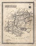
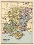
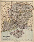
FA2002.2
|
Map, colour printed road map, Hampshire, scale about 1 to
250000, about 4 miles to 1 inch, by John Bartholomew and Son,
Edinburgh, Lothian, from The Little Guide, Hampshire, by Charles
Cox, revised by R L P Jowitt, published by Methuen and Co, and B
T Batsford, London, 1949.
|
|
|
|
FA2002.3
|
Map, pull out from a magazine, Map of County Councillors,
published by Hampshire County Council, printed by Hampshire
Printing Services, 2001
|
|
|
|
FA2002.4
|
Road map, The Daily Herald Road Map of Great Britain, scale
about 10 miles to 1 inch, by George Philip and Son, London,
published by the Odhams Press, Long Acre, London, 1951.
|
|
|
|
FA2002.5
|
Road map, Hampshire County Road Map, road system overprinted
on OS base map, scale 1 inch to 1 mile, by Cook, Hammond and
Kell, London, 1948.
|
|
|
|
FA2002.6
|
Chart, Leisure Folio pack, The Solent and Approaches,
published by the Hydrographic Office, Taunton, Somerset, 1997,
5th edn 2002.
|
|
|
|
FA2002.7
(Blome 1673)
|
Descriptive text, pile of pages from an atlas of maps by
Richard Blome, published 1673.
|
|
|
|
FA2002.8
|
Map, Aldershot Command, in Hampshire, Berkshire and Surrey,
Popular Edition 1 inch map, scale 1 mile to 1 inch, published by
Ordnance Survey, 1920, overprinted by the War Office, 1931.
|
|
|
|
FA2002.9
|
Map, road map, sheet 2, South East England, scale about 5
miles to 1 inch, by George Philip Printers, London, published by
Esso Petroleum Co, 1977.
|
|
|
|
FA2002.10
|
Map, road map, sheet 3, South and West England, scale about 5
miles to 1 inch, by Edward Stanford, London, published by Esso
Petroleum Co, 1950s.
|
|
|
|
FA2002.11
|
Map, road map, sheet 3, South and West England, scale about 5
miles to 1 inch, by Edward Stanford, London, published by Esso
Petroleum Co, 1963.
|
|
|
|
FA2002.12
|
Map, road map, sheet 3, South and West England, scale about 5
miles to 1 inch, by Edward Stanford, London, published by Esso
Petroleum Co, 1966.
|
|
|
|
FA2002.13
|
Itinerary, RAC route description with town street maps,
Winchester to Liverpool, prepared by the Royal Automobile Club,
London, 1960s?
|
|
|
|
FA2002.14
|
Map, road map, South and East England, sheet 2, scale about 4
miles to 1 inch, published for Shell, oil company, by George
Philip and Son, London, 1966.
|
|
|
|
FA2002.15
|
Guide book, Home Counties, About Britain No 3, edited by
Geoffrey Grigson, published for the Festival of Britain Office by
Collins, 14 St James Place, London, 1951.
|
|
|
|
FA2002.16
|
Road book, The Motor Cyclist's Map of Great Britain and
Ireland, scale about 10 miles to 1 inch, by W and A K Johnston
and G W Bacon, published by the Royal Automobile Club, RAC,
1950s-60s?
|
|
|
|
FA2002.17
|
Road map, Droxford Rural District official map, scale roughly
1.5 inches to 1 mile, published by G W May and Co, Wigmore
Street, London, 1970s.
|
|
|
|
FA2002.18
|
Map, Half Inch Contoured Map, sheet 8 Salisbury Plain, scale 2
miles to 1 inch, published by John Bartholomew and Son,
Edinburgh, Lothian, 1970.
|
|
|
|
FA2002.19
|
Street map, Street Plan and Guide to Portsmouth, by Service
Publicatiosn, Brighton, Sussex, 1948?
|
|
|
|
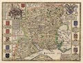
FA2002.21
(Greenwood 1826)
|
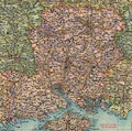
Map, 6 steel plate engravings, Map of the County of
Southampton, ie Hampshire, with the Isle of Wight, scale about 1
miles to 1 inch, by C and J Greenwood and Nathaniel L Kentish,
published by Greenwood, Pringle and Co, Regent Street, Pall Mall,
London, 1826.
|
|
|
|
FA2002.22
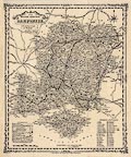
(Lea 1689)
|
Map, hand coloured copper plate engraving, Hampshire, scale
about 4 miles to 1 inch, by Christopher Saxton, engraved by
Leonard Terwoort, Antwerp, Netherlands, first published about
1575, amended 1689 and published by Philip Lea, London, 1693.
|
|
|
|
FA2002.23
(Moll 1724)
|
Map, uncoloured engraving, Hamp Shire ie Hampshire, scale
about 6.5 miles to 1 inch, by Herman Moll, included in a New
Description of England, published 1724.
|
|
|
|
FA2002.24
(Drayton 1612)
|
Map, uncoloured copper plate engraving, fantastical map of
Dorset, Hampshire and the Isle of Wight, published in
Poly-Olbion, by Michael Drayton, poet, engraved by William Hole,
about 1612.
|
|
|
|
FA2002.25
(Greenwood 1829)
|
Map, hand coloured engraving, Map of the County of
Southampton, Hampshire with the Isle of Wight, scale about 3
miles to 1 inch, by C and J Greenwood, engraved by J and J Neele,
Strand, London, published by Greenwood and Co, 13 Regent Street,
London, 1829.
|
|
|
|
FA2002.26
(Saxton 1575)
|
Map, hand coloured copper plate engraving, Southamtoniae, ie
Hampshire, scale about 4 miles to 1 inch, engraved by Leonard
Terwoort, Antwerp, Netherlands, published by Christopher Saxton,
map maker, London? about 1575.
|
|
|
|
FA2002.27
(Morden 1695)
|
Map, uncoloured engraving, Hamp Shire ie Hampshire, scale
about 4 miles to 1 inch, by Robert Morden, published in an
edition of Britannia by William Camden, 1695.
|
|
|
|
FA2002.28
(Blaeu 1645)
|
Map, hand coloured engraving, Vectis Insula or the Isle of
Wight, scale about 1.5 miles to 1 inch, published in Theatrum
Orbis Terrarum, by William J Blaeu, Amsterdam, Netherlands,
1645.
|
|
|
|
FA2002.29
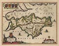
(Blaeu 1645)
|
Map, hand coloured engraving, Hampshire or the County of
Southampton, or Hantshire, scale about 3.5 miles to 1 inch,
published in Theatrum Orbis Terrarum, by William J Blaeu,
Amsterdam, Netherlands, 1645.
|
|
|
|
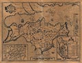
FA2002.30
(Speed 1611)
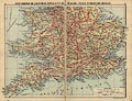
|
Map, uncoloured engraving, Wight Island ie Isle of Wight,
scale about 1.5 miles to 1 inch, with inset town plans of
Newport, Isle of Wight and Southampton, Hampshire, by William
White and John Speed, London, about 1611.
|
|
|
|
FA2002.31
(Speed 1611)
|
Map, uncoloured engraving, Hantshire described and divided,
Hampshire with part of the Isle of Wight, and a town plan of
Winchester, scale about 4 miles to 1 inch, by John Speed,
engraved by Jodocus Hondius, about 1611.
|
|
|
|
FA2002.38
|
Itinerary, strip map, AA route description, Falmouth to
Staines, scale roughly 3 miles to 1 inch? published by the
Automobile Association, 1960s-70s?
|
|
|
|
FA2002.39
|
Itinerary, strip map, AA route description, Chard to
Westerham, published by the Automobile Association,
1960s-70s?
|
|
|
|
FA2002.40
|
Itinerary, strip map, AA route description, Alton to Brighton,
published by the Automobile Association, 1962.
|
|
|
|
FA2002.41
|
Itinerary, strip map, AA route description, Petersfield to
Ripon, published by the Automobile Association, 1959?
|
|
|
|
FA2002.42
|
Map, Burrow's Pointer Guide Map of Basingstoke, Street Plan of
Basingstoke, Hampshire, scale about 4 inches to 1 mile, published
by Edward J Burrow and Co, Cheltenham, Gloucestershire, about
1950s?
|
|
|
|
FA2002.43
|
Road map, Basingstoke and District Multiple Mileage Chart,
scale about 11 miles to 1 inch, complimentary gift from Lintott
Motor Co, Reading Road, Basingstoke, Hampshire, provided by Fleet
Sales Services, 1-2 Pleydell Court, London, 1950s-60s.
|
|
|
|
FA2002.44
|
Road atlas, road maps, Bacon's Road Atlas of 70 Miles round
London, scale about 5 miles to 1 inch, published by G W Bacon and
Co, 127 Strand, London, 1920s-30s?
|
|
|
|
FA2002.45
|
Road map, Bacon's Motoring and Cycling Road Map, sheet 6 South
East England, Road Map of Fifty Miles round London, scale about 5
miles to 1 inch, by G W Bacon and Co, 127 Strand, London,
1920s-30s?
|
|
|
|
FA2002.46
|
Road map, Safety or Graded Road Map of England, sheet 1
Southern Division, scale about 10 miles to 1 inch, design by
Harry Inglis, published by Gall and Inglis, Edinburgh and London,
1910s-20s.
|
|
|
|
FA2002.47
|
Map, Half Inch Contoured Map, sheet 32 Sussex, scale 2 miles
to 1 inch, published by John Bartholomew and Son, the Edinburgh
Geographical Institute, Edinburgh, Lothian, 1920s-30s?
|
|
|
|
FA2002.48
|
Map, Half Inch Contoured Map, sheet 33 New Forest and Isle of
Wight, scale 2 miles to 1 inch, published by John Bartholomew and
Son, the Edinburgh Geographical Institute, Edinburgh, Lothian,
1920s-30s?
|
|
|
|
FA2002.49
|
Map, Aldershot Command, Manoeuvre Area 1939, in Hampshire,
Berkshire and Surrey, Popular Edition 1 inch map, scale 1 mile to
1 inch, published by Ordnance Survey, 1932, overprinted by the
War Office, 1939.
|
|
|
|
FA2002.50
|
Estate plan, map, Plan of Farms at Brown Candover and Chilton
Candover, Hampshire, based on the Ordnance Survey, published by
Warmington and Co, auctioneers etc, 19 Berkeley Street,
Piccadilly, London, early 20th century?
|
|
|
|
FA2002.51
|
Estate plan, map, Plan of the Sherfield Manor Estate,
Sherfield on Loddon, Hampshire, based on the Ordnance Survey,
published by Knight, Frank and Rutley, London etc, and Simmons
and Sons, Basingstoke, Hampshire etc, 1926.
|
|
|
|
FA2002.52
|
Estate plan, map, Stratton Park Esatate, Micheldever,
Hampshire, based on the Ordnance Survey, published by John D Wood
and Co, auctioneers, and Farebrother, Ellis and Co, London,
auctioneers, 1930.
|
|
|
|
FA2002.53
|
Estate plan, map, Plan of the Ewhurst, Wolverton and Tadley
Estates, in Baughurst and Tadley, Hampshire, based on the
Ordnance Survey, published by Hewett and Lee, auctioneers,
Guildford, Surrey, 1943.
|
|
|
|
FA2002.53.1
|
Estate plan, map, Plan of parts of the Ewhurst, Wolverton and
Tadley Estates, in Baughurst and Tadley, Hampshire, based on the
Ordnance Survey, published by Hewett and Lee, auctioneers,
Guildford, Surrey, 1943.
|
|
|
|
FA2002.54
|
Estate plan, maps, sale particulars, photographs, of the
Hackwood Building Estate, Winslade, Hampshire, by Hugh E
Raynbird, surveyor, Basingstoke, and Lamb, Brooks, Sherwood and
Bullock, solicitors, Basingstoke etc, Hampshire, 1900s.
|
|
|
|
FA2002.55
|
Canal map, Lockmaster Maps, Southern Counties Waterways, by
Douglas M Smith, Kingswood Cottage, Dicks Lane Wharf, Rowington,
Warwickshire, 1988.
|
|
|
|
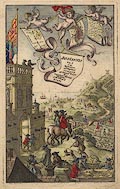
FA2002.77
(Ogilby 1675)
|
Frontispiece, hand coloured engraving, drawn by Francis
Barlow, engraved by W Hollar for the road book, Britannia, by
John Ogilby, London, 1675.
|
|
|
|
FA2002.78
(Lang 1936)
|
Book, The National Road Book, itineraries and descriptive text
for the south of England, by R T Lang, published by E J Burrow
and Co, Cheltenham, Gloucestershire and London, 1936.
|
|
|
|
FA2002.78.1
(Lang 1936)
|
Map, Southern England, scale about 8 miles to 1 inch, inserted
in The National Road Book, drawn by R T Lang, published for E J
Burrow and Co, Cheltenham, Gloucestershire, by Methuen, London,
1936.
|
|
|
|
FA2002.79
(Saxton 1575)
|
Map, hand coloured copper plate engraving, Southamtoniae, ie
Hampshire, scale about 4 miles to 1 inch, engraved by Leonard
Terwoort, Antwerp, Netherlands, published by Christopher Saxton,
map maker, London? about 1575.
|
|
|
|
FA2002.80
(Morden 1695)
|
Map, hand coloured engraving, Hamp Shire ie Hampshire, scale
about 4 miles to 1 inch, by Robert Morden, published in an
edition of Britannia by William Camden, 1695.
|
|
|
|
FA2002.81
(Norden 1607)
|
Map, uncoloured engraving, Hamshire olim Pars Belgarum, county
map of Hampshire, scale about 6 miles to 1 inch, by John Norden
about 1595, version engraved by William Hole and published in
Britannia, by William Camden, 6th Latin edition, about 1607.
|
|
|
|
FA2002.82
(Speed 1695)
|
Map, hand colourd engraving, Hantshire ie Hampshire, scale
about 4 miles to 1 inch, by John Speed, 1611, amended by
Christopher Browne, and later published by Henry Overton, The
White Horse, without Newgate, London, 1689 onwards.
|
|
|
|
FA2002.83
(Bellin 1764)
|
Chart, uncoloured engraving, Carte de l'Isle de Portsey et
Havre de Portsmouth, Portsea Island and Portsmouth Harbour,
Hampshire, scale about 2 miles to 1 inch? by Jacques Bellin,
Depot des Cartes et Plans de la Marine, Paris, France, 1764.
|
|
|
|
FA2002.84.1
(Teesdale 1830)
|
Map, uncoloured lithograph from an engraving, Hampshire, scale
about 12 miles to 1 inch, by Henry G Teesdale, 1830, lithographed
and published by John Heywood, 1860s.
|
|
|
|
FA2002.84.2
(Hinton 1765)
|
Road map, strip map, uncoloured engraving, Road from London to
the 204th Mile Stone ... Lands End, scale about 2.5 miles to 1
inch, plate 10, published by John Hinton in the Universal
Magazine of Knowledge and Pleasure, London, 1767.
|
|
|
|
FA2002.85.1
(Mogg 1814)
|
Strip map, road map, part of route London to Portsmouth,
Hampshire, scale about 1 inch to 1 mile, published by E Mogg,
London, 1814.
|
|
|
|
FA2002.85.2
(Brannon 1859)
|
Map, New Map of Hampshire, with the Isle of Wight, scale about
3 miles to 1 inch, by P Brannon, engraved by Brannon and Co,
published by William White, Collegiate Crescent, Sheffield, West
Yorkshire, 1859.
|
|
|
|
FA2002.85.3
(Collins 1850)
|
Map, uncoloured lithograph from an engraving, Hampshire, with
the Isle of Wight, scale about 4 miles to 1 inch, by Henry G
Collins, 1850, published by John Heywood, Manchester, 1868?
|
|
|
|
FA2002.501
(MacKenzie 1893)
|
Map, colour lithograph? Hampshire with the Isle of Wight,
scale about 6.5 miles to 1 inch, by F S Weller, published by
William MacKenzie, London, etc, about 1893?
|
|
|
|
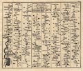
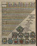
FA2002.502
(Cox 1738)
|
table of distances, for Hampshire, from Magna Brtiannia et
Hibernia Antiqua et Nova, published complete by Thomas Cox,
London, about 1730, this part first published about 1718
|
|
|
|
FA2002.503
|
Road book, road map and itineraries, Hampshire, Wiltshire and
the Isle of Wight, no.3 in the CTC Route Book series, published
by the Cyclists' Touring Club, 3 Craven Hill, Paddington, London,
1930s?
|
|
|
|
FA2002.504
(Titchfield 1600s)
|
Map, lithograph, Titchfield Estate from a 17th Century Map,
drawn by Wilberforce Cobbett, lithographed by Sprague and Co, 4-5
East Harding Street, Fetter Lane, London, 1906.
|
|
|
|
FA2002.505
(Warren 1890s)
|
Map, uncoloured engraving, Map of the Winchester District,
Hampshire, scale about 1.5 miles to 1 inch, published in Warren's
Guide to Winchester, by Warren and Son, Winchester, Hampshire,
1890s-1920s?
|
|
|
|
FA2002.506
(Dispatch 1863)
|
Map, 2 sheet engraving, Hampshire, with the Isle of Wight,
scale about 3 miles to 1 inch, by Edward Weller, 1858, published
in The Dispatch Atlas, by The Weekly Dispatch, 139 Fleet Street,
London, 1858-63.
|
|
|
|
FA2002.507
|
Map, National Rail Network, scale roughly 20 miles to 1 inch,
and leaflet about services, by Association of Train Operating
Companies, ATOC, published by National Rail, London, 2001.
|
|
|
|
FA2002.508
|
atlas, maps and charts, Atlas of Portsmouth, published by the
Department of Geography, Portsmouth Polytechnic, Portsmouth,
Hampshire, 1975.
|
|
|
|
FA2002.509
(Sylvan 1934)
|
Road book, with itineraries and maps, scale about 6 miles to 1
inch, Roadhouses and Clubs of the Home Counties, published by
Sylvan Publications, 5 Gower Street, London, 1934.
|
|
|
|
FA2002.510
(Day 1852)
|
Road map, lithograph, Map of Hampshire shewing the Turnpike
Roads, scale about 2.5 miles to 1 inch, published by Day and Son,
London, 1852.
|
|
|
|
FA2002.511
(von Reilly c1789)
|
Chart, hand coloured engraving, Die Inseln um Portsmouth, The
Islands at Portsmouth, Hampshire, scale about 2 miles to 1 inch,
or 2 inches to 1 league, by Franz Johann Joseph von Reilly,
Germany, about 1789?
|
|
|
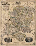
|
FA2002.512
(Bowles 1780)
|
Cart, hand coloured engraving, New Topographical Chart of the
English Channel, scale about 19 statute miles to 1 inch, by
Carrington Bowles, 69 St Pauls Churchyard, London, 1780.
|
|
|
|
FA2002.513
(Bellin 1762)
|
Chart, uncoloured engraving, Carte Reduite de l'Isle de Wight
et Costes Voisines, scale about 2 inches to 1 league, 2 statute
miles to 1 inch, by Jacques Bellin, engraved by Raineau?
published at the Depot de la Marine, Paris, France, 1762.
|
|
|
|
FA2002.514
(Universal British Traveller c1784)
|
Descriptive text, The Modern Universal British Traveller,
Hampshire, perhaps about 1784.
|
|
|
|
FA2002.515
(Taylor 1759)
|
Reproduction map, Map of Hampshire, with the Isle of Wight, 6
sheets, by Isaac Taylor, 1759, scale about 1 mile to 1 inch, but
published at about 3/4 size by Hampshire Field Club and
Archaeological Society, 1933.
|
|
|
|
FA2002.516
(Prichard 1861)
|
Atlas, folder of Ethnographical Maps, for the Natural History
of Man, by Dr J C Prichard, published by H Bailliere, 219 Regent
Street, London, 2nd edition 1861.
|
|
|
|
FA2002.516.1
(Prichard 1861)
|
Map, thematic map, Ethnographical Map of Asia, for the Natural
History of Man, by Dr J C Prichard, published by H Bailliere, 219
Regent Street, London, 2nd edition 1861.
|
|
|
|
FA2002.516.2
(Prichard 1861)
|
Map, thematic map, Ethnographical Map of Europe, for the
Natural History of Man, by Dr J C Prichard, published by H
Bailliere, 219 Regent Street, London, 2nd edition 1861.
|
|
|
|
FA2002.516.3
(Prichard 1861)
|
Map, thematic map, Ethnographical Map of Africa, for the
Natural History of Man, by Dr J C Prichard, published by H
Bailliere, 219 Regent Street, London, 2nd edition 1861.
|
|
|
|
FA2002.516.4
(Prichard 1861)
|
Map, thematic map, Ethnographical Map of North America, for
the Natural History of Man, by Dr J C Prichard, published by H
Bailliere, 219 Regent Street, London, 2nd edition 1861.
|
|
|
|
FA2002.516.5
(Prichard 1861)
|
Map, thematic map, Ethnographical Map of South America, for
the Natural History of Man, by Dr J C Prichard, published by H
Bailliere, 219 Regent Street, London, 2nd edition 1861.
|
|
|
|
FA2002.516.6
(Prichard 1861)
|
Map, thematic map, Ethnographical Map of Polynesia, for the
Natural History of Man, by Dr J C Prichard, published by H
Bailliere, 219 Regent Street, London, 2nd edition 1861.
|
|
|
|
FA2002.517
(Nightingale 1910s)
|
Map, Nightingale's New Survey Map of Hampshire, Dorset,
Berkshire, Wiltshire, etc, scale about 3 miles to 1 inch, by
George Philip and Son, The London Geographical Institute, London,
?published by Nightingale, 1910s?
|
|
|
|
FA2002.518
(Allied 1920s)
|
Road book, with itineraries, maps, etc, The Open Road,
published by Allied Newspapers, Withy Grove, Manchester,
Lancashire, 1920s.
|
|
|
|
FA2002.518.1
(Allied 1920s)
|
Road map, Open Road Map of Geat Britain, scale about 15 miles
to 1 inch, by John Bartholomew and Son, Edinburgh, Lothian,
published by Allied Newspapers, Withy Grove, Manchester,
Lancashire, 1920s.
|
|
|
|
FA2002.518.2
|
Road map, Map Showing How to get Out of London, published in
the Open Road road book, by Allied Newspapers, Withy Grove,
Manchester, Lancashire, 1920s.
|
|
|
|
FA2002.518.3
|
Road map, London to Newmarket, Colchester and the East Coast,
published in the Open Road road book, by Allied Newspapers, Withy
Grove, Manchester, Lancashire, 1920s.
|
|
|
|
FA2002.518.4
|
Road map, London to Canterbury, Margate, Dover, Hastings,
Eastbourne, etc, published in the Open Road road book, by Allied
Newspapers, Withy Grove, Manchester, Lancashire, 1920s.
|
|
|
|
FA2002.518.5
|
Road map, London to Oxford, Northampton, Cambridge, etc,
published in the Open Road road book, by Allied Newspapers, Withy
Grove, Manchester, Lancashire, 1920s.
|
|
|
|
FA2002.518.6
|
Road map, London to Basingstoke, Southampton, Portsmouth,
Brighton, etc, published in the Open Road road book, by Allied
Newspapers, Withy Grove, Manchester, Lancashire, 1920s.
|
|
|
|
FA2002.518.7
|
Road map, The Shakespeare Country, published in the Open Road
road book, by Allied Newspapers, Withy Grove, Manchester,
Lancashire, 1920s.
|
|
|
|
FA2002.518.8
|
Road map, Devon and Cornwall, published in the Open Road road
book, by Allied Newspapers, Withy Grove, Manchester, Lancashire,
1920s.
|
|
|
|
FA2002.518.9
|
Road map, The Dukeries, ie Nottinghamshire area, published in
the Open Road road book, by Allied Newspapers, Withy Grove,
Manchester, Lancashire, 1920s.
|
|
|
|
FA2002.518.10
|
Road map, New Forest, published in the Open Road road book, by
Allied Newspapers, Withy Grove, Manchester, Lancashire,
1920s.
|
|
|
|
FA2002.518.11
|
Road map, Border Counties, published in the Open Road road
book, by Allied Newspapers, Withy Grove, Manchester, Lancashire,
1920s.
|
|
|
|
FA2002.518.12
|
Road map, English Lakes, published in the Open Road road book,
by Allied Newspapers, Withy Grove, Manchester, Lancashire,
1920s.
|
|
|
|
FA2002.518.13
|
Road map, Yorkshire Dales, published in the Open Road road
book, by Allied Newspapers, Withy Grove, Manchester, Lancashire,
1920s.
|
|
|
|
FA2002.518.14
|
Road map, The Peak District, published in the Open Road road
book, by Allied Newspapers, Withy Grove, Manchester, Lancashire,
1920s.
|
|
|
|
FA2002.518.15
|
Road map, The Trossachs, published in the Open Road road book,
by Allied Newspapers, Withy Grove, Manchester, Lancashire,
1920s.
|
|
|
|
FA2002.518.16
|
Road map, The Land o' Burns, published in the Open Road road
book, by Allied Newspapers, Withy Grove, Manchester, Lancashire,
1920s.
|
|
|
|
FA2002.518.17
|
Road map, The Perthshire Highlands, published in the Open Road
road book, by Allied Newspapers, Withy Grove, Manchester,
Lancashire, 1920s.
|
|
|
|
FA2002.518.18
|
Road map, The Scott Country, published in the Open Road road
book, by Allied Newspapers, Withy Grove, Manchester, Lancashire,
1920s.
|
|
|
|
FA2002.519
(Bartholomew 1979)
|
Road atlas, Motorway Atlas, or British Motorway Routefinder,
road maps of England and Wales, published by John Bartholomew and
Son, Duncan Street, Edinburgh, Lothian, 1979.
|
|
|
|
FA2002.520
(Geographia 1950s)
|
Road atlas, the Austin Road Atlas of Great Britain, road maps
of England, Wales and Scotland, by Geographia, 114 Fleet Street,
London, published by Austin Motor Co, Longbridge Works,
Birmingham, West Midlands, 1950s?
|
|
|
|
FA2002.649
|
Itinerary, RAC route description with town street maps,
Croydon to Falmouth, prepared for Miss K M Port by the Royal
Automobile Club, London, 1968.
|
|
|
|
FA2002.650
(Milne 1791)
|
Reproduction map, Hampshire, and Isle of Wight, scale about 1
mile to 1 inch, in 6 parts, surveyed by Thomas Milne, first
published by William Faden, Charing Cross, London, 1791,
reproduction by Harry Margary, Lympne Castle, Kent, 1960s?
|
|
|
|
FA2002.651
(Ptolemy 1793)
|
Map, hand coloured engraving, Albion et Hibernia Britannicae
Insulae, from the data of Claudius Ptolemy, 2nd century, on the
example of Gerhard Mercator, 16th century, scale about 55 miles
to 1 inch, engraved by Basire, published for the Society of
Antiquaries, 1793.
|
|
|
|
FA2002.652
(Arrowsmith 1814)
|
Map, thematic map, hand coloured engraving, the Diocese of
Salisbury and the Diocese of Winchester, as 1535, scale about 6
miles to 1 inch, by Aaron Arrowsmith, London, 1814.
|
|
|
|
FA2002.653
(Philip 1857-1900)
|
Map, colour lithograph, Hampshire, scale about 4 miles to 1
inch, published by George Philip and Son, London and Liverpool,
Lancashire, about 1857, edition about 1900.
|
|
|
|
FA2002.654
(Stanford 1904)
|
Atlas, Stanford's Geological Atlas of Great Britain and
Ireland, by Horace B Woodward, published by Edward Stanford,
12-14 Long Acre, London, 3rd edn 1914.
|
|
|
|
FA2002.654.1
(Stanford 1904)
|
Geological map, colour printed, Geological Map of Great
Britain, scale about 95 miles to 1 inch, in Stanford's Geological
Atlas of Great Britain and Ireland, by Horace B Woodward,
published by Edward Stanford, 12-14 Long Acre, London, 3rd edn
1914.
|
|
|
|
FA2002.654.2
|
Geological map, colour printed, Middlesex, in Stanford's
Geological Atlas of Great Britain and Ireland, by Horace B
Woodward, published by Edward Stanford, 12-14 Long Acre, London,
3rd edn 1914.
|
|
|
|
FA2002.654.3
|
Geological map, colour printed, Oxford and Berkshire, in
Stanford's Geological Atlas of Great Britain and Ireland, by
Horace B Woodward, published by Edward Stanford, 12-14 Long Acre,
London, 3rd edn 1914.
|
|
|
|
FA2002.654.4
|
Geological map, colour printed, Cambridgeshire and
Huntingdonshire, in Stanford's Geological Atlas of Great Britain
and Ireland, by Horace B Woodward, published by Edward Stanford,
12-14 Long Acre, London, 3rd edn 1914.
|
|
|
|
FA2002.654.5
|
Geological map, colour printed, Cheshire, in Stanford's
Geological Atlas of Great Britain and Ireland, by Horace B
Woodward, published by Edward Stanford, 12-14 Long Acre, London,
3rd edn 1914.
|
|
|
|
FA2002.654.6
|
Geological map, colour printed, Cornwall, in Stanford's
Geological Atlas of Great Britain and Ireland, by Horace B
Woodward, published by Edward Stanford, 12-14 Long Acre, London,
3rd edn 1914.
|
|
|
|
FA2002.654.7
|
Geological map, colour printed, Cumberland, and inset map,
Isle of Man, in Stanford's Geological Atlas of Great Britain and
Ireland, by Horace B Woodward, published by Edward Stanford,
12-14 Long Acre, London, 3rd edn 1914.
|
|
|
|
FA2002.654.8
|
Geological map, colour printed, The Lake District comprising
Westmorland and parts of Cumberland and Lancashire, in Stanford's
Geological Atlas of Great Britain and Ireland, by Horace B
Woodward, published by Edward Stanford, 12-14 Long Acre, London,
3rd edn 1914.
|
|
|
|
FA2002.654.9
|
Geological map, colour printed, Derbyshire, in Stanford's
Geological Atlas of Great Britain and Ireland, by Horace B
Woodward, published by Edward Stanford, 12-14 Long Acre, London,
3rd edn 1914.
|
|
|
|
FA2002.654.10
|
Geological map, colour printed, Devonshire, in Stanford's
Geological Atlas of Great Britain and Ireland, by Horace B
Woodward, published by Edward Stanford, 12-14 Long Acre, London,
3rd edn 1914.
|
|
|
|
FA2002.654.11
|
Geological map, colour printed, Dorsetshire, Somersetshire and
South Wiltshire, in Stanford's Geological Atlas of Great Britain
and Ireland, by Horace B Woodward, published by Edward Stanford,
12-14 Long Acre, London, 3rd edn 1914.
|
|
|
|
FA2002.654.12
|
Geological map, colour printed, Durham, in Stanford's
Geological Atlas of Great Britain and Ireland, by Horace B
Woodward, published by Edward Stanford, 12-14 Long Acre, London,
3rd edn 1914.
|
|
|
|
FA2002.654.13
|
Geological map, colour printed, Essex, in Stanford's
Geological Atlas of Great Britain and Ireland, by Horace B
Woodward, published by Edward Stanford, 12-14 Long Acre, London,
3rd edn 1914.
|
|
|
|
FA2002.654.14
|
Geological map, colour printed, Gloucestershire and North
Wiltshire, in Stanford's Geological Atlas of Great Britain and
Ireland, by Horace B Woodward, published by Edward Stanford,
12-14 Long Acre, London, 3rd edn 1914.
|
|
|
|
FA2002.654.15
(Stanford 1904)
|
Geological map, colour printed, Hampshire, scale about 8 miles
to 1 inch, in Stanford's Geological Atlas of Great Britain and
Ireland, by Horace B Woodward, published by Edward Stanford,
12-14 Long Acre, London, 3rd edn 1914.
|
|
|
|
FA2002.654.16
|
Geological map, colour printed, Herefordshire and
Monmouthshire, in Stanford's Geological Atlas of Great Britain
and Ireland, by Horace B Woodward, published by Edward Stanford,
12-14 Long Acre, London, 3rd edn 1914.
|
|
|
|
FA2002.654.17
|
Geological map, colour printed, Kent, in Stanford's Geological
Atlas of Great Britain and Ireland, by Horace B Woodward,
published by Edward Stanford, 12-14 Long Acre, London, 3rd edn
1914.
|
|
|
|
FA2002.654.18
|
Geological map, colour printed, West Yorkshire and Lancashire,
in Stanford's Geological Atlas of Great Britain and Ireland, by
Horace B Woodward, published by Edward Stanford, 12-14 Long Acre,
London, 3rd edn 1914.
|
|
|
|
FA2002.654.19
|
Geological map, colour printed, Leicestershire and
Rutlandshire, in Stanford's Geological Atlas of Great Britain and
Ireland, by Horace B Woodward, published by Edward Stanford,
12-14 Long Acre, London, 3rd edn 1914.
|
|
|
|
FA2002.654.20
|
Geological map, colour printed, Lincolnshire, in Stanford's
Geological Atlas of Great Britain and Ireland, by Horace B
Woodward, published by Edward Stanford, 12-14 Long Acre, London,
3rd edn 1914.
|
|
|
|
FA2002.654.21
|
Geological map, colour printed, Norfolk, in Stanford's
Geological Atlas of Great Britain and Ireland, by Horace B
Woodward, published by Edward Stanford, 12-14 Long Acre, London,
3rd edn 1914.
|
|
|
|
FA2002.654.22
|
Geological map, colour printed, Northamptonshire, in
Stanford's Geological Atlas of Great Britain and Ireland, by
Horace B Woodward, published by Edward Stanford, 12-14 Long Acre,
London, 3rd edn 1914.
|
|
|
|
FA2002.654.23
|
Geological map, colour printed, Northumberland, in Stanford's
Geological Atlas of Great Britain and Ireland, by Horace B
Woodward, published by Edward Stanford, 12-14 Long Acre, London,
3rd edn 1914.
|
|
|
|
FA2002.654.24
|
Geological map, colour printed, Nottinghamshire, in Stanford's
Geological Atlas of Great Britain and Ireland, by Horace B
Woodward, published by Edward Stanford, 12-14 Long Acre, London,
3rd edn 1914.
|
|
|
|
FA2002.654.25
|
Geological map, colour printed, Shropshire, in Stanford's
Geological Atlas of Great Britain and Ireland, by Horace B
Woodward, published by Edward Stanford, 12-14 Long Acre, London,
3rd edn 1914.
|
|
|
|
FA2002.654.26
|
Geological map, colour printed, Staffordshire, in Stanford's
Geological Atlas of Great Britain and Ireland, by Horace B
Woodward, published by Edward Stanford, 12-14 Long Acre, London,
3rd edn 1914.
|
|
|
|
FA2002.654.27
|
Geological map, colour printed, Suffolk, in Stanford's
Geological Atlas of Great Britain and Ireland, by Horace B
Woodward, published by Edward Stanford, 12-14 Long Acre, London,
3rd edn 1914.
|
|
|
|
FA2002.654.28
|
Geological map, colour printed, Surrey and Sussex, in
Stanford's Geological Atlas of Great Britain and Ireland, by
Horace B Woodward, published by Edward Stanford, 12-14 Long Acre,
London, 3rd edn 1914.
|
|
|
|
FA2002.654.29
|
Geological map, colour printed, Warwickshire and
Worcestershire, in Stanford's Geological Atlas of Great Britain
and Ireland, by Horace B Woodward, published by Edward Stanford,
12-14 Long Acre, London, 3rd edn 1914.
|
|
|
|
FA2002.654.30
|
Geological map, colour printed, East Yorkshire, in Stanford's
Geological Atlas of Great Britain and Ireland, by Horace B
Woodward, published by Edward Stanford, 12-14 Long Acre, London,
3rd edn 1914.
|
|
|
|
FA2002.654.31
|
Geological map, colour printed, North Wales, in Stanford's
Geological Atlas of Great Britain and Ireland, by Horace B
Woodward, published by Edward Stanford, 12-14 Long Acre, London,
3rd edn 1914.
|
|
|
|
FA2002.654.32
|
Geological map, colour printed, South Wales, in Stanford's
Geological Atlas of Great Britain and Ireland, by Horace B
Woodward, published by Edward Stanford, 12-14 Long Acre, London,
3rd edn 1914.
|
|
|
|
FA2002.654.33a
|
Geological map, colour printed, North Scotland, Shetland and
Orkney Islands, in Stanford's Geological Atlas of Great Britain
and Ireland, by Horace B Woodward, published by Edward Stanford,
12-14 Long Acre, London, 3rd edn 1914.
|
|
|
|
FA2002.654.33b
|
Geological map, colour printed, Scotland, in Stanford's
Geological Atlas of Great Britain and Ireland, by Horace B
Woodward, published by Edward Stanford, 12-14 Long Acre, London,
3rd edn 1914.
|
|
|
|
FA2002.654.34a
|
Geological map, colour printed, Ireland, in Stanford's
Geological Atlas of Great Britain and Ireland, by Horace B
Woodward, published by Edward Stanford, 12-14 Long Acre, London,
3rd edn 1914.
|
|
|
|
FA2002.654.34b
|
Geological map, colour printed, Ireland, in Stanford's
Geological Atlas of Great Britain and Ireland, by Horace B
Woodward, published by Edward Stanford, 12-14 Long Acre, London,
3rd edn 1914.
|
|
|
|
FA2002.654.34c
|
Geological map, colour printed, Jersey, Guernsey, Alderney,
etc, Channel Islands, in Stanford's Geological Atlas of Great
Britain and Ireland, by Horace B Woodward, published by Edward
Stanford, 12-14 Long Acre, London, 3rd edn 1914.
|
|
|
|
FA2003.1.8
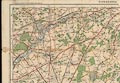
(OS 1810s Old Series)
|
Map, uncoloured engraving, One inch map Old Series, sheet 8,
Dorking, including parts of Hampshire, scale 1 inch to 1 mile,
published under the direction of LtCol Mudge, Ordnance Survey,
Tower of London, London, 1816; edition about 1845-50?
|
|
|
|
FA2003.1.9
(OS 1810s Old Series)
|
Map, uncoloured engraving, One inch map Old Series, sheet 9,
Brighton, including parts of Hampshire, scale 1 inch to 1 mile,
published under the direction of LtCol Mudge, Ordnance Survey,
Tower of London, London, 1813.
|
|
|
|
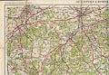
FA2003.1.11
(OS 1810s Old Series)
|
Map, uncoloured engraving, One inch map Old Series, sheet 11,
Winchester, including parts of Hampshire, scale 1 inch to 1 mile,
published under the direction of LtCol Mudge, Ordnance Survey,
Tower of London, London, 1810; edition about 1855?
|
|
|
|
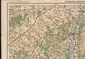
FA2003.1.12
(OS 1810s Old Series)
|
Map, uncoloured engraving, One inch map Old Series, sheet 12,
Basingstoke, including part of Hampshire, scale 1 inch to 1 mile,
published under the direction of LtCol Mudge, Ordnance Survey,
Tower of London, London, 1817.
|
|
|
|
FA2003.1.14
(OS 1810s Old Series)
|
Map, uncoloured engraving, One inch map Old Series, sheet 14,
Devizes, including part of Hampshire, scale 1 inch to 1 mile,
published under the direction of LtCol Mudge, Ordnance Survey,
Tower of London, London, 1817; edition about 1846.
|
|
|
|
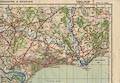
FA2003.1.15
(OS 1810s Old Series)
|
Map, uncoloured engraving, One inch map Old Series, sheet 15,
Salisbury, including part of Hampshire, scale 1 inch to 1 mile,
published under the direction of LtCol Mudge, Ordnance Survey,
Tower of London, London, 1811; edition about 1846?
|
|
|
|
FA2003.1.16
(OS 1810s Old Series)
|
Map, uncoloured engraving, One inch map Old Series, sheet 16,
Poole, including parts of Hampshire, scale 1 inch to 1 mile,
published under the direction of LtCol Mudge, Ordnance Survey,
Tower of London, London, 1811; edition about 1836.
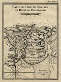
|
|
|
|
FA2003.2
(CTC 1913)
|
Road book, British Road Book, vol II, South West England,
compiled by W Baxter, maps by John Bartholomew and Co, published
for the Cyclists' Touring Club by Thomas Nelson and Sons, London
etc, 1913.
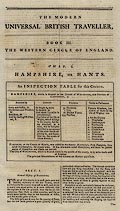
|
|
|
|
FA2003.3.167
(OS 1940s New Popular Edition)
|
Map, One inch map New Popular Edition, sheet 167, Salisbury,
scale 1 mile to 1 inch, published by the Ordnance Survey,
Southampton, Hampshire, after 1940.
|
|
|
|
FA2003.3.168
(OS 1940s New Popular Edition)
|
Map, One inch map New Popular Edition, sheet 168, Winchester,
scale 1 mile to 1 inch, published by the Ordnance Survey,
Southampton, Hampshire, after 1945.
|
|
|
|
FA2003.3.169
(OS 1940s New Popular Edition)
|
Map, One inch map New Popular Edition, sheet 169, Aldershot,
scale 1 mile to 1 inch, published by the Ordnance Survey,
Southampton, Hampshire, after 1940.
|
|
|
|
FA2003.3.179
(OS 1940s New Popular Edition)
|
Map, One inch map New Popular Edition, sheet 179, Bournemouth,
scale 1 mile to 1 inch, published by the Ordnance Survey,
Southampton, Hampshire, after 1940.
|
|
|
|
FA2003.3.180
(OS 1940s New Popular Edition)
|
Map, One inch map New Popular Edition, sheet 180, The Solent,
scale 1 mile to 1 inch, published by the Ordnance Survey,
Southampton, Hampshire, after 1945.
|
|
|
|
FA2003.3.181
(OS 1940s New Popular Edition)
|
Map, One inch map New Popular Edition, sheet 181, Chichester,
scale 1 mile to 1 inch, published by the Ordnance Survey,
Southampton, Hampshire, after 1945.
|
|
|
|
FA2003.4.167
(OS 1950s Seventh Series)
|
Map, One inch map Seventh Series, sheet 167, Salisbury, scale
1 mile to 1 inch, published by the Ordnance Survey, Southampton,
Hampshire, 1960.
|
|
|
|
FA2003.4.169
(OS 1950s Seventh Series)
|
Map, One inch map Seventh Series, sheet 169, Aldershot, scale
1 mile to 1 inch, published by the Ordnance Survey, Southampton,
Hampshire, 1959.
|
|
|
|
FA2003.4.179
(OS 1950s Seventh Series)
|
Map, One inch map Seventh Series, sheet 179, Bournemouth,
scale 1 mile to 1 inch, published by the Ordnance Survey,
Southampton, Hampshire, 1966.
|
|
|
|
FA2003.5
|
Map, colour printed, photographers map no.1, South East
England, by Geographia, 167 Fleet Street, London, for Kodak,
1960s?
|
|
|
|
FA2003.6
|
Road book, atlas of road maps, Street by Street Hampshire,
published by the Automobile Association, AA, Norfolk House,
Priestlet Road, Basingstoke, Hampshire, 2001.
|
|
|
|
FA2003.7.112
(OS 1920s Popular Edition)
|
map, One inch map Popular Edition, sheet 112, Marlborough and
Devizes, scale 1 inch to 1 mile, published by the Ordnance
Survey, Southampton, Hampshire, 1919.
|
|
|
|
FA2003.7.113
(OS 1920s Popular Edition)
|
map, One inch map Popular Edition, sheet 113, Reading and
Newbury, scale 1 inch to 1 mile, published by the Ordnance
Survey, Southampton, Hampshire, 1919.
|
|
|
|
FA2003.7.122
(OS 1920s Popular Edition)
|
map, One inch map Popular Edition, sheet 122, Salisbury and
Bulford, scale 1 inch to 1 mile, published by the Ordnance
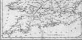
Survey, Southampton, Hampshire, 1919.
|
|
|
|
FA2003.7.123
(OS 1920s Popular Edition)
|
map, One inch map Popular Edition, sheet 123, Winchester and
District, scale 1 inch to 1 mile, published by the Ordnance
Survey, Southampton, Hampshire, 1919.
|
|
|
|
FA2003.7.124
(OS 1920s Popular Edition)
|
map, One inch map Popular Edition, sheet 124, Guildford and
Horsham, scale 1 inch to 1 mile, published by the Ordnance
Survey, Southampton, Hampshire, 1920; revised to 1925.
|
|
|
|
FA2003.7.131
(OS 1920s Popular Edition)
|
map, One inch map Popular Edition, sheet 131, Wimborne and
Ringwood, scale 1 inch to 1 mile, published by the Ordnance
Survey, Southampton, Hampshire, 1919.
|
|
|
|
FA2003.7.141
(OS 1920s Popular Edition)
|
map, One inch map Popular Edition, sheet 141, Bournemouth and
Swanage, scale 1 inch to 1 mile, published by the Ordnance
Survey, Southampton, Hampshire, 1919; revised to 1922?
|
|
|
|
FA2003.7.142
(OS 1920s Popular Edition)
|
map, One inch map Popular Edition, sheet 142, Isle of Wight,
scale 1 inch to 1 mile, published by the Ordnance Survey,
Southampton, Hampshire, 1919; revised to 1926?
|
|
|
|
FA2003.8
(OS 1810s Old Series)
|
Index map, uncoloured engraving, Index to the Ordnance Survey
of England and Wales, south part, Index I, for sheets 1 to 84,
scale 10 miles to 1 inch, published by the Ordnance Survey,
London, mid 19th century.
|
|
|
|
FA2003.9.1
|
Road map, colour printed, Hovis Cycling Road Map, no.1, south
east England, scale about 5 miles to 1 inch, by G Philip and Son,
for the Hovis Bread Flour Co, Macclesfield, Cheshire, and the
Cycling Components Mfring Co, Birmingham, West Midlands,
1890s.
|
|
|
|
FA2003.9.2
|
Road map, colour printed, Hovis Cycling Road Map, no.2, south
central and west England, scale about 5 miles to 1 inch, by G
Philip and Son, for the Hovis Bread Flour Co, Macclesfield,
Cheshire, and the Cycling Components Mfring Co, Birmingham, West
Midlands, 1890s.
|
|
|
|
FA2003.10.1
|
Map, colour lithograph, Plan of the Roman Town of Calleva
Atrebatum, Silchester, Hampshire, scale about 34 inches to 1
mile, published by Victoria County History of England, 1899.
|
|
|
|
FA2003.10.2
|
Map, uncoloured lithograph, Plan of the Roman Town of Calleva
Atrebatum, Silchester, Hampshire, scale about 17 inches to 1
mile, published by the Society of Antiquaries, 1908.
|
|
|
|
FA2003.10.3
|
Map, uncoloured lithograph, Plan of the Roman City Calleva
Atrebatum, Silchester, Hampshire, scale about 21 inches to 1
mile, published about 1907.
|
|
|
|
FA2003.96
(Amalgamated Press 1930s)
|
Road map, set of 31 map cards plus a general index map,
presented with the New Motoring Encyclopedia, published by the
Amalgamated Press, Fleetway House, London, perhaps 1930s.
|
|
|
|
FA2003.97
(Mappa Co 1930s)
|
Road map, the Road-Way Motoring and Cycling Maps of England
and Wales, in 10 sections plus a general map, published by the
Mapp Co, Paternoster House, 34 Paternoster Row, London, perhaps
1930s.
|
|
|
|
FA2004.1
(Naish 1716)
|
Map, uncoloured engraving, The City of Salisbury, scale about
20 ins to 1 mile, by William Naish, first published 1716, 3rd
edition published by Benjamin Collins, New Canal, Salisbury,
Wiltshire, 1751, with an inset map of the River Avon from
Salisbury to the Sea, scale about 1 inch to 1 mile, through
Wiltshire, Hampshire and Dorset, surveyed by Thomas Naish and
James Mooring, 1675.
|
|
|
|
FA2004.2.1
(Jansson 1646)
|
Page, about 36 sheets of Latin text, general description of
the British Isles, Britannia, prefaced by a note about the author
William Camden, from Atlas Novus vol.4, first published by Jan
Jansson, Amsterdam, Netherlands, 1646, this edition about
1659?
|
|
|
|
FA2004.2.2
(Jansson 1646)
|
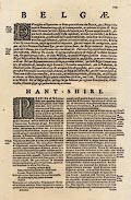
Page, 4 sheets of Latin text, description the Belgae and
Hant-Shire ie Hampshire, from Britannia by William Camden, from
Atlas Novus vol.4, first published by Jan Jansson, Amsterdam,
Netherlands, 1646, this edition about 1659?
|
|
|
|
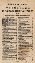
FA2004.2.3
(Jansson 1646)
|
Page, contents page, Latin text, from Atlas Novus vol.4, first
published by Jan Jansson, Amsterdam, Netherlands, 1646, this
edition about 1659?
|
|
|
|
FA2004.2.4
(Jansson 1646)
|
Page, Latin text, an advertisement for the whole atlas, taken
from Atlas Novus vol.4, first published by Jan Jansson,
Amsterdam, Netherlands, 1646, this sheet printed 1659.
|
|
|
|
FA2004.3
(Taylor 1759)
|
Map, hand coloured engraving, Hampshire, with the Isle of
Wight, 6 sheets, scale about 1 mile to 1 inch, by Isaac Taylor,
1759.
|
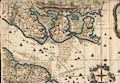
|
|
|
FA2004.4
(Drayton 1612)
|
Book, tooled leather binding, Polyolbion, a poem by Michael
Drayton, published by M Lownes, J Browne, J Helme, and J Busbie,
London, 1612.
|
|
|
|
FA2004.5
(Players 1910)
|
Map, Hampshire, scale abut 52 miles to 1 inch, colour printed
cigarette card in a counties and industries series issued by John
Player and Sons, part of Imperial Tobacco Co, Nottingham,
Nottinghamshire, about 1910.
|
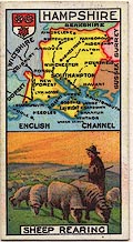
|
|
|
FA2004.6
(Bacon 1896)
|
Atlas, Bacon's Popular Atlas of the British Isles, or
Commercial and Library Atlas of the British Isles, published by G
W Bacon and Co, 127 Strand, London, 1896.
|
|
|
|
FA2004.8
(Bowen 1767)
|
Map, hand coloured engraving, New Medium Map of Hamp Shire ie
Hampshire, scale about 7 miles to 1 inch, by Bowen 1767,
published in Bowles's New Medium English Atlas by Bowles and
Carver, 69 St Paul's Churchyard, London, after 1793.
|
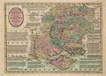
|
|
|
FA2004.9
|
Map, micromap, colour printed, England Scotland and Wales, by
Micromap Ltd, London, 1960s?
|
|
|
|
FA2004.112
|
Map, Hampshire, scale about 5 miles to 1 inch, devised by
Donald McCullough, drawn by Ernest Clegg, published by The
Countryman, London, 1947.
|
|
|
|
FA2004.113
|
Map, Sussex, scale about 4.5 miles to 1 inch, devised by
Donald McCullough for the Women's Land Army Benevolent Fund,
drawn by Ernest Clegg, published by The Countryman, London,
1945.
|
|
|
|
FA2004.114
|
Map, Kent, scale about miles to 1 inch, devised by Donald
McCullough in aid of the Women's Land Army Benevolent Fund, drawn
by Ernest Clegg, published by The Countryman, London, 1945.
|
|
|
|
FA2004.115
|
Map, Wiltshire, scale about 4.5 miles to 1 inch, devised by
Donald McCullough, drawn by Ernest Clegg, published by The
Countryman, London, 1946.
|
|
|
|
FA2004.116
|
Map, Somerset, scale about 5 miles to 1 inch, devised by
Donald McCullough, drawn by Ernest Clegg, published by The
Countryman, London, 1946.
|
|
|
|
FA2004.117
|
Map, Oxfordshire, scale about 5 miles to 1 inch, devised by
Donald McCullough, drawn by Ernest Clegg, published by The
Countryman, London, 1947.
|
|
|
|
FA2004.118
|
Map, Cambridgeshire, scale about 5 miles to 1 inch, devised by
Donald McCullough, drawn by Ernest Clegg, published by The
Countryman, London, 1947.
|
|
|
|
FA2004.119
|
Map, Norfolk, scale about 5 miles to 1 inch, devised by Donald
McCullough in aig of the Women's Land Army Benevolent Fund, drawn
by Ernest Clegg, published by The Countryman, London, 1945.
|
|
|
|
FA2004.120
|
Map, Yorkshire, East Riding, scale about 4.5 miles to 1 inch,
devised by Donald McCullough, drawn by Ernest Clegg, published by
The Countryman, London, 1946.
|
|
|
|
FA2004.121
|
Map, Yorkshire, West Riding, scale about 5 miles to 1 inch,
devised by Donald McCullough, drawn by Ernest Clegg, published by
The Countryman, London, 1946.
|
|
|
|
FA2004.122
|
Map, Derbyshire, scale about 4.5 miles to 1 inch, devised by
Donald McCullough, drawn by Ernest Clegg, published by The
Countryman, London, 1946.
|
|
|
|
FA2004.123
|
Map, Northumberland, scale about 4.5 miles to 1 inch, devised
by Donald McCullough, drawn by Ernest Clegg, published by The
Countryman, London, 1946.
|
|
|
|
|
 |
top of page |
 |
GOS to WOC |
|